| Home | City Bus | Maps | Villages | Cities | Rail | Tourist Places | School | College | Pin Codes | Corona Cases Count |
| Distance Calculator Bus Services IFSC Codes Trace Mobile Number Weather Search Place Trace IP Available Cash ATM/Banks Locate Polling Booth Report an Error contact People |
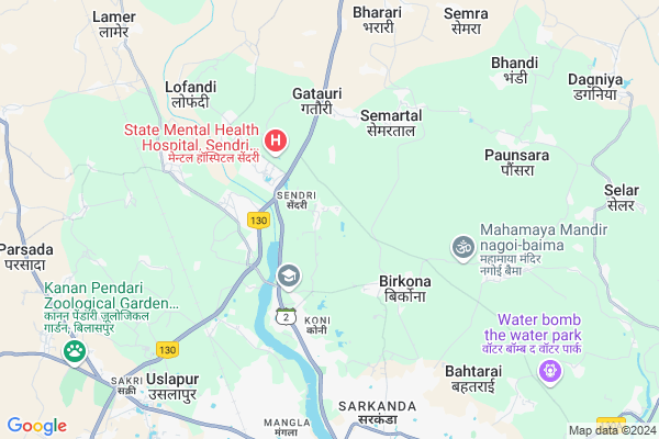
Ramtala
Ramtala Map
EDIT Map
Add Your House
 ..
..
Current Corona Virus Infected Patients Count in Bilaspur District
| City Name | District Name | Total Covid cases |
|---|---|---|
| Bilaspur | Bilaspur | 1 |
Locality Name :
Ramtala
( रमटले )
Tehsil Name : Belha
District : Bilaspur
State : Chattisgarh
Language : Chhattisgarhi and Hindi, Agariya, Bagheli
Current Time 11:03 AM
Date: Friday , Apr 25,2025 (IST)
Time zone: IST (UTC+5:30)
Elevation / Altitude: 268 meters. Above Seal level
Telephone Code / Std Code: 07752
Assembly constituency : Beltara assembly constituency
Assembly MLA : Sushant Shukla
Lok Sabha constituency : Bilaspur parliamentary constituency
Parliament MP : ARUN SAO
Serpanch Name :
Commodities Prices : Sakri Market / Mandi
Rivers Near Ramtala
Lilagar
Hasdeo :Hasdeo River
Lilagar
Hasdeo :Hasdeo River
About Ramtala
Correct below Info and add more info about RamtalaRamtala is a Village in Belha Tehsil in Bilaspur District of Chattisgarh State, India. It is located 12 KM towards North from District head quarters Bilaspur. 22 KM from Belha. 133 KM from State capital Raipur
Koni ( 3 KM ) , Turka Dih ( 4 KM ) , Semartal ( 4 KM ) , Lokhandi ( 5 KM ) , Kachhar ( 5 KM ) are the nearby Villages to Ramtala. Ramtala is surrounded by Takhatpur Tehsil towards west , Belha Tehsil towards South , Kota Tehsil towards North , Masturi Tehsil towards South .
Bilaspur , Bilaspur , Akaltara , Naila Janjgir are the near by Cities to Ramtala.
Ramtala 2011 Census Details
Ramtala Local Language is Chhattisgarhi. Ramtala Village Total population is 2682 and number of houses are 517. Female Population is 48.4%. Village literacy rate is 56.9% and the Female Literacy rate is 22.9%.
Population
| Census Parameter | Census Data |
| Total Population | 2682 |
| Total No of Houses | 517 |
| Female Population % | 48.4 % ( 1299) |
| Total Literacy rate % | 56.9 % ( 1525) |
| Female Literacy rate | 22.9 % ( 615) |
| Scheduled Tribes Population % | 7.6 % ( 204) |
| Scheduled Caste Population % | 54.9 % ( 1473) |
| Working Population % | 44.0 % |
| Child(0 -6) Population by 2011 | 472 |
| Girl Child(0 -6) Population % by 2011 | 48.3 % ( 228) |
Ramtala Census More Deatils.
Politics in Ramtala
Bharatiya Janata Party , BJP , INC are the major political parties in this area.Polling Stations /Booths near Ramtala
1)Ramtala2)Rampur
3)Semrtal
4)Birkona
5)Bhadi
HOW TO REACH Ramtala
By Rail
Ghutku Rail Way Station , Uslapur Rail Way Station are the very nearby railway stations to Ramtala.Pincodes near Ramtala
495009 ( Koni ) , 495001 ( Bilaspur (Bilaspur-CGH) ) , 495330 ( Takhatpur )Colleges near Ramtala
Govt. Pataleshwar College Masturi
Address :
Institute Of Technology Guru Ghasidas University Bilaspur
Address :
Governmet Iti Takhatpur
Address :
Niranjan Kesharwani Collage
Address :
Governmet Jpm College Takhatpur
Address :
Schools in Ramtala
Ms Govt, Ramtala
Address : ramtala , bilha , bilaspur (chhattisgarh) , Chattisgarh . PIN- 495001 , Post - Bilaspur (Bilaspur-CGH)
Govt Health Centers near Ramtala
1) SHC Birkona , , ,2) SHC Sendri , , ,
3) SHC Pendarwa , , ,
Hospitals in Ramtala,Belha
Metropolis Healthcare Ltd
Above Rakshit Dental Clinic; Mission Road; Bilaspur; Chhattisgarh 495001; India
3.1 KM distance Detail
State Mental Health Hospital; Sendri; Bilaspur; Chhattisgarh.
Sendri; Bilaspur; Chhattisgarh 495009; India
3.1 KM distance Detail
more ..
Petrol Bunks in Ramtala,Belha
ANTULAL AND SONS
TILAK ROAD BILASPUR CITY; Bilaspur; Chhattisgarh 495001; India
2.0 KM distance Detail
more ..
Colleges in Ramtala,Belha
saraswati gram siksha samiti chhattisgarh
sarswati vihar; khel parishar; malavan koni; bilaspur; National Highway 130; Badi Koni; Chhattisgarh 495009; India
2.2 KM distance Detail
Pandit Sundarlal Sharma (Open) University
Bilaspur Koni-Birkona Marg ; Gram Post-Birkona; Bilaspur; Chhattisgarh 495009; India
2.3 KM distance Detail
D.p. Vipra College Of Education
Birkona Road; Bilaspur; Chhattisgarh 495001; India
2.7 KM distance Detail
more ..
Schools in Ramtala,Belha
Aadharshila Vidya Mandir
Behind Govt. Engg College; Ramtala Road; Sendri; Bilaspur; Chhattisgarh 495009; India
2.1 KM distance Detail
Ghanshyam
Bilaspur - Korba Road; Sendri; Bilaspur; Chhattisgarh 495009; India
2.2 KM distance Detail
Saraswati shishu mandir Residential Higher Secondary school Koni.Bilaspur
Badi Koni; Chhattisgarh 495009; India
2.3 KM distance Detail
Saraswati Shishu Mandir H.S. Residential School
Badi Koni; Chhattisgarh 495009; India
2.3 KM distance Detail
Govt. Hr. Sec. School; Sendri; Bilaspur
Sendri; Bilaspur; Chhattisgarh 495009; India
2.4 KM distance Detail
Electronic Shops in Ramtala,Belha
Arun Electronic
Bilaspur - Marwahi Bypass Road; Sendri; Bilaspur; Chhattisgarh 495009; India
2.3 KM distance Detail
Digital India Choise Center
School Rd; Sendri; Bilaspur; Chhattisgarh 495009; India
2.5 KM distance Detail
Super Markets in Ramtala,Belha
Kailash Kirana Store
nearby; Govt School; State Bank Rd; Sheorinarayan; Chhattisgarh 495557; India
3.9 KM distance Detail
Police Stations near Ramtala,Belha
Traffic Police Station
chowk; Bilaspur;; Mangla; Bilaspur; Chhattisgarh 495001; India
9.0 KM distance Detail
Governement Offices near Ramtala,Belha
Gram Bharti Stat Office. Bilaspur Chhattisgarh
Badi Koni; Chhattisgarh 495009; India
2.2 KM distance Detail
Avatar Mangalam
#14; Infront of I.T.I.; Koni; Bilaspur; Chhattisgarh 495009; India
4.5 KM distance Detail
About Ramtala &
History
How to reach Ramtala
Tourist Places Near By Ramtala
Schools in Ramtala
Colleges in Ramtala
Temperature & weather of Ramtala
places in Ramtala
Ramtala photos
More Information
How to reach Ramtala
Tourist Places Near By Ramtala
Schools in Ramtala
Colleges in Ramtala
Temperature & weather of Ramtala
places in Ramtala
Ramtala photos
More Information
Village Talk
Post News or Events about this Village
Near Cities
Bilaspur 8 KM near
Bilaspur 10 KM near
Akaltara 35 KM near
Naila Janjgir 52 KM near
Bilaspur 8 KM near
Bilaspur 10 KM near
Akaltara 35 KM near
Naila Janjgir 52 KM near
Near By Taluks
Bilaspur 9 KM near
Takhatpur 21 KM near
Belha 22 KM near
Kota 24 KM near
Bilaspur 9 KM near
Takhatpur 21 KM near
Belha 22 KM near
Kota 24 KM near
Near By Air Ports
Raipur Airport 130 KM near
Jabalpur Airport 262 KM near
Sonegaon Airport 381 KM near
Ranchi Airport 392 KM near
Raipur Airport 130 KM near
Jabalpur Airport 262 KM near
Sonegaon Airport 381 KM near
Ranchi Airport 392 KM near
Near By Tourist Places
Bilaspur 10 KM near
Janjgir-Champa 39 KM near
Janjgir 54 KM near
Korba 66 KM near
Amarkantak 77 KM near
Bilaspur 10 KM near
Janjgir-Champa 39 KM near
Janjgir 54 KM near
Korba 66 KM near
Amarkantak 77 KM near
Near By Districts
Bilaspur 11 KM near
Korba 68 KM near
Janjgir-Champa 80 KM near
Kabirdham 106 KM near
Bilaspur 11 KM near
Korba 68 KM near
Janjgir-Champa 80 KM near
Kabirdham 106 KM near
Near By RailWay Station
Ghutku Rail Way Station 6.6 KM near
Uslapur Rail Way Station 8.2 KM near
Bilaspur Junction Rail Way Station 13 KM near
Ghutku Rail Way Station 6.6 KM near
Uslapur Rail Way Station 8.2 KM near
Bilaspur Junction Rail Way Station 13 KM near