| Home | City Bus | Maps | Villages | Cities | Rail | Tourist Places | School | College | Pin Codes | Corona Cases Count |
| Distance Calculator Bus Services IFSC Codes Trace Mobile Number Weather Search Place Trace IP Available Cash ATM/Banks Locate Polling Booth Report an Error contact People |
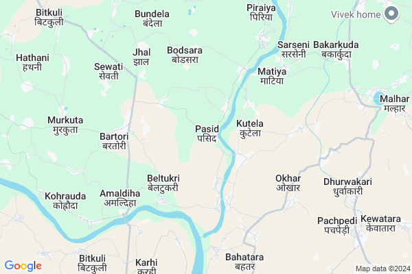
Pasid
Pasid Map
EDIT Map
Add Your House
 ..
..
Current Corona Virus Infected Patients Count in Bilaspur District
| City Name | District Name | Total Covid cases |
|---|---|---|
| Bilaspur | Bilaspur | 1 |
Locality Name :
Pasid
( पसीद )
Tehsil Name : Belha
District : Bilaspur
State : Chattisgarh
Language : Chhattisgarhi and Hindi, Agariya, Bagheli
Current Time 01:13 PM
Date: Sunday , Apr 27,2025 (IST)
Time zone: IST (UTC+5:30)
Elevation / Altitude: 268 meters. Above Seal level
Telephone Code / Std Code: 07752
Assembly constituency : Bilha assembly constituency
Assembly MLA : Dharam Lal Kaushik
Lok Sabha constituency : Bilaspur parliamentary constituency
Parliament MP : ARUN SAO
Serpanch Name :
Commodities Prices : Jairamnagar Market / Mandi
Pasid Live Weather
Temperature: 39.2 °C
overcast clouds
Humidity: 18%
Wind : 4.67 mt/sec towards SW
StationName : "Belha"
observed on 28 Mins Back
Temperature: 39.2 °C
overcast clouds
Humidity: 18%
Wind : 4.67 mt/sec towards SW
StationName : "Belha"
observed on 28 Mins Back
Pasid Weather Forecast for Next 5 days
28-04-2025
26.5°C to 39.6°C
overcast clouds, light rain, clear sky
26.5°C to 39.6°C
overcast clouds, light rain, clear sky
29-04-2025
24.9°C to 38.3°C
clear sky, few clouds, light rain, scattered clouds
24.9°C to 38.3°C
clear sky, few clouds, light rain, scattered clouds
30-04-2025
24.2°C to 42.7°C
clear sky, scattered clouds, few clouds, overcast clouds
24.2°C to 42.7°C
clear sky, scattered clouds, few clouds, overcast clouds
01-05-2025
26.5°C to 43.4°C
broken clouds, scattered clouds, few clouds, clear sky
26.5°C to 43.4°C
broken clouds, scattered clouds, few clouds, clear sky
02-05-2025
25.4°C to 42.9°C
clear sky, light rain, scattered clouds
25.4°C to 42.9°C
clear sky, light rain, scattered clouds
Rivers Near Pasid
Lilagar
Hasdeo :Hasdeo River
Lilagar
Hasdeo :Hasdeo River
About Pasid
Correct below Info and add more info about PasidPasid is a Village in Belha Tehsil in Bilaspur District of Chattisgarh State, India. It is located 24 KM towards South from District head quarters Bilaspur. 14 KM from Belha. 106 KM from State capital Raipur
Bartori ( 5 KM ) , Okhar ( 5 KM ) , Jhal ( 6 KM ) , Sarseni ( 7 KM ) , Bundela ( 7 KM ) are the nearby Villages to Pasid. Pasid is surrounded by Masturi Tehsil towards North , Baloda Bazar Tehsil towards South , Bilaspur Tehsil towards North , Bhatapara Tehsil towards west .
Bilaspur , Bilaspur , Baloda Bazar , Akaltara are the near by Cities to Pasid.
Pasid 2011 Census Details
Pasid Local Language is Chhattisgarhi. Pasid Village Total population is 1472 and number of houses are 308. Female Population is 50.1%. Village literacy rate is 56.0% and the Female Literacy rate is 22.4%.
Population
| Census Parameter | Census Data |
| Total Population | 1472 |
| Total No of Houses | 308 |
| Female Population % | 50.1 % ( 737) |
| Total Literacy rate % | 56.0 % ( 825) |
| Female Literacy rate | 22.4 % ( 330) |
| Scheduled Tribes Population % | 18.9 % ( 278) |
| Scheduled Caste Population % | 4.7 % ( 69) |
| Working Population % | 53.6 % |
| Child(0 -6) Population by 2011 | 225 |
| Girl Child(0 -6) Population % by 2011 | 48.9 % ( 110) |
Pasid Census More Deatils.
Politics in Pasid
Bharatiya Janata Party , BJP , INC are the major political parties in this area.Polling Stations /Booths near Pasid
1)Parsiya2)Magaruchhala
3)Mangla
4)Dodaki
5)Kewanchi
HOW TO REACH Pasid
By Rail
There is no railway station near to Pasid in less than 10 km.Pincodes near Pasid
495551 ( Masturi ) , 495663 ( Gopal Nagar ) , 493332 ( Baloda Bazar )Colleges near Pasid
Govt. Pataleshwar College Masturi
Address :
Institute Of Technology Guru Ghasidas University Bilaspur
Address :
Governmet Iti Takhatpur
Address :
Niranjan Kesharwani Collage
Address :
Governmet Jpm College Takhatpur
Address :
Schools in Pasid
Ms Govt, Pasid
Address : pasid , bilha , bilaspur (chhattisgarh) , Chattisgarh . PIN- 495224 , Post - Bilha
Govt Health Centers near Pasid
1) SHC Pasid , , ,2) SHC Mangla , , ,
3) SHC Kutela , , ,
Petrol Bunks in Pasid,Belha
SANSKAR FUELS PETROL PUMP
Masturi -Malhar- Road; Malhar; Chhattisgarh 495551; India
10.5 KM distance Detail
more ..
Colleges in Pasid,Belha
Government Agrashen College Bilha Bilaspur CG
Bilaspur; Chhattisgarh 495224; India
16.8 KM distance Detail
more ..
About Pasid &
History
How to reach Pasid
Tourist Places Near By Pasid
Schools in Pasid
Colleges in Pasid
Temperature & weather of Pasid
places in Pasid
Pasid photos
More Information
How to reach Pasid
Tourist Places Near By Pasid
Schools in Pasid
Colleges in Pasid
Temperature & weather of Pasid
places in Pasid
Pasid photos
More Information
Village Talk
Post News or Events about this Village
Near Cities
Bilaspur 26 KM near
Bilaspur 26 KM near
Baloda Bazar 27 KM near
Akaltara 31 KM near
Bilaspur 26 KM near
Bilaspur 26 KM near
Baloda Bazar 27 KM near
Akaltara 31 KM near
Near By Taluks
Belha 13 KM near
Masturi 16 KM near
Baloda Bazar 24 KM near
Bhatapara 25 KM near
Belha 13 KM near
Masturi 16 KM near
Baloda Bazar 24 KM near
Bhatapara 25 KM near
Near By Air Ports
Raipur Airport 101 KM near
Jabalpur Airport 278 KM near
Sonegaon Airport 376 KM near
Ranchi Airport 402 KM near
Raipur Airport 101 KM near
Jabalpur Airport 278 KM near
Sonegaon Airport 376 KM near
Ranchi Airport 402 KM near
Near By Tourist Places
Bilaspur 25 KM near
Janjgir-Champa 46 KM near
Janjgir 47 KM near
Korba 81 KM near
Mahasamund 96 KM near
Bilaspur 25 KM near
Janjgir-Champa 46 KM near
Janjgir 47 KM near
Korba 81 KM near
Mahasamund 96 KM near
Near By Districts
Bilaspur 23 KM near
Janjgir-Champa 72 KM near
Korba 82 KM near
Mahasamund 96 KM near
Bilaspur 23 KM near
Janjgir-Champa 72 KM near
Korba 82 KM near
Mahasamund 96 KM near
Near By RailWay Station
Belha Rail Way Station 16 KM near
Bilaspur Junction Rail Way Station 22 KM near
Belha Rail Way Station 16 KM near
Bilaspur Junction Rail Way Station 22 KM near