| Home | City Bus | Maps | Villages | Cities | Rail | Tourist Places | School | College | Pin Codes | Corona Cases Count |
| Distance Calculator Bus Services IFSC Codes Trace Mobile Number Weather Search Place Trace IP Available Cash ATM/Banks Locate Polling Booth Report an Error contact People |
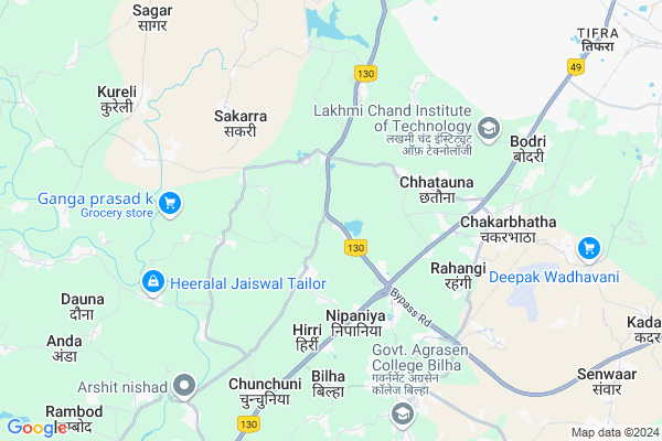
Bodsara
Bodsara Map
EDIT Map
Add Your House
 ..
..
Current Corona Virus Infected Patients Count in Bilaspur District
| City Name | District Name | Total Covid cases |
|---|---|---|
| Bilaspur | Bilaspur | 1 |
Locality Name :
Bodsara
( बोड़सरा )
Tehsil Name : Belha
District : Bilaspur
State : Chattisgarh
Language : Chhattisgarhi and Hindi, Agariya, Bagheli
Current Time 05:04 AM
Date: Saturday , Apr 26,2025 (IST)
Time zone: IST (UTC+5:30)
Elevation / Altitude: 268 meters. Above Seal level
Telephone Code / Std Code: 07752
Assembly constituency : Takhatpur assembly constituency
Assembly MLA : Dharmjeet Singh
Lok Sabha constituency : Bilaspur parliamentary constituency
Parliament MP : ARUN SAO
Serpanch Name :
Pin Code : 495224
Post Office Name : Bilha
Commodities Prices : Tiphra Market / Mandi
Bodsara Live Weather
Temperature: 28.1 °C
scattered clouds
Humidity: 13%
Wind : 0.23 mt/sec towards S
StationName : "Belha"
observed on 2 Hours Back
Temperature: 28.1 °C
scattered clouds
Humidity: 13%
Wind : 0.23 mt/sec towards S
StationName : "Belha"
observed on 2 Hours Back
Bodsara Weather Forecast for Next 5 days
27-04-2025
27.5°C to 44.0°C
scattered clouds, few clouds, clear sky, overcast clouds
27.5°C to 44.0°C
scattered clouds, few clouds, clear sky, overcast clouds
28-04-2025
24.5°C to 39.1°C
overcast clouds, broken clouds, scattered clouds, light rain
24.5°C to 39.1°C
overcast clouds, broken clouds, scattered clouds, light rain
29-04-2025
24.1°C to 38.9°C
few clouds, clear sky, scattered clouds, broken clouds
24.1°C to 38.9°C
few clouds, clear sky, scattered clouds, broken clouds
30-04-2025
23.1°C to 43.4°C
scattered clouds, clear sky, light rain, few clouds
23.1°C to 43.4°C
scattered clouds, clear sky, light rain, few clouds
Rivers Near Bodsara
Lilagar
Hasdeo :Hasdeo River
Lilagar
Hasdeo :Hasdeo River
About Bodsara
Correct below Info and add more info about BodsaraBodsara is a Village in Belha Tehsil in Bilaspur District of Chattisgarh State, India. It is located 14 KM towards west from District head quarters Bilaspur. 11 KM from Belha. 110 KM from State capital Raipur
Bodsara Pin code is 495224 and postal head office is Bilha .
Kharkena ( 3 KM ) , Khamhardih ( 3 KM ) , Muru ( 4 KM ) , Hirri ( 4 KM ) , Sakarra ( 4 KM ) are the nearby Villages to Bodsara. Bodsara is surrounded by Bilaspur Tehsil towards East , Pathariya Tehsil towards west , Takhatpur Tehsil towards North , Masturi Tehsil towards East .
Bilaspur , Bilaspur , Bhatapara , Akaltara are the near by Cities to Bodsara.
Bodsara 2011 Census Details
Bodsara Local Language is Chhattisgarhi. Bodsara Village Total population is 1628 and number of houses are 355. Female Population is 49.1%. Village literacy rate is 51.3% and the Female Literacy rate is 19.2%.
Population
| Census Parameter | Census Data |
| Total Population | 1628 |
| Total No of Houses | 355 |
| Female Population % | 49.1 % ( 800) |
| Total Literacy rate % | 51.3 % ( 835) |
| Female Literacy rate | 19.2 % ( 312) |
| Scheduled Tribes Population % | 2.9 % ( 47) |
| Scheduled Caste Population % | 71.0 % ( 1156) |
| Working Population % | 57.6 % |
| Child(0 -6) Population by 2011 | 260 |
| Girl Child(0 -6) Population % by 2011 | 51.2 % ( 133) |
Bodsara Census More Deatils.
Politics in Bodsara
Bharatiya Janata Party , BJP , INC are the major political parties in this area.Polling Stations /Booths near Bodsara
1)Binouri2)Kharagahna
3)Kharkena
4)Kharkena
5)Ameri
HOW TO REACH Bodsara
By Rail
Belha Rail Way Station , Chakarbhatha Rail Way Station are the very nearby railway stations to Bodsara.Colleges near Bodsara
Govt. Pataleshwar College Masturi
Address :
Institute Of Technology Guru Ghasidas University Bilaspur
Address :
Governmet Iti Takhatpur
Address :
Niranjan Kesharwani Collage
Address :
Governmet Jpm College Takhatpur
Address :
Schools in Bodsara
Ms Govt, Bodsara
Address : bodsara , bilha , bilaspur (chhattisgarh) , Chattisgarh . PIN- 495224 , Post - Bilha
Govt Health Centers near Bodsara
1) SHC Bodsara , , ,2) SHC Muru , , ,
3) PHC AMSENA , , ,
Hospitals in Bodsara,Belha
Aarogya Ausdhalaya Near Dhaihan National Highway Hardi Bilaspur C.g.
Hardi; Chhattisgarh 495220; India
3.8 KM distance Detail
more ..
Petrol Bunks in Bodsara,Belha
Essar Petrol Pump
Pendrideh - Sakri Bypass Rd; Amsena; Chhattisgarh 495220; India
2.5 KM distance Detail
more ..
Colleges in Bodsara,Belha
Goverment Agrasen College Bilha
Raipur Main Road; Bilha; Bilaspur; Chhattisgarh 495224; India
5.8 KM distance Detail
more ..
Electronic Shops in Bodsara,Belha
M.S Enfineering And Febriketion Workshop
Bilaspur; Chhattisgarh 495220; India
2.9 KM distance Detail
Police Stations near Bodsara,Belha
Police Station Chakarbhatha
Near Chakarbhatha Airport; Bilaspur; Chhattisgarh 495001; India
5.4 KM distance Detail
About Bodsara &
History
How to reach Bodsara
Tourist Places Near By Bodsara
Schools in Bodsara
Colleges in Bodsara
Temperature & weather of Bodsara
places in Bodsara
Bodsara photos
More Information
How to reach Bodsara
Tourist Places Near By Bodsara
Schools in Bodsara
Colleges in Bodsara
Temperature & weather of Bodsara
places in Bodsara
Bodsara photos
More Information
Village Talk
Post News or Events about this Village
Near Cities
Bilaspur 11 KM near
Bilaspur 15 KM near
Bhatapara 36 KM near
Akaltara 41 KM near
Bilaspur 11 KM near
Bilaspur 15 KM near
Bhatapara 36 KM near
Akaltara 41 KM near
Near By Taluks
Belha 11 KM near
Bilaspur 14 KM near
Pathariya 17 KM near
Takhatpur 22 KM near
Belha 11 KM near
Bilaspur 14 KM near
Pathariya 17 KM near
Takhatpur 22 KM near
Near By Air Ports
Raipur Airport 108 KM near
Jabalpur Airport 258 KM near
Sonegaon Airport 365 KM near
Ranchi Airport 409 KM near
Raipur Airport 108 KM near
Jabalpur Airport 258 KM near
Sonegaon Airport 365 KM near
Ranchi Airport 409 KM near
Near By Tourist Places
Bilaspur 13 KM near
Janjgir-Champa 52 KM near
Janjgir 60 KM near
Korba 84 KM near
Amarkantak 89 KM near
Bilaspur 13 KM near
Janjgir-Champa 52 KM near
Janjgir 60 KM near
Korba 84 KM near
Amarkantak 89 KM near
Near By Districts
Bilaspur 14 KM near
Korba 85 KM near
Janjgir-Champa 87 KM near
Kabirdham 94 KM near
Bilaspur 14 KM near
Korba 85 KM near
Janjgir-Champa 87 KM near
Kabirdham 94 KM near
Near By RailWay Station
Belha Rail Way Station 7.1 KM near
Chakarbhatha Rail Way Station 7.6 KM near
Dadhapara Rail Way Station 9.2 KM near
Uslapur Rail Way Station 13 KM near
Belha Rail Way Station 7.1 KM near
Chakarbhatha Rail Way Station 7.6 KM near
Dadhapara Rail Way Station 9.2 KM near
Uslapur Rail Way Station 13 KM near