| Home | City Bus | Maps | Villages | Cities | Rail | Tourist Places | School | College | Pin Codes | Corona Cases Count |
| Distance Calculator Bus Services IFSC Codes Trace Mobile Number Weather Search Place Trace IP Available Cash ATM/Banks Locate Polling Booth Report an Error contact People |
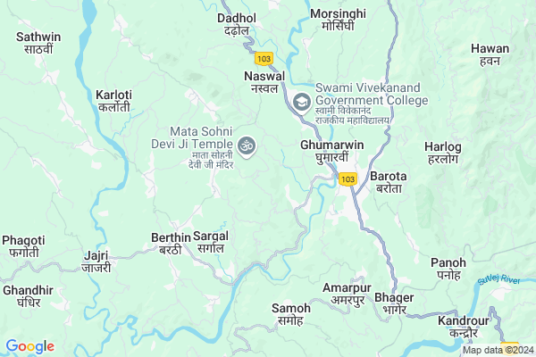
Jangalchalailee
Jangalchalailee Map
EDIT Map
Add Your House
 ..
..
Current Corona Virus Infected Patients Count in Bilaspur District District
| City Name | District Name | Total Covid cases |
|---|
Locality Name :
Jangalchalailee
( जंगलचालैली )
Tehsil Name : Ghumarwin
District : Bilaspur District
State : Himachal Pradesh
Language : Hindi
Current Time 03:11 PM
Date: Tuesday , Apr 29,2025 (IST)
Time zone: IST (UTC+5:30)
Elevation / Altitude: 375 meters. Above Seal level
Telephone Code / Std Code: 01978
Assembly constituency : Ghumarwin assembly constituency
Assembly MLA : Rajesh Dharmani
Lok Sabha constituency : Hamirpur parliamentary constituency
Parliament MP : ANURAG SINGH THAKUR
Serpanch Name :
Main Village Name : Jangal Chalailee
Commodities Prices : Bilaspur Market / Mandi
Jangalchalailee Live Weather
Temperature: 35.2 °C
clear sky
Humidity: 15%
Wind : 5.53 mt/sec towards SW
StationName : "GhumÄ\u0081rwÄ«n"
observed on 22 Mins Back
Temperature: 35.2 °C
clear sky
Humidity: 15%
Wind : 5.53 mt/sec towards SW
StationName : "GhumÄ\u0081rwÄ«n"
observed on 22 Mins Back
Jangalchalailee Weather Forecast for Next 5 days
30-04-2025
22.4°C to 34.9°C
clear sky
22.4°C to 34.9°C
clear sky
01-05-2025
21.5°C to 37.7°C
few clouds, broken clouds, scattered clouds, clear sky
21.5°C to 37.7°C
few clouds, broken clouds, scattered clouds, clear sky
02-05-2025
19.8°C to 38.0°C
broken clouds, scattered clouds, few clouds, light rain, overcast clouds
19.8°C to 38.0°C
broken clouds, scattered clouds, few clouds, light rain, overcast clouds
03-05-2025
20.0°C to 37.5°C
overcast clouds, broken clouds, moderate rain, light rain
20.0°C to 37.5°C
overcast clouds, broken clouds, moderate rain, light rain
04-05-2025
21.2°C to 35.2°C
overcast clouds, light rain, broken clouds
21.2°C to 35.2°C
overcast clouds, light rain, broken clouds
National Highways Reachable To Jangalchalailee
Nationa High Way :NH205
Nationa High Way :NH503A
Nationa High Way :NH205
Nationa High Way :NH503A
Rivers Near Jangalchalailee
Sutlej :Sutlej River :सतलुज नदी :ਸਤਲੁਜ :ستلج
Bakhli Khad
Sutlej :Sutlej River :सतलुज नदी :ਸਤਲੁਜ :ستلج
Bakhli Khad
About Jangalchalailee
Correct below Info and add more info about JangalchalaileeJangalchalailee is a small Village/hamlet in Ghumarwin Tehsil in Bilaspur District District of Himachal Pradesh State, India. It comes under Jangal Chalailee Panchayath. It is located 15 KM towards North from District head quarters Bilaspur,. 70 KM from State capital Shimla
Jangalchalailee is surrounded by Jhandutta Tehsil towards South , Bijhri Tehsil towards west , Bilaspur Tehsil towards South , Bhoranj Tehsil towards North .
Sundarnagar , Nangal , Hamirpur , Mandi are the near by Cities to Jangalchalailee.
This Place is in the border of the Bilaspur District District and Hamirpur District. Hamirpur District Bijhri is west towards this place . Also it is in the Border of other district Mandi .
Demographics of Jangalchalailee
Hindi is the Local Language here.Politics in Jangalchalailee
Bharatiya Janata Party , BJP , INC are the major political parties in this area.Polling Stations /Booths near Jangalchalailee
1)G.m.s.-kallari2)Panchayat Ghar -paplah
3)G.m.s. Mundkhar
4)G.p.s.-auhar
5)G.p.s.-kapahra
HOW TO REACH Jangalchalailee
By Rail
There is no railway station near to Jangalchalailee in less than 10 km.Pincodes near Jangalchalailee
176039 ( Chakmoh ) , 175030 ( Dehar ) , 175034 ( Samaila )Colleges near Jangalchalailee
G.d.c. Jukhala
Address :
Schools near Jangalchalailee
Gsss Barota
Address : barota , ghumarwin-i , bilaspur (h.p.) , Himachal Pradesh . PIN- 174027 , Post - Lehri Sarail
Shiksha Academy Pub.sch. Ghumarwin
Address : ghumarwin , ghumarwin-ii , bilaspur (h.p.) , Himachal Pradesh . PIN- 174001 , Post - Bilaspur (Bilaspur- HP)
Gsss Malyawer
Address : malyawar , ghumarwin-ii , bilaspur (h.p.) , Himachal Pradesh . PIN- 174004 , Post - Kandraur
Gsss Marhana
Address : marhana , ghumarwin-i , bilaspur (h.p.) , Himachal Pradesh . PIN- 174028 , Post - Hatwar
Govt Health Centers near Jangalchalailee
1) Karer SC , VPO Karer Tehsil Barsar Distt. Hamirpur H.P. , Karer ,2) Dhaned Seribaloni PHC , VPO Dhaned Tehsil &Distt. Hamirpur H.P. , Dhaned ,
3) Battal PHC , NA , NA , Near GDC
Hospitals in Jangalchalailee,Ghumarwin
Leelavati Hospital
Indira Market; Old Canteen St; Ghumarwin; Himachal Pradesh 174021; India
3.1 KM distance Detail
more ..
Petrol Bunks in Jangalchalailee,Ghumarwin
Reliance Petroleum
NH-88;MS-101;VILL ABDHANI; PO-TAKREHRA; DISTT; Ghumarwin; Himachal Pradesh 174021; India
3.0 KM distance Detail
Indian Oil Petrol Pump
Bhadrog; Bilaspur; NH-88; Shimla Kangra Road; Ghumarwin; Ghumarwin; Himachal Pradesh 174021; India
3.3 KM distance Detail
Lt Raj Kumar Petrol Pump
Shimla-Kangra Rd; Ghumarwin; Himachal Pradesh 174026; India
3.3 KM distance Detail
more ..
Colleges in Jangalchalailee,Ghumarwin
Maansa Webworld Pvt. Ltd.
Seer Khadd Arc Bridge; Shimla-Kangra Rd; Ghumarwin; Himachal Pradesh 174021; India
2.9 KM distance Detail
NIIT Ghumarwin Centre
Hamirpur Road Tehsil Ghumarwain;Dist. Bilaspur;Himachal Pradesh; Ghumarwin; Himachal Pradesh 174021; India
3.0 KM distance Detail
Swami Vivekanand Government College
Shimla-Kangra Rd; Ghumarwin; Himachal Pradesh 174021; India
3.1 KM distance Detail
more ..
Schools in Jangalchalailee,Ghumarwin
Govt Primary School Bhabba
174021; Bari-Kotla-Bhabha-Badhaghat Link Rd; Ghumarwin; Himachal Pradesh 174029; India
0.5 KM distance Detail
Govt.High School Bari Majherwan
Bari Majherwan; Himachal Pradesh 174029; India
1.7 KM distance Detail
Govt.Secondary School
Godhan - Karangorha; Karangorha; Himachal Pradesh 174029; India
2.0 KM distance Detail
Electronic Shops in Jangalchalailee,Ghumarwin
Lokmitra Kendra Kasaru
Nihari-Berthin Rd; Ghumarwin; Himachal Pradesh 174023; India
2.5 KM distance Detail
Poonam Photo Centre
main market tehsil road ghumarwin; Ghumarwin; Himachal Pradesh 174021; India
3.0 KM distance Detail
Local Parks in Jangalchalailee,Ghumarwin
Reserved Forest Area Ghumarwin
Ghumarwin-Berthin-Talai-Bhakra Rd; Ghumarwin; Himachal Pradesh 174021; India
2.8 KM distance Detail
Forest
Harlog To Kuh; Jangal Mehfuja Mehduda Nain Gujran; Himachal Pradesh 174003; India
9.5 KM distance Detail
Police Stations near Jangalchalailee,Ghumarwin
Sub Divisional Police Officer
Ghumarwin Link Rd; Ghumarwin; Himachal Pradesh 174021; India
2.7 KM distance Detail
Ghumarwin Police Station
Tehsil Rd; Bilaspur; Ghumarwin; Himachal Pradesh 174021; India
3.1 KM distance Detail
Governement Offices near Jangalchalailee,Ghumarwin
Sub Divisional Soil Conservation Officer Office
Ghumarwin Link Rd; Ghumarwin; Himachal Pradesh 174029; India
2.6 KM distance Detail
Excise and Taxation Officer Circle Office
Ghumarwin Link Rd; Ghumarwin; Himachal Pradesh 174029; India
2.7 KM distance Detail
About Jangalchalailee &
History
How to reach Jangalchalailee
Tourist Places Near By Jangalchalailee
Schools in Jangalchalailee
Colleges in Jangalchalailee
Temperature & weather of Jangalchalailee
places in Jangalchalailee
Jangalchalailee photos
More Information
How to reach Jangalchalailee
Tourist Places Near By Jangalchalailee
Schools in Jangalchalailee
Colleges in Jangalchalailee
Temperature & weather of Jangalchalailee
places in Jangalchalailee
Jangalchalailee photos
More Information
Village Talk
Post News or Events about this Village
Near Cities
Sundarnagar 24 KM near
Nangal 33 KM near
Hamirpur 34 KM near
Mandi 43 KM near
Sundarnagar 24 KM near
Nangal 33 KM near
Hamirpur 34 KM near
Mandi 43 KM near
Near By Taluks
Ghumarwin 0 KM near
Jhandutta 7 KM near
Bijhri 20 KM near
Bilaspur 20 KM near
Ghumarwin 0 KM near
Jhandutta 7 KM near
Bijhri 20 KM near
Bilaspur 20 KM near
Near By Air Ports
Simla Airport 64 KM near
Bhuntar Airport 80 KM near
Chandigarh Airport 96 KM near
Ludhiana Airport 111 KM near
Simla Airport 64 KM near
Bhuntar Airport 80 KM near
Chandigarh Airport 96 KM near
Ludhiana Airport 111 KM near
Near By Tourist Places
Rewalsar 29 KM near
Mandi 43 KM near
Una 43 KM near
Chindi 53 KM near
Rupnagar 61 KM near
Rewalsar 29 KM near
Mandi 43 KM near
Una 43 KM near
Chindi 53 KM near
Rupnagar 61 KM near
Near By Districts
Bilaspur District 14 KM near
Hamirpur 34 KM near
Mandi 42 KM near
Una 43 KM near
Bilaspur District 14 KM near
Hamirpur 34 KM near
Mandi 42 KM near
Una 43 KM near
Near By RailWay Station
Anandpur Sahib Rail Way Station 32 KM near
Nangal Dam Rail Way Station 33 KM near
Anandpur Sahib Rail Way Station 32 KM near
Nangal Dam Rail Way Station 33 KM near