| Home | City Bus | Maps | Villages | Cities | Rail | Tourist Places | School | College | Pin Codes | Corona Cases Count |
| Distance Calculator Bus Services IFSC Codes Trace Mobile Number Weather Search Place Trace IP Available Cash ATM/Banks Locate Polling Booth Report an Error contact People |
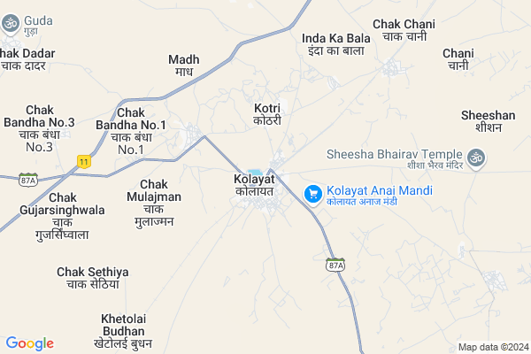
Bajju Map
EDIT Map
Add Your House
 ..
..
Current Corona Virus Infected Patients Count in Bikaner District
| City Name | District Name | Total Covid cases |
|---|---|---|
| Bikaner District | Bikaner | 37 |
Locality Name :
Bajju
( बज्जू )
Tehsil Name : Kolayat
District : Bikaner
State : Rajasthan
Division : Bikaner
Language : Rajasthani and Hindi
Current Time 12:53 PM
Date: Sunday , Apr 27,2025 (IST)
Time zone: IST (UTC+5:30)
Elevation / Altitude: 217 meters. Above Seal level
Telephone Code / Std Code: 01533
Assembly constituency : Kolayat assembly constituency
Assembly MLA : Anshuman Singh Bhati
Lok Sabha constituency : Bikaner parliamentary constituency
Parliament MP : ARJUN RAM MEGHWAL
Serpanch Name :
Pin Code : 334305
Post Office Name : Bajju
Commodities Prices : Bikaner (Grain) Market / Mandi
Bajju Live Weather
Temperature: 41.4 °C
clear sky
Humidity: 6%
Wind : 3.41 mt/sec towards NW
StationName : "Deshnoke"
observed on Now
Temperature: 41.4 °C
clear sky
Humidity: 6%
Wind : 3.41 mt/sec towards NW
StationName : "Deshnoke"
observed on Now
Bajju Weather Forecast for Next 5 days
28-04-2025
30.1°C to 42.6°C
clear sky
30.1°C to 42.6°C
clear sky
29-04-2025
28.2°C to 43.7°C
clear sky
28.2°C to 43.7°C
clear sky
30-04-2025
30.6°C to 44.5°C
clear sky, few clouds, scattered clouds, overcast clouds, broken clouds
30.6°C to 44.5°C
clear sky, few clouds, scattered clouds, overcast clouds, broken clouds
01-05-2025
29.3°C to 45.4°C
clear sky, scattered clouds, few clouds
29.3°C to 45.4°C
clear sky, scattered clouds, few clouds
02-05-2025
29.2°C to 44.7°C
scattered clouds, few clouds, broken clouds, overcast clouds
29.2°C to 44.7°C
scattered clouds, few clouds, broken clouds, overcast clouds
Edit below overview about Bajju
Edit below overview about Bajju
OverView of Bajju
Bajju Town Is 110 Km From Bikaner City.You Can Reach Bajju By Road From Bikaner, Jodhpur, Phalodi, Girajsar. Nearby Rly Stn Is Kolayat 60 Km From Bajju. Kolayat Has Direct Train From Jaisalmer, Phalodi.
Edit below overview about Bajju
National Highways Reachable To Bajju
Nationa High Way :NH754K
Nationa High Way :NH754K
About Bajju
Bajju is a Village in Kolayat Tehsil in Bikaner District of Rajasthan State, India. It belongs to Bikaner Division . It is located 48 KM towards west from District head quarters Bikaner. 5 KM from Kolayat. 351 KM from State capital Jaipur
Bajju Pin code is 334305 and postal head office is Bajju .
Kotri ( 5 KM ) , Chani ( 10 KM ) , Hadla Bhatiyan ( 14 KM ) are the nearby Villages to Bajju. Bajju is surrounded by Bikaner Tehsil towards East , Nokha Tehsil towards East , Bap Tehsil towards west , Sri Dungargarh Tehsil towards East .
Siana , Bikaner , Nokha , Nagaur are the near by Cities to Bajju.
Demographics of Bajju
Rajasthani is the Local Language here.Politics in Bajju
RSNM , BJP , INC are the major political parties in this area.Polling Stations /Booths near Bajju
1)Gups Left Part Railwayline Kolayat2)Gups Right Part Railwayline Kolayat
3)Ggss Right Part Kharicharnan
4)Gups Left Part Jaganwala
5)Gups Right Part Mudh
HOW TO REACH Bajju
By Rail
Kolayat Rail Way Station is the very nearby railway stations to Bajju.Colleges near Bajju
Pr College
Address :
M.d.digree College Bajju
Address :
Sanskar College Bajju
Address : Mistri Market Bajju
Schools in Bajju
Govt Adrash Sen.sec.school Bajju
Address : Bikaner road bajju
Govt Health Centers near Bajju
1) Hadda , PHC Hadda , Main Market Hadda ,2) Kolayat , CHC Kolayat , Jhajhu Circle ,
3) Kotri , SHC Kotri , ,
Hospitals in Bajju,Kolayat
Dr. Ramesh Poonia
Rajshree Nursing Home; Near SBI Bank; Front of Government Hospital;; Kolayat; India
0.2 KM distance Detail
more ..
Petrol Bunks in Bajju,Kolayat
Indian Oil Corporation Petrol Pump
NH 11; Techari Phanta; Rajasthan 334302; India
6.5 KM distance Detail
Indian Oil Corporation Petrol Pump
Techari Phanta; NH 11; Rajasthan 334302; India
6.6 KM distance Detail
more ..
Schools in Bajju,Kolayat
Swami Vivekanand odhaugik Prsikshan Sansthan
Kolayat; Rajasthan 334302; India
0.2 KM distance Detail
Electronic Shops in Bajju,Kolayat
Ganapati service centre; 2/4 wheeler workshop
Kolayat; Rajasthan 334302; India
0.1 KM distance Detail
Attari Electonic Center Kolayat Ji
k peca; government hospital; Kolayat; Rajasthan; India
0.2 KM distance Detail
Chamunda Intrparais
Kolayat - Jhajhu Rd; choraya; Kolayat; Rajasthan 334302; India
0.4 KM distance Detail
About Bajju &
History
How to reach Bajju
Tourist Places Near By Bajju
Schools in Bajju
Colleges in Bajju
Temperature & weather of Bajju
places in Bajju
Bajju photos
More Information
How to reach Bajju
Tourist Places Near By Bajju
Schools in Bajju
Colleges in Bajju
Temperature & weather of Bajju
places in Bajju
Bajju photos
More Information
Village Talk
Post News or Events about this Village
Near Cities
Siana 25 KM near
Bikaner 45 KM near
Nokha 65 KM near
Nagaur 116 KM near
Siana 25 KM near
Bikaner 45 KM near
Nokha 65 KM near
Nagaur 116 KM near
Near By Taluks
Kolayat 5 KM near
Bikaner 45 KM near
Nokha 64 KM near
Bap 88 KM near
Kolayat 5 KM near
Bikaner 45 KM near
Nokha 64 KM near
Bap 88 KM near
Near By Air Ports
Jodhpur Airport 196 KM near
Surat Gujarat Airport 209 KM near
Jaisalmer Airport 255 KM near
Sanganeer Airport 339 KM near
Jodhpur Airport 196 KM near
Surat Gujarat Airport 209 KM near
Jaisalmer Airport 255 KM near
Sanganeer Airport 339 KM near
Near By Tourist Places
Gajner 17 KM near
Bikaner 46 KM near
Khimsar 117 KM near
Osian 138 KM near
Pokran 161 KM near
Gajner 17 KM near
Bikaner 46 KM near
Khimsar 117 KM near
Osian 138 KM near
Pokran 161 KM near
Near By Districts
Bikaner 45 KM near
Nagaur 117 KM near
Jodhpur 194 KM near
Churu 228 KM near
Bikaner 45 KM near
Nagaur 117 KM near
Jodhpur 194 KM near
Churu 228 KM near
Near By RailWay Station
Kolayat Rail Way Station 0.8 KM near
Deshnoke Rail Way Station 41 KM near
Bikaner Junction Rail Way Station 44 KM near
Kolayat Rail Way Station 0.8 KM near
Deshnoke Rail Way Station 41 KM near
Bikaner Junction Rail Way Station 44 KM near