| Home | City Bus | Maps | Villages | Cities | Rail | Tourist Places | School | College | Pin Codes | Corona Cases Count |
| Distance Calculator Bus Services IFSC Codes Trace Mobile Number Weather Search Place Trace IP Available Cash ATM/Banks Locate Polling Booth Report an Error contact People |
Sheh
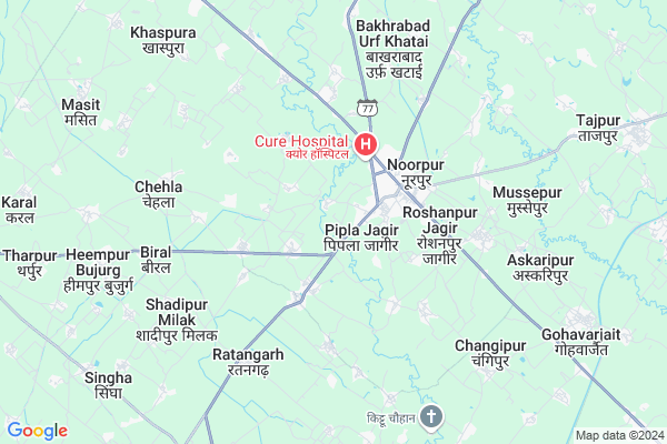
Sheh Map
EDIT Map
Add Your House
 ..
..
Current Corona Virus Infected Patients Count in Bijnor District
| City Name | District Name | Total Covid cases |
|---|---|---|
| Bijnor District | Bijnor | 28 |
Locality Name :
Sheh
( शह )
Block Name : Noorpur
District : Bijnor
State : Uttar Pradesh
Division : Moradabad
Language : Hindi and Urdu
Current Time 12:28 PM
Date: Tuesday , Apr 29,2025 (IST)
Time zone: IST (UTC+5:30)
Elevation / Altitude: 228 meters. Above Seal level
Telephone Code / Std Code: 01344
Assembly constituency : Chandpur assembly constituency
Assembly MLA : Swami Omvesh
Lok Sabha constituency : Bijnor parliamentary constituency
Parliament MP : MALOOK NAGAR
Serpanch Name :
Pin Code : 246727
Post Office Name : Hassupura
Alternate Village Name : Seh
Commodities Prices : Chaandpur Market / Mandi
Sheh Live Weather
Temperature: 33.1 °C
scattered clouds
Humidity: 27%
Wind : 6.75 mt/sec towards SE
StationName : "NÅ«rpur"
observed on 2 Hours Back
Temperature: 33.1 °C
scattered clouds
Humidity: 27%
Wind : 6.75 mt/sec towards SE
StationName : "NÅ«rpur"
observed on 2 Hours Back
Sheh Weather Forecast for Next 5 days
30-04-2025
27.4°C to 37.8°C
few clouds, clear sky, scattered clouds, overcast clouds
27.4°C to 37.8°C
few clouds, clear sky, scattered clouds, overcast clouds
01-05-2025
26.4°C to 40.1°C
broken clouds, overcast clouds, clear sky, scattered clouds
26.4°C to 40.1°C
broken clouds, overcast clouds, clear sky, scattered clouds
02-05-2025
27.2°C to 41.4°C
overcast clouds, broken clouds, scattered clouds
27.2°C to 41.4°C
overcast clouds, broken clouds, scattered clouds
03-05-2025
26.6°C to 39.8°C
overcast clouds, broken clouds, scattered clouds, light rain
26.6°C to 39.8°C
overcast clouds, broken clouds, scattered clouds, light rain
04-05-2025
26.1°C to 41.1°C
overcast clouds, broken clouds, scattered clouds, light rain
26.1°C to 41.1°C
overcast clouds, broken clouds, scattered clouds, light rain
National Highways Reachable To Sheh
Nationa High Way :NH34
Nationa High Way :NH34
Rivers Near Sheh
Ramganga
Kosi
Ramganga
Kosi
About Sheh
Correct below Info and add more info about ShehSheh is a Village in Noorpur Block in Bijnor District of Uttar Pradesh State, India. It belongs to Moradabad Division . It is located 43 KM towards South from District head quarters Bijnor. 418 KM from State capital Lucknow
Sheh Pin code is 246727 and postal head office is Hassupura .
Sheh is surrounded by Budhanpur Seohara Block towards East , Jalilpur Block towards west , Nehtaur Block towards North , Dhanaura Block towards South .
Noorpur , Naugawan Sadat , Nehtaur , Seohara are the near by Cities to Sheh.
Seh 2011 Census Details
Sheh Local Language is Hindi. Seh Village Total population is 1899 and number of houses are 302. Female Population is 46.7%. Village literacy rate is 64.7% and the Female Literacy rate is 25.3%.
Population
| Census Parameter | Census Data |
| Total Population | 1899 |
| Total No of Houses | 302 |
| Female Population % | 46.7 % ( 887) |
| Total Literacy rate % | 64.7 % ( 1228) |
| Female Literacy rate | 25.3 % ( 480) |
| Scheduled Tribes Population % | 0.0 % ( 0) |
| Scheduled Caste Population % | 16.3 % ( 310) |
| Working Population % | 27.3 % |
| Child(0 -6) Population by 2011 | 266 |
| Girl Child(0 -6) Population % by 2011 | 43.2 % ( 115) |
Seh Census More Deatils.
Politics in Sheh
BJP , RLD , SP , BSP , are the major political parties in this area.Polling Stations /Booths near Sheh
1)K.i.c. Dhunndli Room-12)P.v. Bundra Khurd Room - 2
3)K.c.center Khanpur Khader Room-2
4)P.v. Rajpurpura Parsu
5)P.v. Jafarhusenpur
HOW TO REACH Sheh
By Rail
There is no railway station near to Sheh in less than 10 km.Colleges near Sheh
Svm Inter College
Address :
Schools in Sheh
Ups Seh
Address : seh , noorpur , bijnor , Uttar Pradesh . PIN- 246727 , Post - Hassupura
Govt Health Centers near Sheh
1) CHC Noorpur , Community Health Center Building , Town & Post Noorpur Block Noorpur , Chandpur Road Noorpur2) BPHC Noorpur , Primary Health Centre Building , Town & Post Noorpur Block Noorpur ,
3) Kambhor , Health Sub Center Building , Kambhor , Haldaur Road
Schools in Sheh,Noorpur
Electronic Shops in Sheh,Noorpur
Super Markets in Sheh,Noorpur
Local Parks in Sheh,Noorpur
Police Stations near Sheh,Noorpur
Governement Offices near Sheh,Noorpur
About Sheh &
History
How to reach Sheh
Tourist Places Near By Sheh
Schools in Sheh
Colleges in Sheh
Temperature & weather of Sheh
places in Sheh
Sheh photos
More Information
How to reach Sheh
Tourist Places Near By Sheh
Schools in Sheh
Colleges in Sheh
Temperature & weather of Sheh
places in Sheh
Sheh photos
More Information
Village Talk
Post News or Events about this Village
Near Cities
Noorpur 2 KM near
Naugawan Sadat 16 KM near
Nehtaur 22 KM near
Seohara 23 KM near
Noorpur 2 KM near
Naugawan Sadat 16 KM near
Nehtaur 22 KM near
Seohara 23 KM near
Near By Taluks
Noorpur 0 KM near
Budhanpur Seohara 17 KM near
Jalilpur 19 KM near
Nehtaur 19 KM near
Noorpur 0 KM near
Budhanpur Seohara 17 KM near
Jalilpur 19 KM near
Nehtaur 19 KM near
Near By Air Ports
Muzaffarnagar Airport 86 KM near
Pantnagar Airport 118 KM near
Dehra Dun Airport 151 KM near
Indira Gandhi International Airport 158 KM near
Muzaffarnagar Airport 86 KM near
Pantnagar Airport 118 KM near
Dehra Dun Airport 151 KM near
Indira Gandhi International Airport 158 KM near
Near By Tourist Places
Hastinapur 42 KM near
Moradabad 57 KM near
Kashipur 61 KM near
Corbett National Park 76 KM near
Meerut 77 KM near
Hastinapur 42 KM near
Moradabad 57 KM near
Kashipur 61 KM near
Corbett National Park 76 KM near
Meerut 77 KM near
Near By Districts
Jyotiba Phule Nagar 30 KM near
Bijnor 40 KM near
Moradabad 57 KM near
Meerut 78 KM near
Jyotiba Phule Nagar 30 KM near
Bijnor 40 KM near
Moradabad 57 KM near
Meerut 78 KM near
Near By RailWay Station
Seohara Rail Way Station 22 KM near
Dhampur Rail Way Station 24 KM near
Seohara Rail Way Station 22 KM near
Dhampur Rail Way Station 24 KM near