| Home | City Bus | Maps | Villages | Cities | Rail | Tourist Places | School | College | Pin Codes | Corona Cases Count |
| Distance Calculator Bus Services IFSC Codes Trace Mobile Number Weather Search Place Trace IP Available Cash ATM/Banks Locate Polling Booth Report an Error contact People |
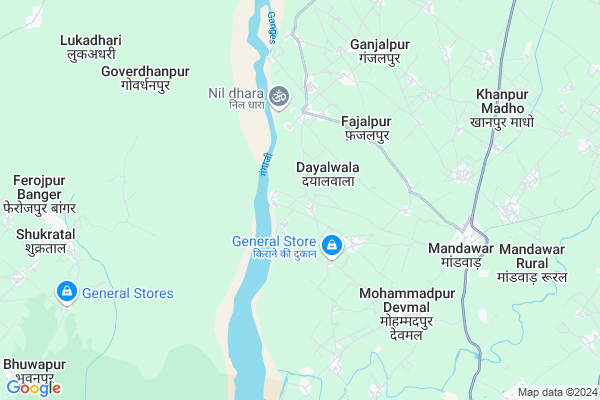
Dewal Garh
Dewal Garh Map
EDIT Map
Add Your House
 ..
..
Current Corona Virus Infected Patients Count in Bijnor District
| City Name | District Name | Total Covid cases |
|---|---|---|
| Bijnor District | Bijnor | 28 |
Locality Name :
Dewal Garh
( देवल ग्रह )
Block Name : Mohammedpur Deomal
District : Bijnor
State : Uttar Pradesh
Division : Moradabad
Language : Hindi and Urdu
Current Time 01:01 PM
Date: Sunday , Apr 27,2025 (IST)
Time zone: IST (UTC+5:30)
Elevation / Altitude: 237 meters. Above Seal level
Telephone Code / Std Code: 01345
Assembly constituency : Bijnor assembly constituency
Assembly MLA : Suchi
Lok Sabha constituency : Bijnor parliamentary constituency
Parliament MP : MALOOK NAGAR
Serpanch Name :
Main Village Name : Badshahpur
Commodities Prices : Kiratpur Market / Mandi
Dewal Garh Live Weather
Temperature: 41.2 °C
overcast clouds
Humidity: 5%
Wind : 1.85 mt/sec towards SW
StationName : "MandÄ\u0081war"
observed on 52 Mins Back
Temperature: 41.2 °C
overcast clouds
Humidity: 5%
Wind : 1.85 mt/sec towards SW
StationName : "MandÄ\u0081war"
observed on 52 Mins Back
Dewal Garh Weather Forecast for Next 5 days
28-04-2025
26.6°C to 41.7°C
overcast clouds, scattered clouds, clear sky
26.6°C to 41.7°C
overcast clouds, scattered clouds, clear sky
29-04-2025
25.4°C to 42.3°C
clear sky
25.4°C to 42.3°C
clear sky
30-04-2025
27.3°C to 41.4°C
clear sky, scattered clouds, few clouds, overcast clouds, broken clouds
27.3°C to 41.4°C
clear sky, scattered clouds, few clouds, overcast clouds, broken clouds
01-05-2025
27.1°C to 41.7°C
overcast clouds, broken clouds, few clouds
27.1°C to 41.7°C
overcast clouds, broken clouds, few clouds
02-05-2025
24.6°C to 40.8°C
broken clouds, few clouds, clear sky, overcast clouds, light rain
24.6°C to 40.8°C
broken clouds, few clouds, clear sky, overcast clouds, light rain
National Highways Reachable To Dewal Garh
Nationa High Way :NH709AG
Nationa High Way :NH709AD
Nationa High Way :NH709AG
Nationa High Way :NH709AD
Rivers Near Dewal Garh
Ramganga
Banganga
Ramganga
Banganga
About Dewal Garh
Correct below Info and add more info about Dewal GarhDewal Garh is a small Village/hamlet in Mohammedpur Deomal Block in Bijnor District of Uttar Pradesh State, India. It comes under Badshahpur Panchayath. It belongs to Moradabad Division . It is located 17 KM towards North from District head quarters Bijnor. 9 KM from Mohammedpur Deomal. 477 KM from State capital Lucknow
Dewal Garh is surrounded by Bijnor Block towards South , Morna Block towards west , Kiratpur Block towards East , Khanpur Block towards North .
Bijnaur , Purquazi , Najibabad , Nagina are the near by Cities to Dewal Garh.
This Place is in the border of the Bijnor District and Muzaffarnagar District. Muzaffarnagar District Morna is west towards this place .
Demographics of Dewal Garh
Hindi is the Local Language here.Politics in Dewal Garh
BJP , nCP , SP , BSP are the major political parties in this area.Polling Stations /Booths near Dewal Garh
1)Abhinav Purv.m.v.mohmadpur Devmal Room 12)P.v.shadipur
3)P.v.shahjadpur Room 1
4)P.v.bakarpur Gari
5)P.v.kachpura
HOW TO REACH Dewal Garh
By Rail
There is no railway station near to Dewal Garh in less than 10 km.Pincodes near Dewal Garh
246721 ( Mandawar (Bijnor) ) , 251316 ( Morna ) , 246723 ( Balawali )Colleges near Dewal Garh
Haffiz Mohammad Ibrahim Inter College
Address :
Rajkiya Balika Inter College
Address :
Balram Kunwar Saraswati Vidya Mandir
Address :
Government Inter College
Address :
Syam Narayan Singh Smarak Inter College
Address :
Schools near Dewal Garh
Kisan Inter College Peli Chuki
Address : peli chuki , mohd.pur devmal , bijnor , Uttar Pradesh . PIN- 229506
Kisan J.h.s
Address : mandhawli , mohd.pur devmal , bijnor , Uttar Pradesh . PIN- 229506
Ups Naval Pur
Address : navalpur , mohd.pur devmal , bijnor , Uttar Pradesh . PIN- 246701 , Post - Bijnor
Jhs Badshahpur Tareekam
Address : badshahpur tarikam , mohd.pur devmal , bijnor , Uttar Pradesh . PIN- 246713
Govt Health Centers near Dewal Garh
1) PHC Chandok , Primary Health Bulding , Village & Post Chandok ,2) Behman Shaura , Health Sub Centre Building , Village Behman Shaura ,
3) Haldua Rampur , Health Sub Center Bulding , Village Haldua Rampur ,
Schools in Dewal Garh,Mohammedpur Deomal
Electronic Shops in Dewal Garh,Mohammedpur Deomal
Super Markets in Dewal Garh,Mohammedpur Deomal
Local Parks in Dewal Garh,Mohammedpur Deomal
Police Stations near Dewal Garh,Mohammedpur Deomal
Governement Offices near Dewal Garh,Mohammedpur Deomal
About Dewal Garh &
History
How to reach Dewal Garh
Tourist Places Near By Dewal Garh
Schools in Dewal Garh
Colleges in Dewal Garh
Temperature & weather of Dewal Garh
places in Dewal Garh
Dewal Garh photos
More Information
How to reach Dewal Garh
Tourist Places Near By Dewal Garh
Schools in Dewal Garh
Colleges in Dewal Garh
Temperature & weather of Dewal Garh
places in Dewal Garh
Dewal Garh photos
More Information
Village Talk
Post News or Events about this Village
Near Cities
Bijnaur 17 KM near
Purquazi 31 KM near
Najibabad 32 KM near
Nagina 39 KM near
Bijnaur 17 KM near
Purquazi 31 KM near
Najibabad 32 KM near
Nagina 39 KM near
Near By Taluks
Mohammedpur Deomal 9 KM near
Bijnor 17 KM near
Morna 19 KM near
Kiratpur 20 KM near
Mohammedpur Deomal 9 KM near
Bijnor 17 KM near
Morna 19 KM near
Kiratpur 20 KM near
Near By Air Ports
Muzaffarnagar Airport 44 KM near
Dehra Dun Airport 101 KM near
Indira Gandhi International Airport 157 KM near
Pantnagar Airport 163 KM near
Muzaffarnagar Airport 44 KM near
Dehra Dun Airport 101 KM near
Indira Gandhi International Airport 157 KM near
Pantnagar Airport 163 KM near
Near By Tourist Places
Hastinapur 43 KM near
Roorkee 50 KM near
Haridwar 56 KM near
Rajaji National Park 73 KM near
Meerut 75 KM near
Hastinapur 43 KM near
Roorkee 50 KM near
Haridwar 56 KM near
Rajaji National Park 73 KM near
Meerut 75 KM near
Near By Districts
Bijnor 17 KM near
Muzaffarnagar 40 KM near
Haridwar 56 KM near
Meerut 76 KM near
Bijnor 17 KM near
Muzaffarnagar 40 KM near
Haridwar 56 KM near
Meerut 76 KM near
Near By RailWay Station
Muazzampur Narayan Junction Rail Way Station 19 KM near
Najibabad Junction Rail Way Station 31 KM near
Muazzampur Narayan Junction Rail Way Station 19 KM near
Najibabad Junction Rail Way Station 31 KM near