| Home | City Bus | Maps | Villages | Cities | Rail | Tourist Places | School | College | Pin Codes | Corona Cases Count |
| Distance Calculator Bus Services IFSC Codes Trace Mobile Number Weather Search Place Trace IP Available Cash ATM/Banks Locate Polling Booth Report an Error contact People |
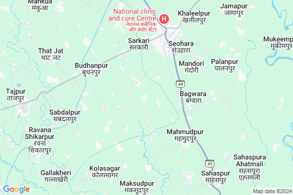
Doltabad
Doltabad Map
EDIT Map
Add Your House
 ..
..
Current Corona Virus Infected Patients Count in Bijnor District
| City Name | District Name | Total Covid cases |
|---|---|---|
| Bijnor District | Bijnor | 28 |
Locality Name :
Doltabad
( दौलताबाद )
Block Name : Budhanpur Seohara
District : Bijnor
State : Uttar Pradesh
Division : Moradabad
Language : Hindi and Urdu
Current Time 08:07 PM
Date: Friday , Apr 25,2025 (IST)
Time zone: IST (UTC+5:30)
Elevation / Altitude: 224 meters. Above Seal level
Telephone Code / Std Code: 01344
Assembly constituency : Noorpur assembly constituency
Assembly MLA : Ram Avatar Singh
Lok Sabha constituency : Moradabad parliamentary constituency
Parliament MP : Dr. S.T. HASAN
Serpanch Name :
Pin Code : 246746
Post Office Name : Seohara
Alternate Village Name : Daultabad
Commodities Prices : Dhampur Market / Mandi
Doltabad Live Weather
Temperature: 33.6 °C
scattered clouds
Humidity: 5%
Wind : 3.03 mt/sec towards W
StationName : "SeohÄ\u0081ra"
observed on 12 Mins Back
Temperature: 33.6 °C
scattered clouds
Humidity: 5%
Wind : 3.03 mt/sec towards W
StationName : "SeohÄ\u0081ra"
observed on 12 Mins Back
Doltabad Weather Forecast for Next 5 days
26-04-2025
28.1°C to 32.3°C
few clouds
28.1°C to 32.3°C
few clouds
27-04-2025
26.2°C to 42.6°C
scattered clouds, few clouds, broken clouds, overcast clouds
26.2°C to 42.6°C
scattered clouds, few clouds, broken clouds, overcast clouds
28-04-2025
27.4°C to 42.0°C
overcast clouds, broken clouds, clear sky, scattered clouds
27.4°C to 42.0°C
overcast clouds, broken clouds, clear sky, scattered clouds
29-04-2025
25.2°C to 42.2°C
scattered clouds, few clouds, clear sky
25.2°C to 42.2°C
scattered clouds, few clouds, clear sky
30-04-2025
27.0°C to 41.7°C
few clouds, broken clouds, clear sky
27.0°C to 41.7°C
few clouds, broken clouds, clear sky
National Highways Reachable To Doltabad
Nationa High Way :NH34
Nationa High Way :NH34
Rivers Near Doltabad
Ramganga
Dhela
Ramganga
Dhela
About Doltabad
Correct below Info and add more info about DoltabadDoltabad is a Village in Budhanpur Seohara Block in Bijnor District of Uttar Pradesh State, India. It belongs to Moradabad Division . It is located 56 KM towards East from District head quarters Bijnor. 2 KM from Budhanpur Seohara. 407 KM from State capital Lucknow
Doltabad Pin code is 246746 and postal head office is Seohara .
Berkhera ( 2 KM ) , Ratanpura ( 2 KM ) , Mandora ( 3 KM ) , Genda Judh ( 3 KM ) , Mahmudpur ( 4 KM ) are the nearby Villages to Doltabad. Doltabad is surrounded by Dhampur Block towards North , Noorpur Block towards west , Chhajlet Block towards South , Nehtaur Block towards west .
Seohara , Sahaspur , Noorpur , Sherkot are the near by Cities to Doltabad.
This Place is in the border of the Bijnor District and Moradabad District. Moradabad District Thakurdwara is East towards this place .
Demographics of Doltabad
Hindi is the Local Language here.Politics in Doltabad
BJP , BKD , BJS , BSP , INC are the major political parties in this area.Polling Stations /Booths near Doltabad
1)Purvi K.j.h.s. Sattonangli2)P.v. Shujatpur Tikar Room 3
3)P.v. Asadpur Dhamroli
4)P.v. Bagwara Room-1
5)Purv.ma.v. Dhingarpur
HOW TO REACH Doltabad
By Rail
Seohara Rail Way Station , Mewa Nawada Rail Way Station are the very nearby railway stations to Doltabad.Colleges near Doltabad
Dkm Junior High School
Address : Vill&po Bagwara Teh Dhampur Distt Bijnor
Schools near Doltabad
Kisan Hayar S. School Mehmood
Address : mehmood pur , burhanpur(seohara) , bijnor , Uttar Pradesh . PIN- 246746 , Post - Seohara
Bidla Public Girls Inter Colle
Address : burhanpur , burhanpur(seohara) , bijnor , Uttar Pradesh . PIN- 246701 , Post - Bijnor
Ups Khakoo Nagla
Address : khaku nangla , burhanpur(seohara) , bijnor , Uttar Pradesh . PIN- 252525
Ups Kamala
Address : kamala , burhanpur(seohara) , bijnor , Uttar Pradesh . PIN- 246746 , Post - Seohara
Govt Health Centers near Doltabad
1) Shahpur Kheri , Health Sub Center Bulding , Village Shahpur Kheri ,2) Azampur , Health Sub Center Facility Building , Village Azampur , 1
3) BPHC Seohara , Primary Health Centre Building , Town & Post Seohara Block Seohara ,
Schools in Doltabad,Budhanpur Seohara
Electronic Shops in Doltabad,Budhanpur Seohara
Super Markets in Doltabad,Budhanpur Seohara
Local Parks in Doltabad,Budhanpur Seohara
Police Stations near Doltabad,Budhanpur Seohara
Governement Offices near Doltabad,Budhanpur Seohara
About Doltabad &
History
How to reach Doltabad
Tourist Places Near By Doltabad
Schools in Doltabad
Colleges in Doltabad
Temperature & weather of Doltabad
places in Doltabad
Doltabad photos
More Information
How to reach Doltabad
Tourist Places Near By Doltabad
Schools in Doltabad
Colleges in Doltabad
Temperature & weather of Doltabad
places in Doltabad
Doltabad photos
More Information
Village Talk
Post News or Events about this Village
Near Cities
Seohara 5 KM near
Sahaspur 7 KM near
Noorpur 17 KM near
Sherkot 22 KM near
Seohara 5 KM near
Sahaspur 7 KM near
Noorpur 17 KM near
Sherkot 22 KM near
Near By Taluks
Budhanpur Seohara 2 KM near
Dhampur 18 KM near
Noorpur 19 KM near
Chhajlet 24 KM near
Budhanpur Seohara 2 KM near
Dhampur 18 KM near
Noorpur 19 KM near
Chhajlet 24 KM near
Near By Air Ports
Pantnagar Airport 99 KM near
Muzaffarnagar Airport 103 KM near
Dehra Dun Airport 154 KM near
Indira Gandhi International Airport 177 KM near
Pantnagar Airport 99 KM near
Muzaffarnagar Airport 103 KM near
Dehra Dun Airport 154 KM near
Indira Gandhi International Airport 177 KM near
Near By Tourist Places
Kashipur 41 KM near
Moradabad 48 KM near
Corbett National Park 60 KM near
Hastinapur 62 KM near
Ramnagar 66 KM near
Kashipur 41 KM near
Moradabad 48 KM near
Corbett National Park 60 KM near
Hastinapur 62 KM near
Ramnagar 66 KM near
Near By Districts
Jyotiba Phule Nagar 35 KM near
Moradabad 48 KM near
Bijnor 54 KM near
Rampur 67 KM near
Jyotiba Phule Nagar 35 KM near
Moradabad 48 KM near
Bijnor 54 KM near
Rampur 67 KM near
Near By RailWay Station
Seohara Rail Way Station 4.5 KM near
Mewa Nawada Rail Way Station 8.3 KM near
Dhampur Rail Way Station 18 KM near
Seohara Rail Way Station 4.5 KM near
Mewa Nawada Rail Way Station 8.3 KM near
Dhampur Rail Way Station 18 KM near