| Home | City Bus | Maps | Villages | Cities | Rail | Tourist Places | School | College | Pin Codes | Corona Cases Count |
| Distance Calculator Bus Services IFSC Codes Trace Mobile Number Weather Search Place Trace IP Available Cash ATM/Banks Locate Polling Booth Report an Error contact People |
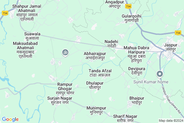
Jafarabad
Jafarabad Map
EDIT Map
Add Your House
 ..
..
Current Corona Virus Infected Patients Count in Bijnor District
| City Name | District Name | Total Covid cases |
|---|---|---|
| Bijnor District | Bijnor | 28 |
Locality Name :
Jafarabad
( जफराबाद )
Block Name : Afzalgarh
District : Bijnor
State : Uttar Pradesh
Division : Moradabad
Language : Hindi and Urdu
Current Time 10:56 AM
Date: Friday , Apr 25,2025 (IST)
Time zone: IST (UTC+5:30)
Elevation / Altitude: 236 meters. Above Seal level
Telephone Code / Std Code: 01344
Assembly constituency : Barhapur assembly constituency
Assembly MLA : Kunwar Sushant Singh
Lok Sabha constituency : Moradabad parliamentary constituency
Parliament MP : Dr. S.T. HASAN
Serpanch Name :
Pin Code : 246747
Post Office Name : Sherkot
Alternate Village Name : Jafrabad
Commodities Prices : Jaspur(UC) Market / Mandi
National Highways Reachable To Jafarabad
Nationa High Way :NH34
Nationa High Way :NH709AD
Nationa High Way :NH34
Nationa High Way :NH709AD
Rivers Near Jafarabad
Ramganga
Kosi
Ramganga
Kosi
About Jafarabad
Correct below Info and add more info about JafarabadJafarabad is a Village in Afzalgarh Block in Bijnor District of Uttar Pradesh State, India. It belongs to Moradabad Division . It is located 70 KM towards East from District head quarters Bijnor. 16 KM from Afzalgarh. 404 KM from State capital Lucknow
Jafarabad Pin code is 246747 and postal head office is Sherkot .
Harkishanpur ( 2 KM ) , Anandi Pur ( 2 KM ) , Mahavatpur ( 5 KM ) , Shergarh ( 6 KM ) , Sultanpurkhas ( 9 KM ) are the nearby Villages to Jafarabad. Jafarabad is surrounded by Thakurdwara Block towards South , Afzalgarh Block towards North , Budhanpur Seohara Block towards west , Dhampur Block towards west .
Jaspur , Thakurdwara , Seohara , Sherkot are the near by Cities to Jafarabad.
Jafarabad 2011 Census Details
Jafarabad Local Language is Hindi. Jafarabad Village Total population is 1395 and number of houses are 241. Female Population is 47.8%. Village literacy rate is 52.0% and the Female Literacy rate is 20.8%.
Population
| Census Parameter | Census Data |
| Total Population | 1395 |
| Total No of Houses | 241 |
| Female Population % | 47.8 % ( 667) |
| Total Literacy rate % | 52.0 % ( 726) |
| Female Literacy rate | 20.8 % ( 290) |
| Scheduled Tribes Population % | 0.0 % ( 0) |
| Scheduled Caste Population % | 47.2 % ( 659) |
| Working Population % | 25.7 % |
| Child(0 -6) Population by 2011 | 196 |
| Girl Child(0 -6) Population % by 2011 | 49.5 % ( 97) |
Jafarabad Census More Deatils.
Politics in Jafarabad
BJP , BSP are the major political parties in this area.Polling Stations /Booths near Jafarabad
1)P.v Abdullapur Qurashi2)P.v Abhrajpur Room No 1
3)P.v Alehdadpur Khajwa
4)P.v Dehlawal Rrom No 2
5)P.v Heempur Makhdoom Jahan
HOW TO REACH Jafarabad
By Rail
There is no railway station near to Jafarabad in less than 10 km.Colleges near Jafarabad
J.m.s Inter College
Address : J.m.s Inter College Seervasuchand Bijnor
Schools in Jafarabad
J.s. Jafarabad
Address : jafarabad , afzalgrah , bijnor , Uttar Pradesh . PIN- 246747 , Post - Sherkot
Govt Health Centers near Jafarabad
1) Dulhapur , , Dulhapur ,2) APHC Harewli , Primary Health Bulding , Village & Post Harewli ,
3) Harewli , Health Sub Center Bulding , Village & Post Harewli ,
Schools in Jafarabad,Afzalgarh
Electronic Shops in Jafarabad,Afzalgarh
Super Markets in Jafarabad,Afzalgarh
Local Parks in Jafarabad,Afzalgarh
Police Stations near Jafarabad,Afzalgarh
Governement Offices near Jafarabad,Afzalgarh
About Jafarabad &
History
How to reach Jafarabad
Tourist Places Near By Jafarabad
Schools in Jafarabad
Colleges in Jafarabad
Temperature & weather of Jafarabad
places in Jafarabad
Jafarabad photos
More Information
How to reach Jafarabad
Tourist Places Near By Jafarabad
Schools in Jafarabad
Colleges in Jafarabad
Temperature & weather of Jafarabad
places in Jafarabad
Jafarabad photos
More Information
Village Talk
Post News or Events about this Village
Near Cities
Jaspur 10 KM near
Thakurdwara 11 KM near
Seohara 17 KM near
Sherkot 20 KM near
Jaspur 10 KM near
Thakurdwara 11 KM near
Seohara 17 KM near
Sherkot 20 KM near
Near By Taluks
Jaspur 11 KM near
Thakurdwara 14 KM near
Afzalgarh 16 KM near
Budhanpur Seohara 24 KM near
Jaspur 11 KM near
Thakurdwara 14 KM near
Afzalgarh 16 KM near
Budhanpur Seohara 24 KM near
Near By Air Ports
Pantnagar Airport 85 KM near
Muzaffarnagar Airport 118 KM near
Dehra Dun Airport 151 KM near
Indira Gandhi International Airport 199 KM near
Pantnagar Airport 85 KM near
Muzaffarnagar Airport 118 KM near
Dehra Dun Airport 151 KM near
Indira Gandhi International Airport 199 KM near
Near By Tourist Places
Kashipur 23 KM near
Corbett National Park 39 KM near
Ramnagar 44 KM near
Moradabad 54 KM near
Lansdowne 71 KM near
Kashipur 23 KM near
Corbett National Park 39 KM near
Ramnagar 44 KM near
Moradabad 54 KM near
Lansdowne 71 KM near
Near By Districts
Jyotiba Phule Nagar 54 KM near
Moradabad 55 KM near
Rampur 65 KM near
Bijnor 67 KM near
Jyotiba Phule Nagar 54 KM near
Moradabad 55 KM near
Rampur 65 KM near
Bijnor 67 KM near
Near By RailWay Station
Seohara Rail Way Station 19 KM near
Kashipur Junction Rail Way Station 25 KM near
Seohara Rail Way Station 19 KM near
Kashipur Junction Rail Way Station 25 KM near