| Home | City Bus | Maps | Villages | Cities | Rail | Tourist Places | School | College | Pin Codes | Corona Cases Count |
| Distance Calculator Bus Services IFSC Codes Trace Mobile Number Weather Search Place Trace IP Available Cash ATM/Banks Locate Polling Booth Report an Error contact People |
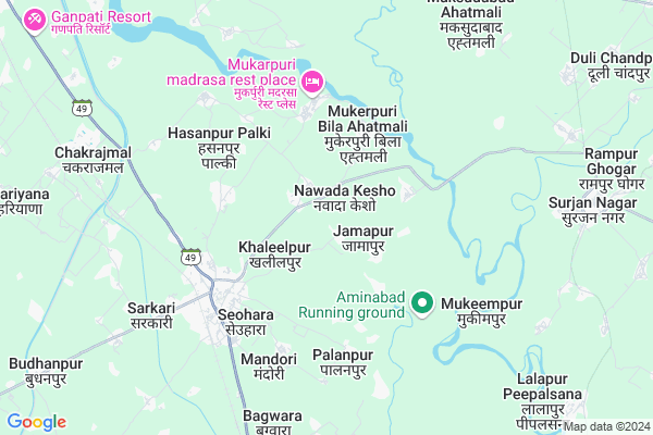
Imratpur
Imratpur Map
EDIT Map
Add Your House
 ..
..
Current Corona Virus Infected Patients Count in Bijnor District
| City Name | District Name | Total Covid cases |
|---|---|---|
| Bijnor District | Bijnor | 28 |
Locality Name :
Imratpur
( इमरतपुर )
Block Name : Afzalgarh
District : Bijnor
State : Uttar Pradesh
Division : Moradabad
Language : Hindi and Urdu
Current Time 01:12 PM
Date: Wednesday , Feb 05,2025 (IST)
Time zone: IST (UTC+5:30)
Elevation / Altitude: 236 meters. Above Seal level
Telephone Code / Std Code: 01344
Assembly constituency : Dhampur assembly constituency
Assembly MLA : Ashok Kumar Rana
Lok Sabha constituency : Nagina parliamentary constituency
Parliament MP : GIRISH CHANDRA
Serpanch Name :
Pin Code : 246746
Post Office Name : Seohara
Main Village Name : Imaratpur
Commodities Prices : Dhampur Market / Mandi
Imratpur Live Weather
Temperature: 22.5 °C
clear sky
Humidity: 40%
Wind : 3.32 mt/sec towards NW
StationName : "SeohÄ\u0081ra"
observed on 2 Hours Back
Temperature: 22.5 °C
clear sky
Humidity: 40%
Wind : 3.32 mt/sec towards NW
StationName : "SeohÄ\u0081ra"
observed on 2 Hours Back
Imratpur Weather Forecast for Next 5 days
06-02-2025
11.8°C to 26.1°C
clear sky
11.8°C to 26.1°C
clear sky
07-02-2025
10.5°C to 26.1°C
clear sky, broken clouds
10.5°C to 26.1°C
clear sky, broken clouds
08-02-2025
9.4°C to 26.5°C
scattered clouds, clear sky, few clouds
9.4°C to 26.5°C
scattered clouds, clear sky, few clouds
09-02-2025
9.7°C to 27.8°C
few clouds, clear sky, scattered clouds
9.7°C to 27.8°C
few clouds, clear sky, scattered clouds
10-02-2025
12.3°C to 29.1°C
few clouds, clear sky
12.3°C to 29.1°C
few clouds, clear sky
National Highways Reachable To Imratpur
Nationa High Way :NH34
Nationa High Way :NH709AD
Nationa High Way :NH34
Nationa High Way :NH709AD
Rivers Near Imratpur
Ramganga
Kosi
Ramganga
Kosi
About Imratpur
Correct below Info and add more info about ImratpurImratpur is a small Village/hamlet in Afzalgarh Block in Bijnor District of Uttar Pradesh State, India. It comes under Imaratpur Panchayath. It belongs to Moradabad Division . It is located 58 KM towards East from District head quarters Bijnor. 23 KM from Afzalgarh. 409 KM from State capital Lucknow
Imratpur Pin code is 246746 and postal head office is Seohara .
Berkhera Tanda Bila Ahatmali ( 2 KM ) , Ameerpur ( 4 KM ) , Palanpur ( 5 KM ) , Aladinpur ( 5 KM ) , Mandora ( 6 KM ) are the nearby Villages to Imratpur. Imratpur is surrounded by Dhampur Block towards west , Thakurdwara Block towards East , Afzalgarh Block towards North , Jaspur Block towards East .
Seohara , Sahaspur , Sherkot , Thakurdwara are the near by Cities to Imratpur.
Demographics of Imratpur
Hindi is the Local Language here.Politics in Imratpur
BJP , RLD , SP , BSP are the major political parties in this area.Polling Stations /Booths near Imratpur
1)Purv Ma.vi.salarabad2)P.v.wazirpur Jagir R.no.1
3)P.v.jamalpur Udaychand R.no.3
4)Purv.ma.vi.kadrabad Khurd
5)Purv.ma.vi.latifpur Urf Sipahiwala R.no.1
HOW TO REACH Imratpur
By Rail
Seohara Rail Way Station , Chakraj Mal Rail Way Station are the very nearby railway stations to Imratpur.Colleges near Imratpur
J.m.s Inter College
Address : J.m.s Inter College Seervasuchand Bijnor
Schools near Imratpur
Ps Rasulpur Veeran
Address : rasulpur bishan , afzalgrah , bijnor , Uttar Pradesh . PIN- 246722 , Post - Afzalgarh
P.s.mohd Pur Rajaori
Address : mohd pur rajawri , afzalgrah , bijnor , Uttar Pradesh . PIN- 246722 , Post - Afzalgarh
Govt Adarsh Inter Collage
Address : afzalgarh , afzalgrah , bijnor , Uttar Pradesh . PIN- 246722 , Post - Afzalgarh
Govt Navratan Inter Collage
Address : reyhad , afzalgrah , bijnor , Uttar Pradesh . PIN- 246722 , Post - Afzalgarh
Govt Health Centers near Imratpur
1) Jamapur , Health Sub Center Bulding , Village Jamapur ,2) Buderan , Health Sub Centre , Village & Post - Buderan, Dhampur. ,
3) Mukerpuri , Health Sub Centre , Village & Post - Mukerpuri, Dhampur. ,
Schools in Imratpur,Afzalgarh
Electronic Shops in Imratpur,Afzalgarh
Super Markets in Imratpur,Afzalgarh
Local Parks in Imratpur,Afzalgarh
Police Stations near Imratpur,Afzalgarh
Governement Offices near Imratpur,Afzalgarh
About Imratpur &
History
How to reach Imratpur
Tourist Places Near By Imratpur
Schools in Imratpur
Colleges in Imratpur
Temperature & weather of Imratpur
places in Imratpur
Imratpur photos
More Information
How to reach Imratpur
Tourist Places Near By Imratpur
Schools in Imratpur
Colleges in Imratpur
Temperature & weather of Imratpur
places in Imratpur
Imratpur photos
More Information
Village Talk
Post News or Events about this Village
Near Cities
Seohara 4 KM near
Sahaspur 12 KM near
Sherkot 15 KM near
Thakurdwara 18 KM near
Seohara 4 KM near
Sahaspur 12 KM near
Sherkot 15 KM near
Thakurdwara 18 KM near
Near By Taluks
Budhanpur Seohara 11 KM near
Dhampur 15 KM near
Thakurdwara 21 KM near
Afzalgarh 22 KM near
Budhanpur Seohara 11 KM near
Dhampur 15 KM near
Thakurdwara 21 KM near
Afzalgarh 22 KM near
Near By Air Ports
Pantnagar Airport 96 KM near
Muzaffarnagar Airport 106 KM near
Dehra Dun Airport 149 KM near
Indira Gandhi International Airport 185 KM near
Pantnagar Airport 96 KM near
Muzaffarnagar Airport 106 KM near
Dehra Dun Airport 149 KM near
Indira Gandhi International Airport 185 KM near
Near By Tourist Places
Kashipur 35 KM near
Corbett National Park 50 KM near
Moradabad 52 KM near
Ramnagar 58 KM near
Hastinapur 68 KM near
Kashipur 35 KM near
Corbett National Park 50 KM near
Moradabad 52 KM near
Ramnagar 58 KM near
Hastinapur 68 KM near
Near By Districts
Jyotiba Phule Nagar 44 KM near
Moradabad 52 KM near
Bijnor 56 KM near
Rampur 68 KM near
Jyotiba Phule Nagar 44 KM near
Moradabad 52 KM near
Bijnor 56 KM near
Rampur 68 KM near
Near By RailWay Station
Seohara Rail Way Station 5.7 KM near
Dhampur Rail Way Station 15 KM near
Seohara Rail Way Station 5.7 KM near
Dhampur Rail Way Station 15 KM near