| Home | City Bus | Maps | Villages | Cities | Rail | Tourist Places | School | College | Pin Codes | Corona Cases Count |
| Distance Calculator Bus Services IFSC Codes Trace Mobile Number Weather Search Place Trace IP Available Cash ATM/Banks Locate Polling Booth Report an Error contact People |
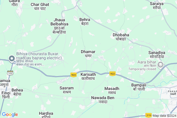
Amarpur Map
EDIT Map
Add Your House
 ..
..
Current Corona Virus Infected Patients Count in Bhojpur District
| City Name | District Name | Total Covid cases |
|---|---|---|
| Bhojpur District | Bhojpur | 2 |
Locality Name :
Amarpur
( अमरपुर )
Block Name : Agiaon
District : Bhojpur
State : Bihar
Division : Patna
Language : Maithili and Hindi, Urdu, Bhojpuri
Current Time 11:39 AM
Date: Sunday , Apr 27,2025 (IST)
Time zone: IST (UTC+5:30)
Elevation / Altitude: 67 meters. Above Seal level
Telephone Code / Std Code: 06337
Assembly constituency : Barhara assembly constituency
Assembly MLA : Raghvendra Pratap Singh
Lok Sabha constituency : Arrah parliamentary constituency
Parliament MP : R. K. Singh
Serpanch Name :
Pin Code : 802156
Post Office Name : Dhamar
Main Village Name : Amarpur
Commodities Prices : Ballia Market / Mandi
Amarpur Live Weather
Temperature: 39.2 °C
broken clouds
Humidity: 11%
Wind : 0.78 mt/sec towards S
StationName : "Arrah"
observed on 1 Hours Back
Temperature: 39.2 °C
broken clouds
Humidity: 11%
Wind : 0.78 mt/sec towards S
StationName : "Arrah"
observed on 1 Hours Back
Amarpur Weather Forecast for Next 5 days
28-04-2025
28.6°C to 41.8°C
overcast clouds, light rain, broken clouds
28.6°C to 41.8°C
overcast clouds, light rain, broken clouds
29-04-2025
25.9°C to 40.6°C
broken clouds, few clouds, scattered clouds, overcast clouds, light rain
25.9°C to 40.6°C
broken clouds, few clouds, scattered clouds, overcast clouds, light rain
30-04-2025
26.6°C to 36.5°C
broken clouds, overcast clouds, scattered clouds
26.6°C to 36.5°C
broken clouds, overcast clouds, scattered clouds
01-05-2025
24.9°C to 37.9°C
overcast clouds, scattered clouds, few clouds, clear sky, broken clouds
24.9°C to 37.9°C
overcast clouds, scattered clouds, few clouds, clear sky, broken clouds
02-05-2025
25.4°C to 37.2°C
broken clouds, scattered clouds, light rain, overcast clouds
25.4°C to 37.2°C
broken clouds, scattered clouds, light rain, overcast clouds
National Highways Reachable To Amarpur
Nationa High Way :NH22
Nationa High Way :NH22
Rivers Near Amarpur
Punpun :पुनपुन नदी
Punpun :पुनपुन नदी
Punpun :पुनपुन नदी
Punpun :पुनपुन नदी
About Amarpur
Correct below Info and add more info about AmarpurAmarpur is a small Village/hamlet in Agiaon Block in Bhojpur District of Bihar State, India. It comes under Amarpur Panchayath. It belongs to Patna Division . It is located 14 KM towards west from District head quarters Arrah. 31 KM from Agiaon. 67 KM from State capital Patna
Amarpur Pin code is 802156 and postal head office is Dhamar .
Agarsanda ( 3 KM ) , Saraiya ( 3 KM ) , Kalyanpur ( 3 KM ) , Baghipakar ( 4 KM ) , Masadh ( 4 KM ) are the nearby Villages to Amarpur. Amarpur is surrounded by Udwantnagar Block towards South , Behea Block towards west , Shahpur Block towards west , Barhara Block towards East .
Behea , Jagdispur , Revelganj , Reoti are the near by Cities to Amarpur.
This Place is in the border of the Bhojpur District and Arwal District. Arwal District Arwal is South towards this place . Also it is in the Border of other district Patna .
Amarpur 2011 Census Details
Amarpur Local Language is Maithili. Amarpur Village Total population is and number of houses are . Female Population is -1.0%. Village literacy rate is -1.0% and the Female Literacy rate is -1.0%.
Population
| Census Parameter | Census Data |
| Total Population | |
| Total No of Houses | |
| Female Population % | -1.0 % ( ) |
| Total Literacy rate % | -1.0 % ( ) |
| Female Literacy rate | -1.0 % ( ) |
| Scheduled Tribes Population % | -1.0 % ( ) |
| Scheduled Caste Population % | -1.0 % ( ) |
| Working Population % | -1.0 % |
| Child(0 -6) Population by 2011 | |
| Girl Child(0 -6) Population % by 2011 | -1.0 % ( ) |
Amarpur Census More Deatils.
Politics in Amarpur
JD(U) , Bharatiya Janata Party , LJP , BJP , RJD are the major political parties in this area.Polling Stations /Booths near Amarpur
1)Panchayat Bhawan Behra2)Madhay Vidyalay Dhamar(pashichmi Bhag)
3)Madhay Vidyalay Daulatpur (uttri Bhag)
4)Utkramit Madhay Vidyalay Devriya
5)Madhay Vidyalay Fuha (uttar Bhag)
HOW TO REACH Amarpur
By Rail
Karisath Rail Way Station , Sarvodaya Halt Rail Way Station are the very nearby railway stations to Amarpur. Piro Rail Way Station (near to Arrah) , Charpokhari Halt Rail Way Station (near to Arrah) are the Rail way stations reachable from near by towns.By Road
Arrah are the nearby by towns to Amarpur having road connectivity to AmarpurColleges near Amarpur
Sri Tridandi Swami Manas College Panwari
Address :
Jan Sahakari Collage
Address :
Suhasat Sehdeo High School+2 College Sandeh (bhojpur)
Address :
Sb College
Address :
Bss College
Address :
Schools near Amarpur
P. S. Senwathra
Address : senwathara , agion , bhojpur , Bihar . PIN- 802201 , Post - Agiaon
P. S. Dhobahan
Address : dhobahan , agion , bhojpur , Bihar . PIN- 802203 , Post - Garhani
Girls P. S. Bikhampur
Address : bhikhampur , agion , bhojpur , Bihar . PIN- 802208 , Post - Sahar (Bhojpur)
P.s. Baruna
Address : baruna , agion , bhojpur , Bihar . PIN- 802201 , Post - Agiaon
Govt Health Centers near Amarpur
1) Jhaua , , Jhaua , Jhaua2) Baluwa , Baluwa , Baluwa , Rampur Sanadiya
3) Baluwa , , Balua ,
Hospitals in Amarpur,Agiaon
Adarsh Clinic
Arrah; Bhojpur; NH-84; Arrah Buxar Road; Bhojpur; Bhojpur; Bihar 802301; India
10.1 KM distance Detail
more ..
Petrol Bunks in Amarpur,Agiaon
Hindustan Petroleum
Bibiganj; Bhojpur; NH-84; Buxar Arrah Road; Bhojpur; Bhojpur; Bihar 802301; India
4.9 KM distance Detail
Bharat Petroleum
NH-84; Buxar Arrah Road; Rampur; BISHUNPUR; Bhojpur; Bihar 802301; India
6.2 KM distance Detail
more ..
Colleges in Amarpur,Agiaon
Micro India Computer Education
Arrah - Salempur Rd; Dhobaha; Bihar 802156; India
5.5 KM distance Detail
Government Enter College
Arrah; Bhojpur; NH-84; Arrah Buxar Road; Bhojpur; Bhojpur; Bihar 802301; India
7.7 KM distance Detail
Tarkeshwar Narain Agrawal Teachers' Training College
Harigaon Village; Sanya Barhatta; Jagdishpur; Bhojpur; Bihar 802186; India
10.8 KM distance Detail
more ..
Police Stations near Amarpur,Agiaon
Kalyanpur Police Station
Kalyanpur Road; Champaran district; Motihari; Bihar 845413; India
6.3 KM distance Detail
Governement Offices near Amarpur,Agiaon
PANCHAYAT BHAVAN BIHAR SARKAR DHAMAR ; Bihar 802156
Dhamar; Bihar 802156; India
1.6 KM distance Detail
About Amarpur &
History
How to reach Amarpur
Tourist Places Near By Amarpur
Schools in Amarpur
Colleges in Amarpur
Temperature & weather of Amarpur
places in Amarpur
Amarpur photos
More Information
How to reach Amarpur
Tourist Places Near By Amarpur
Schools in Amarpur
Colleges in Amarpur
Temperature & weather of Amarpur
places in Amarpur
Amarpur photos
More Information
Village Talk
Post News or Events about this Village
Near Cities
Behea 10 KM near
Jagdispur 21 KM near
Revelganj 27 KM near
Reoti 31 KM near
Behea 10 KM near
Jagdispur 21 KM near
Revelganj 27 KM near
Reoti 31 KM near
Near By Taluks
Ara 6 KM near
Udwantnagar 11 KM near
Behea 11 KM near
Shahpur 14 KM near
Ara 6 KM near
Udwantnagar 11 KM near
Behea 11 KM near
Shahpur 14 KM near
Near By Air Ports
Patna Airport 60 KM near
Gaya Airport 114 KM near
Gorakhpur Airport 189 KM near
Varanasi Airport 191 KM near
Patna Airport 60 KM near
Gaya Airport 114 KM near
Gorakhpur Airport 189 KM near
Varanasi Airport 191 KM near
Near By Tourist Places
Golghar 66 KM near
Patna 66 KM near
Takht Sri Patna Sahib 69 KM near
Agam Kuan 72 KM near
Vaishali 77 KM near
Golghar 66 KM near
Patna 66 KM near
Takht Sri Patna Sahib 69 KM near
Agam Kuan 72 KM near
Vaishali 77 KM near
Near By Districts
Bhojpur 13 KM near
Saran 33 KM near
Arwal 44 KM near
Ballia 48 KM near
Bhojpur 13 KM near
Saran 33 KM near
Arwal 44 KM near
Ballia 48 KM near
Near By RailWay Station
Karisath Rail Way Station 5.5 KM near
Sarvodaya Halt Rail Way Station 7.0 KM near
Bihiya Rail Way Station 11 KM near
Ara Junction Rail Way Station 13 KM near
Karisath Rail Way Station 5.5 KM near
Sarvodaya Halt Rail Way Station 7.0 KM near
Bihiya Rail Way Station 11 KM near
Ara Junction Rail Way Station 13 KM near