| Home | City Bus | Maps | Villages | Cities | Rail | Tourist Places | School | College | Pin Codes | Corona Cases Count |
| Distance Calculator Bus Services IFSC Codes Trace Mobile Number Weather Search Place Trace IP Available Cash ATM/Banks Locate Polling Booth Report an Error contact People |
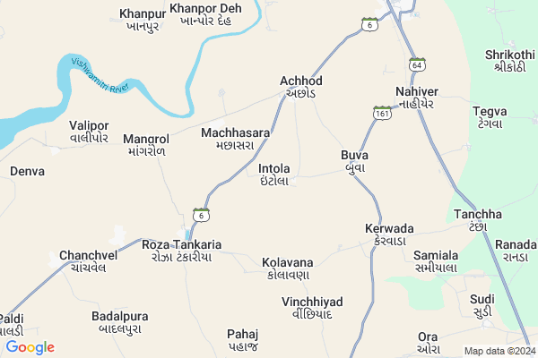
Intola Map
EDIT Map
Add Your House
 ..
..
Current Corona Virus Infected Patients Count in Bharuch District
| City Name | District Name | Total Covid cases |
|---|---|---|
| Bharuch District | Bharuch | 29 |
Locality Name :
Intola
( ઇન્ટોલ )
Taluka Name : Amod
District : Bharuch
State : Gujarat
Language : Gujarati and Hindi
Current Time 08:24 AM
Date: Wednesday , Apr 30,2025 (IST)
Time zone: IST (UTC+5:30)
Elevation / Altitude: 15 meters. Above Seal level
Telephone Code / Std Code: 02641
Assembly constituency : Jambusar assembly constituency
Assembly MLA : Devkishordasji Bhaktisvarupdasji Swami
Lok Sabha constituency : Bharuch parliamentary constituency
Parliament MP : Mansukhbhai Dhanjibhai Vasava
Serpanch Name :
Pin Code : 392110
Post Office Name : Amod
Alternate Village Name : Itola
Commodities Prices : Baruch(Vagara) Market / Mandi
National Highways Reachable To Intola
Nationa High Way :NH48
Nationa High Way :NH64
Nationa High Way :NH48
Nationa High Way :NH64
Rivers Near Intola
Narmada River
Karjan
Narmada River
Karjan
About Intola
Correct below Info and add more info about IntolaIntola is a Village in Amod Taluka in Bharuch District of Gujarat State, India. It is located 34 KM towards North from District head quarters Bharuch. 11 KM from . 170 KM from State capital Gandhinagar
Intola Pin code is 392110 and postal head office is Amod .
Buva ( 3 KM ) , Roza Tankariya ( 3 KM ) , Achhod ( 4 KM ) , Kolavana ( 4 KM ) , Kerwada ( 6 KM ) are the nearby Villages to Intola. Intola is surrounded by Vagra Taluka towards South , Jambusar Taluka towards North , Bharuch Taluka towards South , Karjan Taluka towards East .
Bharuch , Karjan , Ankleshwar , Padra are the near by Cities to Intola.
It is near to arabian sea. There is a chance of humidity in the weather.
Intola 2011 Census Details
Intola Local Language is Gujarati. Intola Village Total population is 790 and number of houses are 138. Female Population is 49.7%. Village literacy rate is 78.1% and the Female Literacy rate is 37.2%.
Population
| Census Parameter | Census Data |
| Total Population | 790 |
| Total No of Houses | 138 |
| Female Population % | 49.7 % ( 393) |
| Total Literacy rate % | 78.1 % ( 617) |
| Female Literacy rate | 37.2 % ( 294) |
| Scheduled Tribes Population % | 28.5 % ( 225) |
| Scheduled Caste Population % | 7.7 % ( 61) |
| Working Population % | 31.9 % |
| Child(0 -6) Population by 2011 | 126 |
| Girl Child(0 -6) Population % by 2011 | 49.2 % ( 62) |
Intola Census More Deatils.
Politics in Intola
Bharatiya Janata Party , BJP , INC are the major political parties in this area.Polling Stations /Booths near Intola
1)Ikhar-42)Limaj
3)Machhasara-1
4)Buva-1
5)Bojadra
HOW TO REACH Intola
By Rail
Amod Rail Way Station is the very nearby railway stations to Intola.Colleges near Intola
Arts & Commerce Collage Of Sarbhan
Address :
Schools in Intola
Intola P. S.
Address : intola , amod , bharuch , Gujarat . PIN- 392110 , Post - Amod
Govt Health Centers near Intola
1) Panetha PHC , Primary Health Centre Panetha , Near B.S.N.L Office , Main Road2) Umalla CHC , , CHC Umalla , Near BoI
3) Rajuvadiya , Rajuvadiya , Navi nagri ,
Hospitals in Intola,Amod
Prathmik Arogya Kendra
Achhod; Bharuch; SH-6; Muler Chokdi to Amod Road; Amod; Amod; Gujarat 392110; India
4.7 KM distance Detail
more ..
Petrol Bunks in Intola,Amod
Hindustan Petroleum
Shraddha Society; Bharuch; NH-228; Vadodara Road; Amod; Amod; Gujarat 392110; India
9.5 KM distance Detail
more ..
Colleges in Intola,Amod
Anonymous Security Consulting Pvt Ltd
Uplivat; Jambusar; Gujarat 392150; India
16.1 KM distance Detail
more ..
Schools in Intola,Amod
Government Primary School
Buva; Bharuch; SH-161; Vagara Tegva Road; Amod; Amod; Gujarat 392110; India
4.1 KM distance Detail
Kanya Highschool
Achhod; Bharuch; SH-6; Muler Chokdi to Amod Road; Amod; Amod; Gujarat 392110; India
4.4 KM distance Detail
Government High School
Roza Tankariya; Bharuch; SH-6; Muler Chokdi to Amod Road; Amod; Amod; Gujarat 392165; India
4.5 KM distance Detail
Super Markets in Intola,Amod
Rajendrakumar & Brothers
Opp. Gram Panchayat office; Vagara; Bharuch; Gujarat 392140; India
11.6 KM distance Detail
Governement Offices near Intola,Amod
Executive Magistrate Office
Shraddha Society; Bharuch; NH-228; Vadodara Road; Amod; Amod; Gujarat 392110; India
9.7 KM distance Detail
About Intola &
History
How to reach Intola
Tourist Places Near By Intola
Schools in Intola
Colleges in Intola
Temperature & weather of Intola
places in Intola
Intola photos
More Information
How to reach Intola
Tourist Places Near By Intola
Schools in Intola
Colleges in Intola
Temperature & weather of Intola
places in Intola
Intola photos
More Information
Village Talk
Post News or Events about this Village
Near Cities
Bharuch 32 KM near
Karjan 38 KM near
Ankleshwar 46 KM near
Padra 49 KM near
Bharuch 32 KM near
Karjan 38 KM near
Ankleshwar 46 KM near
Padra 49 KM near
Near By Taluks
Amod 11 KM near
Vagra 17 KM near
Jambusar 24 KM near
Bharuch 32 KM near
Amod 11 KM near
Vagra 17 KM near
Jambusar 24 KM near
Bharuch 32 KM near
Near By Air Ports
Vadodara Airport 67 KM near
Bhavnagar Airport 76 KM near
Ahmedabad Airport 143 KM near
Civil Airport 239 KM near
Vadodara Airport 67 KM near
Bhavnagar Airport 76 KM near
Ahmedabad Airport 143 KM near
Civil Airport 239 KM near
Near By Tourist Places
Bharuch 33 KM near
Dahej 43 KM near
Ankleshwar 46 KM near
Baroda 62 KM near
Bhavnagar 80 KM near
Bharuch 33 KM near
Dahej 43 KM near
Ankleshwar 46 KM near
Baroda 62 KM near
Bhavnagar 80 KM near
Near By Districts
Bharuch 32 KM near
Vadodara 61 KM near
Narmada 79 KM near
Anand 80 KM near
Bharuch 32 KM near
Vadodara 61 KM near
Narmada 79 KM near
Anand 80 KM near
Near By RailWay Station
Palej Rail Way Station 29 KM near
Bharuch Junction Rail Way Station 34 KM near
Palej Rail Way Station 29 KM near
Bharuch Junction Rail Way Station 34 KM near