| Home | City Bus | Maps | Villages | Cities | Rail | Tourist Places | School | College | Pin Codes | Corona Cases Count |
| Distance Calculator Bus Services IFSC Codes Trace Mobile Number Weather Search Place Trace IP Available Cash ATM/Banks Locate Polling Booth Report an Error contact People |
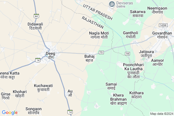
Bahaj Map
EDIT Map
Add Your House
 ..
..
Current Corona Virus Infected Patients Count in Bharatpur District
| City Name | District Name | Total Covid cases |
|---|---|---|
| Bharatpur District | Bharatpur | 110 |
Locality Name :
Bahaj
( बहज )
Tehsil Name : Deeg
District : Bharatpur
State : Rajasthan
Division : Bharatpur
Language : Hindi and Rajasthani, Bharatpur
Current Time 08:21 AM
Date: Wednesday , Apr 30,2025 (IST)
Time zone: IST (UTC+5:30)
Elevation / Altitude: 181 meters. Above Seal level
Telephone Code / Std Code: 05641
Assembly constituency : Deeg Kumher assembly constituency
Assembly MLA : Dr. Shailesh Singh
Lok Sabha constituency : Bharatpur parliamentary constituency
Parliament MP : RANJEETA KOLI
Serpanch Name :
Pin Code : 321203
Post Office Name : Deeg
Commodities Prices : Nagar Market / Mandi
Bahaj Live Weather
Temperature: 27.5 °C
clear sky
Humidity: 35%
Wind : 2.63 mt/sec towards SE
StationName : "Govardhan"
observed on 2 Hours Back
Temperature: 27.5 °C
clear sky
Humidity: 35%
Wind : 2.63 mt/sec towards SE
StationName : "Govardhan"
observed on 2 Hours Back
Bahaj Weather Forecast for Next 5 days
01-05-2025
28.9°C to 39.5°C
clear sky
28.9°C to 39.5°C
clear sky
02-05-2025
29.1°C to 43.0°C
clear sky, scattered clouds, light rain
29.1°C to 43.0°C
clear sky, scattered clouds, light rain
03-05-2025
29.3°C to 43.0°C
few clouds, scattered clouds, overcast clouds, light rain
29.3°C to 43.0°C
few clouds, scattered clouds, overcast clouds, light rain
04-05-2025
30.0°C to 43.7°C
light rain, broken clouds, few clouds, scattered clouds, overcast clouds
30.0°C to 43.7°C
light rain, broken clouds, few clouds, scattered clouds, overcast clouds
05-05-2025
28.5°C to 41.8°C
overcast clouds, broken clouds, few clouds
28.5°C to 41.8°C
overcast clouds, broken clouds, few clouds
National Highways Reachable To Bahaj
Nationa High Way :NH21
Nationa High Way :NH21
Rivers Near Bahaj
यमुना (Yamuna) :Yamuna :यमुना
यमुना (Yamuna) :Yamuna :यमुना
यमुना (Yamuna) :Yamuna :यमुना
यमुना (Yamuna) :Yamuna :यमुना
About Bahaj
Correct below Info and add more info about BahajBahaj is a Village in Deeg Tehsil in Bharatpur District of Rajasthan State, India. It belongs to Bharatpur Division . It is located 35 KM towards North from District head quarters Bharatpur. 9 KM from Deeg. 193 KM from State capital Jaipur
Bahaj Pin code is 321203 and postal head office is Deeg .
Samai ( 4 KM ) , Au ( 5 KM ) , Deeg ( 5 KM ) , Iklahra ( 6 KM ) , Khera Brahman ( 6 KM ) are the nearby Villages to Bahaj. Bahaj is surrounded by Govardhan Tehsil towards East , Kumher Tehsil towards South , Mathura Tehsil towards East , Kaman Tehsil towards North .
Nagar , Mathura , Bharatpur , Nadbai are the near by Cities to Bahaj.
This Place is in the border of the Bharatpur District and Mathura District. Mathura District Govardhan is East towards this place . It is near to the Uttar Pradesh State Border.
Bahaj 2011 Census Details
Bahaj Local Language is Hindi. Bahaj Village Total population is 7712 and number of houses are 1420. Female Population is 47.6%. Village literacy rate is 62.5% and the Female Literacy rate is 23.9%.
Population
| Census Parameter | Census Data |
| Total Population | 7712 |
| Total No of Houses | 1420 |
| Female Population % | 47.6 % ( 3670) |
| Total Literacy rate % | 62.5 % ( 4819) |
| Female Literacy rate | 23.9 % ( 1847) |
| Scheduled Tribes Population % | 0.1 % ( 7) |
| Scheduled Caste Population % | 25.6 % ( 1977) |
| Working Population % | 48.4 % |
| Child(0 -6) Population by 2011 | 1209 |
| Girl Child(0 -6) Population % by 2011 | 45.0 % ( 544) |
Bahaj Census More Deatils.
Politics in Bahaj
Bharatiya Janata Party , BJP , INC are the major political parties in this area.Polling Stations /Booths near Bahaj
1)Govt. Upper Primary School Lanki2)Govt.senior Secondary School Samai Left Part
3)Govt.girls Upper Primary School Naveen Bhawan Bahaj
4)Govt. Girls Upper Primary School Naveen Deeg
5)Govt. Girls Upper Primary School Karaua
HOW TO REACH Bahaj
By Rail
Deeg Rail Way Station is the very nearby railway stations to Bahaj.Colleges near Bahaj
Bsm Brij Gorav Collage
Address :
Guru Madhvanand Pratima College
Address :
Kms Iti College
Address :
Shree Bhavarlal Shastri Sanskrit College
Address :
Sanskar College Nadbai
Address :
Schools in Bahaj
Gaurav U.p.s.bahej
Address : bahaj , deeg , bharatpur , Rajasthan . PIN- 321203 , Post - Deeg
Shalu Sikhan Sanshathan
Address : bahaj , deeg , bharatpur , Rajasthan . PIN- 321203 , Post - Deeg
Barsha U.a.b.m. Bhej
Address : bahaj , deeg , bharatpur , Rajasthan . PIN- 321203 , Post - Deeg
Govt.a.b.u.p.s. Bhej
Address : bahaj , deeg , bharatpur , Rajasthan . PIN- 321203 , Post - Deeg
Govt.u.p.s.s. Bhej
Address : bahaj , deeg , bharatpur , Rajasthan . PIN- 321203 , Post - Deeg
Govt Health Centers near Bahaj
1) Deeg , hospital , old bus stand deeg , near pakka talab2) NOTIONAL Deeg , , old bus stand , mathura roard
3) NOTIONAL Poochhri , , near rest house , 4 kos prakrima marg
Hospitals in Bahaj,Deeg
CHC POONCHHARY KA LOTHA HOSPITAL
Govardhan Parikrama Marg; Govardhan; Uttar Pradesh 281502; India
7.1 KM distance Detail
Community Health Center punchhary ka lotha
CHC; Punchhary ka lotha; Rajasthan 321203; India
7.1 KM distance Detail
more ..
Petrol Bunks in Bahaj,Deeg
Shahid Mohan Singh Filling station INDIAN OIL PETROL PUMP
Ding; Bharatpur; SH-14; Bharatpur Road; Deeg; Rajasthan 321203; India
8.0 KM distance Detail
more ..
Colleges in Bahaj,Deeg
Parsadi Lal Sharma College
Ding; Bharatpur; SH-14; Bharatpur Road; Deeg; Deeg; Rajasthan 321203; India
4.5 KM distance Detail
Shree Bajrang Polytechnic College
SH 44; Bharatpur; Rajasthan; Rajasthan 321203; India
4.8 KM distance Detail
Bajrang Polytechnic College
Ding; Bharatpur; SH-14; Bharatpur Road; Deeg; Deeg; Rajasthan 321201; India
4.9 KM distance Detail
more ..
Schools in Bahaj,Deeg
Sheela Joshi Govt. Sr. Sec. School; Bahaj
MDR70; Bahaj; Rajasthan 321203; India
0.6 KM distance Detail
Electronic Shops in Bahaj,Deeg
Kanha Mobile Shop
Barsana Rd; Deeg Adda; Govardhan; Uttar Pradesh 281502; India
10.8 KM distance Detail
Super Markets in Bahaj,Deeg
Kaushal Shoes Center
Govardhan Parikrama Marg; Deeg Adda; Govardhan; Uttar Pradesh 281502; India
10.9 KM distance Detail
Kapoor Chand Banbari Lal
; Deeg Adda; Govardhan; Uttar Pradesh 281502; India
10.9 KM distance Detail
Police Stations near Bahaj,Deeg
Police Station Of Poochhri
Govardhan Parikrama Marg; Govardhan; Uttar Pradesh 281502; India
7.3 KM distance Detail
Police Chauki
Alwar - Bharatpur Rd; Rundh Narayanpur; Rajasthan 321203; India
8.3 KM distance Detail
About Bahaj &
History
How to reach Bahaj
Tourist Places Near By Bahaj
Schools in Bahaj
Colleges in Bahaj
Temperature & weather of Bahaj
places in Bahaj
Bahaj photos
More Information
How to reach Bahaj
Tourist Places Near By Bahaj
Schools in Bahaj
Colleges in Bahaj
Temperature & weather of Bahaj
places in Bahaj
Bahaj photos
More Information
Village Talk
Post News or Events about this Village
Near Cities
Nagar 30 KM near
Mathura 34 KM near
Bharatpur 34 KM near
Nadbai 36 KM near
Nagar 30 KM near
Mathura 34 KM near
Bharatpur 34 KM near
Nadbai 36 KM near
Near By Taluks
Deeg 9 KM near
Govardhan 12 KM near
Kumher 21 KM near
Mathura 29 KM near
Deeg 9 KM near
Govardhan 12 KM near
Kumher 21 KM near
Mathura 29 KM near
Near By Air Ports
Kheria Airport 76 KM near
Indira Gandhi International Airport 138 KM near
Gwalior Airport 174 KM near
Sanganeer Airport 191 KM near
Kheria Airport 76 KM near
Indira Gandhi International Airport 138 KM near
Gwalior Airport 174 KM near
Sanganeer Airport 191 KM near
Near By Tourist Places
Govardhan 10 KM near
Mathura 33 KM near
Bharatpur 34 KM near
Vrindavan 38 KM near
Dabchick 53 KM near
Govardhan 10 KM near
Mathura 33 KM near
Bharatpur 34 KM near
Vrindavan 38 KM near
Dabchick 53 KM near
Near By Districts
Mathura 33 KM near
Bharatpur 34 KM near
Mahamaya Nagar 73 KM near
Agra 78 KM near
Mathura 33 KM near
Bharatpur 34 KM near
Mahamaya Nagar 73 KM near
Agra 78 KM near
Near By RailWay Station
Deeg Rail Way Station 5.7 KM near
Bharatpur Junction Rail Way Station 31 KM near
Mathura Junction Rail Way Station 33 KM near
Deeg Rail Way Station 5.7 KM near
Bharatpur Junction Rail Way Station 31 KM near
Mathura Junction Rail Way Station 33 KM near