| Home | City Bus | Maps | Villages | Cities | Rail | Tourist Places | School | College | Pin Codes | Corona Cases Count |
| Distance Calculator Bus Services IFSC Codes Trace Mobile Number Weather Search Place Trace IP Available Cash ATM/Banks Locate Polling Booth Report an Error contact People |
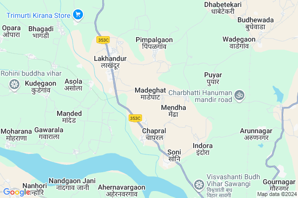
Madeghat
Madeghat Map
EDIT Map
Add Your House
 ..
..
Current Corona Virus Infected Patients Count in Bhandara District
| City Name | District Name | Total Covid cases |
|---|
Locality Name :
Madeghat
( मढेघाट )
Taluka Name : Lakhandur
District : Bhandara
State : Maharashtra
Region : Vidarbh
Division : Nagpur
Language : Marathi
Current Time 04:16 PM
Date: Friday , Apr 25,2025 (IST)
Time zone: IST (UTC+5:30)
Elevation / Altitude: 252 meters. Above Seal level
Telephone Code / Std Code: 07181
Assembly constituency : Sakoli assembly constituency
Assembly MLA : Nanabhau Falgunrao Patole
Lok Sabha constituency : Bhandara-Gondiya parliamentary constituency
Parliament MP : Sunil Baburao Mendhe
Serpanch Name :
Pin Code : 441803
Post Office Name : Lakhandur
Commodities Prices : Lakhandur Market / Mandi
Madeghat Live Weather
Temperature: 43.6 °C
clear sky
Humidity: 10%
Wind : 1.09 mt/sec towards N
StationName : "Pawni"
observed on 1 Hours Back
Temperature: 43.6 °C
clear sky
Humidity: 10%
Wind : 1.09 mt/sec towards N
StationName : "Pawni"
observed on 1 Hours Back
Madeghat Weather Forecast for Next 5 days
26-04-2025
32.2°C to 43.3°C
clear sky, few clouds
32.2°C to 43.3°C
clear sky, few clouds
27-04-2025
30.7°C to 43.6°C
clear sky, scattered clouds, broken clouds, overcast clouds, light rain
30.7°C to 43.6°C
clear sky, scattered clouds, broken clouds, overcast clouds, light rain
28-04-2025
28.2°C to 38.7°C
overcast clouds, light rain, few clouds, scattered clouds
28.2°C to 38.7°C
overcast clouds, light rain, few clouds, scattered clouds
29-04-2025
26.9°C to 42.6°C
clear sky, scattered clouds, broken clouds, few clouds, overcast clouds
26.9°C to 42.6°C
clear sky, scattered clouds, broken clouds, few clouds, overcast clouds
30-04-2025
29.5°C to 45.0°C
broken clouds, clear sky, scattered clouds, overcast clouds
29.5°C to 45.0°C
broken clouds, clear sky, scattered clouds, overcast clouds
National Highways Reachable To Madeghat
Nationa High Way :NH353D
Nationa High Way :NH353D
Rivers Near Madeghat
Nagan
Khobragadi River
Nagan
Khobragadi River
About Madeghat
Correct below Info and add more info about MadeghatMadeghat is a Village in Lakhandur Taluka in Bhandara District of Maharashtra State, India. It belongs to Vidarbh region . It belongs to Nagpur Division . It is located 64 KM towards South from District head quarters Bhandara. 8 KM from Lakhandur. 891 KM from State capital Mumbai
Madeghat Pin code is 441803 and postal head office is Lakhandur .
Chaprad ( 4 KM ) , Khairi ( 4 KM ) , Lakhandur ( 4 KM ) , Puyar ( 5 KM ) , Vihirgaon ( 5 KM ) are the nearby Villages to Madeghat. Madeghat is surrounded by Arjuni Morgaon Taluka towards East , Desaiganj (Wadsa) Taluka towards South , Brahmapuri Taluka towards South , Pauni Taluka towards west .
Pauni , Bhandara , Umred , Gadchiroli are the near by Cities to Madeghat.
This Place is in the border of the Bhandara District and Chandrapur District. Chandrapur District Brahmapuri is South towards this place . Also it is in the Border of other district Gadchiroli .
Madeghat 2011 Census Details
Madeghat Local Language is Marathi. Madeghat Village Total population is 2362 and number of houses are 592. Female Population is 50.3%. Village literacy rate is 67.1% and the Female Literacy rate is 30.2%.
Population
| Census Parameter | Census Data |
| Total Population | 2362 |
| Total No of Houses | 592 |
| Female Population % | 50.3 % ( 1187) |
| Total Literacy rate % | 67.1 % ( 1584) |
| Female Literacy rate | 30.2 % ( 713) |
| Scheduled Tribes Population % | 9.7 % ( 228) |
| Scheduled Caste Population % | 24.2 % ( 572) |
| Working Population % | 60.3 % |
| Child(0 -6) Population by 2011 | 249 |
| Girl Child(0 -6) Population % by 2011 | 47.8 % ( 119) |
Madeghat Census More Deatils.
Politics in Madeghat
BJP , INC are the major political parties in this area.Polling Stations /Booths near Madeghat
1)Zilla Parisad Primary School No-2(plot) Lakhandur First Building2)Zilla Parisad Primary School New Building Opara
3)Zilla Parisad Primary School Chichal North Side Room No-1
4)Zilla Parisad Sinior Primary School Chicholi Old Building
5)Zilla Parisad Sinior Primary School Old Building West Side Room Virli/bu.
HOW TO REACH Madeghat
By Rail
Arun Nagar Rail Way Station , Wadegaon Rail Way Station are the very nearby railway stations to Madeghat. Wadsa Rail Way Station (near to Desaiganj) , Arun Nagar Rail Way Station (near to Desaiganj) , Bhandara Road Rail Way Station (near to Bhandara) are the Rail way stations reachable from near by towns.By Road
Desaiganj , Pauni , Bhandara are the nearby by towns to Madeghat having road connectivity to MadeghatColleges near Madeghat
Dnyaneshwar Junior College Salebhata
Address :
Muncipal Junior Or Senior College
Address :
Manohar Jr College Gurdha
Address :
Nirdhanrao Waghaye Patil Senior College
Address :
Manoharbhai Patel Institute Of Engineering & Technology, Shahapur
Address :
Schools in Madeghat
Z.p. Upper Prymary School Made
Address : madeghat , lakhandur , bhandara , Maharashtra . PIN- 441803 , Post - Lakhandur
Govt Health Centers near Madeghat
1) Arher Navargaon , Sub Centre Arher Navargaon, 1066 , Pimpalgaon - Paharni Raod , Near Vetarnary Hospital2) Ahernavargaon , Primary Health Centre Arher Navargaon, 1066 , Ward No. 3, Mali Mohalla , Near Vetarnary Hospital
3) Pimpalgaon , Sub Centre Pimpalgaon, 455 , Ward No.3, , New Plot Mohalla
Hospitals in Madeghat,Lakhandur
Nakade Hospital
1; Sakoli Warsa Rd; Sai Colony; MSEB Colony; Lakhandur; Maharashtra 441803; India
4.1 KM distance Detail
more ..
Petrol Bunks in Madeghat,Lakhandur
HP PETROL PUMP - MANSHA PETROLEUM
Hpcl Petrol Pump Tal-lakhandur Lakhandur Wadsa Road; Nagpur; Maharashtra 441803; India
1.9 KM distance Detail
VINAYAK PETROLEUM SERVICE STATION
LAKHANDUR; WADSA RD; BHAND; BHANDARA; Maharashtra 441803; India
2.7 KM distance Detail
more ..
Colleges in Madeghat,Lakhandur
Yasawantrao Chavhan College Lakhandur
1; Sakoli Warsa Rd; MSEB Colony; Lakhandur; Maharashtra 441803; India
3.3 KM distance Detail
more ..
Electronic Shops in Madeghat,Lakhandur
vijay compur & xerox Center Lakhandur
Sai Colony; Lakhandur; Maharashtra 441803; India
4.2 KM distance Detail
Local Parks in Madeghat,Lakhandur
Police Stations near Madeghat,Lakhandur
Police Station Lakhandur पोलीस स्टेशन लाखांदूर
Lakhandur; Maharashtra 441803; India
3.6 KM distance Detail
About Madeghat &
History
How to reach Madeghat
Tourist Places Near By Madeghat
Schools in Madeghat
Colleges in Madeghat
Temperature & weather of Madeghat
places in Madeghat
Madeghat photos
More Information
How to reach Madeghat
Tourist Places Near By Madeghat
Schools in Madeghat
Colleges in Madeghat
Temperature & weather of Madeghat
places in Madeghat
Madeghat photos
More Information
Village Talk
Post News or Events about this Village
Near Cities
Pauni 33 KM near
Bhandara 62 KM near
Umred 68 KM near
Gadchiroli 68 KM near
Pauni 33 KM near
Bhandara 62 KM near
Umred 68 KM near
Gadchiroli 68 KM near
Near By Taluks
Lakhandur 8 KM near
Arjuni Morgaon 20 KM near
Brahmapuri 20 KM near
Desaiganj (Wadsa) 20 KM near
Lakhandur 8 KM near
Arjuni Morgaon 20 KM near
Brahmapuri 20 KM near
Desaiganj (Wadsa) 20 KM near
Near By Air Ports
Sonegaon Airport 108 KM near
Raipur Airport 220 KM near
Jabalpur Airport 241 KM near
Nanded Airport 359 KM near
Sonegaon Airport 108 KM near
Raipur Airport 220 KM near
Jabalpur Airport 241 KM near
Nanded Airport 359 KM near
Near By Tourist Places
Bhandara 62 KM near
Tadoba 82 KM near
Nagpur 109 KM near
Chandrapur 120 KM near
Rajnandgaon 138 KM near
Bhandara 62 KM near
Tadoba 82 KM near
Nagpur 109 KM near
Chandrapur 120 KM near
Rajnandgaon 138 KM near
Near By Districts
Bhandara 62 KM near
Gadchiroli 68 KM near
Gondia 96 KM near
Nagpur 108 KM near
Bhandara 62 KM near
Gadchiroli 68 KM near
Gondia 96 KM near
Nagpur 108 KM near
Near By RailWay Station
Arun Nagar Rail Way Station 9.1 KM near
Bhandara Road Rail Way Station 70 KM near
Tumsar Road Junction Rail Way Station 78 KM near
Arun Nagar Rail Way Station 9.1 KM near
Bhandara Road Rail Way Station 70 KM near
Tumsar Road Junction Rail Way Station 78 KM near