| Home | City Bus | Maps | Villages | Cities | Rail | Tourist Places | School | College | Pin Codes | Corona Cases Count |
| Distance Calculator Bus Services IFSC Codes Trace Mobile Number Weather Search Place Trace IP Available Cash ATM/Banks Locate Polling Booth Report an Error contact People |
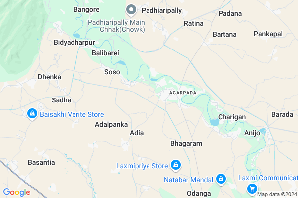
Pandado Map
EDIT Map
Add Your House
 ..
..
Current Corona Virus Infected Patients Count in Bhadrak District
| City Name | District Name | Total Covid cases |
|---|---|---|
| Bhadrak District | Bhadrak | 12 |
| Dhamnagar | Bhadrak | 2 |
| Tihidi | Bhadrak | 2 |
Locality Name :
Pandado
( ପଂଡାଡ )
Tehsil Name : Bonth
District : Bhadrak
State : Odisha
Language : Oriya and Hindi
Current Time 01:50 PM
Date: Tuesday , Apr 29,2025 (IST)
Time zone: IST (UTC+5:30)
Elevation / Altitude: 23 meters. Above Seal level
Telephone Code / Std Code: 06784
Assembly constituency : Bhandaripokhari assembly constituency
Assembly MLA : prafulla samal
Lok Sabha constituency : Bhadrak parliamentary constituency
Parliament MP : MANJULATA MANDAL
Serpanch Name :
Pin Code : 756114
Post Office Name : Bant
Commodities Prices : Bhadrak Market / Mandi
Pandado Live Weather
Temperature: 37.3 °C
clear sky
Humidity: 31%
Wind : 2.48 mt/sec towards SW
StationName : "Bhadrakh"
observed on 1 Hours Back
Temperature: 37.3 °C
clear sky
Humidity: 31%
Wind : 2.48 mt/sec towards SW
StationName : "Bhadrakh"
observed on 1 Hours Back
Pandado Weather Forecast for Next 5 days
30-04-2025
24.6°C to 39.1°C
clear sky, heavy intensity rain, overcast clouds, broken clouds
24.6°C to 39.1°C
clear sky, heavy intensity rain, overcast clouds, broken clouds
01-05-2025
22.2°C to 37.4°C
scattered clouds, clear sky, heavy intensity rain, broken clouds
22.2°C to 37.4°C
scattered clouds, clear sky, heavy intensity rain, broken clouds
02-05-2025
21.9°C to 32.5°C
scattered clouds, few clouds, clear sky, light rain, moderate rain, very heavy rain, overcast clouds
21.9°C to 32.5°C
scattered clouds, few clouds, clear sky, light rain, moderate rain, very heavy rain, overcast clouds
03-05-2025
23.4°C to 31.2°C
broken clouds, clear sky, scattered clouds, light rain, moderate rain, overcast clouds
23.4°C to 31.2°C
broken clouds, clear sky, scattered clouds, light rain, moderate rain, overcast clouds
04-05-2025
24.8°C to 36.0°C
broken clouds, clear sky, light rain, moderate rain, scattered clouds
24.8°C to 36.0°C
broken clouds, clear sky, light rain, moderate rain, scattered clouds
Edit below overview about Pandado
Edit below overview about Pandado
OverView of Pandado
My village name is pandado. its near by agarpada.its 3 km fron agarapada CT school.In this village so many people are SC. Now its a well educated village in bhadrak. so many peoples are doing jobsEdit below overview about Pandado
National Highways Reachable To Pandado
Nationa High Way :NH316
Nationa High Way :NH53
Nationa High Way :NH316
Nationa High Way :NH53
Rivers Near Pandado
Brahmani :Брагмані
Shilabati
Brahmani :Брагмані
Shilabati
About Pandado
Pandado is a small Village/hamlet in Bonth Tehsil in Bhadrak District of Odisha State, India. It is located 24 KM towards west from District head quarters Bhadrak. 8 KM from Bonth. 136 KM from State capital Bhubaneswar
Pandado Pin code is 756114 and postal head office is Bant .
Odanga ( 9 KM ) , Basantia ( 10 KM ) , Tillo ( 11 KM ) , Ramakrushnapur ( 11 KM ) , Bonth ( 11 KM ) are the nearby Villages to Pandado. Pandado is surrounded by Hatadihi Tehsil towards west , Khaira Tehsil towards East , Bhadrak Tehsil towards East , Anandapur Tehsil towards west .
Bhadrak , Anandapur , Soro , Byasanagar are the near by Cities to Pandado.
This Place is in the border of the Bhadrak District and Kendujhar District. Kendujhar District Hatadihi is west towards this place .
Pandado 2011 Census Details
Pandado Local Language is Oriya. Pandado Village Total population is 710 and number of houses are 172. Female Population is 48.9%. Village literacy rate is 76.6% and the Female Literacy rate is 34.1%.
Population
| Census Parameter | Census Data |
| Total Population | 710 |
| Total No of Houses | 172 |
| Female Population % | 48.9 % ( 347) |
| Total Literacy rate % | 76.6 % ( 544) |
| Female Literacy rate | 34.1 % ( 242) |
| Scheduled Tribes Population % | 9.4 % ( 67) |
| Scheduled Caste Population % | 54.6 % ( 388) |
| Working Population % | 27.0 % |
| Child(0 -6) Population by 2011 | 105 |
| Girl Child(0 -6) Population % by 2011 | 52.4 % ( 55) |
Pandado Census More Deatils.
Politics in Pandado
BJD , INC are the major political parties in this area.Polling Stations /Booths near Pandado
1)Puripada Pry School2)Purusandha Nodal Up School(e)
3)Purushandh Up School (n)
4)Ranipada Nodal Up School
5)Todanga Nodal Up School(n)
HOW TO REACH Pandado
By Rail
There is no railway station near to Pandado in less than 10 km.Colleges near Pandado
I G M College Of Science & Technologies
Address :
Bhadrak College
Address :
Tihidi Collage Tihidi
Address :
Dhamanagar College
Address :
Saheed Mahavidyalaya Barapur
Address :
Schools in Pandado
Sankattaraini High Schoo,pandado
Address : pandado , bonth , bhadrak , Sikkim . PIN- 756114 , Post - Bant
Chirol P.s.
Address : pandado , bonth , bhadrak , Sikkim . PIN- 756114 , Post - Bant
Govt Health Centers near Pandado
1) Sarasada SC , , , AFTER SARSADA HIGH SCHOOL,NATIONAL HIGHWAY 5 SIDE2) SABARANGA , , , L.I CENTRE
3) Biruhan SC , Gadadhar Panda , Biruhan , Near Biruhan AWC
Petrol Bunks in Pandado,Bonth
Sudarsan Petrol Shop
Agarpada Road; Near Allahabad Bank; Purusandha; Odisha 756115; India
2.4 KM distance Detail
more ..
Schools in Pandado,Bonth
Sankat tarini High School;pandado
Pandado - Uladanga Rd; Oldanga; Odisha 756114; India
1.9 KM distance Detail
Electronic Shops in Pandado,Bonth
Sony Electronics Agarapada
High School; Agarpada Road; Agarpada; Purusandha; Odisha 756115; India
2.0 KM distance Detail
Gurukrupa Communication
Agarpada Road; Agarpada; Purusandha; Odisha 756115; India
2.2 KM distance Detail
Police Stations near Pandado,Bonth
ଆଗରପଡ଼ା ଥାନା Agarapada Police Station
Agarpada Road; Agarpada; Purusandha; Odisha 756115; India
2.7 KM distance Detail
Governement Offices near Pandado,Bonth
Rauturapur Forest Beat House. Agarpada
Agarpada; Rauturapur; Odisha 756115; India
0.8 KM distance Detail
About Pandado &
History
How to reach Pandado
Tourist Places Near By Pandado
Schools in Pandado
Colleges in Pandado
Temperature & weather of Pandado
places in Pandado
Pandado photos
More Information
How to reach Pandado
Tourist Places Near By Pandado
Schools in Pandado
Colleges in Pandado
Temperature & weather of Pandado
places in Pandado
Pandado photos
More Information
Village Talk
Post News or Events about this Village
Near Cities
Bhadrak 23 KM near
Anandapur 26 KM near
Soro 38 KM near
Byasanagar 41 KM near
Bhadrak 23 KM near
Anandapur 26 KM near
Soro 38 KM near
Byasanagar 41 KM near
Near By Taluks
Bonth 8 KM near
Hatadihi 11 KM near
Khaira 17 KM near
Bhadrak 25 KM near
Bonth 8 KM near
Hatadihi 11 KM near
Khaira 17 KM near
Bhadrak 25 KM near
Near By Air Ports
Bhubaneswar Airport 133 KM near
Ranchi Airport 289 KM near
Netaji Subhas Chandra Bose Airport 300 KM near
Gaya Airport 470 KM near
Bhubaneswar Airport 133 KM near
Ranchi Airport 289 KM near
Netaji Subhas Chandra Bose Airport 300 KM near
Gaya Airport 470 KM near
Near By Tourist Places
Barehipani & Joranda Barehipani & Joranda Falls 68 KM near
Chandipur 83 KM near
Baripada 101 KM near
Cuttack 107 KM near
Paradeep Beach 113 KM near
Barehipani & Joranda Barehipani & Joranda Falls 68 KM near
Chandipur 83 KM near
Baripada 101 KM near
Cuttack 107 KM near
Paradeep Beach 113 KM near
Near By Districts
Bhadrak 23 KM near
Jajapur 43 KM near
Baleshwar 72 KM near
Kendrapara 86 KM near
Bhadrak 23 KM near
Jajapur 43 KM near
Baleshwar 72 KM near
Kendrapara 86 KM near
Near By RailWay Station
Bhadrak Rail Way Station 22 KM near
Soro Rail Way Station 40 KM near
Bhadrak Rail Way Station 22 KM near
Soro Rail Way Station 40 KM near