| Home | City Bus | Maps | Villages | Cities | Rail | Tourist Places | School | College | Pin Codes | Corona Cases Count |
| Distance Calculator Bus Services IFSC Codes Trace Mobile Number Weather Search Place Trace IP Available Cash ATM/Banks Locate Polling Booth Report an Error contact People |
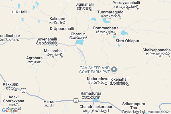
Chornur Map
EDIT Map
Add Your House
 ..
..
Current Corona Virus Infected Patients Count in Bellary District
| City Name | District Name | Total Covid cases |
|---|---|---|
| Hospete | Ballari | 7 |
| Hospet | Ballari | 3 |
| Ballari District | Ballari | 2 |
| Bellary | Ballari | 1 |
Locality Name :
Chornur
( ಚೋರನೂರ್ )
Taluk Name : Sandur
District : Bellary
State : Karnataka
Division : Gulbarga
Language : Kannada and Telugu, Dakhni, Hindi, English
Current Time 11:41 AM
Date: Tuesday , Apr 29,2025 (IST)
Time zone: IST (UTC+5:30)
Elevation / Altitude: 489 meters. Above Seal level
Telephone Code / Std Code: 08395
Assembly constituency : Sandur assembly constituency
Assembly MLA : E. Tukaram
Lok Sabha constituency : Bellary parliamentary constituency
Parliament MP : Y. DEVENDRAPPA
Serpanch Name :
Pin Code : 583128
Post Office Name : Choranur
Commodities Prices : Kottur Market / Mandi
Chornur Live Weather
Temperature: 28.6 °C
few clouds
Humidity: 45%
Wind : 2.09 mt/sec towards W
StationName : "KÅ«dligi"
observed on 2 Hours Back
Temperature: 28.6 °C
few clouds
Humidity: 45%
Wind : 2.09 mt/sec towards W
StationName : "KÅ«dligi"
observed on 2 Hours Back
Chornur Weather Forecast for Next 5 days
30-04-2025
27.1°C to 37.9°C
clear sky, broken clouds, overcast clouds
27.1°C to 37.9°C
clear sky, broken clouds, overcast clouds
01-05-2025
24.3°C to 36.2°C
broken clouds, few clouds, scattered clouds, overcast clouds
24.3°C to 36.2°C
broken clouds, few clouds, scattered clouds, overcast clouds
02-05-2025
23.1°C to 37.1°C
scattered clouds, clear sky, few clouds
23.1°C to 37.1°C
scattered clouds, clear sky, few clouds
03-05-2025
23.0°C to 36.9°C
few clouds, clear sky, scattered clouds
23.0°C to 36.9°C
few clouds, clear sky, scattered clouds
04-05-2025
23.4°C to 37.6°C
scattered clouds, clear sky, few clouds
23.4°C to 37.6°C
scattered clouds, clear sky, few clouds
Edit below overview about Chornur
Edit below overview about Chornur
OverView of Chornur
chornur is one of the nice village in sandur taluk , Chornur lake is very big aroung 2km area,in chornur Choleshwara tempale is very good tourisum placeEdit below overview about Chornur
National Highways Reachable To Chornur
Nationa High Way :NH50
Nationa High Way :NH 67;150A
Nationa High Way :NH50
Nationa High Way :NH 67;150A
Rivers Near Chornur
Hagari :Vedavati :ವೇದಾವತಿ
Narihalla :ನರಿಹಳ್ಳ
Hagari :Vedavati :ವೇದಾವತಿ
Narihalla :ನರಿಹಳ್ಳ
About Chornur
Chornur is a Village in Sandur Taluk in Bellary District of Karnataka State, India. It belongs to Gulbarga Division . It is located 57 KM towards west from District head quarters Bellary. 22 KM from Sandur. 284 KM from State capital Bangalore
Chornur Pin code is 583128 and postal head office is Choranur .
Ramadurga ( 5 KM ) , Sovenahalli ( 6 KM ) , Kalingeri ( 9 KM ) , Jermali ( 13 KM ) , Bandri ( 15 KM ) are the nearby Villages to Chornur. Chornur is surrounded by Sandur Taluk towards North , Molakalmuru Taluk towards East , D.Hirehal Taluk towards East , Hagaribommanahalli Taluk towards west .
Sandur , Rayadurg , Hospet , Bellary are the near by Cities to Chornur.
Chornur 2011 Census Details
Chornur Local Language is Kannada. Chornur Village Total population is 7421 and number of houses are 1349. Female Population is 50.2%. Village literacy rate is 48.8% and the Female Literacy rate is 21.5%.
Population
| Census Parameter | Census Data |
| Total Population | 7421 |
| Total No of Houses | 1349 |
| Female Population % | 50.2 % ( 3729) |
| Total Literacy rate % | 48.8 % ( 3618) |
| Female Literacy rate | 21.5 % ( 1592) |
| Scheduled Tribes Population % | 41.5 % ( 3077) |
| Scheduled Caste Population % | 12.7 % ( 946) |
| Working Population % | 39.2 % |
| Child(0 -6) Population by 2011 | 1177 |
| Girl Child(0 -6) Population % by 2011 | 51.2 % ( 603) |
Chornur Census More Deatils.
Politics in Chornur
Bharatiya Janata Party , BJP , Indian National Congress (INC) , INC are the major political parties in this area.Polling Stations /Booths near Chornur
1)Government Higher Primary School Room No 1 G.basapura2)Government Lower Primary School Uttaramalai
3)Government Higher Primary School Near 8 Kolai West Wing Sandur
4)Government Higher Primary School Hosa Madapura
5)Government Higher Primary School Yarriahana Halli
HOW TO REACH Chornur
By Road
Kudligi is the Nearest Town to Chornur. Kudligi is 20 km from Chornur. Road connectivity is there from Kudligi to Chornur.By Rail
There is no railway station near to Chornur in less than 10 km.Colleges near Chornur
Govt Comp P.u Collage
Address :
Ses College
Address : Sandur, Bellary District.
Kandra Education Trust’s Sri Mata College
Address : Sandur, Bellary District.
Schools near Chornur
Hps Jindal Vidyanagar
Address : vaddu , sandur , bellary , Karnataka . PIN- 583275 , Post - Vidyanagar (Bellary)
Hs Jindhal Adarsha Vidyalaya
Address : kure kuppa , sandur , bellary , Karnataka . PIN- 583123 , Post - Toranagallu
Hps Murarji School Bannihatti
Address : banni hatti , sandur , bellary , Karnataka . PIN- 583131 , Post - Harapanahalli Town
Hps Murarji School Choranur
Address : choranoor , sandur , bellary , Karnataka . PIN- 583128 , Post - Choranur
Govt Health Centers near Chornur
1) UHC SIDDALIGAPPA CHWOKI-B , UHC SIDDALIGAPPA CHWOKI, Behind Kottureshwara ITI Collage, Jambbhnath Road, Mehboobnagar Hospet-5832 , ,2) UHC SIDDALIGAPPA CHWOKI-A , MEHBOOB NAGAR, HOSPET , ,
3) UHC SIDDALIGAPPA CHWOKI-C , NO BUILDING , Its a subcenter in Urban Health center ,
Sub Villages in Chornur
Hospitals in Chornur,Sandur
Prathamika Arogya Kendra; Bandri
Hospital Road; Sandur Taluk; Bellary District; Bandri; Karnataka 583124; India
16.3 KM distance Detail
more ..
Schools in Chornur,Sandur
Murarji Desai Residential School Metriki
MDR School; Chornur; Karnataka 583128; India
3.0 KM distance Detail
Governement Offices near Chornur,Sandur
Thaluku Tribes Welfare Office
Kudligi Rd; Gollarahatti; Bommaghatta; Karnataka 583128; India
17.9 KM distance Detail
About Chornur &
History
How to reach Chornur
Tourist Places Near By Chornur
Schools in Chornur
Colleges in Chornur
Temperature & weather of Chornur
places in Chornur
Chornur photos
More Information
How to reach Chornur
Tourist Places Near By Chornur
Schools in Chornur
Colleges in Chornur
Temperature & weather of Chornur
places in Chornur
Chornur photos
More Information
Village Talk
Post News or Events about this Village
Near Cities
Sandur 21 KM near
Rayadurg 47 KM near
Hospet 51 KM near
Bellary 54 KM near
Sandur 21 KM near
Rayadurg 47 KM near
Hospet 51 KM near
Bellary 54 KM near
Near By Taluks
Kudligi 19 KM near
Sandur 21 KM near
Molakalmuru 27 KM near
D.Hirehal 37 KM near
Kudligi 19 KM near
Sandur 21 KM near
Molakalmuru 27 KM near
D.Hirehal 37 KM near
Near By Air Ports
Hubli Airport 183 KM near
Bengaluru International Airport 254 KM near
Sambre Airport 259 KM near
Bajpe Airport 312 KM near
Hubli Airport 183 KM near
Bengaluru International Airport 254 KM near
Sambre Airport 259 KM near
Bajpe Airport 312 KM near
Near By Tourist Places
Hospet 49 KM near
Hampi 54 KM near
Chitradurga 85 KM near
Pattadakkal 156 KM near
Aihole 160 KM near
Hospet 49 KM near
Hampi 54 KM near
Chitradurga 85 KM near
Pattadakkal 156 KM near
Aihole 160 KM near
Near By Districts
Bellary 54 KM near
Koppal 71 KM near
Chitradurga 85 KM near
Davangere 93 KM near
Bellary 54 KM near
Koppal 71 KM near
Chitradurga 85 KM near
Davangere 93 KM near
Near By RailWay Station
Toranagallu Junction Rail Way Station 40 KM near
Hosapete Junction Rail Way Station 51 KM near
Toranagallu Junction Rail Way Station 40 KM near
Hosapete Junction Rail Way Station 51 KM near