| Home | City Bus | Maps | Villages | Cities | Rail | Tourist Places | School | College | Pin Codes | Corona Cases Count |
| Distance Calculator Bus Services IFSC Codes Trace Mobile Number Weather Search Place Trace IP Available Cash ATM/Banks Locate Polling Booth Report an Error contact People |
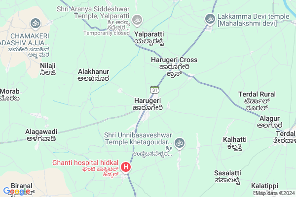
Harugeri Map
EDIT Map
Add Your House
 ..
..
Current Corona Virus Infected Patients Count in Belgaum District
| City Name | District Name | Total Covid cases |
|---|---|---|
| Belagavi District | Belagavi | 25 |
| Hirebagewadi | Belagavi | 12 |
| Raibagh | Belagavi | 8 |
| Raibag | Belagavi | 3 |
| Raibhag | Belagavi | 2 |
| Bagewadi | Belagavi | 1 |
| Chikkodi | Belagavi | 1 |
Locality Name :
Harugeri
( ಹಾರೂಗೇರಿ )
Taluk Name : Raybag
District : Belgaum
State : Karnataka
Division : Belgaum
Language : Kannada and Marathi, English,
Current Time 11:30 AM
Date: Monday , Apr 28,2025 (IST)
Time zone: IST (UTC+5:30)
Elevation / Altitude: 596 meters. Above Seal level
Telephone Code / Std Code: 08331
Assembly constituency : Kudachi assembly constituency
Assembly MLA : Mahendra. Kallappa. Tammannavar
Lok Sabha constituency : Chikkodi parliamentary constituency
Parliament MP : ANNASAHEB SHANKAR JOLLE
Serpanch Name :
Pin Code : 591220
Post Office Name : Harugeri
Commodities Prices : Kudchi Market / Mandi
Harugeri Live Weather
Temperature: 34.9 °C
clear sky
Humidity: 22%
Wind : 0.92 mt/sec towards N
StationName : "RÄ\u0081ybÄ\u0081g"
observed on Now
Temperature: 34.9 °C
clear sky
Humidity: 22%
Wind : 0.92 mt/sec towards N
StationName : "RÄ\u0081ybÄ\u0081g"
observed on Now
Harugeri Weather Forecast for Next 5 days
29-04-2025
27.1°C to 38.6°C
clear sky
27.1°C to 38.6°C
clear sky
30-04-2025
25.5°C to 39.8°C
few clouds, clear sky
25.5°C to 39.8°C
few clouds, clear sky
01-05-2025
23.8°C to 39.3°C
few clouds, clear sky, broken clouds
23.8°C to 39.3°C
few clouds, clear sky, broken clouds
02-05-2025
24.1°C to 39.6°C
broken clouds, overcast clouds, clear sky, few clouds, scattered clouds
24.1°C to 39.6°C
broken clouds, overcast clouds, clear sky, few clouds, scattered clouds
03-05-2025
25.0°C to 40.4°C
scattered clouds, clear sky, few clouds
25.0°C to 40.4°C
scattered clouds, clear sky, few clouds
Edit below overview about Harugeri
Edit below overview about Harugeri
OverView of Harugeri
it is the biggest gram panchayat in karnataka.it is having more schools and colleges , here more preperance to educate the childrens.Edit below overview about Harugeri
National Highways Reachable To Harugeri
Nationa High Way :NH48
Nationa High Way :NH48
Rivers Near Harugeri
Krishna :クリシュナ :ಕೃಷ್ಣಾ :कृष्णा
Krishna :クリシュナ :ಕೃಷ್ಣಾ :कृष्णा
Krishna :クリシュナ :ಕೃಷ್ಣಾ :कृष्णा
Krishna :クリシュナ :ಕೃಷ್ಣಾ :कृष्णा
About Harugeri
Harugeri is a Village in Raybag Taluk in Belgaum District of Karnataka State, India. It belongs to Belgaum Division . It is located 102 KM towards North from District head quarters Belgaum. 14 KM from Raybag. 568 KM from State capital Bangalore
Harugeri Pin code is 591220 and postal head office is Harugeri .
Nilaji ( 8 KM ) , Koligudda ( 8 KM ) , Khemlapur ( 10 KM ) , Bastwad ( 11 KM ) , Palbhavi ( 12 KM ) are the nearby Villages to Harugeri. Harugeri is surrounded by Athni Taluk towards North , Jamkhandi Taluk towards East , Gokak Taluk towards South , Shirol Taluk towards west .
Terdal , Rabkavi Banhatti , Mudalgi , Mahalingpur are the near by Cities to Harugeri.
Harugeri 2011 Census Details
Harugeri Local Language is Kannada. Harugeri Village Total population is 28754 and number of houses are 5567. Female Population is 48.9%. Village literacy rate is 60.9% and the Female Literacy rate is 26.4%.
Population
| Census Parameter | Census Data |
| Total Population | 28754 |
| Total No of Houses | 5567 |
| Female Population % | 48.9 % ( 14073) |
| Total Literacy rate % | 60.9 % ( 17499) |
| Female Literacy rate | 26.4 % ( 7593) |
| Scheduled Tribes Population % | 3.6 % ( 1035) |
| Scheduled Caste Population % | 20.3 % ( 5846) |
| Working Population % | 36.9 % |
| Child(0 -6) Population by 2011 | 3975 |
| Girl Child(0 -6) Population % by 2011 | 45.8 % ( 1819) |
Harugeri Census More Deatils.
Politics in Harugeri
Bharatiya Janata Party , BJP , Bharatiya Janata Party (BJP) , INC are the major political parties in this area.Polling Stations /Booths near Harugeri
1)Govt.veternary Office Godown Old Building Room No.1 Harugeri2)Govt.public Library Harugeri
3)Gram Panchayat Office Mugalkhod
4)Govt.mla Model Urdu Boys School New Building Room No 9 Kudachi
5)Govt.higher Primary Kannada Central Schoolnorth Wing Room No.6 Paramanandwadi
HOW TO REACH Harugeri
By Road
Terdal is the Nearest Town to Harugeri. Terdal is 11 km from Harugeri. Road connectivity is there from Terdal to Harugeri.By Rail
There is no railway station near to Harugeri in less than 10 km.Colleges near Harugeri
H V Pre-camposite College Harugeri
Address :
Schools in Harugeri
Shri Channavrishabhendra H School H
Address : harugeri , raibag , chikkodi , Karnataka . PIN- 591220 , Post - Harugeri
St. Pt. Eng H.s. (unaided)
Address : harugeri , raibag , chikkodi , Karnataka . PIN- 591220 , Post - Harugeri
Murarji Desai Resident
Address : harugeri , raibag , chikkodi , Karnataka . PIN- 591213 , Post - Ankali
K.h.p.s.darurtot
Address : harugeri , raibag , chikkodi , Karnataka . PIN- 591220 , Post - Harugeri
K.h.p.s.harugericross
Address : harugeri , raibag , chikkodi , Karnataka . PIN- 591220 , Post - Harugeri
Govt Health Centers near Harugeri
1) Alagawadi , Janata Plot Alagwadi , Janata Plot , Near Dattareya Temple2) Harugeri-2 , SC Harugeri , Mugalkhod road , Near Karisiddeshawar Temple
3) Kabbenur , Kabbenur , Kabbenur , Kabbenur
Sub Villages in Harugeri
Colleges in Harugeri,Raybag
Bhagawan ITI College(RSC)
Vidyanagar Colony; Harugeri; Karnataka 591220; India
1.6 KM distance Detail
Shri Siddhivinayaka Rural Ayurvedic Medical College
Athani Gokak Road; Belgaum District; Harugeri; Karnataka 591220; India
2.5 KM distance Detail
more ..
Schools in Harugeri,Raybag
Karnwadi Shale Harugerifzvinut
Vidyanagar Colony; Harugeri; Karnataka 591220; India
1.5 KM distance Detail
Janata Education Society; Harugeri
SH31; Vidyanagar Colony; Harugeri; Karnataka 591220; India
1.6 KM distance Detail
Electronic Shops in Harugeri,Raybag
PARVATHI COMMUNICATION
Hidkal - Khanadal Rd; Khanadal; Karnataka 591235; India
6.8 KM distance Detail
Super Markets in Harugeri,Raybag
Sajane's Kirana Shop
Railway Station Rd; Kudachi Rural; Karnataka 591311; India
17.8 KM distance Detail
Local Parks in Harugeri,Raybag
Memorial Park Martin Luther King Bust
2300 W 7th St Chester; PA; Mudalgi - Shivapur - Hallur Road; Mudalagi; Karnataka 19013; India
21.8 KM distance Detail
About Harugeri &
History
How to reach Harugeri
Tourist Places Near By Harugeri
Schools in Harugeri
Colleges in Harugeri
Temperature & weather of Harugeri
places in Harugeri
Harugeri photos
More Information
How to reach Harugeri
Tourist Places Near By Harugeri
Schools in Harugeri
Colleges in Harugeri
Temperature & weather of Harugeri
places in Harugeri
Harugeri photos
More Information
Village Talk
Post News or Events about this Village
Near Cities
Terdal 12 KM near
Rabkavi Banhatti 21 KM near
Mudalgi 23 KM near
Mahalingpur 25 KM near
Terdal 12 KM near
Rabkavi Banhatti 21 KM near
Mudalgi 23 KM near
Mahalingpur 25 KM near
Near By Taluks
Raybag 14 KM near
Athni 28 KM near
Jamkhandi 41 KM near
Gokak 46 KM near
Raybag 14 KM near
Athni 28 KM near
Jamkhandi 41 KM near
Gokak 46 KM near
Near By Air Ports
Kolhapur Airport 75 KM near
Sambre Airport 91 KM near
Hubli Airport 145 KM near
Sholapur Airport 181 KM near
Kolhapur Airport 75 KM near
Sambre Airport 91 KM near
Hubli Airport 145 KM near
Sholapur Airport 181 KM near
Near By Tourist Places
Kolhapur 86 KM near
Bijapur 98 KM near
Panhala 105 KM near
Badami 115 KM near
Pattadakkal 125 KM near
Kolhapur 86 KM near
Bijapur 98 KM near
Panhala 105 KM near
Badami 115 KM near
Pattadakkal 125 KM near
Near By Districts
Sangli 60 KM near
Kolhapur 86 KM near
Bagalkot 97 KM near
Belgaum 98 KM near
Sangli 60 KM near
Kolhapur 86 KM near
Bagalkot 97 KM near
Belgaum 98 KM near
Near By RailWay Station
Kudachi Rail Way Station 17 KM near
Raybag Rail Way Station 17 KM near
Kudachi Rail Way Station 17 KM near
Raybag Rail Way Station 17 KM near