| Home | City Bus | Maps | Villages | Cities | Rail | Tourist Places | School | College | Pin Codes | Corona Cases Count |
| Distance Calculator Bus Services IFSC Codes Trace Mobile Number Weather Search Place Trace IP Available Cash ATM/Banks Locate Polling Booth Report an Error contact People |
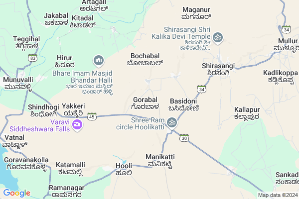
Gorabal Map
EDIT Map
Add Your House
 ..
..
Current Corona Virus Infected Patients Count in Belgaum District
| City Name | District Name | Total Covid cases |
|---|---|---|
| Belagavi District | Belagavi | 25 |
| Hirebagewadi | Belagavi | 12 |
| Raibagh | Belagavi | 8 |
| Raibag | Belagavi | 3 |
| Raibhag | Belagavi | 2 |
| Bagewadi | Belagavi | 1 |
| Chikkodi | Belagavi | 1 |
Locality Name :
Gorabal
( ಗೊರಬಲ್ )
Taluk Name : Parasgad
District : Belgaum
State : Karnataka
Division : Belgaum
Language : Kannada and Marathi, English,
Current Time 09:07 AM
Date: Wednesday , Apr 30,2025 (IST)
Time zone: IST (UTC+5:30)
Elevation / Altitude: 738 meters. Above Seal level
Telephone Code / Std Code: 08330
Assembly constituency : Saundatti Yellamma assembly constituency
Assembly MLA : Vishwas Vasant Vaidya
Lok Sabha constituency : Belgaum parliamentary constituency
Parliament MP : ANGADI SURESH CHANNABASAPPA
Serpanch Name :
Pin Code : 591126
Post Office Name : Saundatti
Commodities Prices : Ramdurga Market / Mandi
National Highways Reachable To Gorabal
Nationa High Way :NH748
Nationa High Way :NH748
Rivers Near Gorabal
Markandeya :ಮರ್ಕಂಧೆಯ :मार्कण्डेय
Markandeya :ಮರ್ಕಂಧೆಯ :मार्कण्डेय
Markandeya :ಮರ್ಕಂಧೆಯ :मार्कण्डेय
Markandeya :ಮರ್ಕಂಧೆಯ :मार्कण्डेय
About Gorabal
Correct below Info and add more info about GorabalGorabal is a Village in Parasgad Taluk in Belgaum District of Karnataka State, India. It belongs to Belgaum Division . It is located 86 KM towards East from District head quarters Belgaum. 20 KM from Parasgad. 479 KM from State capital Bangalore
Gorabal Pin code is 591126 and postal head office is Saundatti .
Hooli ( 5 KM ) , Sirasangi ( 7 KM ) , Munavalli ( 11 KM ) , Teggihal ( 11 KM ) , Goravanakolla ( 11 KM ) are the nearby Villages to Gorabal. Gorabal is surrounded by Ramdurg Taluk towards North , Naragund Taluk towards East , Navalgund Taluk towards South , Dharwad Taluk towards South .
Saundatti-Yellamma , Ramdurg , Nargund , Navalgund are the near by Cities to Gorabal.
Gorabal 2011 Census Details
Gorabal Local Language is Kannada. Gorabal Village Total population is 2536 and number of houses are 437. Female Population is 48.2%. Village literacy rate is 57.6% and the Female Literacy rate is 22.5%.
Population
| Census Parameter | Census Data |
| Total Population | 2536 |
| Total No of Houses | 437 |
| Female Population % | 48.2 % ( 1222) |
| Total Literacy rate % | 57.6 % ( 1460) |
| Female Literacy rate | 22.5 % ( 571) |
| Scheduled Tribes Population % | 47.0 % ( 1191) |
| Scheduled Caste Population % | 4.7 % ( 118) |
| Working Population % | 43.8 % |
| Child(0 -6) Population by 2011 | 361 |
| Girl Child(0 -6) Population % by 2011 | 51.0 % ( 184) |
Gorabal Census More Deatils.
Politics in Gorabal
Bharatiya Janata Party , BJP , Bharatiya Janata Party (BJP) , INC are the major political parties in this area.Polling Stations /Booths near Gorabal
1)Govt Higher Primary Kannada School Room No 32)Govt Higher Primary Kannada School Old Building Room No 3
3)Govt Comp High School East Wing
4)Govt Comp High School South Wing Room No : 3
5)Govt Higher Primary Kannada School New Building Room No 1
HOW TO REACH Gorabal
By Road
Saundatti-Yellamma is the Nearest Town to Gorabal. Saundatti-Yellamma is 20 km from Gorabal. Road connectivity is there from Saundatti-Yellamma to Gorabal.By Rail
There is no railway station near to Gorabal in less than 10 km.Colleges near Gorabal
Kmc High School Sattigeri
Address :
Vidyavahini Pvt Industrial Training Institute (iti) Yaragatti
Address : Opp Old Apmc Market Road Opp- Police Station
Shri Shivayogeeshwar Rural Ayurvedic Medical College & Hospital
Address : Shri Shivayogeeshwar Rural Ayurvedic Medical Colle
Schools in Gorabal
K.h.p.s.
Address : gorabal , soundatti , belgaum , Karnataka . PIN- 591126 , Post - Saundatti
Govt Health Centers near Gorabal
1) Uppin Betageri , Medical Officer Primary Health Center , Jantha Plot , Khadhi Kandra2) Lokur , Medical Officer Primary Health Center , Lokur , Lokur
3) Kotabagi , Kotabagi , Kotabagi , Kotabagi
Hospitals in Gorabal,Parasgad
Dr. Tased Maternity and General Hospital
Panchalingeshwar Cross; Munavalli; Manolli; Karnataka 591117; India
11.6 KM distance Detail
ಪುರಸಭೆ ಕಾರ್ಯಾಲಯ;ಮುನವಳ್ಳಿ.
Valmiki Nagar; Munavalli; Manolli; Karnataka 591117; India
11.8 KM distance Detail
more ..
Petrol Bunks in Gorabal,Parasgad
Sash Enterprises; Essar Oil Pump
Unnamed Rd;; Ugargol; Karnataka 591110; India
13.0 KM distance Detail
more ..
About Gorabal &
History
How to reach Gorabal
Tourist Places Near By Gorabal
Schools in Gorabal
Colleges in Gorabal
Temperature & weather of Gorabal
places in Gorabal
Gorabal photos
More Information
How to reach Gorabal
Tourist Places Near By Gorabal
Schools in Gorabal
Colleges in Gorabal
Temperature & weather of Gorabal
places in Gorabal
Gorabal photos
More Information
Village Talk
Post News or Events about this Village
Near Cities
Saundatti-Yellamma 13 KM near
Ramdurg 16 KM near
Nargund 25 KM near
Navalgund 38 KM near
Saundatti-Yellamma 13 KM near
Ramdurg 16 KM near
Nargund 25 KM near
Navalgund 38 KM near
Near By Taluks
Parasgad 20 KM near
Ramdurg 20 KM near
Naragund 27 KM near
Navalgund 38 KM near
Parasgad 20 KM near
Ramdurg 20 KM near
Naragund 27 KM near
Navalgund 38 KM near
Near By Air Ports
Hubli Airport 61 KM near
Sambre Airport 70 KM near
Kolhapur Airport 146 KM near
Dabolim Airport 173 KM near
Hubli Airport 61 KM near
Sambre Airport 70 KM near
Kolhapur Airport 146 KM near
Dabolim Airport 173 KM near
Near By Tourist Places
Badami 56 KM near
Hubli 61 KM near
Pattadakkal 73 KM near
Aihole 83 KM near
Dandeli 91 KM near
Badami 56 KM near
Hubli 61 KM near
Pattadakkal 73 KM near
Aihole 83 KM near
Dandeli 91 KM near
Near By Districts
Dharwad 54 KM near
Bagalkot 70 KM near
Gadag 72 KM near
Belgaum 83 KM near
Dharwad 54 KM near
Bagalkot 70 KM near
Gadag 72 KM near
Belgaum 83 KM near
Near By RailWay Station
Badami Rail Way Station 53 KM near
Dharwad Rail Way Station 55 KM near
Badami Rail Way Station 53 KM near
Dharwad Rail Way Station 55 KM near