| Home | City Bus | Maps | Villages | Cities | Rail | Tourist Places | School | College | Pin Codes | Corona Cases Count |
| Distance Calculator Bus Services IFSC Codes Trace Mobile Number Weather Search Place Trace IP Available Cash ATM/Banks Locate Polling Booth Report an Error contact People |
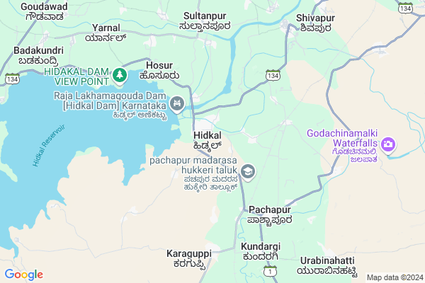
Hospet Map
EDIT Map
Add Your House
 ..
..
Current Corona Virus Infected Patients Count in Belgaum District
| City Name | District Name | Total Covid cases |
|---|---|---|
| Belagavi District | Belagavi | 25 |
| Hirebagewadi | Belagavi | 12 |
| Raibagh | Belagavi | 8 |
| Raibag | Belagavi | 3 |
| Raibhag | Belagavi | 2 |
| Bagewadi | Belagavi | 1 |
| Chikkodi | Belagavi | 1 |
Locality Name :
Hospet
( ಹೊಸ್ಪೆಟ್ )
Taluk Name : Hukeri
District : Belgaum
State : Karnataka
Division : Belgaum
Language : Kannada and Marathi, English,
Current Time 10:02 AM
Date: Thursday , Apr 24,2025 (IST)
Time zone: IST (UTC+5:30)
Elevation / Altitude: 650 meters. Above Seal level
Telephone Code / Std Code: 08333
Assembly constituency : Yemkanmardi assembly constituency
Assembly MLA : Satish Laxmanarao Jarkiholi
Lok Sabha constituency : Chikkodi parliamentary constituency
Parliament MP : ANNASAHEB SHANKAR JOLLE
Serpanch Name :
Pin Code : 591107
Post Office Name : Hidkal Dam
Commodities Prices : Gokak Market / Mandi
Hospet Live Weather
Temperature: 20.7 °C
broken clouds
Humidity: 46%
Wind : 2.05 mt/sec towards W
StationName : "Konnūr"
observed on 2 Hours Back
Temperature: 20.7 °C
broken clouds
Humidity: 46%
Wind : 2.05 mt/sec towards W
StationName : "Konnūr"
observed on 2 Hours Back
Hospet Weather Forecast for Next 5 days
25-04-2025
25.2°C to 37.9°C
scattered clouds, few clouds, light rain
25.2°C to 37.9°C
scattered clouds, few clouds, light rain
26-04-2025
24.8°C to 37.1°C
light rain, broken clouds, scattered clouds, few clouds
24.8°C to 37.1°C
light rain, broken clouds, scattered clouds, few clouds
27-04-2025
24.4°C to 38.3°C
broken clouds, scattered clouds, few clouds
24.4°C to 38.3°C
broken clouds, scattered clouds, few clouds
28-04-2025
23.8°C to 38.3°C
broken clouds, scattered clouds, few clouds, clear sky
23.8°C to 38.3°C
broken clouds, scattered clouds, few clouds, clear sky
29-04-2025
23.3°C to 38.7°C
broken clouds, scattered clouds, few clouds, clear sky
23.3°C to 38.7°C
broken clouds, scattered clouds, few clouds, clear sky
National Highways Reachable To Hospet
Nationa High Way :NH548H
Nationa High Way :NH548H
Rivers Near Hospet
Ghataprabha
Vedaganga :ವೇದಗಂಗ :वेदगंग
Ghataprabha
Vedaganga :ವೇದಗಂಗ :वेदगंग
About Hospet
Correct below Info and add more info about HospetHospet is a Village in Hukeri Taluk in Belgaum District of Karnataka State, India. It belongs to Belgaum Division . It is located 40 KM towards North from District head quarters Belgaum. 13 KM from Hukeri. 552 KM from State capital Bangalore
Hospet Pin code is 591107 and postal head office is Hidkal Dam .
Pachapur ( 6 KM ) , Karaguppi ( 7 KM ) , Aralikatti ( 8 KM ) , Mavanur ( 8 KM ) , Basapur ( 9 KM ) are the nearby Villages to Hospet. Hospet is surrounded by Gokak Taluk towards East , Gadhinglaj Taluk towards west , Belgaum Taluk towards South , Chikodi Taluk towards North .
Gokak , Sankeshwar , Belgaum , Mudalgi are the near by Cities to Hospet.
Hospet 2011 Census Details
Hospet Local Language is Kannada. Hospet Village Total population is 3713 and number of houses are 776. Female Population is 49.9%. Village literacy rate is 73.1% and the Female Literacy rate is 33.6%.
Population
| Census Parameter | Census Data |
| Total Population | 3713 |
| Total No of Houses | 776 |
| Female Population % | 49.9 % ( 1852) |
| Total Literacy rate % | 73.1 % ( 2715) |
| Female Literacy rate | 33.6 % ( 1247) |
| Scheduled Tribes Population % | 4.6 % ( 169) |
| Scheduled Caste Population % | 18.7 % ( 695) |
| Working Population % | 36.0 % |
| Child(0 -6) Population by 2011 | 453 |
| Girl Child(0 -6) Population % by 2011 | 48.8 % ( 221) |
Hospet Census More Deatils.
Politics in Hospet
Bharatiya Janata Party , BJP , Indian National Congress (INC) , INC are the major political parties in this area.Polling Stations /Booths near Hospet
1)Govt Kannada Boys School Malyanatti2)Govt. Model Higher Primary Kannada Boys School New Building Pachapur
3)Govt.higher Primary Urdu School Masaraguppi
4)Govt.higher Primary Kannada School Rustumpur
5)Govt Lower Primary School Hale Hosur
HOW TO REACH Hospet
By Road
Hukeri is the Nearest Town to Hospet. Hukeri is 20 km from Hospet. Road connectivity is there from Hukeri to Hospet.By Rail
Pachhapur Rail Way Station , Parkanhatti Rail Way Station are the very nearby railway stations to Hospet.Colleges near Hospet
Ssn Arts & Commerce College Hukkeri
Address :
Sri Rajarajeshwari Iti Hukkeri
Address :
Schools in Hospet
K.l.p.s.labour Camp
Address : hospet , hukkeri , chikkodi , Karnataka . PIN- 591107 , Post - Hidkal Dam
U.h.p.s.hidkal Col
Address : hospet , hukkeri , chikkodi , Karnataka . PIN- 591107 , Post - Hidkal Dam
K.h.p.s.hidkal Col
Address : hospet , hukkeri , chikkodi , Karnataka . PIN- 591107 , Post - Hidkal Dam
K.l.p.s.nirvanatti
Address : hospet , hukkeri , chikkodi , Karnataka . PIN- 590007
K.l.p.s.shindhihatti
Address : hospet , hukkeri , chikkodi , Karnataka . PIN- 591107 , Post - Hidkal Dam
Govt Health Centers near Hospet
1) Amminbavi , Amminbavi , Amminbavi , Amminbavi2) Kabbenur , Kabbenur , Kabbenur , Kabbenur
3) Dharwad Ward 4 , PHQ , PHQ , PHQ
Petrol Bunks in Hospet,Hukeri
Reliance Petroleum
SANKESHWAR FILL & FLY;SY. NO. 168 & 169 NEAR DAM CROSS;HIDKAL DAM CROSS;HANCHINAL VILLAGE;HUKKERI TALUK Sankeshwara; Karnataka 591246; India
3.0 KM distance Detail
more ..
Colleges in Hospet,Hukeri
Govt First Grade College Pachhapur;
Hukkeri Taluk;Belgaum district; Pachhapur; Karnataka 591122; India
5.5 KM distance Detail
Government Pre University College
Old Gokak-Belgaum Rd; Urabinhatti Benchinmardi; Karnataka 591122; India
10.3 KM distance Detail
more ..
Super Markets in Hospet,Hukeri
Patanjali Store;Godchanmalki Falls Road;Pachhapur
Ganga Nagar; Pachhapur; Karnataka 591122; India
5.8 KM distance Detail
Local Parks in Hospet,Hukeri
ತೋಟಗಾರಿಕಾ ಇಲಾಖೆಯ ಸುವರ್ಣ ಉದ್ಯಾನವನ ಹಿಡಕಲ್ ಡ್ಯಾಂ.
Hidkal; Karnataka 591107; India
2.7 KM distance Detail
Police Stations near Hospet,Hukeri
Police Station;Ankalgi
157; Old Gokak-Belgaum Rd; Ankalgi; Karnataka 591101; India
13.9 KM distance Detail
About Hospet &
History
How to reach Hospet
Tourist Places Near By Hospet
Schools in Hospet
Colleges in Hospet
Temperature & weather of Hospet
places in Hospet
Hospet photos
More Information
How to reach Hospet
Tourist Places Near By Hospet
Schools in Hospet
Colleges in Hospet
Temperature & weather of Hospet
places in Hospet
Hospet photos
More Information
Village Talk
Post News or Events about this Village
Near Cities
Gokak 20 KM near
Sankeshwar 27 KM near
Belgaum 37 KM near
Mudalgi 44 KM near
Gokak 20 KM near
Sankeshwar 27 KM near
Belgaum 37 KM near
Mudalgi 44 KM near
Near By Taluks
Hukeri 12 KM near
Gokak 20 KM near
Gadhinglaj 35 KM near
Belgaum 36 KM near
Hukeri 12 KM near
Gokak 20 KM near
Gadhinglaj 35 KM near
Belgaum 36 KM near
Near By Air Ports
Sambre Airport 34 KM near
Kolhapur Airport 77 KM near
Hubli Airport 108 KM near
Dabolim Airport 135 KM near
Sambre Airport 34 KM near
Kolhapur Airport 77 KM near
Hubli Airport 108 KM near
Dabolim Airport 135 KM near
Near By Tourist Places
Nersa 72 KM near
Amboli 81 KM near
Kolhapur 85 KM near
Dajipur Wildlife Sanctuary 101 KM near
Dandeli 103 KM near
Nersa 72 KM near
Amboli 81 KM near
Kolhapur 85 KM near
Dajipur Wildlife Sanctuary 101 KM near
Dandeli 103 KM near
Near By Districts
Belgaum 38 KM near
Kolhapur 86 KM near
Sangli 90 KM near
Dharwad 94 KM near
Belgaum 38 KM near
Kolhapur 86 KM near
Sangli 90 KM near
Dharwad 94 KM near
Near By RailWay Station
Parkanhatti Rail Way Station 4.6 KM near
Pachhapur Rail Way Station 5.0 KM near
Ghataprabha Rail Way Station 18 KM near
Belagavi Rail Way Station 39 KM near
Parkanhatti Rail Way Station 4.6 KM near
Pachhapur Rail Way Station 5.0 KM near
Ghataprabha Rail Way Station 18 KM near
Belagavi Rail Way Station 39 KM near