| Home | City Bus | Maps | Villages | Cities | Rail | Tourist Places | School | College | Pin Codes | Corona Cases Count |
| Distance Calculator Bus Services IFSC Codes Trace Mobile Number Weather Search Place Trace IP Available Cash ATM/Banks Locate Polling Booth Report an Error contact People |
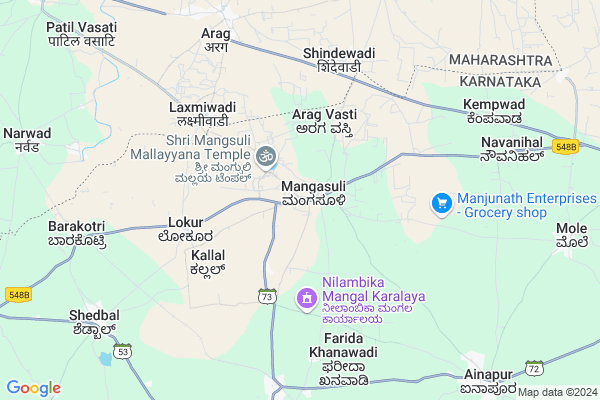
Mangasuli Map
EDIT Map
Add Your House
 ..
..
Current Corona Virus Infected Patients Count in Belgaum District
| City Name | District Name | Total Covid cases |
|---|---|---|
| Belagavi District | Belagavi | 25 |
| Hirebagewadi | Belagavi | 12 |
| Raibagh | Belagavi | 8 |
| Raibag | Belagavi | 3 |
| Raibhag | Belagavi | 2 |
| Bagewadi | Belagavi | 1 |
| Chikkodi | Belagavi | 1 |
Locality Name :
Mangasuli
( ಮಂಗಸೂಳಿ )
Taluk Name : Athni
District : Belgaum
State : Karnataka
Division : Belgaum
Language : Kannada and Marathi, English,
Current Time 09:22 AM
Date: Wednesday , Apr 30,2025 (IST)
Time zone: IST (UTC+5:30)
Elevation / Altitude: 547 meters. Above Seal level
Telephone Code / Std Code: 08289
Assembly constituency : Kagwad assembly constituency
Assembly MLA : Bharamgouda Alagouda Kage
Lok Sabha constituency : Chikkodi parliamentary constituency
Parliament MP : ANNASAHEB SHANKAR JOLLE
Serpanch Name :
Pin Code : 591234
Post Office Name : Mangsuli
Commodities Prices : Kudchi Market / Mandi
Mangasuli Live Weather
Temperature: 32.6 °C
clear sky
Humidity: 29%
Wind : 2.5 mt/sec towards NW
StationName : "Kudachi"
observed on Now
Temperature: 32.6 °C
clear sky
Humidity: 29%
Wind : 2.5 mt/sec towards NW
StationName : "Kudachi"
observed on Now
Mangasuli Weather Forecast for Next 5 days
01-05-2025
25.7°C to 39.4°C
clear sky, few clouds, broken clouds, scattered clouds
25.7°C to 39.4°C
clear sky, few clouds, broken clouds, scattered clouds
02-05-2025
23.9°C to 40.0°C
clear sky, scattered clouds, broken clouds
23.9°C to 40.0°C
clear sky, scattered clouds, broken clouds
03-05-2025
24.3°C to 39.4°C
broken clouds, clear sky, scattered clouds, few clouds
24.3°C to 39.4°C
broken clouds, clear sky, scattered clouds, few clouds
04-05-2025
25.0°C to 39.5°C
scattered clouds, few clouds, clear sky
25.0°C to 39.5°C
scattered clouds, few clouds, clear sky
05-05-2025
25.3°C to 37.9°C
broken clouds, scattered clouds, clear sky
25.3°C to 37.9°C
broken clouds, scattered clouds, clear sky
National Highways Reachable To Mangasuli
Nationa High Way :NH166
Nationa High Way :NH166
Rivers Near Mangasuli
Krishna :クリシュナ :ಕೃಷ್ಣಾ :कृष्णा
Krishna :クリシュナ :ಕೃಷ್ಣಾ :कृष्णा
Krishna :クリシュナ :ಕೃಷ್ಣಾ :कृष्णा
Krishna :クリシュナ :ಕೃಷ್ಣಾ :कृष्णा
About Mangasuli
Correct below Info and add more info about MangasuliMangasuli is a Village in Athni Taluk in Belgaum District of Karnataka State, India. It belongs to Belgaum Division . It is located 121 KM towards North from District head quarters Belgaum. 26 KM from Athni. 599 KM from State capital Bangalore
Mangasuli Pin code is 591234 and postal head office is Mangsuli .
Mole ( 11 KM ) , Kagawad ( 14 KM ) , Kudachi(r) ( 15 KM ) , Kusnal ( 15 KM ) , Krishna Kittur ( 15 KM ) are the nearby Villages to Mangasuli. Mangasuli is surrounded by Miraj Taluk towards west , Shirol Taluk towards west , Raybag Taluk towards South , Sangli Taluk towards west .
Miraj , Sangli , Terdal , Sadalgi are the near by Cities to Mangasuli.
Mangasuli 2011 Census Details
Mangasuli Local Language is Kannada. Mangasuli Village Total population is 12432 and number of houses are 2594. Female Population is 48.8%. Village literacy rate is 65.5% and the Female Literacy rate is 28.4%.
Population
| Census Parameter | Census Data |
| Total Population | 12432 |
| Total No of Houses | 2594 |
| Female Population % | 48.8 % ( 6061) |
| Total Literacy rate % | 65.5 % ( 8145) |
| Female Literacy rate | 28.4 % ( 3534) |
| Scheduled Tribes Population % | 6.5 % ( 810) |
| Scheduled Caste Population % | 18.2 % ( 2265) |
| Working Population % | 47.2 % |
| Child(0 -6) Population by 2011 | 1559 |
| Girl Child(0 -6) Population % by 2011 | 46.1 % ( 719) |
Mangasuli Census More Deatils.
Politics in Mangasuli
Bharatiya Janata Party , BJP , Indian National Congress (INC) , INC are the major political parties in this area.Polling Stations /Booths near Mangasuli
1)Govt.lower Marathi Primary School (vinayakwadi) Ugar Khurd2)Govt.marathi Higher Primary School Middle Room Bus Stand Back Side Ugar Khurd
3)Anganawadi Kendra Railway Station Road Ugar Khurd
4)Govt.kannada Higher Primary School West Side North Room Bus Stand Back Side Ugar Khurd
5)Govt.madari Higher Primary Kannada Boys School Room No.2 Shedabal
HOW TO REACH Mangasuli
By Road
Kudchi is the Nearest Town to Mangasuli. Kudchi is 14 km from Mangasuli. Road connectivity is there from Kudchi to Mangasuli.By Rail
Ugar Khurd Rail Way Station , Shedbal Rail Way Station are the very nearby railway stations to Mangasuli. Also you can consider railway Stations from Near By town Kudchi. Kudachi Rail Way Station , Ugar Khurd Rail Way Station are the railway Stations near to Kudchi. You can reach from Kudchi to Mangasuli by road after .Colleges near Mangasuli
Servodaya Pu College Gundewadi
Address :
Composite Pre University College
Address :
Shri Appayya Swami
Address :
M G Pu College Tesang
Address :
Govt First Grade College
Address :
Schools in Mangasuli
M.l.p.s.vikaswadi
Address : mangusuli , kagwad , chikkodi , Karnataka . PIN- 591234 , Post - Mangsuli
K.h.p.s.
Address : mangusuli , kagwad , chikkodi , Karnataka . PIN- 591234 , Post - Mangsuli
M.l.p.g.s.
Address : mangusuli , kagwad , chikkodi , Karnataka . PIN- 591234 , Post - Mangsuli
M.h.p.s.
Address : mangusuli , kagwad , chikkodi , Karnataka . PIN- 591234 , Post - Mangsuli
Govt Health Centers near Mangasuli
1) Harugeri-2 , SC Harugeri , Mugalkhod road , Near Karisiddeshawar Temple2) Alagawadi , Janata Plot Alagwadi , Janata Plot , Near Dattareya Temple
3) Kabbenur , Kabbenur , Kabbenur , Kabbenur
Petrol Bunks in Mangasuli,Athni
HP PETROL PUMP - SHRI KHANDEPRASAD PETROLEUM
HPC Dealer RS NO 339/4B/3 Mallaya Temple Road Managasuli;; Belgaum; Karnataka 591234; India
1.8 KM distance Detail
more ..
Colleges in Mangasuli,Athni
Shri Hari Vidyalaya PU and Degree College
SH 73; Ugar Khurd; Ugar; Karnataka 591316; India
8.6 KM distance Detail
more ..
Schools in Mangasuli,Athni
Peoples Education Society; BBA college
Ugar Khurd; Ugar; Karnataka 591316; India
7.4 KM distance Detail
Super Markets in Mangasuli,Athni
MALIK INDUSTRIES OF UGAR KHURD CASHEW FACTORY
Ugar Khurd; Ugar; Karnataka 591316; India
9.9 KM distance Detail
Governement Offices near Mangasuli,Athni
Gram Sachivalaya Arag
Near Bus Stand; Main Road Dist.; Arag; Maharashtra 416401; India
8.7 KM distance Detail
NOOR-E-ISLAM (MUSLIM ) MINORITY COMMITEE
Ugar Khurd; Ugar; Karnataka 591316; India
10.7 KM distance Detail
About Mangasuli &
History
How to reach Mangasuli
Tourist Places Near By Mangasuli
Schools in Mangasuli
Colleges in Mangasuli
Temperature & weather of Mangasuli
places in Mangasuli
Mangasuli photos
More Information
How to reach Mangasuli
Tourist Places Near By Mangasuli
Schools in Mangasuli
Colleges in Mangasuli
Temperature & weather of Mangasuli
places in Mangasuli
Mangasuli photos
More Information
Village Talk
Post News or Events about this Village
Near Cities
Miraj 24 KM near
Sangli 35 KM near
Terdal 38 KM near
Sadalgi 38 KM near
Miraj 24 KM near
Sangli 35 KM near
Terdal 38 KM near
Sadalgi 38 KM near
Near By Taluks
Miraj 25 KM near
Athni 25 KM near
Shirol 28 KM near
Raybag 31 KM near
Miraj 25 KM near
Athni 25 KM near
Shirol 28 KM near
Raybag 31 KM near
Near By Air Ports
Kolhapur Airport 59 KM near
Sambre Airport 111 KM near
Sholapur Airport 172 KM near
Hubli Airport 173 KM near
Kolhapur Airport 59 KM near
Sambre Airport 111 KM near
Sholapur Airport 172 KM near
Hubli Airport 173 KM near
Near By Tourist Places
Kolhapur 69 KM near
Panhala 85 KM near
Bijapur 106 KM near
Dajipur Wildlife Sanctuary 122 KM near
Pandharpur 131 KM near
Kolhapur 69 KM near
Panhala 85 KM near
Bijapur 106 KM near
Dajipur Wildlife Sanctuary 122 KM near
Pandharpur 131 KM near
Near By Districts
Sangli 33 KM near
Kolhapur 69 KM near
Bijapur District 107 KM near
Belgaum 115 KM near
Sangli 33 KM near
Kolhapur 69 KM near
Bijapur District 107 KM near
Belgaum 115 KM near
Near By RailWay Station
Ugar Khurd Rail Way Station 8.1 KM near
Kudachi Rail Way Station 13 KM near
Miraj Junction Rail Way Station 25 KM near
Ugar Khurd Rail Way Station 8.1 KM near
Kudachi Rail Way Station 13 KM near
Miraj Junction Rail Way Station 25 KM near