| Home | City Bus | Maps | Villages | Cities | Rail | Tourist Places | School | College | Pin Codes | Corona Cases Count |
| Distance Calculator Bus Services IFSC Codes Trace Mobile Number Weather Search Place Trace IP Available Cash ATM/Banks Locate Polling Booth Report an Error contact People |
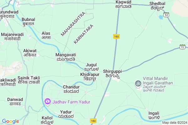
Jugul Map
EDIT Map
Add Your House
 ..
..
Current Corona Virus Infected Patients Count in Belgaum District
| City Name | District Name | Total Covid cases |
|---|---|---|
| Belagavi District | Belagavi | 25 |
| Hirebagewadi | Belagavi | 12 |
| Raibagh | Belagavi | 8 |
| Raibag | Belagavi | 3 |
| Raibhag | Belagavi | 2 |
| Bagewadi | Belagavi | 1 |
| Chikkodi | Belagavi | 1 |
Locality Name :
Jugul
( ಜುಗುಲ್ )
Taluk Name : Athni
District : Belgaum
State : Karnataka
Division : Belgaum
Language : Kannada and Marathi, English,
Current Time 10:29 AM
Date: Sunday , Apr 27,2025 (IST)
Time zone: IST (UTC+5:30)
Elevation / Altitude: 547 meters. Above Seal level
Telephone Code / Std Code: 08289
Assembly constituency : Kagwad assembly constituency
Assembly MLA : Bharamgouda Alagouda Kage
Lok Sabha constituency : Chikkodi parliamentary constituency
Parliament MP : ANNASAHEB SHANKAR JOLLE
Serpanch Name :
Pin Code : 591242
Post Office Name : Shirguppi
Commodities Prices : Soundati Market / Mandi
Jugul Live Weather
Temperature: 35.0 °C
few clouds
Humidity: 25%
Wind : 0.22 mt/sec towards NE
StationName : "KurandvÄ\u0081d"
observed on Now
Temperature: 35.0 °C
few clouds
Humidity: 25%
Wind : 0.22 mt/sec towards NE
StationName : "KurandvÄ\u0081d"
observed on Now
Jugul Weather Forecast for Next 5 days
28-04-2025
26.6°C to 39.1°C
few clouds, scattered clouds, broken clouds
26.6°C to 39.1°C
few clouds, scattered clouds, broken clouds
29-04-2025
24.4°C to 39.6°C
scattered clouds, broken clouds, clear sky
24.4°C to 39.6°C
scattered clouds, broken clouds, clear sky
30-04-2025
24.1°C to 39.7°C
scattered clouds, clear sky, few clouds
24.1°C to 39.7°C
scattered clouds, clear sky, few clouds
01-05-2025
23.0°C to 39.2°C
clear sky, few clouds, broken clouds, scattered clouds
23.0°C to 39.2°C
clear sky, few clouds, broken clouds, scattered clouds
02-05-2025
23.6°C to 40.2°C
few clouds, clear sky, scattered clouds
23.6°C to 40.2°C
few clouds, clear sky, scattered clouds
National Highways Reachable To Jugul
Nationa High Way :NH166
Nationa High Way :NH166
Rivers Near Jugul
Krishna :クリシュナ :ಕೃಷ್ಣಾ :कृष्णा
Krishna :クリシュナ :ಕೃಷ್ಣಾ :कृष्णा
Krishna :クリシュナ :ಕೃಷ್ಣಾ :कृष्णा
Krishna :クリシュナ :ಕೃಷ್ಣಾ :कृष्णा
About Jugul
Correct below Info and add more info about JugulJugul is a Village in Athni Taluk in Belgaum District of Karnataka State, India. It belongs to Belgaum Division . It is located 103 KM towards North from District head quarters Belgaum. 46 KM from Athni. 599 KM from State capital Bangalore
Jugul Pin code is 591242 and postal head office is Shirguppi .
Yadoor ( 8 KM ) , Kagawad ( 9 KM ) , Manjari ( 9 KM ) , Ingali ( 10 KM ) , Kallol ( 10 KM ) are the nearby Villages to Jugul. Jugul is surrounded by Raybag Taluk towards South , Miraj Taluk towards North , Ichalkaranji Taluk towards west , Chikodi Taluk towards South .
Sadalgi , Miraj , Ichalkaranji , Sangli are the near by Cities to Jugul.
Jugul 2011 Census Details
Jugul Local Language is Kannada. Jugul Village Total population is 8827 and number of houses are 1962. Female Population is 49.4%. Village literacy rate is 71.6% and the Female Literacy rate is 31.6%.
Population
| Census Parameter | Census Data |
| Total Population | 8827 |
| Total No of Houses | 1962 |
| Female Population % | 49.4 % ( 4362) |
| Total Literacy rate % | 71.6 % ( 6321) |
| Female Literacy rate | 31.6 % ( 2786) |
| Scheduled Tribes Population % | 0.4 % ( 35) |
| Scheduled Caste Population % | 13.7 % ( 1211) |
| Working Population % | 41.5 % |
| Child(0 -6) Population by 2011 | 886 |
| Girl Child(0 -6) Population % by 2011 | 47.2 % ( 418) |
Jugul Census More Deatils.
Politics in Jugul
Bharatiya Janata Party , BJP , Indian National Congress (INC) , INC are the major political parties in this area.Polling Stations /Booths near Jugul
1)Gram Panchayat Building Mangasuli2)Nammura Govt.kannada Lower Primary School Western Room Jakkaratti
3)Old Panchayat Building Bevanur
4)Shri.siddeshwar High School New Building South Side Room No.3 Mole
5)Siddeshwar Vidyalay East Room Shiraguppi
HOW TO REACH Jugul
By Road
Kudchi is the Nearest Town to Jugul. Kudchi is 19 km from Jugul. Road connectivity is there from Kudchi to Jugul.By Rail
There is no railway station near to Jugul in less than 10 km. How ever there are railway Stations from Near By town Kudchi. are the railway Stations near to Kudchi. You can reach from Kudchi to Jugul by road after .Colleges near Jugul
Servodaya Pu College Gundewadi
Address :
Composite Pre University College
Address :
Shri Appayya Swami
Address :
M G Pu College Tesang
Address :
Govt First Grade College
Address :
Schools in Jugul
K.h.p.b.s.
Address : jugul , kagwad , chikkodi , Karnataka . PIN- 591242 , Post - Shirguppi
Kss Pry School.jugul
Address : jugul , kagwad , chikkodi , Karnataka . PIN- 591242 , Post - Shirguppi
K.h.p.g.s.
Address : jugul , kagwad , chikkodi , Karnataka . PIN- 591242 , Post - Shirguppi
U.h.p.s.
Address : jugul , kagwad , chikkodi , Karnataka . PIN- 591242 , Post - Shirguppi
K.s.s.high School Jugul
Address : Karnataka Shikshn Samiti's High school Jugul.
Govt Health Centers near Jugul
1) Harugeri-2 , SC Harugeri , Mugalkhod road , Near Karisiddeshawar Temple2) Alagawadi , Janata Plot Alagwadi , Janata Plot , Near Dattareya Temple
3) Kabbenur , Kabbenur , Kabbenur , Kabbenur
Petrol Bunks in Jugul,Athni
HP PETROL PUMP - SHRI SHIDDESHWAR PETROL PUMP
Hpcl Dealer VPC NO 2539; Ankali Raibagh Road Ankali; Taluqa Chikodi; Belgaum; Karnataka 591213; India
12.7 KM distance Detail
more ..
Colleges in Jugul,Athni
K.L.E. Degree College Ankali
Ankali-Kadapur Rd; Ankali; Karnataka 591213; India
12.4 KM distance Detail
Kagawade Art And Commerse College
Kagawade Galli; Nasalapur; Karnataka 591213; India
13.1 KM distance Detail
more ..
Schools in Jugul,Athni
Sai School .SR College INGALI
74; 16th Road; Pali Village; Bandra West; Mumbai; Maharashtra 400050; India
9.7 KM distance Detail
Governement Offices near Jugul,Athni
NOOR-E-ISLAM (MUSLIM ) MINORITY COMMITEE
Ugar Khurd; Ugar; Karnataka 591316; India
16.1 KM distance Detail
About Jugul &
History
How to reach Jugul
Tourist Places Near By Jugul
Schools in Jugul
Colleges in Jugul
Temperature & weather of Jugul
places in Jugul
Jugul photos
More Information
How to reach Jugul
Tourist Places Near By Jugul
Schools in Jugul
Colleges in Jugul
Temperature & weather of Jugul
places in Jugul
Jugul photos
More Information
Village Talk
Post News or Events about this Village
Near Cities
Sadalgi 18 KM near
Miraj 25 KM near
Ichalkaranji 29 KM near
Sangli 32 KM near
Sadalgi 18 KM near
Miraj 25 KM near
Ichalkaranji 29 KM near
Sangli 32 KM near
Near By Taluks
Shirol 14 KM near
Raybag 26 KM near
Miraj 27 KM near
Ichalkaranji 28 KM near
Shirol 14 KM near
Raybag 26 KM near
Miraj 27 KM near
Ichalkaranji 28 KM near
Near By Air Ports
Kolhapur Airport 42 KM near
Sambre Airport 96 KM near
Hubli Airport 165 KM near
Dabolim Airport 185 KM near
Kolhapur Airport 42 KM near
Sambre Airport 96 KM near
Hubli Airport 165 KM near
Dabolim Airport 185 KM near
Near By Tourist Places
Kolhapur 53 KM near
Panhala 72 KM near
Dajipur Wildlife Sanctuary 102 KM near
Amboli 116 KM near
Bijapur 124 KM near
Kolhapur 53 KM near
Panhala 72 KM near
Dajipur Wildlife Sanctuary 102 KM near
Amboli 116 KM near
Bijapur 124 KM near
Near By Districts
Sangli 31 KM near
Kolhapur 53 KM near
Belgaum 99 KM near
Bijapur District 126 KM near
Sangli 31 KM near
Kolhapur 53 KM near
Belgaum 99 KM near
Bijapur District 126 KM near
Near By RailWay Station
Kudachi Rail Way Station 20 KM near
Raybag Rail Way Station 22 KM near
Kudachi Rail Way Station 20 KM near
Raybag Rail Way Station 22 KM near