| Home | City Bus | Maps | Villages | Cities | Rail | Tourist Places | School | College | Pin Codes | Corona Cases Count |
| Distance Calculator Bus Services IFSC Codes Trace Mobile Number Weather Search Place Trace IP Available Cash ATM/Banks Locate Polling Booth Report an Error contact People |
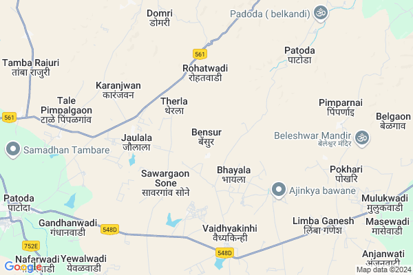
Bensur
Bensur Map
EDIT Map
Add Your House
 ..
..
Current Corona Virus Infected Patients Count in Beed District
| City Name | District Name | Total Covid cases |
|---|
Locality Name :
Bensur
( बेनसुर )
Taluka Name : Patoda
District : Beed
State : Maharashtra
Region : Marathwada
Division : Aurangabad
Language : English and Hindi, Marathi
Current Time 04:54 AM
Date: Saturday , Apr 26,2025 (IST)
Time zone: IST (UTC+5:30)
Elevation / Altitude: 528 meters. Above Seal level
Telephone Code / Std Code: 02444
Assembly constituency : Ashti assembly constituency
Assembly MLA : Ajabe Balasaheb Bhausaheb
Lok Sabha constituency : Beed parliamentary constituency
Parliament MP : Pritam Gopinathrao Munde
Serpanch Name :
Pin Code : 414204
Post Office Name : Patoda (Beed)
Commodities Prices : Beed Market / Mandi
Bensur Live Weather
Temperature: 29.4 °C
broken clouds
Humidity: 23%
Wind : 5.14 mt/sec towards NW
StationName : "Bhūm"
observed on Now
Temperature: 29.4 °C
broken clouds
Humidity: 23%
Wind : 5.14 mt/sec towards NW
StationName : "Bhūm"
observed on Now
Bensur Weather Forecast for Next 5 days
27-04-2025
28.9°C to 38.5°C
broken clouds, scattered clouds, overcast clouds
28.9°C to 38.5°C
broken clouds, scattered clouds, overcast clouds
28-04-2025
27.9°C to 37.9°C
scattered clouds, clear sky, few clouds
27.9°C to 37.9°C
scattered clouds, clear sky, few clouds
29-04-2025
26.8°C to 37.9°C
clear sky, few clouds
26.8°C to 37.9°C
clear sky, few clouds
30-04-2025
27.5°C to 38.7°C
clear sky, overcast clouds
27.5°C to 38.7°C
clear sky, overcast clouds
Edit below overview about Bensur
Edit below overview about Bensur
OverView of Bensur
Legend has it that the village was named Bensur after the goddess Benai saved her devotees by killing the demon Benasura. Bensur is an entirely Maratha community living in the village. Both Arsul and Adsul surnames are of the same origin in the village. The inhabitants of Bansur are originally from the Chavan clan. As per the fame of our Chauhan clan, the village is full of brave heroes. There are many freedom fighters in the village. Martyr Devrao Arsul, freedom fighter Manikrao Bappaji Arsul, freedom fighter Daulatrao Bappaji Arsul , freedom fighter Dadarao Maroti Arsul, freedom fighter Srirang Arsul, freedom fighter Madhavrao Arsul have all raised the name of the village in the Marathwada liberation struggle by fighting against Razakar. There are two Wadas under Bensur village namely Ghatewadi and Ramwadi. Bensur village is known as the village of Shur Veera in Beed district.During the period 1985 to 1990 Sarpanch Ramrao Manikrao Arsul made a long yatra to the only dargah in the village which is famous as Kanhoba and gave an example of equality of all religions.Edit below overview about Bensur
Rivers Near Bensur
Sina :सीना नदी :Сіна
Sina :सीना नदी :Сіна
Sina :सीना नदी :Сіна
Sina :सीना नदी :Сіна
About Bensur
Bensur is a Village in Patoda Taluka in Beed District of Maharashtra State, India. It belongs to Marathwada region . It belongs to Aurangabad Division . It is located 29 KM towards west from District head quarters Beed. 15 KM from Patoda. 335 KM from State capital Mumbai
Bensur Pin code is 414204 and postal head office is Patoda (Beed).
Sawargaon Sone ( 3 KM ) , Rohatwadi ( 3 KM ) , Waghira ( 5 KM ) , Somnathwadi ( 6 KM ) , Karanjwan ( 6 KM ) are the nearby Villages to Bensur. Bensur is surrounded by Shirur ( Ka ) Taluka towards North , Beed Taluka towards East , Jamkhed Taluka towards west , Washi Taluka towards South .
Pathardi , Paithan , Manjlegaon , Osmanabad are the near by Cities to Bensur.
Bensur 2011 Census Details
Bensur Local Language is English. Bensur Village Total population is 1108 and number of houses are 215. Female Population is 46.1%. Village literacy rate is 67.7% and the Female Literacy rate is 25.5%.
Population
| Census Parameter | Census Data |
| Total Population | 1108 |
| Total No of Houses | 215 |
| Female Population % | 46.1 % ( 511) |
| Total Literacy rate % | 67.7 % ( 750) |
| Female Literacy rate | 25.5 % ( 283) |
| Scheduled Tribes Population % | 3.2 % ( 35) |
| Scheduled Caste Population % | 14.2 % ( 157) |
| Working Population % | 58.4 % |
| Child(0 -6) Population by 2011 | 123 |
| Girl Child(0 -6) Population % by 2011 | 45.5 % ( 56) |
Bensur Census More Deatils.
Politics in Bensur
Bharatiya Janata Party , BJP , NCP are the major political parties in this area.Polling Stations /Booths near Bensur
1)Belgaon2)Ralesangavi
3)Bhatodi
4)Bhayala
5)Bhurewadi
HOW TO REACH Bensur
By Rail
There is no railway station near to Bensur in less than 10 km. are the Rail way stations reachable from near by towns.By Road
Bid are the nearby by towns to Bensur having road connectivity to BensurColleges near Bensur
Arts, Science And Commerce College Amalner !
Address :
Agri Politechnic College Daskhed
Address : A/p.daskhed Tq- Patoda Dist- Beed
National Backward Class Agriculture Education Of Information Technology
Address : Pandharwadi Phata, Tal.patoda, Dist.beed
Schools in Bensur
Zpps Bensur
Address : bensur , patoda , bid , Maharashtra . PIN- 414204 , Post - Patoda (Beed)
Govt Health Centers near Bensur
1) Jategaon , Sub Center Jategaon , Jategaon , Patoda Road2) Manjarsumbha , sub Centre Manjarsumbha , ,
3) Manzari , sub Centre Manzari , ,
Petrol Bunks in Bensur,Patoda
Bangar Petroleum Patoda
Patoda-Manjarsumbha Rd; Mahajanwadi; Maharashtra 431126; India
7.8 KM distance Detail
HP PETROL PUMP - BANGAR KRUSHI SEVA KENDRA
GUT NO 876 Patoda- Manjorsumba Road Taluqa Patoda; Sholapur; Maharashtra 414203; India
12.5 KM distance Detail
A.Z. PETROLEUM
HPC Dealers SUR NO. 866; Ahmednagar Raod Patoda Post; Sholapur; Maharashtra 414204; India
12.7 KM distance Detail
more ..
Colleges in Bensur,Patoda
Padmabhushan Vasantdada Patil College; Patoda
SH 155; Patoda; Beed; Maharashtra 414204; India
12.8 KM distance Detail
PVP College; Patoda
Taluka Patoda Dist - Beed; Patoda; Maharashtra 414205; India
14.0 KM distance Detail
more ..
Schools in Bensur,Patoda
hutatatma devrao vidhalay bhayala photos
Bhayala Rd; Waghira; Maharashtra 414204; India
2.8 KM distance Detail
ZILLA PARISHAD HIGH SCHOOL; THERLA
Bensur Rd; Therla; Maharashtra 414204; India
3.0 KM distance Detail
Electronic Shops in Bensur,Patoda
Rajmata Motor & Rewarding(electricals) Store
Limba Ganesh; Maharashtra 431126; India
9.7 KM distance Detail
सुज्योत ईलेक्टिकल्स
Patoda-Manjarsumbha Rd; Patoda; Maharashtra 414204; India
12.4 KM distance Detail
भगवान इलेक्टरीकल्स & मशिनरी स्टोअर्स
414204; Patoda; Maharashtra 414204; India
12.6 KM distance Detail
About Bensur &
History
How to reach Bensur
Tourist Places Near By Bensur
Schools in Bensur
Colleges in Bensur
Temperature & weather of Bensur
places in Bensur
Bensur photos
More Information
How to reach Bensur
Tourist Places Near By Bensur
Schools in Bensur
Colleges in Bensur
Temperature & weather of Bensur
places in Bensur
Bensur photos
More Information
Village Talk
Post News or Events about this Village
Near Cities
Pathardi 62 KM near
Paithan 82 KM near
Manjlegaon 85 KM near
Osmanabad 99 KM near
Pathardi 62 KM near
Paithan 82 KM near
Manjlegaon 85 KM near
Osmanabad 99 KM near
Near By Taluks
Patoda 15 KM near
Shirur ( Ka ) 27 KM near
Beed 28 KM near
Jamkhed 37 KM near
Patoda 15 KM near
Shirur ( Ka ) 27 KM near
Beed 28 KM near
Jamkhed 37 KM near
Near By Air Ports
Latur Airport 117 KM near
Chikkalthana Airport 129 KM near
Sholapur Airport 155 KM near
Lohegaon Airport 198 KM near
Latur Airport 117 KM near
Chikkalthana Airport 129 KM near
Sholapur Airport 155 KM near
Lohegaon Airport 198 KM near
Near By Tourist Places
Ahmednagar 104 KM near
Tuljapur 117 KM near
Aurangabad 133 KM near
Pandharpur 148 KM near
Solapur 149 KM near
Ahmednagar 104 KM near
Tuljapur 117 KM near
Aurangabad 133 KM near
Pandharpur 148 KM near
Solapur 149 KM near
Near By Districts
Beed 27 KM near
Osmanabad 98 KM near
Ahmednagar 105 KM near
Latur 130 KM near
Beed 27 KM near
Osmanabad 98 KM near
Ahmednagar 105 KM near
Latur 130 KM near
Near By RailWay Station
Barsi Town Rail Way Station 76 KM near
Jeur Rail Way Station 87 KM near
Barsi Town Rail Way Station 76 KM near
Jeur Rail Way Station 87 KM near