| Home | City Bus | Maps | Villages | Cities | Rail | Tourist Places | School | College | Pin Codes | Corona Cases Count |
| Distance Calculator Bus Services IFSC Codes Trace Mobile Number Weather Search Place Trace IP Available Cash ATM/Banks Locate Polling Booth Report an Error contact People |
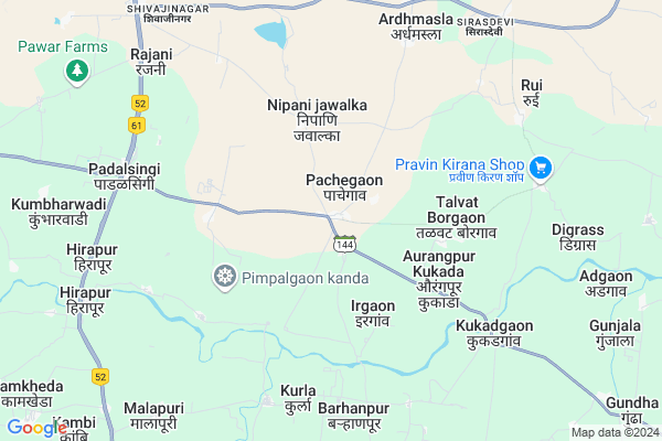
Pachegaon
Pachegaon Map
EDIT Map
Add Your House
 ..
..
Current Corona Virus Infected Patients Count in Beed District
| City Name | District Name | Total Covid cases |
|---|
Locality Name :
Pachegaon
( पाचेगाव )
Taluka Name : Georai
District : Beed
State : Maharashtra
Region : Marathwada
Division : Aurangabad
Language : English and Hindi, Marathi
Current Time 06:55 AM
Date: Saturday , Apr 26,2025 (IST)
Time zone: IST (UTC+5:30)
Elevation / Altitude: 473 meters. Above Seal level
Telephone Code / Std Code: 02447
Assembly constituency : Georai assembly constituency
Assembly MLA : Laxman Madhavrao Pawar
Lok Sabha constituency : Beed parliamentary constituency
Parliament MP : Pritam Gopinathrao Munde
Serpanch Name :
Pin Code : 431127
Post Office Name : Gevrai
Commodities Prices : Gevrai Market / Mandi
Pachegaon Live Weather
Temperature: 32.0 °C
broken clouds
Humidity: 24%
Wind : 3.96 mt/sec towards NW
StationName : "Gevrai"
observed on 2 Hours Back
Temperature: 32.0 °C
broken clouds
Humidity: 24%
Wind : 3.96 mt/sec towards NW
StationName : "Gevrai"
observed on 2 Hours Back
Pachegaon Weather Forecast for Next 5 days
27-04-2025
31.2°C to 41.1°C
broken clouds, scattered clouds
31.2°C to 41.1°C
broken clouds, scattered clouds
28-04-2025
31.0°C to 40.2°C
broken clouds, scattered clouds, clear sky
31.0°C to 40.2°C
broken clouds, scattered clouds, clear sky
29-04-2025
28.9°C to 40.2°C
clear sky, scattered clouds
28.9°C to 40.2°C
clear sky, scattered clouds
30-04-2025
29.3°C to 41.5°C
clear sky, few clouds, overcast clouds, broken clouds
29.3°C to 41.5°C
clear sky, few clouds, overcast clouds, broken clouds
Rivers Near Pachegaon
Ashti
Nani
Ashti
Nani
About Pachegaon
Correct below Info and add more info about PachegaonPachegaon is a Village in Georai Taluka in Beed District of Maharashtra State, India. It belongs to Marathwada region . It belongs to Aurangabad Division . It is located 21 KM towards North from District head quarters Beed. 14 KM from Takalgaon T.Georai. 364 KM from State capital Mumbai
Pachegaon Pin code is 431127 and postal head office is Gevrai .
Aherwahegaon ( 4 KM ) , Pimpalgaon Kanada ( 4 KM ) , Kurla ( 7 KM ) , Ardhmasala ( 7 KM ) , Malapuri ( 7 KM ) are the nearby Villages to Pachegaon. Pachegaon is surrounded by Beed Taluka towards South , Wadwani Taluka towards East , Shirur ( Ka ) Taluka towards west , Majalgaon Taluka towards East .
Manjlegaon , Paithan , Partur , Pathri are the near by Cities to Pachegaon.
Pachegaon 2011 Census Details
Pachegaon Local Language is English. Pachegaon Village Total population is 2248 and number of houses are 471. Female Population is 47.7%. Village literacy rate is 59.8% and the Female Literacy rate is 24.1%.
Population
| Census Parameter | Census Data |
| Total Population | 2248 |
| Total No of Houses | 471 |
| Female Population % | 47.7 % ( 1072) |
| Total Literacy rate % | 59.8 % ( 1345) |
| Female Literacy rate | 24.1 % ( 542) |
| Scheduled Tribes Population % | 1.8 % ( 40) |
| Scheduled Caste Population % | 14.1 % ( 317) |
| Working Population % | 53.1 % |
| Child(0 -6) Population by 2011 | 352 |
| Girl Child(0 -6) Population % by 2011 | 45.5 % ( 160) |
Pachegaon Census More Deatils.
Politics in Pachegaon
Bharatiya Janata Party , BJP , NCP are the major political parties in this area.Polling Stations /Booths near Pachegaon
1)Daithan2)Nipani Javalka
3)Pachegaon
4)Jadidjavla
5)Nathapur
HOW TO REACH Pachegaon
By Rail
There is no railway station near to Pachegaon in less than 10 km. are the Rail way stations reachable from near by towns.By Road
Bid , Georai , Manjlegaon are the nearby by towns to Pachegaon having road connectivity to PachegaonColleges near Pachegaon
Janvikas Mahavidyalaya Bansarola
Address :
Kailas Kala Niketan,beed
Address :
Arts, Science And Commerce College Amalner !
Address :
Pt.javaharlal Nehru Jr.collage Ashti
Address :
Sahyadri Iti & Enggering
Address :
Schools in Pachegaon
Tirupati Ashram Hs Pachegaon
Address : pachegaon , georai , bid , Maharashtra . PIN- 431127 , Post - Gevrai
High School Pachegaon
Address : pachegaon , georai , bid , Maharashtra . PIN- 431127 , Post - Gevrai
Zpps Pachegaon
Address : pachegaon , georai , bid , Maharashtra . PIN- 431127 , Post - Gevrai
Govt Health Centers near Pachegaon
1) Borgaon , sub Centre Borgaon , ,2) Pachegaon , sub Centre Pachegaon , ,
3) Rui , sub Centre Rui , ,
Hospitals in Pachegaon,Georai
Shree MangalPrakash Hospital
Sirasdevi; Kajalyachi Wadi; Maharashtra 431129; India
9.5 KM distance Detail
shree hospital dr shivaji khetre
Sirasdevi; Kajalyachi Wadi; Maharashtra 431129; India
10.2 KM distance Detail
more ..
Petrol Bunks in Pachegaon,Georai
Indian Oil Petrol Pump
Ardhamasala Stand; Ardhmasla; Maharashtra 431129; India
8.5 KM distance Detail
more ..
Colleges in Pachegaon,Georai
Nagadnarayan gurukul madalmohi
Georai - Kharwandi Kasar Rd; Bhadangwadi; Maharashtra 431143; India
15.3 KM distance Detail
R.B Attal Collage Of Science Art and Commerce
Ahilya Nagar; Georai; Maharashtra 431127; India
17.9 KM distance Detail
R. B. Attal College of Arts; Science and Commerce
Ahilya Nagar; Georai; Maharashtra 431127; India
17.9 KM distance Detail
more ..
Schools in Pachegaon,Georai
माध्यमिक व उच्च माध्यमिक विद्यालय पाचेगांव
पाचेगांव; महाराष्ट्र 431143; India
0.2 KM distance Detail
Jai Bhavani Middle and Seniro Secondary School
Damunaik Tanda; Bid; SH-185; Parli Vaijanath Beed Highway; Beed; Beed; Maharashtra 431122; India
0.3 KM distance Detail
Tirupati Bal Sadan School
Damunaik Tanda; Bid; Parli Vaijanath Beed Highway; Beed; Beed; Maharashtra 431122; India
0.6 KM distance Detail
Swami Vivekananada Bal Sadan
Jayramnaik Tanda; Bid; Parli Vaijanath Beed Highway; Beed; Beed; Maharashtra 431122; India
0.6 KM distance Detail
Local Parks in Pachegaon,Georai
Naik Nagar Park
Naik Rd; Naik Nagar; Gajanan Nagar; Georai; Maharashtra 431127; India
18.9 KM distance Detail
Police Stations near Pachegaon,Georai
Police Headquarters Pimpalner
Pimpalner Rd; Police Colony; Pimpalner; Maharashtra 431122; India
19.1 KM distance Detail
Police Station Pimpalner
Shree Swami Samarth Kendra Marg; Pimpalner; Maharashtra 431122; India
19.1 KM distance Detail
Governement Offices near Pachegaon,Georai
संभाजी राजे पेठ; ग्रामपंचायत कार्यालय पाचेगांव.
Pachegaon; Maharashtra 431143; India
0.3 KM distance Detail
Irrigation Department Office
Jayakwadi Colony; Georai; Maharashtra 431127; India
17.1 KM distance Detail
About Pachegaon &
History
How to reach Pachegaon
Tourist Places Near By Pachegaon
Schools in Pachegaon
Colleges in Pachegaon
Temperature & weather of Pachegaon
places in Pachegaon
Pachegaon photos
More Information
How to reach Pachegaon
Tourist Places Near By Pachegaon
Schools in Pachegaon
Colleges in Pachegaon
Temperature & weather of Pachegaon
places in Pachegaon
Pachegaon photos
More Information
Village Talk
Post News or Events about this Village
Near Cities
Manjlegaon 48 KM near
Paithan 64 KM near
Partur 72 KM near
Pathri 73 KM near
Manjlegaon 48 KM near
Paithan 64 KM near
Partur 72 KM near
Pathri 73 KM near
Near By Taluks
Georai 14 KM near
Beed 21 KM near
Wadwani 32 KM near
Shirur ( Ka ) 43 KM near
Georai 14 KM near
Beed 21 KM near
Wadwani 32 KM near
Shirur ( Ka ) 43 KM near
Near By Air Ports
Chikkalthana Airport 103 KM near
Latur Airport 118 KM near
Nanded Airport 176 KM near
Sholapur Airport 188 KM near
Chikkalthana Airport 103 KM near
Latur Airport 118 KM near
Nanded Airport 176 KM near
Sholapur Airport 188 KM near
Near By Tourist Places
Aurangabad 109 KM near
Ahmednagar 128 KM near
Grishneshwar 134 KM near
Tuljapur 143 KM near
Hingoli 172 KM near
Aurangabad 109 KM near
Ahmednagar 128 KM near
Grishneshwar 134 KM near
Tuljapur 143 KM near
Hingoli 172 KM near
Near By Districts
Beed 20 KM near
Jalna 88 KM near
Aurangabad District 108 KM near
Parbhani 114 KM near
Beed 20 KM near
Jalna 88 KM near
Aurangabad District 108 KM near
Parbhani 114 KM near
Near By RailWay Station
Partur Rail Way Station 71 KM near
Selu Rail Way Station 81 KM near
Partur Rail Way Station 71 KM near
Selu Rail Way Station 81 KM near