| Home | City Bus | Maps | Villages | Cities | Rail | Tourist Places | School | College | Pin Codes | Corona Cases Count |
| Distance Calculator Bus Services IFSC Codes Trace Mobile Number Weather Search Place Trace IP Available Cash ATM/Banks Locate Polling Booth Report an Error contact People |
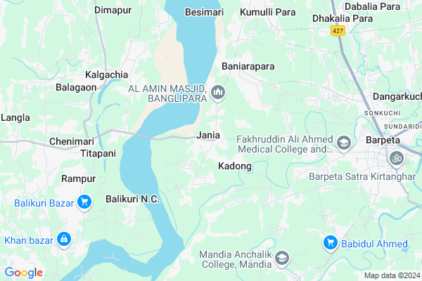
Jania Map
EDIT Map
Add Your House
 ..
..
Current Corona Virus Infected Patients Count in Barpeta District
| City Name | District Name | Total Covid cases |
|---|
Locality Name :
Jania
( जानिए )
Tehsil Name : Mandia
District : Barpeta
State : Assam
Language : Assamese
Current Time 02:16 PM
Date: Tuesday , Apr 29,2025 (IST)
Time zone: IST (UTC+5:30)
Elevation / Altitude: 52 meters. Above Seal level
Telephone Code / Std Code: 03666
Assembly constituency : Jania assembly constituency
Assembly MLA : Rafiqul Islam
Lok Sabha constituency : Barpeta parliamentary constituency
Parliament MP : Abdul Khaleque
Serpanch Name :
Pin Code : 781314
Post Office Name : Santinagar (Barpeta)
Commodities Prices : Dadengiri Market / Mandi
Jania Live Weather
Temperature: 33.3 °C
broken clouds
Humidity: 36%
Wind : 4.74 mt/sec towards NE
StationName : "Barpeta"
observed on Now
Temperature: 33.3 °C
broken clouds
Humidity: 36%
Wind : 4.74 mt/sec towards NE
StationName : "Barpeta"
observed on Now
Jania Weather Forecast for Next 5 days
30-04-2025
22.4°C to 33.2°C
broken clouds, light rain, overcast clouds
22.4°C to 33.2°C
broken clouds, light rain, overcast clouds
01-05-2025
22.0°C to 33.3°C
light rain, clear sky, few clouds, overcast clouds
22.0°C to 33.3°C
light rain, clear sky, few clouds, overcast clouds
02-05-2025
23.3°C to 34.1°C
light rain, overcast clouds, broken clouds, scattered clouds
23.3°C to 34.1°C
light rain, overcast clouds, broken clouds, scattered clouds
03-05-2025
24.1°C to 35.5°C
overcast clouds, light rain
24.1°C to 35.5°C
overcast clouds, light rain
04-05-2025
23.7°C to 34.3°C
light rain, overcast clouds, broken clouds, scattered clouds, few clouds, moderate rain
23.7°C to 34.3°C
light rain, overcast clouds, broken clouds, scattered clouds, few clouds, moderate rain
National Highways Reachable To Jania
Nationa High Way :NH17
Nationa High Way :NH17
Rivers Near Jania
Brahmaputra :ব্ৰহ্মপুত্ৰ :ব্রহ্মপুত্র :Brahmaputra :Brahmaputra :ब्रह्मपुत्र :ಬ್ರಹ್ಮಪುತ್ರ :பிரம்மபுத்திரா :బ్రహ్మపుత్రా :Брахмапутра :雅鲁藏布江
Aai
Brahmaputra :ব্ৰহ্মপুত্ৰ :ব্রহ্মপুত্র :Brahmaputra :Brahmaputra :ब्रह्मपुत्र :ಬ್ರಹ್ಮಪುತ್ರ :பிரம்மபுத்திரா :బ్రహ్మపుత్రా :Брахмапутра :雅鲁藏布江
Aai
About Jania
Correct below Info and add more info about JaniaJania is a Village in Mandia Tehsil in Barpeta District of Assam State, India. It is located 10 KM towards west from District head quarters Barpeta. 9 KM from Mandia. 98 KM from State capital Dispur
Jania Pin code is 781314 and postal head office is Santinagar (Barpeta).
Sawpur ( 2 KM ) , Balaipathar ( 5 KM ) , Titapani ( 6 KM ) , Tapeswara ( 6 KM ) , Kalgachia ( 6 KM ) are the nearby Villages to Jania. Jania is surrounded by Mandia Tehsil towards South , Sarukhetri Tehsil towards East , Barpeta Tehsil towards East , Gomaphulbari Tehsil towards South .
Barpeta , Barpeta Road , Goalpara , Bongaigaon are the near by Cities to Jania.
Jania 2011 Census Details
Jania Local Language is Assamese. Jania Village Total population is 6468 and number of houses are 1263. Female Population is 48.2%. Village literacy rate is 44.6% and the Female Literacy rate is 18.5%.
Population
| Census Parameter | Census Data |
| Total Population | 6468 |
| Total No of Houses | 1263 |
| Female Population % | 48.2 % ( 3115) |
| Total Literacy rate % | 44.6 % ( 2887) |
| Female Literacy rate | 18.5 % ( 1198) |
| Scheduled Tribes Population % | 0.0 % ( 0) |
| Scheduled Caste Population % | 17.8 % ( 1150) |
| Working Population % | 43.7 % |
| Child(0 -6) Population by 2011 | 1118 |
| Girl Child(0 -6) Population % by 2011 | 48.9 % ( 547) |
Jania Census More Deatils.
Politics in Jania
72678 , Indian National Congress , 88.72% , AUDF , BJP , AGP , INC are the major political parties in this area.Polling Stations /Booths near Jania
1)140 No Balikuri 2 No L.p. School (r/w)2)829 No Patlikuchi L.p. School (r/w)
3)834 No Salekura L.p. School (l/w)
4)Isabpur M.v. School (r/w)
5)Jania High School (l/w)
HOW TO REACH Jania
By Rail
There is no railway station near to Jania in less than 10 km.Colleges near Jania
Fakharuddin Ali Ahmed Memorial College Jania
Address :
Schools in Jania
Dapon Jatiya Vidyalaya
Address : jania , mondia , barpeta , Assam . PIN- 781314 , Post - Santinagar (Barpeta)
Jania High School
Address : jania , mondia , barpeta , Assam . PIN- 781314 , Post - Santinagar (Barpeta)
Jania Anchalik Sr Madrasa
Address : jania , mondia , barpeta , Assam . PIN- 781314 , Post - Santinagar (Barpeta)
Govt Health Centers near Jania
1) Simlitola Char PHC(New) , Simlitola Char PHC , Simlitola Char PHC ,2) Mahatma Gandhi Model Hospital , Makhibaha , , Tihu Makhibaha Road , Near Makhibaha Girls High School
3) 200 Bedded Civil Hospital , Bhalukdubi , , Near Post Office, Bhalukdubi
About Jania &
History
How to reach Jania
Tourist Places Near By Jania
Schools in Jania
Colleges in Jania
Temperature & weather of Jania
places in Jania
Jania photos
More Information
How to reach Jania
Tourist Places Near By Jania
Schools in Jania
Colleges in Jania
Temperature & weather of Jania
places in Jania
Jania photos
More Information
Village Talk
Post News or Events about this Village
Near Cities
Barpeta 9 KM near
Barpeta Road 21 KM near
Goalpara 38 KM near
Bongaigaon 44 KM near
Barpeta 9 KM near
Barpeta Road 21 KM near
Goalpara 38 KM near
Bongaigaon 44 KM near
Near By Taluks
Rupshi 6 KM near
Mandia 8 KM near
Sarukhetri 10 KM near
Barpeta 16 KM near
Rupshi 6 KM near
Mandia 8 KM near
Sarukhetri 10 KM near
Barpeta 16 KM near
Near By Air Ports
Borjhar Airport 79 KM near
Rupsi Airport 114 KM near
Shillong Airport 143 KM near
Salonibari Airport 214 KM near
Borjhar Airport 79 KM near
Rupsi Airport 114 KM near
Shillong Airport 143 KM near
Salonibari Airport 214 KM near
Near By Tourist Places
Barpeta 20 KM near
Bongaigaon 43 KM near
Goalpara 46 KM near
Manas National Park 52 KM near
Nalbari 59 KM near
Barpeta 20 KM near
Bongaigaon 43 KM near
Goalpara 46 KM near
Manas National Park 52 KM near
Nalbari 59 KM near
Near By Districts
Barpeta 9 KM near
Goalpara 38 KM near
Bongaigaon 43 KM near
Chirang 44 KM near
Barpeta 9 KM near
Goalpara 38 KM near
Bongaigaon 43 KM near
Chirang 44 KM near
Near By RailWay Station
Barpeta Road Rail Way Station 22 KM near
Goalpara Town Rail Way Station 41 KM near
Barpeta Road Rail Way Station 22 KM near
Goalpara Town Rail Way Station 41 KM near