| Home | City Bus | Maps | Villages | Cities | Rail | Tourist Places | School | College | Pin Codes | Corona Cases Count |
| Distance Calculator Bus Services IFSC Codes Trace Mobile Number Weather Search Place Trace IP Available Cash ATM/Banks Locate Polling Booth Report an Error contact People |
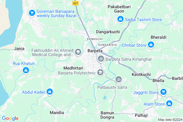
Gajia Map
EDIT Map
Add Your House
 ..
..
Current Corona Virus Infected Patients Count in Barpeta District
| City Name | District Name | Total Covid cases |
|---|
Locality Name :
Gajia
( गाजीअ )
Tehsil Name : Mandia
District : Barpeta
State : Assam
Language : Assamese
Current Time 09:39 AM
Date: Wednesday , Apr 30,2025 (IST)
Time zone: IST (UTC+5:30)
Elevation / Altitude: 52 meters. Above Seal level
Telephone Code / Std Code: 03666
Assembly constituency : Barpeta assembly constituency
Assembly MLA : Abdur Rahim Ahmed
Lok Sabha constituency : Barpeta parliamentary constituency
Parliament MP : Abdul Khaleque
Serpanch Name :
Pin Code : 781314
Post Office Name : Santinagar (Barpeta)
Commodities Prices : Dadengiri Market / Mandi
Gajia Live Weather
Temperature: 24.1 °C
scattered clouds
Humidity: 60%
Wind : 6 mt/sec towards E
StationName : "Barpeta"
observed on 2 Hours Back
Temperature: 24.1 °C
scattered clouds
Humidity: 60%
Wind : 6 mt/sec towards E
StationName : "Barpeta"
observed on 2 Hours Back
Gajia Weather Forecast for Next 5 days
01-05-2025
25.0°C to 33.4°C
broken clouds, light rain, overcast clouds
25.0°C to 33.4°C
broken clouds, light rain, overcast clouds
02-05-2025
24.5°C to 35.2°C
light rain, scattered clouds, few clouds, overcast clouds
24.5°C to 35.2°C
light rain, scattered clouds, few clouds, overcast clouds
03-05-2025
23.9°C to 35.3°C
broken clouds, few clouds, scattered clouds, overcast clouds, light rain
23.9°C to 35.3°C
broken clouds, few clouds, scattered clouds, overcast clouds, light rain
04-05-2025
23.7°C to 35.2°C
light rain, broken clouds, overcast clouds
23.7°C to 35.2°C
light rain, broken clouds, overcast clouds
05-05-2025
24.4°C to 34.6°C
light rain, overcast clouds, few clouds
24.4°C to 34.6°C
light rain, overcast clouds, few clouds
National Highways Reachable To Gajia
Nationa High Way :NH17
Nationa High Way :NH17
Rivers Near Gajia
Brahmaputra :ব্ৰহ্মপুত্ৰ :ব্রহ্মপুত্র :Brahmaputra :Brahmaputra :ब्रह्मपुत्र :ಬ್ರಹ್ಮಪುತ್ರ :பிரம்மபுத்திரா :బ్రహ్మపుత్రా :Брахмапутра :雅鲁藏布江
Aai
Brahmaputra :ব্ৰহ্মপুত্ৰ :ব্রহ্মপুত্র :Brahmaputra :Brahmaputra :ब्रह्मपुत्र :ಬ್ರಹ್ಮಪುತ್ರ :பிரம்மபுத்திரா :బ్రహ్మపుత్రా :Брахмапутра :雅鲁藏布江
Aai
About Gajia
Correct below Info and add more info about GajiaGajia is a Village in Mandia Tehsil in Barpeta District of Assam State, India. It is located 0 KM towards west from District head quarters Barpeta. 8 KM from Mandia. 88 KM from State capital Dispur
Gajia Pin code is 781314 and postal head office is Santinagar (Barpeta).
Dharmapur-bhatnapaity ( 1 KM ) , Dakhin Paschim Sarukhetri ( 1 KM ) , Uttar Pub Sarukhetri ( 1 KM ) , Barpeta ( 1 KM ) , Sundaridia ( 2 KM ) are the nearby Villages to Gajia. Gajia is surrounded by Barpeta Tehsil towards East , Mandia Tehsil towards South , Rupshi Tehsil towards west , Chenga Tehsil towards East .
Barpeta , Barpeta Road , Goalpara , Nalbari are the near by Cities to Gajia.
Gajia 2011 Census Details
Gajia Local Language is Assamese. Gajia Village Total population is 839 and number of houses are 176. Female Population is 50.5%. Village literacy rate is 87.8% and the Female Literacy rate is 43.0%.
Population
| Census Parameter | Census Data |
| Total Population | 839 |
| Total No of Houses | 176 |
| Female Population % | 50.5 % ( 424) |
| Total Literacy rate % | 87.8 % ( 737) |
| Female Literacy rate | 43.0 % ( 361) |
| Scheduled Tribes Population % | 0.0 % ( 0) |
| Scheduled Caste Population % | 0.2 % ( 2) |
| Working Population % | 31.0 % |
| Child(0 -6) Population by 2011 | 62 |
| Girl Child(0 -6) Population % by 2011 | 45.2 % ( 28) |
Gajia Census More Deatils.
Politics in Gajia
Indian National Congress , 89.92% , AUDF , BJP , AGP , 78187 , INC are the major political parties in this area.Polling Stations /Booths near Gajia
1)Jeevanlata High School (r/w)2)Juroram Pathak Girls High School (l/w)
3)Juroram Pathak Girls High School (m/w)
4)898 No. Kathilijhar Lp School (r/w)
5)918 No. Metuakuchi Lp School (l/w)
HOW TO REACH Gajia
By Rail
There is no railway station near to Gajia in less than 10 km.Colleges near Gajia
Luitporia College
Address :
Global Academy Mandia
Address : College Road, Mandia
dist, Barpeta (assam)
pin, 781308
Fakharuddin Ali Ahmed Memorial College Jania
Address :
Mandia Anchalik College
Address : Mandia (barpeta),assam
Schools in Gajia
Gajia Mes
Address : gajia , mondia , barpeta , Assam . PIN- 781314 , Post - Santinagar (Barpeta)
Govt Health Centers near Gajia
1) Simlitola Char PHC(New) , Simlitola Char PHC , Simlitola Char PHC ,2) Mahatma Gandhi Model Hospital , Makhibaha , , Tihu Makhibaha Road , Near Makhibaha Girls High School
3) Digheli SD , Digheli SD , , Near Digheli High School
Hospitals in Gajia,Mandia
Sanjevani Hospital; Barpeta
Medical College Rd; Muslimpatty; Gorakhpur; Assam 781301; India
0.7 KM distance Detail
DR TILAK PATHAK
Ward No:17; Near Measurement Office; Metuakuchi; Barpeta Town; Assam 781301; India
0.8 KM distance Detail
more ..
Petrol Bunks in Gajia,Mandia
HP PETROL PUMP - COCO AUTO CARE CENTRE
Barpeta Town Assam; Gauhati; Assam 781301; India
1.7 KM distance Detail
more ..
Electronic Shops in Gajia,Mandia
My Jio Store
My Jio Store Syndicate Bank Bldg Metuakuchi Barpeta Town Dag No 1236 K P Patta No 677 Of Barpeta Town Mouza; Barpeta; Assam 781301; India
0.8 KM distance Detail
Super Markets in Gajia,Mandia
Ahmed Prakashan
B.k; Muslimpatty-Eidgah Rd; Muslimpatty; Barpeta Town; Assam 781301; India
1.5 KM distance Detail
Police Stations near Gajia,Mandia
Barpeta Police Station
Barpeta-Doulashal-Hajo Rd; Barpeta Town; Assam 781301; India
1.7 KM distance Detail
Governement Offices near Gajia,Mandia
Office of The Executive Engineer; Barpeta Water Resources Division; Barpeta
Bhera; Assam 781301; India
0.9 KM distance Detail
Gyan Grantha Ghar
Barpeta-Mandia Road; near District Library; Muslimpatty; Barpeta; Assam 781301; India
0.9 KM distance Detail
JobCityCentre.com
Mouri Gaon Tiniali; Mouri Gaon;Mandia; Barpeta; Assam 781308; India
1.1 KM distance Detail
About Gajia &
History
How to reach Gajia
Tourist Places Near By Gajia
Schools in Gajia
Colleges in Gajia
Temperature & weather of Gajia
places in Gajia
Gajia photos
More Information
How to reach Gajia
Tourist Places Near By Gajia
Schools in Gajia
Colleges in Gajia
Temperature & weather of Gajia
places in Gajia
Gajia photos
More Information
Village Talk
Post News or Events about this Village
Near Cities
Barpeta 0 KM near
Barpeta Road 22 KM near
Goalpara 45 KM near
Nalbari 49 KM near
Barpeta 0 KM near
Barpeta Road 22 KM near
Goalpara 45 KM near
Nalbari 49 KM near
Near By Taluks
Sarukhetri 0 KM near
Barpeta 7 KM near
Mandia 7 KM near
Rupshi 15 KM near
Sarukhetri 0 KM near
Barpeta 7 KM near
Mandia 7 KM near
Rupshi 15 KM near
Near By Air Ports
Borjhar Airport 70 KM near
Rupsi Airport 122 KM near
Shillong Airport 136 KM near
Salonibari Airport 205 KM near
Borjhar Airport 70 KM near
Rupsi Airport 122 KM near
Shillong Airport 136 KM near
Salonibari Airport 205 KM near
Near By Tourist Places
Barpeta 21 KM near
Nalbari 51 KM near
Bongaigaon 52 KM near
Manas National Park 53 KM near
Goalpara 54 KM near
Barpeta 21 KM near
Nalbari 51 KM near
Bongaigaon 52 KM near
Manas National Park 53 KM near
Goalpara 54 KM near
Near By Districts
Barpeta 0 KM near
Goalpara 46 KM near
Chirang 46 KM near
Nalbari 51 KM near
Barpeta 0 KM near
Goalpara 46 KM near
Chirang 46 KM near
Nalbari 51 KM near
Near By RailWay Station
Barpeta Road Rail Way Station 23 KM near
Goalpara Town Rail Way Station 48 KM near
Barpeta Road Rail Way Station 23 KM near
Goalpara Town Rail Way Station 48 KM near