| Home | City Bus | Maps | Villages | Cities | Rail | Tourist Places | School | College | Pin Codes | Corona Cases Count |
| Distance Calculator Bus Services IFSC Codes Trace Mobile Number Weather Search Place Trace IP Available Cash ATM/Banks Locate Polling Booth Report an Error contact People |
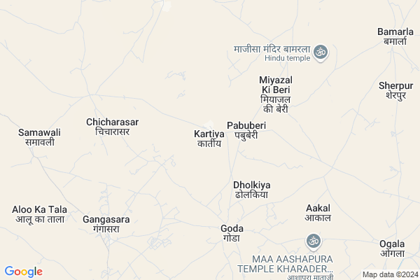
Kartiya
Kartiya Map
EDIT Map
Add Your House
 ..
..
Current Corona Virus Infected Patients Count in Barmer District
| City Name | District Name | Total Covid cases |
|---|---|---|
| Barmer District | Barmer | 2 |
Locality Name :
Kartiya
( करतिया )
Tehsil Name : Dhorimanna
District : Barmer
State : Rajasthan
Division : Jodhpur
Language : Rajasthani and Hindi ,english
Current Time 04:48 PM
Date: Monday , Apr 28,2025 (IST)
Time zone: IST (UTC+5:30)
Telephone Code / Std Code: 02989
Assembly constituency : Chohtan assembly constituency
Assembly MLA : Adu Ram Meghwal
Lok Sabha constituency : Barmer parliamentary constituency
Parliament MP : KAILASH CHOUDHARY
Serpanch Name :
Pin Code : 344704
Post Office Name : Dhorimana
Commodities Prices : Sanchor Market / Mandi
Kartiya Live Weather
Temperature: 44.1 °C
clear sky
Humidity: 10%
Wind : 9.66 mt/sec towards S
StationName : "SÄ\u0081nchor"
observed on 7 Mins Back
Temperature: 44.1 °C
clear sky
Humidity: 10%
Wind : 9.66 mt/sec towards S
StationName : "SÄ\u0081nchor"
observed on 7 Mins Back
Kartiya Weather Forecast for Next 5 days
29-04-2025
29.0°C to 42.4°C
clear sky, overcast clouds
29.0°C to 42.4°C
clear sky, overcast clouds
30-04-2025
26.5°C to 46.3°C
scattered clouds, clear sky
26.5°C to 46.3°C
scattered clouds, clear sky
01-05-2025
26.2°C to 45.2°C
clear sky
26.2°C to 45.2°C
clear sky
02-05-2025
24.8°C to 43.9°C
clear sky
24.8°C to 43.9°C
clear sky
03-05-2025
24.5°C to 40.7°C
clear sky, scattered clouds, few clouds
24.5°C to 40.7°C
clear sky, scattered clouds, few clouds
Rivers Near Kartiya
Bandi
Sagi
Bandi
Sagi
About Kartiya
Correct below Info and add more info about KartiyaKartiya is a Village in Dhorimanna Tehsil in Barmer District of Rajasthan State, India. It belongs to Jodhpur Division . It is located 95 KM towards South from District head quarters Barmer. 31 KM from Dhorimana. 586 KM from State capital Jaipur
Kartiya Pin code is 344704 and postal head office is Dhorimana .
Chichadasar ( 7 KM ) , Sonari ( 7 KM ) , Ogala ( 12 KM ) , Bamarla ( 12 KM ) , Kekad ( 12 KM ) are the nearby Villages to Kartiya. Kartiya is surrounded by Chohtan Tehsil towards North , Sanchore Tehsil towards East , Tharad Tehsil towards South , Barmer Tehsil towards North .
Sanchore , Tharad , Barmer , Bhinmal are the near by Cities to Kartiya.
Kartiya 2011 Census Details
Kartiya Local Language is Rajasthani. Kartiya Village Total population is 1031 and number of houses are 156. Female Population is 46.7%. Village literacy rate is 37.2% and the Female Literacy rate is 11.8%.
Population
| Census Parameter | Census Data |
| Total Population | 1031 |
| Total No of Houses | 156 |
| Female Population % | 46.7 % ( 481) |
| Total Literacy rate % | 37.2 % ( 384) |
| Female Literacy rate | 11.8 % ( 122) |
| Scheduled Tribes Population % | 0.0 % ( 0) |
| Scheduled Caste Population % | 48.6 % ( 501) |
| Working Population % | 44.4 % |
| Child(0 -6) Population by 2011 | 210 |
| Girl Child(0 -6) Population % by 2011 | 47.6 % ( 100) |
Kartiya Census More Deatils.
Politics in Kartiya
Bharatiya Janata Party , BJP , INC are the major political parties in this area.Polling Stations /Booths near Kartiya
1)Goverment Siniour Secondary School Kitnoriya2)Goverment Upper Primary School Daya Bhag Jaton Ka Bera
3)Goverment Secondary School Daxini Bhag Bhalgaon
4)Goverment Primary School Bachhwal
5)Goverment Upper Praimary School Husain Ka Tala
HOW TO REACH Kartiya
By Rail
There is no railway station near to Kartiya in less than 10 km.Colleges near Kartiya
Sanwariya Collage Dhorimanna
Address :
Government College, Gudamalani
Address :
Bishnoidhaka
Address :
उज्ज्वल एज्यूकेशन सॉफ्ट टेक मौखावा खुर्द
Address : उज्ज्वल एज्यूकेशन सॉफ्ट टेक मौखावा खुर्द
Schools in Kartiya
Gups Kartiya
Address : kartiya , dhorimana , barmer , Rajasthan . PIN- 344704 , Post - Dhorimana
Govt Health Centers near Kartiya
1) Kartiya , SUBCENTER KARTIYA , GRAMPANCHAYAT KARTIYA ,2) Chicharasar , , ,
3) Gora , SUBCENTER GORA , GRAMPANCHAYAT GORA ,
Schools in Kartiya,Dhorimanna
govt. aadrsh sr. sec. school shobhala darshan
darshan; Shobhala; Rajasthan 344702; India
15.4 KM distance Detail
Vishvamitra Sec.School Shobhala Darshan
; Chhachhi Beri; Rajasthan 344704; India
16.7 KM distance Detail
Electronic Shops in Kartiya,Dhorimanna
Super Markets in Kartiya,Dhorimanna
Local Parks in Kartiya,Dhorimanna
Police Stations near Kartiya,Dhorimanna
Governement Offices near Kartiya,Dhorimanna
About Kartiya &
History
How to reach Kartiya
Tourist Places Near By Kartiya
Schools in Kartiya
Colleges in Kartiya
Temperature & weather of Kartiya
places in Kartiya
Kartiya photos
More Information
How to reach Kartiya
Tourist Places Near By Kartiya
Schools in Kartiya
Colleges in Kartiya
Temperature & weather of Kartiya
places in Kartiya
Kartiya photos
More Information
Village Talk
Post News or Events about this Village
Near Cities
Sanchore 63 KM near
Tharad 87 KM near
Barmer 92 KM near
Bhinmal 111 KM near
Sanchore 63 KM near
Tharad 87 KM near
Barmer 92 KM near
Bhinmal 111 KM near
Near By Taluks
Dhorimanna 29 KM near
Chohtan 52 KM near
Sanchore 61 KM near
Tharad 84 KM near
Dhorimanna 29 KM near
Chohtan 52 KM near
Sanchore 61 KM near
Tharad 84 KM near
Near By Air Ports
Jaisalmer Airport 239 KM near
Jodhpur Airport 252 KM near
Kandla Airport 272 KM near
Rudra Mata Airport 282 KM near
Jaisalmer Airport 239 KM near
Jodhpur Airport 252 KM near
Kandla Airport 272 KM near
Rudra Mata Airport 282 KM near
Near By Tourist Places
Barmer 91 KM near
Jalore 156 KM near
Banaskantha 168 KM near
Mount Abu 171 KM near
Kutch 171 KM near
Barmer 91 KM near
Jalore 156 KM near
Banaskantha 168 KM near
Mount Abu 171 KM near
Kutch 171 KM near
Near By Districts
Barmer 91 KM near
Jalore 158 KM near
Banas Kantha 168 KM near
Patan 174 KM near
Barmer 91 KM near
Jalore 158 KM near
Banas Kantha 168 KM near
Patan 174 KM near
Near By RailWay Station
Barmer Rail Way Station 91 KM near
Bhildi Junction Rail Way Station 132 KM near
Barmer Rail Way Station 91 KM near
Bhildi Junction Rail Way Station 132 KM near