| Home | City Bus | Maps | Villages | Cities | Rail | Tourist Places | School | College | Pin Codes | Corona Cases Count |
| Distance Calculator Bus Services IFSC Codes Trace Mobile Number Weather Search Place Trace IP Available Cash ATM/Banks Locate Polling Booth Report an Error contact People |
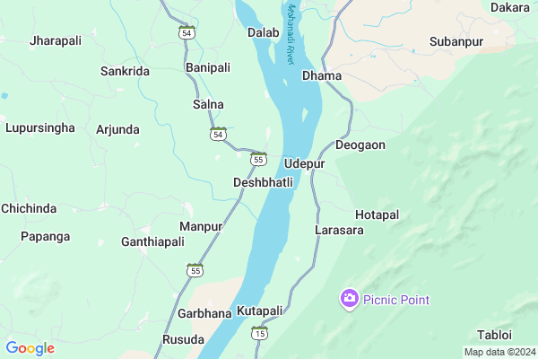
Deshbhatli Map
EDIT Map
Add Your House
 ..
..
Current Corona Virus Infected Patients Count in Bargarh District
| City Name | District Name | Total Covid cases |
|---|
Locality Name :
Deshbhatli
( ଦେଶଭଟଲି )
Tehsil Name : Bheden
District : Bargarh
State : Odisha
Language : Oriya and Hindi
Current Time 06:15 AM
Date: Monday , Apr 28,2025 (IST)
Time zone: IST (UTC+5:30)
Elevation / Altitude: 178 meters. Above Seal level
Telephone Code / Std Code: 06682
Assembly constituency : Attabira assembly constituency
Assembly MLA : snehangini chhuria
Lok Sabha constituency : Bargarh parliamentary constituency
Parliament MP :
Serpanch Name :
Pin Code : 768102
Post Office Name : Larambha
Commodities Prices : Attabira Market / Mandi
Deshbhatli Live Weather
Temperature: 26.9 °C
clear sky
Humidity: 44%
Wind : 0.9 mt/sec towards SE
StationName : "Binka"
observed on Now
Temperature: 26.9 °C
clear sky
Humidity: 44%
Wind : 0.9 mt/sec towards SE
StationName : "Binka"
observed on Now
Deshbhatli Weather Forecast for Next 5 days
29-04-2025
25.5°C to 40.4°C
scattered clouds, few clouds, clear sky, broken clouds
25.5°C to 40.4°C
scattered clouds, few clouds, clear sky, broken clouds
30-04-2025
24.1°C to 41.7°C
clear sky, scattered clouds, light rain, few clouds
24.1°C to 41.7°C
clear sky, scattered clouds, light rain, few clouds
01-05-2025
23.3°C to 43.0°C
clear sky, few clouds, scattered clouds
23.3°C to 43.0°C
clear sky, few clouds, scattered clouds
02-05-2025
23.5°C to 42.1°C
few clouds, clear sky, light rain, overcast clouds, broken clouds
23.5°C to 42.1°C
few clouds, clear sky, light rain, overcast clouds, broken clouds
03-05-2025
22.9°C to 41.7°C
clear sky, broken clouds, scattered clouds, light rain, overcast clouds
22.9°C to 41.7°C
clear sky, broken clouds, scattered clouds, light rain, overcast clouds
Rivers Near Deshbhatli
Talkhol
Jīra River :Jira River :Jira
Talkhol
Jīra River :Jira River :Jira
About Deshbhatli
Correct below Info and add more info about DeshbhatliDeshbhatli is a Village in Bheden Tehsil in Bargarh District of Odisha State, India. It is located 36 KM towards East from District head quarters Bargarh. 11 KM from Bheden. 266 KM from State capital Bhubaneswar
Deshbhatli Pin code is 768102 and postal head office is Larambha .
Dalab ( 6 KM ) , Rusuda ( 8 KM ) , Arjunda ( 9 KM ) , Papanga ( 10 KM ) , Lupursingha ( 10 KM ) are the nearby Villages to Deshbhatli. Deshbhatli is surrounded by Maneswar Tehsil towards North , Attabira Tehsil towards North , Binika Tehsil towards South , Jujomura Tehsil towards East .
Sambalpur , Burla , Bargarh , Belpahar are the near by Cities to Deshbhatli.
Deshbhatli 2011 Census Details
Deshbhatli Local Language is Oriya. Deshbhatli Village Total population is 1054 and number of houses are 274. Female Population is 50.3%. Village literacy rate is 69.6% and the Female Literacy rate is 30.9%.
Population
| Census Parameter | Census Data |
| Total Population | 1054 |
| Total No of Houses | 274 |
| Female Population % | 50.3 % ( 530) |
| Total Literacy rate % | 69.6 % ( 734) |
| Female Literacy rate | 30.9 % ( 326) |
| Scheduled Tribes Population % | 42.4 % ( 447) |
| Scheduled Caste Population % | 21.4 % ( 226) |
| Working Population % | 55.9 % |
| Child(0 -6) Population by 2011 | 109 |
| Girl Child(0 -6) Population % by 2011 | 48.6 % ( 53) |
Deshbhatli Census More Deatils.
Politics in Deshbhatli
BJP , BJD , INC are the major political parties in this area.Polling Stations /Booths near Deshbhatli
1)Dekulba Pups2)Tupapada Pugu Primary School
3)Dunguripali Ps
4)Deskumbhari Ugups
5)Desbhatli Nodal Ups
HOW TO REACH Deshbhatli
By Rail
There is no railway station near to Deshbhatli in less than 10 km.Colleges near Deshbhatli
Anchalik Kissan College Bheden
Address :
Bheden Degree College Bheden
Address : Bheden College
Palishree College
Address : Chichinda, Bargarh
Anchalik Kishan College
Address : Bargarh
Schools in Deshbhatli
Deshbhatli Girls H.s
Address : deshbhatli , bheden , bargarh , Sikkim . PIN- 768102 , Post - Larambha
Deshbhatli Nodal Up
Address : deshbhatli , bheden , bargarh , Sikkim . PIN- 768102 , Post - Larambha
Govt Health Centers near Deshbhatli
1) Hatibari , , ,2) DR.JANARDAN PUJARI MATERNITY HOME SAMBALPUR , JPM SAMBALPUR , GOLEBAZAR , Golebazar
3) UFWC, AITHAPALI , URBAN FAMILY WELFARE CENTER AINTHAPALI , Aithapali , Near Trafic
Petrol Bunks in Deshbhatli,Bheden
Indian Oil Petrol Pump
Bhuthapali; Bargarh; SH-54; Bargarh; Bargarh; Odisha 768030; India
6.4 KM distance Detail
HARI OM FUEL CENTRE- IOCL PETROL PUMP
21°16'38. 83°51'46.; 1; Main Rd 3; Kamla Nagar; Kotra Sultanabad; Bhopal; Madhya Pradesh 462003; India
8.7 KM distance Detail
more ..
Governement Offices near Deshbhatli,Bheden
Ajunda Godown
Jharapali - Arjunda - Tangarpali Rd; Arjunda; Odisha 768104; India
8.6 KM distance Detail
About Deshbhatli &
History
How to reach Deshbhatli
Tourist Places Near By Deshbhatli
Schools in Deshbhatli
Colleges in Deshbhatli
Temperature & weather of Deshbhatli
places in Deshbhatli
Deshbhatli photos
More Information
How to reach Deshbhatli
Tourist Places Near By Deshbhatli
Schools in Deshbhatli
Colleges in Deshbhatli
Temperature & weather of Deshbhatli
places in Deshbhatli
Deshbhatli photos
More Information
Village Talk
Post News or Events about this Village
Near Cities
Sambalpur 33 KM near
Burla 35 KM near
Bargarh 37 KM near
Belpahar 72 KM near
Sambalpur 33 KM near
Burla 35 KM near
Bargarh 37 KM near
Belpahar 72 KM near
Near By Taluks
Bheden 10 KM near
Maneswar 24 KM near
Attabira 24 KM near
Binika 27 KM near
Bheden 10 KM near
Maneswar 24 KM near
Attabira 24 KM near
Binika 27 KM near
Near By Air Ports
Raipur Airport 250 KM near
Bhubaneswar Airport 253 KM near
Ranchi Airport 308 KM near
Vishakhapatnam Airport 441 KM near
Raipur Airport 250 KM near
Bhubaneswar Airport 253 KM near
Ranchi Airport 308 KM near
Vishakhapatnam Airport 441 KM near
Near By Tourist Places
Sambalpur 31 KM near
Hirakud 39 KM near
Phulbani 100 KM near
Raigarh 102 KM near
Rourkela 171 KM near
Sambalpur 31 KM near
Hirakud 39 KM near
Phulbani 100 KM near
Raigarh 102 KM near
Rourkela 171 KM near
Near By Districts
Sambalpur 34 KM near
Bargarh 35 KM near
Sonepur 46 KM near
Boudh 67 KM near
Sambalpur 34 KM near
Bargarh 35 KM near
Sonepur 46 KM near
Boudh 67 KM near
Near By RailWay Station
Hirakud Rail Way Station 32 KM near
Bargarh Road Rail Way Station 32 KM near
Hirakud Rail Way Station 32 KM near
Bargarh Road Rail Way Station 32 KM near