| Home | City Bus | Maps | Villages | Cities | Rail | Tourist Places | School | College | Pin Codes | Corona Cases Count |
| Distance Calculator Bus Services IFSC Codes Trace Mobile Number Weather Search Place Trace IP Available Cash ATM/Banks Locate Polling Booth Report an Error contact People |
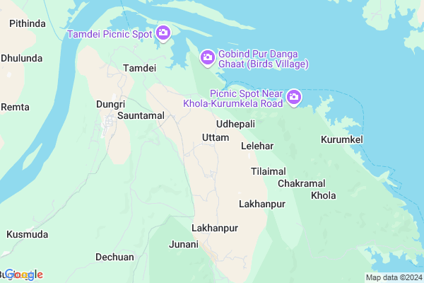
Uttam Map
EDIT Map
Add Your House
 ..
..
Current Corona Virus Infected Patients Count in Bargarh District
| City Name | District Name | Total Covid cases |
|---|
Locality Name :
Uttam
( ଉତ୍ତମ )
Tehsil Name : Ambabhona
District : Bargarh
State : Odisha
Language : Oriya and Hindi
Current Time 04:39 PM
Date: Tuesday , Apr 29,2025 (IST)
Time zone: IST (UTC+5:30)
Elevation / Altitude: 185 meters. Above Seal level
Telephone Code / Std Code: 06646
Assembly constituency : Bhatli assembly constituency
Assembly MLA : susanta singh
Lok Sabha constituency : Bargarh parliamentary constituency
Parliament MP :
Serpanch Name :
Pin Code : 768052
Post Office Name : Dunguri Lsq Colony Campus
Commodities Prices : Raigarh Market / Mandi
Uttam Live Weather
Temperature: 33.6 °C
few clouds
Humidity: 27%
Wind : 11.74 mt/sec towards W
StationName : "Raigarh"
observed on Now
Temperature: 33.6 °C
few clouds
Humidity: 27%
Wind : 11.74 mt/sec towards W
StationName : "Raigarh"
observed on Now
Uttam Weather Forecast for Next 5 days
30-04-2025
23.5°C to 26.1°C
light rain, broken clouds, clear sky
23.5°C to 26.1°C
light rain, broken clouds, clear sky
01-05-2025
21.4°C to 34.5°C
clear sky, light rain, few clouds
21.4°C to 34.5°C
clear sky, light rain, few clouds
02-05-2025
21.8°C to 33.6°C
clear sky, few clouds, light rain, broken clouds
21.8°C to 33.6°C
clear sky, few clouds, light rain, broken clouds
03-05-2025
21.5°C to 34.9°C
clear sky, scattered clouds, light rain, overcast clouds
21.5°C to 34.9°C
clear sky, scattered clouds, light rain, overcast clouds
04-05-2025
22.3°C to 35.1°C
few clouds, clear sky
22.3°C to 35.1°C
few clouds, clear sky
National Highways Reachable To Uttam
Nationa High Way :NH49
Nationa High Way :NH49
Rivers Near Uttam
Rānj Jhor :Ranj Jhor
Jaba Nadi :Jaba Nadi
Rānj Jhor :Ranj Jhor
Jaba Nadi :Jaba Nadi
About Uttam
Correct below Info and add more info about UttamUttam is a Village in Ambabhona Tehsil in Bargarh District of Odisha State, India. It is located 44 KM towards North from District head quarters Bargarh. 22 KM from Ambabhona. 327 KM from State capital Bhubaneswar
Uttam Pin code is 768052 and postal head office is Dunguri Lsq Colony Campus .
Uttam is surrounded by Ambabhona Tehsil towards west , Bhatli Tehsil towards South , Pussore Tehsil towards west , Raigarh Tehsil towards west .
Belpahar , Bargarh , Burla , Brajrajnagar are the near by Cities to Uttam.
Uttam 2011 Census Details
Uttam Local Language is Oriya. Uttam Village Total population is 895 and number of houses are 193. Female Population is 51.1%. Village literacy rate is 69.7% and the Female Literacy rate is 30.7%.
Population
| Census Parameter | Census Data |
| Total Population | 895 |
| Total No of Houses | 193 |
| Female Population % | 51.1 % ( 457) |
| Total Literacy rate % | 69.7 % ( 624) |
| Female Literacy rate | 30.7 % ( 275) |
| Scheduled Tribes Population % | 36.4 % ( 326) |
| Scheduled Caste Population % | 12.6 % ( 113) |
| Working Population % | 66.9 % |
| Child(0 -6) Population by 2011 | 83 |
| Girl Child(0 -6) Population % by 2011 | 55.4 % ( 46) |
Uttam Census More Deatils.
Politics in Uttam
BJP , BJD , INC are the major political parties in this area.Polling Stations /Booths near Uttam
1)Urduna Sevashram2)Turimunda P.s.
3)Chadeigaon Pry. School
4)Lebidi Ugmes
5)Temeren Pugup School
HOW TO REACH Uttam
By Rail
There is no railway station near to Uttam in less than 10 km.Colleges near Uttam
Swami Vivekanand College Dunguri
Address :
M.g. Degree College
Address : Bhukta, Bargarh
Schools in Uttam
Uttam Ughs
Address : uttam , ambabhona , bargarh , Sikkim . PIN- 768052 , Post - Dunguri Lsq Colony Campus
Govt Health Centers near Uttam
1) DR.JANARDAN PUJARI MATERNITY HOME SAMBALPUR , JPM SAMBALPUR , GOLEBAZAR , Golebazar2) UFWC, AITHAPALI , URBAN FAMILY WELFARE CENTER AINTHAPALI , Aithapali , Near Trafic
3) Hatibari , , ,
Hospitals in Uttam,Ambabhona
govt doctor
rengalpali root from kanaktora; Rengalpali; Chhattisgarh 496440; India
20.0 KM distance Detail
more ..
Petrol Bunks in Uttam,Ambabhona
Hindustan Petroleum
Jharsuguda; Bhikampali; Jharsuguda; NH-200; Raipur Chandikhol Highway; Jharsuguda; Jharsuguda; Odisha 768217; India
17.9 KM distance Detail
more ..
Colleges in Uttam,Ambabhona
JANKI COLLEGE OF EDUCATION
Medical college Road; Dhanuhardera; Chhattisgarh 496440; India
22.2 KM distance Detail
more ..
Police Stations near Uttam,Ambabhona
police fandi;kanaktora
National Highway 200; Kanaktura; Odisha 768226; India
20.2 KM distance Detail
Governement Offices near Uttam,Ambabhona
RTO OFFICE; CG GOVT.
National Highway 200; Bodajhariya; Chhattisgarh 496440; India
21.1 KM distance Detail
About Uttam &
History
How to reach Uttam
Tourist Places Near By Uttam
Schools in Uttam
Colleges in Uttam
Temperature & weather of Uttam
places in Uttam
Uttam photos
More Information
How to reach Uttam
Tourist Places Near By Uttam
Schools in Uttam
Colleges in Uttam
Temperature & weather of Uttam
places in Uttam
Uttam photos
More Information
Village Talk
Post News or Events about this Village
Near Cities
Belpahar 33 KM near
Bargarh 36 KM near
Burla 37 KM near
Brajrajnagar 39 KM near
Belpahar 33 KM near
Bargarh 36 KM near
Burla 37 KM near
Brajrajnagar 39 KM near
Near By Taluks
Lakhanpur 17 KM near
Ambabhona 20 KM near
Bhatli 28 KM near
Pussore 30 KM near
Lakhanpur 17 KM near
Ambabhona 20 KM near
Bhatli 28 KM near
Pussore 30 KM near
Near By Air Ports
Raipur Airport 225 KM near
Ranchi Airport 283 KM near
Bhubaneswar Airport 312 KM near
Gaya Airport 411 KM near
Raipur Airport 225 KM near
Ranchi Airport 283 KM near
Bhubaneswar Airport 312 KM near
Gaya Airport 411 KM near
Near By Tourist Places
Raigarh 36 KM near
Hirakud 37 KM near
Sambalpur 49 KM near
Janjgir 126 KM near
Korba 135 KM near
Raigarh 36 KM near
Hirakud 37 KM near
Sambalpur 49 KM near
Janjgir 126 KM near
Korba 135 KM near
Near By Districts
Raigarh 36 KM near
Bargarh 42 KM near
Sambalpur 49 KM near
Jharsuguda 53 KM near
Raigarh 36 KM near
Bargarh 42 KM near
Sambalpur 49 KM near
Jharsuguda 53 KM near
Near By RailWay Station
Raigarh Rail Way Station 36 KM near
Brajrajnagar Rail Way Station 40 KM near
Raigarh Rail Way Station 36 KM near
Brajrajnagar Rail Way Station 40 KM near