| Home | City Bus | Maps | Villages | Cities | Rail | Tourist Places | School | College | Pin Codes | Corona Cases Count |
| Distance Calculator Bus Services IFSC Codes Trace Mobile Number Weather Search Place Trace IP Available Cash ATM/Banks Locate Polling Booth Report an Error contact People |
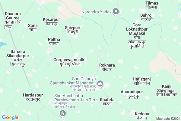
Gurganwa Ahatmali
Gurganwa Ahatmali Map
EDIT Map
Add Your House
 ..
..
Current Corona Virus Infected Patients Count in Bareilly District
| City Name | District Name | Total Covid cases |
|---|---|---|
| Bareilly District | Bareilly | 6 |
Locality Name :
Gurganwa Ahatmali
( गुडगांवा एहतमाली )
Block Name : Majhgawan
District : Bareilly
State : Uttar Pradesh
Division : Bareilly
Language : Hindi and English, Urdu, Punjabi, And Kumaoni
Current Time 09:18 PM
Date: Wednesday , Feb 05,2025 (IST)
Time zone: IST (UTC+5:30)
Elevation / Altitude: 165 meters. Above Seal level
Telephone Code / Std Code: 05498
Assembly constituency : Aonla assembly constituency
Assembly MLA : Dharmpal Singh
Lok Sabha constituency : Aonla parliamentary constituency
Parliament MP : DHARMENDRA KASHYAP
Serpanch Name :
Pin Code : 243303
Post Office Name : Shivaji Marg (Bareilly)
Commodities Prices : Anwala Market / Mandi
Gurganwa Ahatmali Live Weather
Temperature: 15.1 °C
clear sky
Humidity: 37%
Wind : 4.73 mt/sec towards W
StationName : "Sarauli"
observed on 58 Mins Back
Temperature: 15.1 °C
clear sky
Humidity: 37%
Wind : 4.73 mt/sec towards W
StationName : "Sarauli"
observed on 58 Mins Back
Gurganwa Ahatmali Weather Forecast for Next 5 days
06-02-2025
11.7°C to 15.1°C
clear sky
11.7°C to 15.1°C
clear sky
07-02-2025
10.4°C to 24.9°C
clear sky
10.4°C to 24.9°C
clear sky
08-02-2025
9.3°C to 24.6°C
clear sky, few clouds, scattered clouds
9.3°C to 24.6°C
clear sky, few clouds, scattered clouds
09-02-2025
11.2°C to 26.4°C
broken clouds, overcast clouds, clear sky, scattered clouds, few clouds
11.2°C to 26.4°C
broken clouds, overcast clouds, clear sky, scattered clouds, few clouds
10-02-2025
13.0°C to 27.5°C
clear sky
13.0°C to 27.5°C
clear sky
National Highways Reachable To Gurganwa Ahatmali
Nationa High Way :NH21
Nationa High Way :NH21
Rivers Near Gurganwa Ahatmali
Nakatia Nadi
Nakatia Nadi
Nakatia Nadi
Nakatia Nadi
About Gurganwa Ahatmali
Correct below Info and add more info about Gurganwa AhatmaliGurganwa Ahatmali is a Village in Majhgawan Block in Bareilly District of Uttar Pradesh State, India. It belongs to Bareilly Division . It is located 31 KM towards west from District head quarters Bareilly. 16 KM from Majhgawan. 292 KM from State capital Lucknow
Gurganwa Ahatmali Pin code is 243303 and postal head office is Shivaji Marg (Bareilly).
Rokhara ( 2 KM ) , Gurganwamustkil ( 2 KM ) , Peparia Uprala ( 2 KM ) , Gularia Uprala ( 4 KM ) , Shivpuri ( 4 KM ) are the nearby Villages to Gurganwa Ahatmali. Gurganwa Ahatmali is surrounded by Mirganj Block towards North , Majhgawan Block towards South , Fatehganj West Block towards East , Shahabad Block towards North .
Ujhani , Shahabad, Rampur , Bareilly , Chandausi are the near by Cities to Gurganwa Ahatmali.
Gurganwa Ahatmali 2011 Census Details
Gurganwa Ahatmali Local Language is Hindi. Gurganwa Ahatmali Village Total population is 2289 and number of houses are 337. Female Population is 46.4%. Village literacy rate is 33.2% and the Female Literacy rate is 12.7%.
Population
| Census Parameter | Census Data |
| Total Population | 2289 |
| Total No of Houses | 337 |
| Female Population % | 46.4 % ( 1063) |
| Total Literacy rate % | 33.2 % ( 760) |
| Female Literacy rate | 12.7 % ( 291) |
| Scheduled Tribes Population % | 0.0 % ( 0) |
| Scheduled Caste Population % | 18.4 % ( 422) |
| Working Population % | 30.1 % |
| Child(0 -6) Population by 2011 | 478 |
| Girl Child(0 -6) Population % by 2011 | 47.7 % ( 228) |
Gurganwa Ahatmali Census More Deatils.
Politics in Gurganwa Ahatmali
BJP , SP , BSP are the major political parties in this area.Polling Stations /Booths near Gurganwa Ahatmali
1)P.p. Ghunsi2)Pri.path. Gurugawan Mu0 North Block R.no.1
3)P.p. Bhuda
4)P.p. Kasumara R. No. 2
5)P.p. Rauhatapur
HOW TO REACH Gurganwa Ahatmali
By Rail
There is no railway station near to Gurganwa Ahatmali in less than 10 km.Colleges near Gurganwa Ahatmali
Chutragupt Inter College Rajpur Kalan
Address : Barauda Utter Pradesh Grameen Bank
M.a.arbic College Rajput Kaplan Bareilly
Address : Rajpur Kalan
Schools near Gurganwa Ahatmali
Ups Dhirpur
Address : dhirpur , majhgawan , bareilly , Uttar Pradesh . PIN- 243201 , Post - K.S.W.Tulsi Nagar
Ups Nauhara Hasanpur
Address : nauhara hasanpur , majhgawan , bareilly , Uttar Pradesh . PIN- 243302 , Post - Bisharatganj
Ups Bindaura
Address : bhindaura , majhgawan , bareilly , Uttar Pradesh . PIN- 243301 , Post - Tehsil Aonla
Ups Gidauli
Address : gidauli , majhgawan , bareilly , Uttar Pradesh . PIN- 243302 , Post - Bisharatganj
Govt Health Centers near Gurganwa Ahatmali
1) Mugalpur , , , Near Junior School2) Kesarpur , Kesarpur , Kesarpur , Kesarpur
3) Kesarpur , , Keshar pur , Keshar pur
Hospitals in Gurganwa Ahatmali,Majhgawan
Lal Bahadur Shastri Rajkiy Government Homeopathy Hospital
Ram Nagar; Uttar Pradesh 243303; India
9.6 KM distance Detail
more ..
Petrol Bunks in Gurganwa Ahatmali,Majhgawan
HP PETROL PUMP - SHIV FILLING CENTRE
Village: Ramnagar Shahbad Road; TEH: Aonla; Meerut; Uttar Pradesh 243301; India
8.3 KM distance Detail
more ..
Colleges in Gurganwa Ahatmali,Majhgawan
Guari Shanker Mahavidyalaya Gularia uprala
Gularia Uprala; Uttar Pradesh 243303; India
2.7 KM distance Detail
Shree Laxmi Narayan Degree College of Agriculture; Science & Management
Pahuncha Buzurg Mustakil; Uttar Pradesh 243504; India
12.7 KM distance Detail
more ..
Schools in Gurganwa Ahatmali,Majhgawan
LAL BAHADUR SHASTRI JUNIOR HIGH SCHOOL
Gurganwamustkil; Uttar Pradesh 243303; India
2.3 KM distance Detail
Gauri Shanker Inter College Gularia Uprala;
Gularia Uprala; Uttar Pradesh 243303; India
3.8 KM distance Detail
Electronic Shops in Gurganwa Ahatmali,Majhgawan
V. T. Electronics
Aliganj Bas Stand Station Raod Aonla Barielly; Aonla; Uttar Pradesh 243301; India
8.3 KM distance Detail
Super Markets in Gurganwa Ahatmali,Majhgawan
Yadav Khad Cement Avam Dharmkanta
Ganj Bypass Rd; Barsera Sikandarpur; Uttar Pradesh 243303; India
9.2 KM distance Detail
Police Stations near Gurganwa Ahatmali,Majhgawan
Police Chowki ( गुरगांव मुस्तकिल )
Gurganwamustkil; Uttar Pradesh 243303; India
2.3 KM distance Detail
Police Station Meerganj
NH 24 Highway; Near post office; Barelli; Meerganj; 243304; India
15.9 KM distance Detail
Governement Offices near Gurganwa Ahatmali,Majhgawan
Block Development Officer-Majgawan Block
Aliganj Road; Majhgawan; Uttar Pradesh 243302; India
20.9 KM distance Detail
About Gurganwa Ahatmali &
History
How to reach Gurganwa Ahatmali
Tourist Places Near By Gurganwa Ahatmali
Schools in Gurganwa Ahatmali
Colleges in Gurganwa Ahatmali
Temperature & weather of Gurganwa Ahatmali
places in Gurganwa Ahatmali
Gurganwa Ahatmali photos
More Information
How to reach Gurganwa Ahatmali
Tourist Places Near By Gurganwa Ahatmali
Schools in Gurganwa Ahatmali
Colleges in Gurganwa Ahatmali
Temperature & weather of Gurganwa Ahatmali
places in Gurganwa Ahatmali
Gurganwa Ahatmali photos
More Information
Village Talk
Post News or Events about this Village
Near Cities
Ujhani 17 KM near
Shahabad, Rampur 22 KM near
Bareilly 29 KM near
Chandausi 40 KM near
Ujhani 17 KM near
Shahabad, Rampur 22 KM near
Bareilly 29 KM near
Chandausi 40 KM near
Near By Taluks
Ramnagar 9 KM near
Mirganj 14 KM near
Majhgawan 15 KM near
Fatehganj West 22 KM near
Ramnagar 9 KM near
Mirganj 14 KM near
Majhgawan 15 KM near
Fatehganj West 22 KM near
Near By Air Ports
Pantnagar Airport 82 KM near
Muzaffarnagar Airport 204 KM near
Kheria Airport 205 KM near
Indira Gandhi International Airport 224 KM near
Pantnagar Airport 82 KM near
Muzaffarnagar Airport 204 KM near
Kheria Airport 205 KM near
Indira Gandhi International Airport 224 KM near
Near By Tourist Places
Moradabad 64 KM near
Kashipur 100 KM near
Khatima 108 KM near
Kathgodam 113 KM near
Ramnagar 120 KM near
Moradabad 64 KM near
Kashipur 100 KM near
Khatima 108 KM near
Kathgodam 113 KM near
Ramnagar 120 KM near
Near By Districts
Bareilly 29 KM near
Rampur 48 KM near
Budaun 49 KM near
Moradabad 64 KM near
Bareilly 29 KM near
Rampur 48 KM near
Budaun 49 KM near
Moradabad 64 KM near
Near By RailWay Station
Aonla Rail Way Station 16 KM near
Bareilly City Rail Way Station 29 KM near
Aonla Rail Way Station 16 KM near
Bareilly City Rail Way Station 29 KM near