| Home | City Bus | Maps | Villages | Cities | Rail | Tourist Places | School | College | Pin Codes | Corona Cases Count |
| Distance Calculator Bus Services IFSC Codes Trace Mobile Number Weather Search Place Trace IP Available Cash ATM/Banks Locate Polling Booth Report an Error contact People |
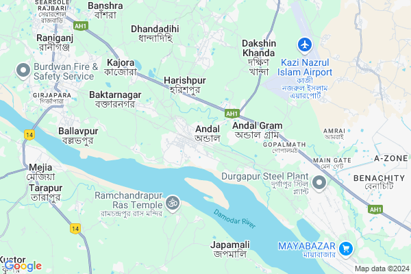
Andal
Andal Map
EDIT Map
Add Your House
 ..
..
Current Corona Virus Infected Patients Count in Bardhaman District
| City Name | District Name | Total Covid cases |
|---|
Locality Name :
Andal
( অন্ডাল )
Block Name : Ondal
District : Bardhaman
State : West Bengal
Division : Burdwan
Language : Bengali and English
Current Time 01:01 PM
Date: Friday , Apr 25,2025 (IST)
Time zone: IST (UTC+5:30)
Elevation / Altitude: 89 meters. Above Seal level
Telephone Code / Std Code: 0343
Assembly constituency : Raniganj assembly constituency
Assembly MLA : Tapas Banerjee
Lok Sabha constituency : Asansol parliamentary constituency
Parliament MP : BABUL SUPRIYO
Serpanch Name :
Pin Code : 713321
Post Office Name : Andal South Bazar
Commodities Prices : Durgapur Market / Mandi
Edit below overview about Andal
Edit below overview about Andal
OverView of Andal
ANDL Gram or Andal village are the same place. But not Andal. There are missing ANDAL GRAM. It is under AndalGram Panchayet near NH2. This place is under Andal CDO and Andal PS.Ondal Village High school is also situated here.Google Maps also pointed WARIA in place of ANDAL GRAM. Above 10 Km will be the distances.Edit below overview about Andal
Rivers Near Andal
Barakar River
Ajay
Barakar River
Ajay
About Andal
Andal is a Village in Ondal Block in Bardhaman District of West Bengal State, India. It belongs to Burdwan Division . It is located 90 KM towards west from District head quarters Bardhaman. 0 KM from Ondal. 192 KM from State capital Kolkata
Andal Pin code is 713321 and postal head office is Andal South Bazar .
Ondal ( 1 KM ) , Madanpur ( 3 KM ) , Dakshinkhanda ( 5 KM ) , Kajora ( 6 KM ) , Ballavpur ( 7 KM ) are the nearby Villages to Andal. Andal is surrounded by Raniganj Block towards west , Mejhia Block towards west , Durgapur Block towards East , Jamuria Block towards North .
Asansol , Kulti , Sonamukhi , Bankura are the near by Cities to Andal.
This Place is in the border of the Bardhaman District and Bankura District. Bankura District Mejhia is west towards this place .
Demographics of Andal
Bengali is the Local Language here.Politics in Andal
CPM , Bharatiya Janata Party , CPI(M) , BJP , AITC are the major political parties in this area.Polling Stations /Booths near Andal
1)Saldanga F.p School2)Sankra G.s.f.p.school (new Building)
3)Sankra G.s.f.p.school(old Building)
4)Sankra G.s.f.p.school(old Building) (roomno. 1)
5)Nimcha Kadamdanga F.p.school Room-3
HOW TO REACH Andal
By Rail
Andal Junction Rail Way Station , Kajoragram Rail Way Station are the very nearby railway stations to Andal.Colleges near Andal
Sir Rash Behari Ghosh Mahavidhalaya, Ukhrid Collage
Address :
Sir Rash Behari Ghosh Mahavidhalaya,ukhrid
Address :
International Institute Of Business & Excellence
Address :
Laudoha Govt.p.t.t.i
Address : Laudoha ,burdwan ,pin-713385
Katwa College
Address :
Schools near Andal
Ukhra Kunja Bihari Institution
Address : Ukhra Near Netaji Statue, Ukhra
Kajora High School (h.s)
Address : Vill+p.o - kajora gram
Govt Health Centers near Andal
1) Baktarnagar SC , Baktarnagar SC building , Bakternagar Village ,2) Baktarnagar PHC , Baktarnagar PHC building , Baktarnagar , Bakternagar Village
3) 5/6 Pit Colliery SC , 5/6 Pit Colliery SC building , , ECL COLLIERY OFFICE MADHUJORE
Schools in Andal,Ondal
Eastern Railway High School
South Bazar Road; Durgapur; Andal; West Bengal 713321; India
0.3 KM distance Detail
Electronic Shops in Andal,Ondal
Biswakarma Welding Shop
Kabiraj Gali; Durgapur; Andal; West Bengal 713217; India
0.2 KM distance Detail
Local Parks in Andal,Ondal
ENGINEERING GROUP GROUND EASTERN RAILWAY BHARAT SCOUTS & GUIDES
Station Road; Ramprasadpur; Andal; West Bengal 713321; India
0.7 KM distance Detail
Abani Sadhu Marriage Hall
Near Ramprasadpur Panchayat Office; Andal; West Bengal 713321; India
1.3 KM distance Detail
Police Stations near Andal,Ondal
Andal Traffic Guard
Ukhra Road; Andal More; Durgapur; West Bengal 713221; India
2.4 KM distance Detail
About Andal &
History
How to reach Andal
Tourist Places Near By Andal
Schools in Andal
Colleges in Andal
Temperature & weather of Andal
places in Andal
Andal photos
More Information
How to reach Andal
Tourist Places Near By Andal
Schools in Andal
Colleges in Andal
Temperature & weather of Andal
places in Andal
Andal photos
More Information
Village Talk
Post News or Events about this Village
Near Cities
Asansol 27 KM near
Kulti 43 KM near
Sonamukhi 43 KM near
Bankura 46 KM near
Asansol 27 KM near
Kulti 43 KM near
Sonamukhi 43 KM near
Bankura 46 KM near
Near By Taluks
Ondal 0 KM near
Raniganj 8 KM near
Mejhia 10 KM near
Durgapur 13 KM near
Ondal 0 KM near
Raniganj 8 KM near
Mejhia 10 KM near
Durgapur 13 KM near
Near By Air Ports
Netaji Subhas Chandra Bose Airport 184 KM near
Ranchi Airport 215 KM near
Gaya Airport 293 KM near
Patna Airport 345 KM near
Netaji Subhas Chandra Bose Airport 184 KM near
Ranchi Airport 215 KM near
Gaya Airport 293 KM near
Patna Airport 345 KM near
Near By Tourist Places
Durgapur 18 KM near
Asansol 27 KM near
Bankura 46 KM near
Maithan 50 KM near
Santiniketan 57 KM near
Durgapur 18 KM near
Asansol 27 KM near
Bankura 46 KM near
Maithan 50 KM near
Santiniketan 57 KM near
Near By Districts
Bankura 46 KM near
Birbhum 55 KM near
Jamtara 64 KM near
Dumka 85 KM near
Bankura 46 KM near
Birbhum 55 KM near
Jamtara 64 KM near
Dumka 85 KM near
Near By RailWay Station
Andal Junction Rail Way Station 0.7 KM near
Kajoragram Rail Way Station 4.7 KM near
Waria Rail Way Station 8.7 KM near
Raniganj Rail Way Station 8 KM near
Andal Junction Rail Way Station 0.7 KM near
Kajoragram Rail Way Station 4.7 KM near
Waria Rail Way Station 8.7 KM near
Raniganj Rail Way Station 8 KM near