| Home | City Bus | Maps | Villages | Cities | Rail | Tourist Places | School | College | Pin Codes | Corona Cases Count |
| Distance Calculator Bus Services IFSC Codes Trace Mobile Number Weather Search Place Trace IP Available Cash ATM/Banks Locate Polling Booth Report an Error contact People |
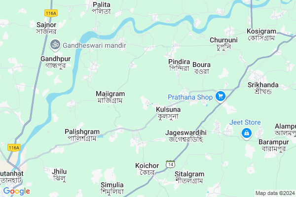
Bhalugram
Bhalugram Map
EDIT Map
Add Your House
 ..
..
Current Corona Virus Infected Patients Count in Bardhaman District
| City Name | District Name | Total Covid cases |
|---|
Locality Name :
Bhalugram
( বালুগ্রাম )
Block Name : Mangolkote
District : Bardhaman
State : West Bengal
Division : Burdwan
Language : Bengali and English
Current Time 12:15 PM
Date: Monday , Apr 28,2025 (IST)
Time zone: IST (UTC+5:30)
Elevation / Altitude: 19 meters. Above Seal level
Telephone Code / Std Code: 03453
Assembly constituency : Mangalkot assembly constituency
Assembly MLA : Apurba Chowdhury (Achal)
Lok Sabha constituency : Bolpur parliamentary constituency
Parliament MP : ASIT KUMAR MAL
Serpanch Name :
Pin Code : 713143
Post Office Name : Koychor
Commodities Prices : Katwa Market / Mandi
Bhalugram Live Weather
Temperature: 37.5 °C
few clouds
Humidity: 21%
Wind : 0.31 mt/sec towards E
StationName : "KÄ\u0081toya"
observed on 1 Hours Back
Temperature: 37.5 °C
few clouds
Humidity: 21%
Wind : 0.31 mt/sec towards E
StationName : "KÄ\u0081toya"
observed on 1 Hours Back
Bhalugram Weather Forecast for Next 5 days
29-04-2025
24.1°C to 38.0°C
light rain, scattered clouds, overcast clouds
24.1°C to 38.0°C
light rain, scattered clouds, overcast clouds
30-04-2025
22.6°C to 35.9°C
broken clouds, clear sky, light rain, overcast clouds, few clouds
22.6°C to 35.9°C
broken clouds, clear sky, light rain, overcast clouds, few clouds
01-05-2025
21.7°C to 33.7°C
few clouds, light rain, moderate rain, overcast clouds
21.7°C to 33.7°C
few clouds, light rain, moderate rain, overcast clouds
02-05-2025
22.9°C to 35.3°C
broken clouds, few clouds, clear sky, scattered clouds, light rain, moderate rain
22.9°C to 35.3°C
broken clouds, few clouds, clear sky, scattered clouds, light rain, moderate rain
03-05-2025
24.2°C to 33.0°C
overcast clouds, broken clouds, clear sky
24.2°C to 33.0°C
overcast clouds, broken clouds, clear sky
Rivers Near Bhalugram
Hooghly :হুগলী :Hugli :Hooghly :Hugli
Ajay
Hooghly :হুগলী :Hugli :Hooghly :Hugli
Ajay
About Bhalugram
Correct below Info and add more info about BhalugramBhalugram is a Village in Mangolkote Block in Bardhaman District of West Bengal State, India. It belongs to Burdwan Division . It is located 49 KM towards North from District head quarters Bardhaman. 5 KM from Mangolkote. 139 KM from State capital Kolkata
Bhalugram Pin code is 713143 and postal head office is Koychor .
Kaichar-ii ( 5 KM ) , Palita ( 8 KM ) , Billeswar ( 8 KM ) , Nigan ( 10 KM ) , Kshirgram ( 10 KM ) are the nearby Villages to Bhalugram. Bhalugram is surrounded by Katwa-I Block towards East , Ketugram_I Block towards North , Ketugram-Ii Block towards North , Nanoor Block towards west .
Srirampur , Nabadwip , Bardhaman , Sainthia are the near by Cities to Bhalugram.
This Place is in the border of the Bardhaman District and Birbhum District. Birbhum District Nanoor is west towards this place .
Bhalugram 2011 Census Details
Bhalugram Local Language is Bengali. Bhalugram Village Total population is 3494 and number of houses are 837. Female Population is 48.1%. Village literacy rate is 54.2% and the Female Literacy rate is 25.4%.
Population
| Census Parameter | Census Data |
| Total Population | 3494 |
| Total No of Houses | 837 |
| Female Population % | 48.1 % ( 1682) |
| Total Literacy rate % | 54.2 % ( 1894) |
| Female Literacy rate | 25.4 % ( 887) |
| Scheduled Tribes Population % | 0.0 % ( 0) |
| Scheduled Caste Population % | 33.9 % ( 1185) |
| Working Population % | 29.8 % |
| Child(0 -6) Population by 2011 | 454 |
| Girl Child(0 -6) Population % by 2011 | 47.1 % ( 214) |
Bhalugram Census More Deatils.
Politics in Bhalugram
CPM , CPI(M) , AITC , All India Trinamool Congress , INC are the major political parties in this area.Polling Stations /Booths near Bhalugram
1)Bhalsuni F.p.school (room-2)2)Bhalugram F.p.school (r-1)
3)Bhalugram F.p.school (r-2)
4)Lakhuria F.p.school (r-3)
5)Laxmipur Daspara F.p. School
HOW TO REACH Bhalugram
By Rail
Bankapasi Rail Way Station , Kaichar Halt Rail Way Station are the very nearby railway stations to Bhalugram.Colleges near Bhalugram
Sir Rash Behari Ghosh Mahavidhalaya, Ukhrid Collage
Address :
Sir Rash Behari Ghosh Mahavidhalaya,ukhrid
Address :
International Institute Of Business & Excellence
Address :
Laudoha Govt.p.t.t.i
Address : Laudoha ,burdwan ,pin-713385
Katwa College
Address :
Schools near Bhalugram
Nutanhat S.d.m Girls High School
Address : mongalkote/i , mongalkote , barddhaman , West Bengal . PIN- 713147 , Post - Nutanhat
Shimulia Ulangini Girls High
Address : simulia-i/i , mongalkote , barddhaman , West Bengal . PIN- 713143 , Post - Koychor
Majigram Bisweswari High Schoo
Address : majhigram/viii , mongalkote , barddhaman , West Bengal . PIN- 713143 , Post - Koychor
Mongalkote A.k.m. High School
Address : mongalkote/ii , mongalkote , barddhaman , West Bengal . PIN- 713147 , Post - Nutanhat
Govt Health Centers near Bhalugram
1) Haripur SC , Haripur SC , ,2) Bannagra SC , Barnagra SC , ,
3) Churpuni SC , Churpuni SC , ,
Petrol Bunks in Bhalugram,Mangolkote
Reliance Petroleum
DAG.196(P);197(P) JL.NO.10; KHANERHAT; KOSHIGRAM; POKOSHIGRAM;P.SKATWA; Katwa; West Bengal 713150; India
10.6 KM distance Detail
more ..
Colleges in Bhalugram,Mangolkote
Bengal Institute of Technology - Katwa
Jagigram Industrial Complex; Katwa; West Bengal 713130; India
12.9 KM distance Detail
more ..
Schools in Bhalugram,Mangolkote
BHALUGRAM JAME MASJID. ভাল্যগ্রাম জামে মসজিদ
Bhlayagram; West Bengal 713143; India
0.4 KM distance Detail
Al-Iman Mission
Katwa Natunhat Road; Kulsuna; Bardhaman; West Bengal 713143; India
2.1 KM distance Detail
Electronic Shops in Bhalugram,Mangolkote
Progress Computer
Churpuni Majigram Road; Majigram; West Bengal 713143; India
2.8 KM distance Detail
Super Markets in Bhalugram,Mangolkote
Ma Laxmi Paddy Bhandur
Kshiragram - Purba Gopalpur Rd; Purbba Gopalpur; West Bengal 713143; India
9.5 KM distance Detail
Governement Offices near Bhalugram,Mangolkote
Digital Seva(Adhar Enrolment)
Katwa Bardhaman Road; Koichor; West Bengal 713143; India
6.4 KM distance Detail
About Bhalugram &
History
How to reach Bhalugram
Tourist Places Near By Bhalugram
Schools in Bhalugram
Colleges in Bhalugram
Temperature & weather of Bhalugram
places in Bhalugram
Bhalugram photos
More Information
How to reach Bhalugram
Tourist Places Near By Bhalugram
Schools in Bhalugram
Colleges in Bhalugram
Temperature & weather of Bhalugram
places in Bhalugram
Bhalugram photos
More Information
Village Talk
Post News or Events about this Village
Near Cities
Srirampur 32 KM near
Nabadwip 44 KM near
Bardhaman 45 KM near
Sainthia 50 KM near
Srirampur 32 KM near
Nabadwip 44 KM near
Bardhaman 45 KM near
Sainthia 50 KM near
Near By Taluks
Mangolkote 4 KM near
Katwa-I 12 KM near
Ketugram_I 14 KM near
Ketugram-Ii 15 KM near
Mangolkote 4 KM near
Katwa-I 12 KM near
Ketugram_I 14 KM near
Ketugram-Ii 15 KM near
Near By Air Ports
Netaji Subhas Chandra Bose Airport 127 KM near
Ranchi Airport 307 KM near
Singerbhil Airport 371 KM near
Gaya Airport 375 KM near
Netaji Subhas Chandra Bose Airport 127 KM near
Ranchi Airport 307 KM near
Singerbhil Airport 371 KM near
Gaya Airport 375 KM near
Near By Tourist Places
Santiniketan 38 KM near
Burdwan 46 KM near
Bardhaman 46 KM near
Navadvipa 47 KM near
Mayapur 48 KM near
Santiniketan 38 KM near
Burdwan 46 KM near
Bardhaman 46 KM near
Navadvipa 47 KM near
Mayapur 48 KM near
Near By Districts
Bardhaman 46 KM near
Nadia 61 KM near
Birbhum 65 KM near
Murshidabad 69 KM near
Bardhaman 46 KM near
Nadia 61 KM near
Birbhum 65 KM near
Murshidabad 69 KM near
Near By RailWay Station
Bankapasi Rail Way Station 5.3 KM near
Kaichar Halt Rail Way Station 7.0 KM near
Shrikhanda Rail Way Station 7.9 KM near
Katwa Junction Rail Way Station 15 KM near
Salar Rail Way Station 26 KM near
Bankapasi Rail Way Station 5.3 KM near
Kaichar Halt Rail Way Station 7.0 KM near
Shrikhanda Rail Way Station 7.9 KM near
Katwa Junction Rail Way Station 15 KM near
Salar Rail Way Station 26 KM near