| Home | City Bus | Maps | Villages | Cities | Rail | Tourist Places | School | College | Pin Codes | Corona Cases Count |
| Distance Calculator Bus Services IFSC Codes Trace Mobile Number Weather Search Place Trace IP Available Cash ATM/Banks Locate Polling Booth Report an Error contact People |
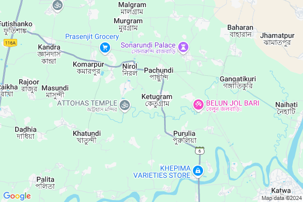
Ketugram
Ketugram Map
EDIT Map
Add Your House
 ..
..
Current Corona Virus Infected Patients Count in Bardhaman District
| City Name | District Name | Total Covid cases |
|---|
Locality Name :
Ketugram
( কেতুগ্রাম )
Block Name : Ketugram-ii
District : Bardhaman
State : West Bengal
Division : Burdwan
Language : Bengali and English
Current Time 05:34 AM
Date: Saturday , Apr 26,2025 (IST)
Time zone: IST (UTC+5:30)
Elevation / Altitude: 26 meters. Above Seal level
Telephone Code / Std Code: 03453
Assembly constituency : Ketugram assembly constituency
Assembly MLA : Sekh Sahonawez
Lok Sabha constituency : Bolpur parliamentary constituency
Parliament MP : ASIT KUMAR MAL
Serpanch Name :
Pin Code : 713140
Post Office Name : Ketugram
Commodities Prices : Katwa Market / Mandi
Ketugram Live Weather
Temperature: 26.1 °C
clear sky
Humidity: 88%
Wind : 4.16 mt/sec towards S
StationName : "KÄ\u0081toya"
observed on 1 Hours Back
Temperature: 26.1 °C
clear sky
Humidity: 88%
Wind : 4.16 mt/sec towards S
StationName : "KÄ\u0081toya"
observed on 1 Hours Back
Ketugram Weather Forecast for Next 5 days
27-04-2025
26.1°C to 43.1°C
clear sky
26.1°C to 43.1°C
clear sky
28-04-2025
26.4°C to 42.0°C
few clouds, overcast clouds, light rain, broken clouds
26.4°C to 42.0°C
few clouds, overcast clouds, light rain, broken clouds
29-04-2025
24.8°C to 34.0°C
light rain, scattered clouds, broken clouds
24.8°C to 34.0°C
light rain, scattered clouds, broken clouds
30-04-2025
22.8°C to 35.1°C
overcast clouds, scattered clouds, few clouds, broken clouds, moderate rain, light rain
22.8°C to 35.1°C
overcast clouds, scattered clouds, few clouds, broken clouds, moderate rain, light rain
Rivers Near Ketugram
Hooghly :হুগলী :Hugli :Hooghly :Hugli
Kopai
Hooghly :হুগলী :Hugli :Hooghly :Hugli
Kopai
About Ketugram
Correct below Info and add more info about KetugramKetugram is a Town in Ketugram-ii Block in Bardhaman District of West Bengal State, India. It belongs to Burdwan Division . It is located 64 KM towards North from District head quarters Bardhaman. It is a Block head quarter.
Ketugram Pin code is 713140 and postal head office is Ketugram .
Nirol ( 3 KM ) , Gangatikuri ( 6 KM ) , Billeswar ( 7 KM ) , Pandugram ( 8 KM ) , Jyandas-kandara ( 9 KM ) are the nearby Villages to Ketugram. Ketugram is surrounded by Ketugram_I Block towards west , Bharatpur-Ii Block towards North , Katwa-I Block towards South , Mangolkote Block towards South .
Srirampur , Sainthia , Nabadwip , Baharampur are the nearby Cities to Ketugram.
This Place is in the border of the Bardhaman District and Murshidabad District. Murshidabad District Bharatpur-ii is North towards this place .
Ketugram 2011 Census Details
Ketugram Local Language is Bengali. Ketugram town Total population is 9990 and number of houses are 2253. Female Population is 48.7%. town literacy rate is 56.1% and the Female Literacy rate is 25.3%.
Population
| Census Parameter | Census Data |
| Total Population | 9990 |
| Total No of Houses | 2253 |
| Female Population % | 48.7 % ( 4863) |
| Total Literacy rate % | 56.1 % ( 5603) |
| Female Literacy rate | 25.3 % ( 2528) |
| Scheduled Tribes Population % | 0.0 % ( 0) |
| Scheduled Caste Population % | 26.3 % ( 2624) |
| Working Population % | 35.4 % |
| Child(0 -6) Population by 2011 | 1218 |
| Girl Child(0 -6) Population % by 2011 | 49.3 % ( 601) |
Ketugram Census More Deatils.
Demographics of Ketugram
Bengali is the Local Language here.Politics in Ketugram
CPM , CPI(M) , AITC , All India Trinamool Congress , INC are the major political parties in this area.Polling Stations /Booths near Ketugram
1)Ketugram Jr Girls High Schoo (room No. 2)2)Ketugram Sir A.t.m. Institution (room No. 2)
3)Ketugram Sir A.t.m. Institution (room No. 4)
4)Ketugram F.p. School (room No. 2)
5)Ketugram Jr Girls High Schoo
HOW TO REACH Ketugram
By Rail
Shiblun Rail Way Station , Gangatikuri Rail Way Station are the very nearby railway stations to Ketugram.Govt Health Centers near Ketugram
1) Sonarundi S.C. , , KANDI BURDWAN ROAD , NEAR HIGH SCHOOL2) Kantadihi SC , Kantadihi SC , ,
3) Simulia P.H.C. , , Simulia Kaandra Road , Near G.P. Office
Hospitals in Ketugram,Ketugram-ii
Ketugram BPHC
Police Station; State Highway 6; Ketugram; Ketugram; West Bengal; India
0.9 KM distance Detail
Mokshada Bhawan _putan
Nirole School Road; Komarpur; Nirol; West Bengal 713140; India
3.1 KM distance Detail
more ..
Petrol Bunks in Ketugram,Ketugram-ii
Reliance Petroleum
DAG.196(P);197(P) JL.NO.10; KHANERHAT; KOSHIGRAM; POKOSHIGRAM;P.SKATWA; Katwa; West Bengal 713150; India
10.3 KM distance Detail
more ..
Colleges in Ketugram,Ketugram-ii
Sonar Tori College Of Education
Burdwan; P.O. Banwaribad; Near Gangatikuri Railway Station; Balutia; West Bengal 713140; India
5.5 KM distance Detail
Kandra RadhaKanta Kundu Mahavidyalaya(KANDRA COLLEGE)
SH 6; Kandra; Burdwan; West Bengal 713129; India
9.7 KM distance Detail
more ..
Schools in Ketugram,Ketugram-ii
Brahmadanga Nityaananda F.P School
Ketugram Ambalgram Rd; Ketugram; West Bengal 713140; India
1.6 KM distance Detail
Electronic Shops in Ketugram,Ketugram-ii
Saha Music Gallery
Sirundi - Ketugram Rd; Ketugram; West Bengal 713140; India
0.6 KM distance Detail
Ghosh MOBILE
Pachundi; Katwa; Purba; Busstand; Ketugram; West Bengal 713140; India
2.1 KM distance Detail
Police Stations near Ketugram,Ketugram-ii
Komarpur Police Camp
Ramjibanpur - Ketugram - Katwa Rd; Komarpur; West Bengal 713129; India
7.0 KM distance Detail
About Ketugram &
History
How to reach Ketugram
Tourist Places Near By Ketugram
Schools in Ketugram
Colleges in Ketugram
Temperature & weather of Ketugram
places in Ketugram
Ketugram photos
More Information
How to reach Ketugram
Tourist Places Near By Ketugram
Schools in Ketugram
Colleges in Ketugram
Temperature & weather of Ketugram
places in Ketugram
Ketugram photos
More Information
Town Talk
Post News or Events about this Town
Near Cities
Srirampur 44 KM near
Sainthia 46 KM near
Nabadwip 49 KM near
Baharampur 55 KM near
Srirampur 44 KM near
Sainthia 46 KM near
Nabadwip 49 KM near
Baharampur 55 KM near
Near By Taluks
Ketugram-Ii 1 KM near
Ketugram_I 7 KM near
Bharatpur-Ii 11 KM near
Katwa-I 17 KM near
Ketugram-Ii 1 KM near
Ketugram_I 7 KM near
Bharatpur-Ii 11 KM near
Katwa-I 17 KM near
Near By Air Ports
Netaji Subhas Chandra Bose Airport 139 KM near
Ranchi Airport 313 KM near
Singerbhil Airport 365 KM near
Rupsi Airport 371 KM near
Netaji Subhas Chandra Bose Airport 139 KM near
Ranchi Airport 313 KM near
Singerbhil Airport 365 KM near
Rupsi Airport 371 KM near
Near By Tourist Places
Santiniketan 41 KM near
Navadvipa 52 KM near
Mayapur 52 KM near
Burdwan 61 KM near
Bardhaman 61 KM near
Santiniketan 41 KM near
Navadvipa 52 KM near
Mayapur 52 KM near
Burdwan 61 KM near
Bardhaman 61 KM near
Near By Districts
Murshidabad 55 KM near
Bardhaman 61 KM near
Birbhum 62 KM near
Nadia 64 KM near
Murshidabad 55 KM near
Bardhaman 61 KM near
Birbhum 62 KM near
Nadia 64 KM near
Near By RailWay Station
Shiblun Rail Way Station 5.2 KM near
Gangatikuri Rail Way Station 6.1 KM near
Jhamatpur Baharan Rail Way Station 8.7 KM near
Katwa Junction Rail Way Station 12 KM near
Salar Rail Way Station 12 KM near
Shiblun Rail Way Station 5.2 KM near
Gangatikuri Rail Way Station 6.1 KM near
Jhamatpur Baharan Rail Way Station 8.7 KM near
Katwa Junction Rail Way Station 12 KM near
Salar Rail Way Station 12 KM near