| Home | City Bus | Maps | Villages | Cities | Rail | Tourist Places | School | College | Pin Codes | Corona Cases Count |
| Distance Calculator Bus Services IFSC Codes Trace Mobile Number Weather Search Place Trace IP Available Cash ATM/Banks Locate Polling Booth Report an Error contact People |
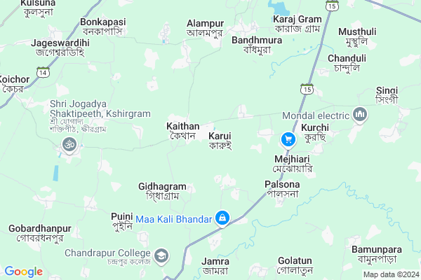
Karui
Karui Map
EDIT Map
Add Your House
 ..
..
Current Corona Virus Infected Patients Count in Bardhaman District
| City Name | District Name | Total Covid cases |
|---|
Locality Name :
Karui
( কারুই )
Block Name : Katwa-ii
District : Bardhaman
State : West Bengal
Division : Burdwan
Language : Bengali and English
Current Time 11:35 AM
Date: Tuesday , Apr 29,2025 (IST)
Time zone: IST (UTC+5:30)
Elevation / Altitude: 18 meters. Above Seal level
Telephone Code / Std Code: 03453
Assembly constituency : Katwa assembly constituency
Assembly MLA : Rabindranath Chatterjee
Lok Sabha constituency : Bardhaman Purba parliamentary constituency
Parliament MP : SUNIL KUMAR MONDAL
Serpanch Name :
Pin Code : 713143
Post Office Name : Koychor
Commodities Prices : Katwa Market / Mandi
Karui Live Weather
Temperature: 35.4 °C
clear sky
Humidity: 33%
Wind : 1.21 mt/sec towards SE
StationName : "PÄ\u0081tuli"
observed on Now
Temperature: 35.4 °C
clear sky
Humidity: 33%
Wind : 1.21 mt/sec towards SE
StationName : "PÄ\u0081tuli"
observed on Now
Karui Weather Forecast for Next 5 days
30-04-2025
22.7°C to 36.6°C
clear sky, moderate rain, light rain, scattered clouds, broken clouds
22.7°C to 36.6°C
clear sky, moderate rain, light rain, scattered clouds, broken clouds
01-05-2025
24.1°C to 36.2°C
overcast clouds, clear sky, scattered clouds, light rain
24.1°C to 36.2°C
overcast clouds, clear sky, scattered clouds, light rain
02-05-2025
23.3°C to 36.7°C
broken clouds, clear sky, few clouds, moderate rain, light rain, overcast clouds
23.3°C to 36.7°C
broken clouds, clear sky, few clouds, moderate rain, light rain, overcast clouds
03-05-2025
24.9°C to 36.0°C
overcast clouds, broken clouds, few clouds, light rain, scattered clouds
24.9°C to 36.0°C
overcast clouds, broken clouds, few clouds, light rain, scattered clouds
04-05-2025
26.1°C to 35.7°C
broken clouds, clear sky, light rain, scattered clouds
26.1°C to 35.7°C
broken clouds, clear sky, light rain, scattered clouds
Rivers Near Karui
Hooghly :হুগলী :Hugli :Hooghly :Hugli
Ajay
Hooghly :হুগলী :Hugli :Hooghly :Hugli
Ajay
About Karui
Correct below Info and add more info about KaruiKarui is a Village in Katwa-ii Block in Bardhaman District of West Bengal State, India. It belongs to Burdwan Division . It is located 47 KM towards North from District head quarters Bardhaman. 14 KM from Katwa-Ii. 127 KM from State capital Kolkata
Karui Pin code is 713143 and postal head office is Koychor .
Sargram ( 6 KM ) , Karajgram ( 8 KM ) , Kshirgram ( 8 KM ) , Sudpur ( 9 KM ) , Singi ( 10 KM ) are the nearby Villages to Karui. Karui is surrounded by Manteswar Block towards South , Katwa-Ii Block towards East , Mangolkote Block towards west , Purbasthali-I Block towards East .
Srirampur , Nabadwip , Memari , Bardhaman are the near by Cities to Karui.
This Place is in the border of the Bardhaman District and Nadia District. Nadia District Nakashipara is East towards this place .
Karui 2011 Census Details
Karui Local Language is Bengali. Karui Village Total population is 10506 and number of houses are 2363. Female Population is 48.5%. Village literacy rate is 61.2% and the Female Literacy rate is 27.3%.
Population
| Census Parameter | Census Data |
| Total Population | 10506 |
| Total No of Houses | 2363 |
| Female Population % | 48.5 % ( 5091) |
| Total Literacy rate % | 61.2 % ( 6430) |
| Female Literacy rate | 27.3 % ( 2866) |
| Scheduled Tribes Population % | 1.6 % ( 164) |
| Scheduled Caste Population % | 27.2 % ( 2853) |
| Working Population % | 32.3 % |
| Child(0 -6) Population by 2011 | 1285 |
| Girl Child(0 -6) Population % by 2011 | 46.3 % ( 595) |
Karui Census More Deatils.
Politics in Karui
CPM , CPI(M) , AITC , All India Trinamool Congress , INC are the major political parties in this area.Polling Stations /Booths near Karui
1)Karui Purbapara Fp School2)Mallickpur Fp School
3)Karui Fp School (r-1)
4)Karui High School
5)Karajgram North F.p.schopol(room-2)
HOW TO REACH Karui
By Rail
Bankapasi Rail Way Station , Kaichar Halt Rail Way Station are the very nearby railway stations to Karui.Colleges near Karui
Katwa College
Address :
Paruliya College
Address :
Schools near Karui
Mejhiary S.c.s. High School
Address : karui/vi , katwa-ii , barddhaman , West Bengal . PIN- 713143 , Post - Koychor
Agradwip U.u.m. Vidyalaya
Address : agradwip/viii , katwa-ii , barddhaman , West Bengal . PIN- 713502 , Post - Dainhat
Okersa High School
Address : singhee/i , katwa-ii , barddhaman , West Bengal . PIN- 713514 , Post - Singhi
Panchpara Jr. High Madrasah
Address : singhee/xi , katwa-ii , barddhaman , West Bengal . PIN- 713514 , Post - Singhi
Govt Health Centers near Karui
1) Kaithan SC , Kaithan SC , ,2) Srikhanda SC , Srikhanda SC , ,
3) Kalsa SC , Kalsa SC , ,
Petrol Bunks in Karui,Katwa-ii
HP PETROL PUMP - RAMAVTAR FILLING STATION
Vill- Gopekhanji PO- PS- Katwa; Dainhat; Durgapur; West Bengal 713502; India
11.9 KM distance Detail
Bharat Petroleum Fuel Station
SH6; Vivekananda Pally; Panchghara P; West Bengal 713130; India
14.2 KM distance Detail
more ..
Colleges in Karui,Katwa-ii
Raja Ram Mohan Roy College Of Education
Jagadanandapur; West Bengal 713502; India
11.9 KM distance Detail
Dr. Gour Mohan Roy College
Monteswar; Perbirhata; Burdwan; West Bengal 713145; India
13.7 KM distance Detail
more ..
Super Markets in Karui,Katwa-ii
Ma Laxmi Paddy Bhandur
Kshiragram - Purba Gopalpur Rd; Purbba Gopalpur; West Bengal 713143; India
6.8 KM distance Detail
Governement Offices near Karui,Katwa-ii
Haat Tala Ration Shop
Karajgram Haat Tala Rd; Karaj Gram; West Bengal 713502; India
8.2 KM distance Detail
Samobai Samity
Karajgram - Panchanantala Road; Karaj Gram; West Bengal 713502; India
8.3 KM distance Detail
About Karui &
History
How to reach Karui
Tourist Places Near By Karui
Schools in Karui
Colleges in Karui
Temperature & weather of Karui
places in Karui
Karui photos
More Information
How to reach Karui
Tourist Places Near By Karui
Schools in Karui
Colleges in Karui
Temperature & weather of Karui
places in Karui
Karui photos
More Information
Village Talk
Post News or Events about this Village
Near Cities
Srirampur 21 KM near
Nabadwip 30 KM near
Memari 39 KM near
Bardhaman 43 KM near
Srirampur 21 KM near
Nabadwip 30 KM near
Memari 39 KM near
Bardhaman 43 KM near
Near By Taluks
Katwa-I 6 KM near
Manteswar 13 KM near
Mangolkote 13 KM near
Katwa-Ii 13 KM near
Katwa-I 6 KM near
Manteswar 13 KM near
Mangolkote 13 KM near
Katwa-Ii 13 KM near
Near By Air Ports
Netaji Subhas Chandra Bose Airport 115 KM near
Ranchi Airport 318 KM near
Singerbhil Airport 361 KM near
Rupsi Airport 386 KM near
Netaji Subhas Chandra Bose Airport 115 KM near
Ranchi Airport 318 KM near
Singerbhil Airport 361 KM near
Rupsi Airport 386 KM near
Near By Tourist Places
Navadvipa 33 KM near
Mayapur 34 KM near
Burdwan 44 KM near
Bardhaman 44 KM near
Santiniketan 51 KM near
Navadvipa 33 KM near
Mayapur 34 KM near
Burdwan 44 KM near
Bardhaman 44 KM near
Santiniketan 51 KM near
Near By Districts
Bardhaman 45 KM near
Nadia 47 KM near
Murshidabad 73 KM near
Birbhum 80 KM near
Bardhaman 45 KM near
Nadia 47 KM near
Murshidabad 73 KM near
Birbhum 80 KM near
Near By RailWay Station
Katwa Junction Rail Way Station 15 KM near
Salar Rail Way Station 31 KM near
Katwa Junction Rail Way Station 15 KM near
Salar Rail Way Station 31 KM near