| Home | City Bus | Maps | Villages | Cities | Rail | Tourist Places | School | College | Pin Codes | Corona Cases Count |
| Distance Calculator Bus Services IFSC Codes Trace Mobile Number Weather Search Place Trace IP Available Cash ATM/Banks Locate Polling Booth Report an Error contact People |
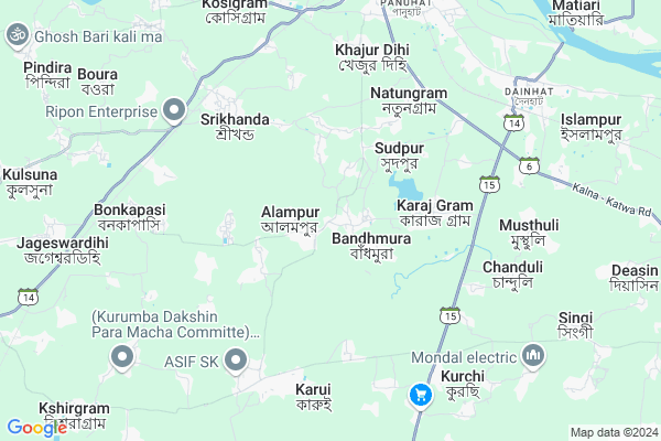
Koshigram
Koshigram Map
EDIT Map
Add Your House
 ..
..
Current Corona Virus Infected Patients Count in Bardhaman District
| City Name | District Name | Total Covid cases |
|---|
Locality Name :
Koshigram
( কোশিগ্রাম )
Block Name : Katwa-i
District : Bardhaman
State : West Bengal
Division : Burdwan
Language : Bengali and English
Current Time 12:25 PM
Date: Tuesday , Apr 29,2025 (IST)
Time zone: IST (UTC+5:30)
Elevation / Altitude: 19 meters. Above Seal level
Telephone Code / Std Code: 03453
Assembly constituency : Mangalkot assembly constituency
Assembly MLA : Apurba Chowdhury (Achal)
Lok Sabha constituency : Bolpur parliamentary constituency
Parliament MP : ASIT KUMAR MAL
Serpanch Name :
Commodities Prices : Katwa Market / Mandi
Rivers Near Koshigram
Ajay
Ajay
Ajay
Ajay
About Koshigram
Correct below Info and add more info about KoshigramKoshigram is a Village in Katwa-i Block in Bardhaman District of West Bengal State, India. It belongs to Burdwan Division . It is located 53 KM towards North from District head quarters Bardhaman. 133 KM from State capital Kolkata
Koshigram is surrounded by Katwa-Ii Block towards East , Mangolkote Block towards west , Ketugram-Ii Block towards North , Manteswar Block towards South .
Srirampur , Nabadwip , Memari , Krishnanagar are the near by Cities to Koshigram.
This Place is in the border of the Bardhaman District and Murshidabad District. Murshidabad District Bharatpur-ii is North towards this place . Also it is in the Border of other district Nadia .
Demographics of Koshigram
Bengali is the Local Language here.Politics in Koshigram
CPM , CPI(M) , AITC , All India Trinamool Congress , INC are the major political parties in this area.Polling Stations /Booths near Koshigram
1)Durmut Nutanpara F.p.school (r-2)2)Ganfulia F.p.school (room-1)
3)Ganfulia F.p.school (room-2)
4)Ganfulia F.p.school (room-3)
5)Ganfulia Paschimpara F.p.school (room-1)
HOW TO REACH Koshigram
By Rail
Shrikhanda Rail Way Station , Shripat Shrikhand Rail Way Station are the very nearby railway stations to Koshigram.Pincodes near Koshigram
713516 ( Panuhat ) , 713517 ( Sudpur ) , 713150 ( Srikhanda )Colleges near Koshigram
Sir Rash Behari Ghosh Mahavidhalaya, Ukhrid Collage
Address :
Sir Rash Behari Ghosh Mahavidhalaya,ukhrid
Address :
International Institute Of Business & Excellence
Address :
Laudoha Govt.p.t.t.i
Address : Laudoha ,burdwan ,pin-713385
Katwa College
Address :
Schools near Koshigram
Kadampukur Sr. Madrasah
Address : srikhanda/vii , katwa-i , barddhaman , West Bengal . PIN- 713150 , Post - Srikhanda
Katwa Balika Vidyalaya
Address : katwa ward/1 , katwa municipality , barddhaman , West Bengal . PIN- 713130 , Post - Katwa
Kasiswari Balika Vidyalaya
Address : katwa ward/7 , katwa municipality , barddhaman , West Bengal . PIN- 713313
Katwa Sri Ramkrishna Vidyapith
Address : katwa ward/7 , katwa municipality , barddhaman , West Bengal . PIN- 713130 , Post - Katwa
Govt Health Centers near Koshigram
1) Ganfulia SC , Ganfulia SC , ,2) Gusumba SC , Gusumba SC , ,
3) Barampur SC , Barampur SC , ,
Hospitals in Koshigram,Katwa-i
Anandaniketan Rural Cancer Detection & Management Center:
Sudpur; West Bengal 713518; India
3.0 KM distance Detail
more ..
Petrol Bunks in Koshigram,Katwa-i
HP PETROL PUMP - RAMAVTAR FILLING STATION
Vill- Gopekhanji PO- PS- Katwa; Dainhat; Durgapur; West Bengal 713502; India
6.5 KM distance Detail
Bharat Petroleum Fuel Station
SH6; Vivekananda Pally; Panchghara P; West Bengal 713130; India
7.6 KM distance Detail
more ..
Colleges in Koshigram,Katwa-i
Raja Ram Mohan Roy College Of Education
Jagadanandapur; West Bengal 713502; India
7.7 KM distance Detail
Bengal Institute of Technology - Katwa
Jagigram Industrial Complex; Katwa; West Bengal 713130; India
7.9 KM distance Detail
more ..
Schools in Koshigram,Katwa-i
DURGAGRAM FREE PRIMARY SCHOOL
Dutta Para Jaor Rasta; Durga Gram; West Bengal 713516; India
1.1 KM distance Detail
Durga Grammar Whitening Prathmik Vidyalaya
Durga Gram; West Bengal 713516; India
1.3 KM distance Detail
Sishu Bikash Kendro
Karajgram - Panchanantala Road; Durga Gram; West Bengal 713516; India
1.5 KM distance Detail
Governement Offices near Koshigram,Katwa-i
Haat Tala Ration Shop
Karajgram Haat Tala Rd; Karaj Gram; West Bengal 713502; India
3.5 KM distance Detail
Samobai Samity
Karajgram - Panchanantala Road; Karaj Gram; West Bengal 713502; India
3.6 KM distance Detail
About Koshigram &
History
How to reach Koshigram
Tourist Places Near By Koshigram
Schools in Koshigram
Colleges in Koshigram
Temperature & weather of Koshigram
places in Koshigram
Koshigram photos
More Information
How to reach Koshigram
Tourist Places Near By Koshigram
Schools in Koshigram
Colleges in Koshigram
Temperature & weather of Koshigram
places in Koshigram
Koshigram photos
More Information
Village Talk
Post News or Events about this Village
Near Cities
Srirampur 27 KM near
Nabadwip 32 KM near
Memari 46 KM near
Krishnanagar 49 KM near
Srirampur 27 KM near
Nabadwip 32 KM near
Memari 46 KM near
Krishnanagar 49 KM near
Near By Taluks
Katwa-I 0 KM near
Katwa-Ii 9 KM near
Mangolkote 14 KM near
Ketugram-Ii 18 KM near
Katwa-I 0 KM near
Katwa-Ii 9 KM near
Mangolkote 14 KM near
Ketugram-Ii 18 KM near
Near By Air Ports
Netaji Subhas Chandra Bose Airport 121 KM near
Ranchi Airport 319 KM near
Singerbhil Airport 359 KM near
Rupsi Airport 380 KM near
Netaji Subhas Chandra Bose Airport 121 KM near
Ranchi Airport 319 KM near
Singerbhil Airport 359 KM near
Rupsi Airport 380 KM near
Near By Tourist Places
Navadvipa 35 KM near
Mayapur 36 KM near
Burdwan 50 KM near
Bardhaman 50 KM near
Santiniketan 50 KM near
Navadvipa 35 KM near
Mayapur 36 KM near
Burdwan 50 KM near
Bardhaman 50 KM near
Santiniketan 50 KM near
Near By Districts
Nadia 49 KM near
Bardhaman 50 KM near
Murshidabad 67 KM near
Birbhum 77 KM near
Nadia 49 KM near
Bardhaman 50 KM near
Murshidabad 67 KM near
Birbhum 77 KM near
Near By RailWay Station
Shrikhanda Rail Way Station 6.6 KM near
Shripat Shrikhand Rail Way Station 7.9 KM near
Dainhat Rail Way Station 8.2 KM near
Katwa Junction Rail Way Station 8 KM near
Salar Rail Way Station 25 KM near
Shrikhanda Rail Way Station 6.6 KM near
Shripat Shrikhand Rail Way Station 7.9 KM near
Dainhat Rail Way Station 8.2 KM near
Katwa Junction Rail Way Station 8 KM near
Salar Rail Way Station 25 KM near