| Home | City Bus | Maps | Villages | Cities | Rail | Tourist Places | School | College | Pin Codes | Corona Cases Count |
| Distance Calculator Bus Services IFSC Codes Trace Mobile Number Weather Search Place Trace IP Available Cash ATM/Banks Locate Polling Booth Report an Error contact People |
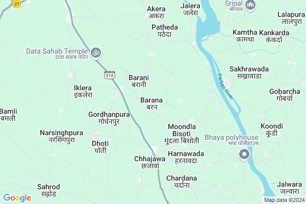
Barana
Barana Map
EDIT Map
Add Your House
 ..
..
Current Corona Virus Infected Patients Count in Baran District
| City Name | District Name | Total Covid cases |
|---|
Locality Name :
Barana
( बरना )
Tehsil Name : Baran (full)
District : Baran
State : Rajasthan
Division : Kota
Language : Hindi and Rajasthani
Current Time 05:57 AM
Date: Saturday , Apr 26,2025 (IST)
Time zone: IST (UTC+5:30)
Elevation / Altitude: 275 meters. Above Seal level
Telephone Code / Std Code: 07456
Assembly constituency : Baran-Atru assembly constituency
Assembly MLA : Radheyshyam Bairwa
Lok Sabha constituency : Jhalawar-Baran parliamentary constituency
Parliament MP : DUSHYANT SINGH
Serpanch Name :
Pin Code : 325205
Post Office Name : Krishi Upaj Mandi Baran
Commodities Prices : Baran Market / Mandi
Barana Live Weather
Temperature: 28.9 °C
few clouds
Humidity: 18%
Wind : 2.93 mt/sec towards SW
StationName : "BÄ\u0081rÄ\u0081n"
observed on 1 Hours Back
Temperature: 28.9 °C
few clouds
Humidity: 18%
Wind : 2.93 mt/sec towards SW
StationName : "BÄ\u0081rÄ\u0081n"
observed on 1 Hours Back
Barana Weather Forecast for Next 5 days
27-04-2025
28.4°C to 40.1°C
few clouds, clear sky, overcast clouds, broken clouds
28.4°C to 40.1°C
few clouds, clear sky, overcast clouds, broken clouds
28-04-2025
29.2°C to 41.0°C
scattered clouds, clear sky, few clouds
29.2°C to 41.0°C
scattered clouds, clear sky, few clouds
29-04-2025
29.9°C to 43.4°C
clear sky, scattered clouds
29.9°C to 43.4°C
clear sky, scattered clouds
30-04-2025
30.2°C to 43.8°C
scattered clouds, clear sky
30.2°C to 43.8°C
scattered clouds, clear sky
National Highways Reachable To Barana
Nationa High Way :NH27
Nationa High Way :NH27
Rivers Near Barana
Banganga
Khari Nadi
Banganga
Khari Nadi
About Barana
Correct below Info and add more info about BaranaBarana is a Town in Baran District of Rajasthan State, India. It belongs to Kota Division .
Barana Pin code is 325205 and postal head office is Krishi Upaj Mandi Baran .
Moondla Bisoti , Dhoti , Iklera , Patheda , Chardana are the some of Localities in Barana. Barana is surrounded by Atru Tehsil towards South , Kishanganj Tehsil towards North , Anta Tehsil towards North , Sangod Tehsil towards west .
Baran , Mangrol , Jhalawar , Sheopur are the nearby Cities to Barana.
Barana 2011 Census Details
Barana Local Language is Hindi. Barana town Total population is 962 and number of houses are 208. Female Population is 48.6%. town literacy rate is 52.0% and the Female Literacy rate is 19.5%.
Population
| Census Parameter | Census Data |
| Total Population | 962 |
| Total No of Houses | 208 |
| Female Population % | 48.6 % ( 468) |
| Total Literacy rate % | 52.0 % ( 500) |
| Female Literacy rate | 19.5 % ( 188) |
| Scheduled Tribes Population % | 51.0 % ( 491) |
| Scheduled Caste Population % | 20.7 % ( 199) |
| Working Population % | 60.9 % |
| Child(0 -6) Population by 2011 | 115 |
| Girl Child(0 -6) Population % by 2011 | 54.8 % ( 63) |
Barana Census More Deatils.
Demographics of Barana
Hindi is the Local Language here.Polling Stations /Booths near Barana
1)Government Secondary School Kanotia2)Government Upper Primary School Ugrapura
3)Government Senior Secondary School Badora Room No.2
4)Government Senior Secondary School Katawar Room No. 2
5)Government Upper Primary School Bairpur
HOW TO REACH Barana
By Rail
Chajawa Rail Way Station , Piplod Road Rail Way Station are the very nearby railway stations to Barana.Govt Health Centers near Barana
1) Nagela , Nagela , ,2) Patiya , Patiya , ,
3) Mor Dungari , Mor Dungari , ,
Hospitals in Barana,Baran (full)
Up Swasthya Kendra
Amli; Baran; SH-37A; Baran; Baran; Rajasthan 325210; India
10.2 KM distance Detail
more ..
Petrol Bunks in Barana,Baran (full)
RAJ FILLING STATION
BARAN; NEAR COLLECTRATE OF; Baran; Rajasthan 325025; India
2.7 KM distance Detail
SETHI FILLING STATION
BARAN; NEAR RAILWAY STATI; Baran; Rajasthan 325025; India
5.6 KM distance Detail
more ..
Colleges in Barana,Baran (full)
Shre Shyam College
Bara; Baran; NH-76; Baran; Baran; Rajasthan 355205; India
13.5 KM distance Detail
Rajkiya Snatkottar Kanya Mahavidyalaya
Baran Rd; New Nakoda Colony; Nakoda Colony; Baran; Rajasthan 325215; India
14.3 KM distance Detail
nakoda Hariyaali
nakoda hariyaali; Baran; New Nakoda Colony; Nakoda Colony; Baran; Rajasthan 325205; India
14.4 KM distance Detail
more ..
Schools in Barana,Baran (full)
Adarsh Government Senior Secondary School
Gordhanpura; Baran; SH-37A; Baran; Baran; Rajasthan 325207; India
2.7 KM distance Detail
Electronic Shops in Barana,Baran (full)
Suman Ac Ripening & Photo Studio Shop
RJ SH 37A; Gordhanpura; Rajasthan 325205; India
3.0 KM distance Detail
Electronic And RO Sels And Service Gordhanpura
Dhoti; Rajasthan 325205; India
3.6 KM distance Detail
Super Markets in Barana,Baran (full)
Pradhyuman Jewellers (प्रद्युम्न ज्वैलर्स)
; Fatehpur; Rajasthan 325205; India
13.2 KM distance Detail
Police Stations near Barana,Baran (full)
Police Chauki; Tel Factory Baran
Rajasthan State Highway 1; New Nakoda Colony; Baran; Rajasthan 325205; India
14.1 KM distance Detail
Governement Offices near Barana,Baran (full)
Atal Seva Kendra
Barana; Baran; SH-37A; Baran; Baran; Rajasthan 325207; India
3.0 KM distance Detail
Iavar Roop Nirman Office
Amli; Baran; SH-37A; Baran; Baran; Rajasthan 325210; India
10.2 KM distance Detail
About Barana &
History
How to reach Barana
Tourist Places Near By Barana
Schools in Barana
Colleges in Barana
Temperature & weather of Barana
places in Barana
Barana photos
More Information
How to reach Barana
Tourist Places Near By Barana
Schools in Barana
Colleges in Barana
Temperature & weather of Barana
places in Barana
Barana photos
More Information
Town Talk
Post News or Events about this Town
Near Cities
Baran 13 KM near
Mangrol 40 KM near
Jhalawar 71 KM near
Sheopur 83 KM near
Baran 13 KM near
Mangrol 40 KM near
Jhalawar 71 KM near
Sheopur 83 KM near
Near By Taluks
Baran (Full) 13 KM near
Atru 22 KM near
Kishanganj 22 KM near
Anta 35 KM near
Baran (Full) 13 KM near
Atru 22 KM near
Kishanganj 22 KM near
Anta 35 KM near
Near By Air Ports
Bhopal Airport 231 KM near
Sanganeer Airport 242 KM near
Gwalior Airport 243 KM near
Indore Airport 297 KM near
Bhopal Airport 231 KM near
Sanganeer Airport 242 KM near
Gwalior Airport 243 KM near
Indore Airport 297 KM near
Near By Tourist Places
Kota 87 KM near
Jhalawar 92 KM near
Guna 93 KM near
Bundi 119 KM near
Ranthambore 125 KM near
Kota 87 KM near
Jhalawar 92 KM near
Guna 93 KM near
Bundi 119 KM near
Ranthambore 125 KM near
Near By Districts
Baran 13 KM near
Jhalawar 70 KM near
Sheopur 83 KM near
Kota 84 KM near
Baran 13 KM near
Jhalawar 70 KM near
Sheopur 83 KM near
Kota 84 KM near
Near By RailWay Station
Chajawa Rail Way Station 1.1 KM near
Piplod Road Rail Way Station 6.4 KM near
Baran Rail Way Station 14 KM near
Chhabra Gugor Rail Way Station 49 KM near
Chajawa Rail Way Station 1.1 KM near
Piplod Road Rail Way Station 6.4 KM near
Baran Rail Way Station 14 KM near
Chhabra Gugor Rail Way Station 49 KM near