| Home | City Bus | Maps | Villages | Cities | Rail | Tourist Places | School | College | Pin Codes | Corona Cases Count |
| Distance Calculator Bus Services IFSC Codes Trace Mobile Number Weather Search Place Trace IP Available Cash ATM/Banks Locate Polling Booth Report an Error contact People |
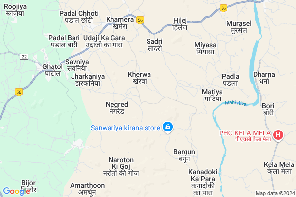
Kherwa Map
EDIT Map
Add Your House
 ..
..
Current Corona Virus Infected Patients Count in Banswara District
| City Name | District Name | Total Covid cases |
|---|---|---|
| Banswara District | Banswara | 62 |
Locality Name :
Kherwa
( खेरवा )
Tehsil Name : Ghatol
District : Banswara
State : Rajasthan
Division : Udaipur
Language : Hindi and Rajasthani
Current Time 06:02 AM
Date: Saturday , Apr 26,2025 (IST)
Time zone: IST (UTC+5:30)
Elevation / Altitude: 509 meters. Above Seal level
Telephone Code / Std Code: 02961
Assembly constituency : Ghatol assembly constituency
Assembly MLA : Nanalal Ninama
Lok Sabha constituency : Banswara parliamentary constituency
Parliament MP : KANAKMAL KATARA
Serpanch Name :
Pin Code : 327027
Post Office Name : Khamera
Commodities Prices : Sailana Market / Mandi
Kherwa Live Weather
Temperature: 25.5 °C
clear sky
Humidity: 44%
Wind : 2.54 mt/sec towards SW
StationName : "BÄ\u0081nswÄ\u0081ra"
observed on Now
Temperature: 25.5 °C
clear sky
Humidity: 44%
Wind : 2.54 mt/sec towards SW
StationName : "BÄ\u0081nswÄ\u0081ra"
observed on Now
Kherwa Weather Forecast for Next 5 days
27-04-2025
27.6°C to 41.0°C
clear sky
27.6°C to 41.0°C
clear sky
28-04-2025
26.7°C to 42.1°C
clear sky
26.7°C to 42.1°C
clear sky
29-04-2025
27.4°C to 43.3°C
clear sky, few clouds, overcast clouds, broken clouds
27.4°C to 43.3°C
clear sky, few clouds, overcast clouds, broken clouds
30-04-2025
28.0°C to 43.8°C
clear sky, few clouds, overcast clouds
28.0°C to 43.8°C
clear sky, few clouds, overcast clouds
01-05-2025
27.9°C to 44.1°C
few clouds, clear sky, scattered clouds
27.9°C to 44.1°C
few clouds, clear sky, scattered clouds
Edit below overview about Kherwa
Edit below overview about Kherwa
OverView of Kherwa
Kherwa is a village in Ghatol Tehsil of District Banswara in Rajasthan, India.It was ruled by Rajputs of the Shaktawat clan before independe.Kherwa was is one of the thikanas of the house of Mewar. Current kuwar of kherwa: Rudra pratap singh Shaktawat.Edit below overview about Kherwa
Rivers Near Kherwa
Sau River
Dudiya Khai
Sau River
Dudiya Khai
About Kherwa
Kherwa is a Village in Ghatol Tehsil in Banswara District of Rajasthan State, India. It belongs to Udaipur Division . It is located 24 KM towards North from District head quarters Banswara. 9 KM from Ghatol. 442 KM from State capital Jaipur
Kherwa Pin code is 327027 and postal head office is Khamera .
Miyasa ( 6 KM ) , Savniya ( 6 KM ) , Khamera ( 7 KM ) , Padla ( 8 KM ) , Amarthoon ( 8 KM ) are the nearby Villages to Kherwa. Kherwa is surrounded by Peepal Khoont Tehsil towards East , Chhoti Sarwan Tehsil towards South , Banswara Tehsil towards South , Arnod Tehsil towards East .
Banswara , Pratapgarh , Sagwara , Ramngarh are the near by Cities to Kherwa.
Kherwa 2011 Census Details
Kherwa Local Language is Hindi. Kherwa Village Total population is 2435 and number of houses are 567. Female Population is 48.8%. Village literacy rate is 37.9% and the Female Literacy rate is 11.0%.
Population
| Census Parameter | Census Data |
| Total Population | 2435 |
| Total No of Houses | 567 |
| Female Population % | 48.8 % ( 1189) |
| Total Literacy rate % | 37.9 % ( 922) |
| Female Literacy rate | 11.0 % ( 269) |
| Scheduled Tribes Population % | 89.4 % ( 2177) |
| Scheduled Caste Population % | 0.8 % ( 19) |
| Working Population % | 60.1 % |
| Child(0 -6) Population by 2011 | 446 |
| Girl Child(0 -6) Population % by 2011 | 46.4 % ( 207) |
Kherwa Census More Deatils.
Politics in Kherwa
Bharatiya Janata Party , BJP , INC are the major political parties in this area.Polling Stations /Booths near Kherwa
1)Govt. Secondary School Building Jagpura (right Side)2)Govt. U.p School Building Thakra
3)Govt. Primary School Building Naroto Ki Goj
4)Govt. Her Secondray School Building Padoli Gordhan (left Side)
5)Govt.u. P School Building Delwara (right Side)
HOW TO REACH Kherwa
By Rail
There is no railway station near to Kherwa in less than 10 km.Colleges near Kherwa
Govt. Ekling-nath Acharya Sanskrit Mahavidyalay
Address :
Lbs College Of Arts & Commerce
Address :
Excellent College
Address :
Schools near Kherwa
Karshan Vidhya Mandir Buvasa
Address : bhuvasa , ghatol , banswara , Rajasthan . PIN- 327021 , Post - Ganoda
Universal Gyan Bharti Public School
Address : ghatol , ghatol , banswara , Rajasthan . PIN- 327023 , Post - Ghatol
V.u.p.s. Bh.
Address : bhungda , ghatol , banswara , Rajasthan . PIN- 327026 , Post - Mahidam
Niskalank Vidhya Mandir
Address : motatanda , ghatol , banswara , Rajasthan . PIN- 327021 , Post - Ganoda
Govt Health Centers near Kherwa
1) Kelamela , PHC Building , ,2) Rujia , , ,
3) Himmat Singh Ka Gada , , ,
Hospitals in Kherwa,Ghatol
Primary Health Center
Savaniya; Banswara; NH-113; Banswara Road; Banswara; Banswara; Rajasthan 327023; India
6.6 KM distance Detail
Primary Health Center
113; Banswara Rd; Industrial Area; Banswara; Rajasthan 327023; India
6.9 KM distance Detail
more ..
Petrol Bunks in Kherwa,Ghatol
Tripura Filling Station-Indian Oil Petrol Pump
Ghatal; Banswara; NH-113; Banswara Road; Banswara; Banswara; Rajasthan 327023; India
7.3 KM distance Detail
RAINY FILLING STATION
Ghatol Mahi Dam Link Rd; Banswara; Rajasthan 327027; India
9.6 KM distance Detail
more ..
Colleges in Kherwa,Ghatol
Nakoda Computers PMKVY
Tehsil Road; Opp. Police Chowki; Ghatol; Rajasthan 327023; India
8.4 KM distance Detail
KALA COMMUNICATION AND STUDY CENTRE
POST OFFICE CHOURAYA ;MAIN ROAD GHATOL GANORA ROAD National Highway 113; Ghatol; Rajasthan 327023; India
8.8 KM distance Detail
more ..
Schools in Kherwa,Ghatol
Government Primary School
Sadri; Banswara; NH-113; Chittor Road; Banswara; Banswara; Rajasthan 312601; India
5.4 KM distance Detail
Government Primary School
Nava Khera; Banswara; NH-113; Chittor Road; Banswara; Banswara; Rajasthan 312601; India
6.2 KM distance Detail
Governement Offices near Kherwa,Ghatol
Adhishashi Abhiyanta
113; Banswara Rd; Teliwada; Industrial Area; Banswara; Rajasthan 327023; India
8.1 KM distance Detail
Patwari Office
113; Banswara Rd; Industrial Area; Banswara; Rajasthan 327023; India
8.2 KM distance Detail
Atal Seva Center
113; Banswara Rd; Industrial Area; Banswara; Rajasthan 327023; India
9.1 KM distance Detail
About Kherwa &
History
How to reach Kherwa
Tourist Places Near By Kherwa
Schools in Kherwa
Colleges in Kherwa
Temperature & weather of Kherwa
places in Kherwa
Kherwa photos
More Information
How to reach Kherwa
Tourist Places Near By Kherwa
Schools in Kherwa
Colleges in Kherwa
Temperature & weather of Kherwa
places in Kherwa
Kherwa photos
More Information
Village Talk
Post News or Events about this Village
Near Cities
Banswara 27 KM near
Pratapgarh 50 KM near
Sagwara 52 KM near
Ramngarh 64 KM near
Banswara 27 KM near
Pratapgarh 50 KM near
Sagwara 52 KM near
Ramngarh 64 KM near
Near By Taluks
Ghatol 8 KM near
Peepal Khoont 23 KM near
Chhoti Sarwan 28 KM near
Banswara 29 KM near
Ghatol 8 KM near
Peepal Khoont 23 KM near
Chhoti Sarwan 28 KM near
Banswara 29 KM near
Near By Air Ports
Dabok Airport 128 KM near
Indore Airport 197 KM near
Vadodara Airport 227 KM near
Ahmedabad Airport 228 KM near
Dabok Airport 128 KM near
Indore Airport 197 KM near
Vadodara Airport 227 KM near
Ahmedabad Airport 228 KM near
Near By Tourist Places
Banswara 25 KM near
Ratlam 86 KM near
Dungarpur 88 KM near
Neemuch 100 KM near
Dahod 111 KM near
Banswara 25 KM near
Ratlam 86 KM near
Dungarpur 88 KM near
Neemuch 100 KM near
Dahod 111 KM near
Near By Districts
Banswara 24 KM near
Pratapgarh 50 KM near
Mandsaur 77 KM near
Ratlam 83 KM near
Banswara 24 KM near
Pratapgarh 50 KM near
Mandsaur 77 KM near
Ratlam 83 KM near
Near By RailWay Station
Jaora Rail Way Station 73 KM near
Mandsor Rail Way Station 79 KM near
Jaora Rail Way Station 73 KM near
Mandsor Rail Way Station 79 KM near