| Home | City Bus | Maps | Villages | Cities | Rail | Tourist Places | School | College | Pin Codes | Corona Cases Count |
| Distance Calculator Bus Services IFSC Codes Trace Mobile Number Weather Search Place Trace IP Available Cash ATM/Banks Locate Polling Booth Report an Error contact People |
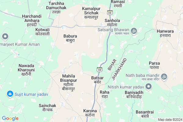
Birbalpur Map
EDIT Map
Add Your House
 ..
..
Current Corona Virus Infected Patients Count in Banka District
| City Name | District Name | Total Covid cases |
|---|---|---|
| Banka District | Banka | 1 |
| Bilaspur | Banka | 1 |
Locality Name :
Birbalpur
( बीरबलपुर )
Block Name : Dhuraiya
District : Banka
State : Bihar
Division : Bhagalpur
Language : Maithili and Hindi, Urdu, Angika, Indo-aryan
Current Time 09:38 PM
Date: Sunday , Apr 27,2025 (IST)
Time zone: IST (UTC+5:30)
Elevation / Altitude: 41 meters. Above Seal level
Telephone Code / Std Code: 06424
Assembly constituency : Dhuraiya assembly constituency
Assembly MLA : Bhudeo Choudhary
Lok Sabha constituency : Banka parliamentary constituency
Parliament MP : GIRIDHARI YADAV
Serpanch Name :
Pin Code : 813205
Post Office Name : Ghogha
Main Village Name : Birbalpur
Commodities Prices : Samsi Market / Mandi
Birbalpur Live Weather
Temperature: 31.2 °C
broken clouds
Humidity: 27%
Wind : 3.31 mt/sec towards W
StationName : "BhÄ\u0081galpur"
observed on Now
Temperature: 31.2 °C
broken clouds
Humidity: 27%
Wind : 3.31 mt/sec towards W
StationName : "BhÄ\u0081galpur"
observed on Now
Birbalpur Weather Forecast for Next 5 days
28-04-2025
23.6°C to 30.4°C
broken clouds, scattered clouds
23.6°C to 30.4°C
broken clouds, scattered clouds
29-04-2025
23.9°C to 30.3°C
scattered clouds, overcast clouds, light rain, broken clouds, few clouds
23.9°C to 30.3°C
scattered clouds, overcast clouds, light rain, broken clouds, few clouds
30-04-2025
23.2°C to 32.7°C
clear sky, scattered clouds, broken clouds, overcast clouds, light rain
23.2°C to 32.7°C
clear sky, scattered clouds, broken clouds, overcast clouds, light rain
01-05-2025
23.4°C to 36.1°C
overcast clouds, light rain
23.4°C to 36.1°C
overcast clouds, light rain
02-05-2025
25.5°C to 34.8°C
light rain, overcast clouds, broken clouds
25.5°C to 34.8°C
light rain, overcast clouds, broken clouds
Rivers Near Birbalpur
Guhka
Sunder
Guhka
Sunder
About Birbalpur
Correct below Info and add more info about BirbalpurBirbalpur is a small Village/hamlet in Dhuraiya Block in Banka District of Bihar State, India. It comes under Birbalpur Panchayath. It belongs to Bhagalpur Division . It is located 34 KM towards East from District head quarters Banka. 9 KM from Dhuraiya. 247 KM from State capital Patna
Birbalpur Pin code is 813205 and postal head office is Ghogha .
Batsar ( 6 KM ) , Sijhat Baliyas ( 7 KM ) , Kurma ( 7 KM ) , Sakahara ( 9 KM ) , Sainchak ( 9 KM ) are the nearby Villages to Birbalpur. Birbalpur is surrounded by Sonhaula Block towards North , Goradih Block towards North , Pathergama Block towards South , Rajaun Block towards west .
Amarpur , Colgong , Godda , Bhagalpur are the near by Cities to Birbalpur.
This Place is in the border of the Banka District and Bhagalpur District. Bhagalpur District Goradih is North towards this place . Also it is in the Border of other district Godda . It is near to the Jharkhand State Border.
Birbalpur 2011 Census Details
Birbalpur Local Language is Maithili. Birbalpur Village Total population is 1403 and number of houses are 223. Female Population is 47.7%. Village literacy rate is 53.1% and the Female Literacy rate is 19.1%.
Population
| Census Parameter | Census Data |
| Total Population | 1403 |
| Total No of Houses | 223 |
| Female Population % | 47.7 % ( 669) |
| Total Literacy rate % | 53.1 % ( 745) |
| Female Literacy rate | 19.1 % ( 268) |
| Scheduled Tribes Population % | 0.0 % ( 0) |
| Scheduled Caste Population % | 4.6 % ( 65) |
| Working Population % | 27.4 % |
| Child(0 -6) Population by 2011 | 276 |
| Girl Child(0 -6) Population % by 2011 | 47.8 % ( 132) |
Birbalpur Census More Deatils.
Politics in Birbalpur
JD(U) , RLSP , BJP , Janata Dal (United) , RJD , are the major political parties in this area.Polling Stations /Booths near Birbalpur
1)Utkramit Madhya Vidyalaya Khajurakorama2)Pronnat Madhya Vidyalaya Alipur Dhaniya Gadiya (banya Bhag)
3)Prathamik Vidyalaya Assamanichak Uttar
4)Prathamik Vidyalaya Manikapur
5)Urdu Madhya Vidyalaya Hasay (banya Bhag)
HOW TO REACH Birbalpur
By Rail
There is no railway station near to Birbalpur in less than 10 km. Nathnagar Rail Way Station (near to Bhagalpur) , Murahara Rail Way Station (near to Banka) , Bhagalpur Junction Rail Way Station (near to Bhagalpur) , Banka Junction Rail Way Station (near to Banka) , Ekchari Rail Way Station (near to Colgong) , Kahalgaon Rail Way Station (near to Colgong) are the Rail way stations reachable from near by towns.By Road
Banka , Bhagalpur , Colgong are the nearby by towns to Birbalpur having road connectivity to BirbalpurColleges near Birbalpur
Sri Suresh Prashad Yadav College
Address :
Locknath College Sahapur Amarpur
Address :
Lakhi Narayan Parsad Khetan Maha Vidyale
Address :
Lakhi Parsad Khetan Maha Vidyale
Address :
Government Engineering College Banka
Address :
Schools in Birbalpur
Urdu. P.s. Birbalpur
Address : birbalpur , dhoraiya , banka , Bihar . PIN- 813205 , Post - Ghogha
Govt Health Centers near Birbalpur
1) Sishwa Tintanga , Sishwa Tintanga , Sishwa Tintanga , Sishwa Tintanga2) Gadhiya Chautham , , Gorhia ,
3) Kataria Kursela , Kataria , Kataria , Kataria
Petrol Bunks in Birbalpur,Dhuraiya
Indian Oil Petrol Pump
Punsiya - Dhoraiya Rd; Dhoraiya; Chandadih; Bihar 813109; India
10.3 KM distance Detail
more ..
Electronic Shops in Birbalpur,Dhuraiya
Anand Electrical & Mobile Shoping Center
SH 84; Barsar; Jharkhand 813113; India
1.6 KM distance Detail
About Birbalpur &
History
How to reach Birbalpur
Tourist Places Near By Birbalpur
Schools in Birbalpur
Colleges in Birbalpur
Temperature & weather of Birbalpur
places in Birbalpur
Birbalpur photos
More Information
How to reach Birbalpur
Tourist Places Near By Birbalpur
Schools in Birbalpur
Colleges in Birbalpur
Temperature & weather of Birbalpur
places in Birbalpur
Birbalpur photos
More Information
Village Talk
Post News or Events about this Village
Near Cities
Amarpur 27 KM near
Colgong 28 KM near
Godda 29 KM near
Bhagalpur 30 KM near
Amarpur 27 KM near
Colgong 28 KM near
Godda 29 KM near
Bhagalpur 30 KM near
Near By Taluks
Dhuraiya 8 KM near
Sonhaula 12 KM near
Goradih 14 KM near
Rajaun 15 KM near
Dhuraiya 8 KM near
Sonhaula 12 KM near
Goradih 14 KM near
Rajaun 15 KM near
Near By Air Ports
Patna Airport 240 KM near
Bagdogra Airport 243 KM near
Gaya Airport 250 KM near
Ranchi Airport 298 KM near
Patna Airport 240 KM near
Bagdogra Airport 243 KM near
Gaya Airport 250 KM near
Ranchi Airport 298 KM near
Near By Tourist Places
Bhagalpur 29 KM near
Sahibganj 60 KM near
Munger 83 KM near
Deoghar 85 KM near
Pakur 95 KM near
Bhagalpur 29 KM near
Sahibganj 60 KM near
Munger 83 KM near
Deoghar 85 KM near
Pakur 95 KM near
Near By Districts
Godda 28 KM near
Bhagalpur 29 KM near
Banka 32 KM near
Sahebganj 61 KM near
Godda 28 KM near
Bhagalpur 29 KM near
Banka 32 KM near
Sahebganj 61 KM near
Near By RailWay Station
Ghoga Rail Way Station 20 KM near
Ekchari Rail Way Station 23 KM near
Ghoga Rail Way Station 20 KM near
Ekchari Rail Way Station 23 KM near