| Home | City Bus | Maps | Villages | Cities | Rail | Tourist Places | School | College | Pin Codes | Corona Cases Count |
| Distance Calculator Bus Services IFSC Codes Trace Mobile Number Weather Search Place Trace IP Available Cash ATM/Banks Locate Polling Booth Report an Error contact People |
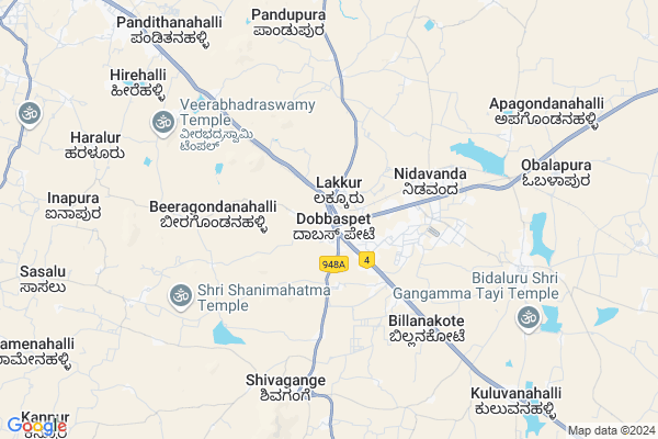
Sompura
Sompura Map
EDIT Map
Add Your House
 ..
..
Current Corona Virus Infected Patients Count in Bangalore Rural District
| City Name | District Name | Total Covid cases |
|---|---|---|
| Bengaluru Rural District | Bengaluru Rural | 5 |
| Doddaballapura | Bengaluru Rural | 1 |
Locality Name :
Sompura
( ಸೋಂಪುರ )
City Name : Nelamangala
District : Bangalore Rural
State : Karnataka
Division : Bangalore
Language : Kannada and Konkani, Tulu, Telugu, English, Kodava
Current Time 09:08 AM
Date: Wednesday , Apr 30,2025 (IST)
Time zone: IST (UTC+5:30)
Elevation / Altitude: 899 meters. Above Seal level
Telephone Code / Std Code: 08118
Assembly constituency : Nelamangala assembly constituency
Assembly MLA : Shreenivasaiah N
Lok Sabha constituency : Chikkaballapur parliamentary constituency
Parliament MP : B.N.Bache Gowda
Pin Code : 562111
Post Office Name : Dobbespet
Commodities Prices : Tumkur Market / Mandi
Sompura Live Weather
Temperature: 27.5 °C
broken clouds
Humidity: 52%
Wind : 3.34 mt/sec towards S
StationName : "Tumkūr"
observed on 47 Mins Back
Temperature: 27.5 °C
broken clouds
Humidity: 52%
Wind : 3.34 mt/sec towards S
StationName : "Tumkūr"
observed on 47 Mins Back
Sompura Weather Forecast for Next 5 days
01-05-2025
24.8°C to 36.1°C
broken clouds, overcast clouds, light rain
24.8°C to 36.1°C
broken clouds, overcast clouds, light rain
02-05-2025
22.9°C to 34.8°C
light rain, broken clouds, scattered clouds, overcast clouds
22.9°C to 34.8°C
light rain, broken clouds, scattered clouds, overcast clouds
03-05-2025
22.3°C to 35.8°C
overcast clouds, broken clouds, scattered clouds, light rain
22.3°C to 35.8°C
overcast clouds, broken clouds, scattered clouds, light rain
04-05-2025
20.8°C to 33.3°C
overcast clouds, scattered clouds, light rain
20.8°C to 33.3°C
overcast clouds, scattered clouds, light rain
05-05-2025
20.9°C to 34.3°C
overcast clouds, scattered clouds, broken clouds, light rain
20.9°C to 34.3°C
overcast clouds, scattered clouds, broken clouds, light rain
Edit below overview about Sompura
Edit below overview about Sompura
OverView of Sompura
sompura is an centerd hobli... commercial center for above 50plus surrounded villagesnow its used to call Dabaspete.. which is named after the british office died here..its an acient city with somanatheshwara temple..so many touring places located near by like shivagange, siddara betta, ramara betta, goravanahalii and so on.even its an educational center for village students.Cvg school is serving from many decade by serving poor students. and gheetha English scool serving from last 30yrs.and also their is many schools.its well connected to bangalore, tumkur, doddaballapur and Ramanagar. transportation facility provided from Ksrtc andrailwy.Edit below overview about Sompura
National Highways Reachable To Sompura
Nationa High Way :NH44;NH48;NH75
Nationa High Way :NH648
Nationa High Way :NH44;NH48;NH75
Nationa High Way :NH648
About Sompura
Sompura is a Locality in Nelamangala City in Karnataka State, India. It is belongs to Bangalore Division .
Sompura Pin code is 562111 and postal head office is Dobbespet .
Honnenahalli , Narasipura , Shivagange , Thyamagondlu , Manne are the nearby Localities to Sompura.
Tumkur , Magadi , Nelamangala , Madhugiri are the nearby Cities to Nelamangala.
Demographics of Sompura
Kannada is the Local Language here. Total population of Sompura is 2903 .Males are 1528 and Females are 1,375 living in 600 Houses. Total area of Sompura is 185 hectares.Politics in Sompura
Bharatiya Janata Party , JD(S) , Janata Dal (Secular) (JD(S)) , BJP , INC are the major political parties in this area.Polling Stations /Booths near Sompura
1)Government Higher Primary School Mylanahalli2)Govt.lower Primary School Room No -2 Kengal -2
3)Govt.lower Primary School Bittasandra
4)Government Lower Primary School A.k.colony.thyamagondlu
5)Government Higher Primary School Nijagal Kempohalli
HOW TO REACH Sompura
By Road
Nelamangala is the Nearest Town to Nelamangala. Nelamangala is 20 km from Sompura. Road connectivity is there from Nelamangala to Sompura.By Rail
Dobbspet Rail Way Station , Nidvanda Rail Way Station are the very nearby railway station to Sompura.Govt Health Centers near Sompura
1) Yarebudhihal , Yarebudhihal , Yarebudhihal , Yarebudhihal2) BELAGUMBA , , Urdigere Main Road , Belagumba
3) GCR Colony , , GCR COLONY , GCR COLONY
Hospitals in Sompura,Nelamangala
Sri Lakshmi Dental Clinic
Maruthi complex; Madhugiri road;; Sompura; Karnataka 562111; India
0.3 KM distance Detail
Government Primary Health Centre
Nelamangala Taluk; SH 3; Dabaspete; Karnataka 562111; India
0.3 KM distance Detail
Meda Medical & General Store
Mada Complex; Hospital Road; Dobbspet; Karnataka 562111; India
0.3 KM distance Detail
Jk Specialist Center
Maruthi complex; Madhugiri Rd; Heggadahalli; Karnataka 562111; India
0.3 KM distance Detail
more ..
Petrol Bunks in Sompura,Nelamangala
S M PETROLEUM COMPANY
DOBOSPET TUMKUR ROAD; BANGALORE RUR; Karnataka 562111; India
0.2 KM distance Detail
IOC - Rajarajeshwari Service Station Unit 2 (COCO Dabaspet)
Kasaba Nilagal; Bangalore Rural; Dabaspet; Karnataka 562111; India
1.2 KM distance Detail
Reliance Petroleum
NH 4 KASABA NIJAGAL DABBASPET POST NELAMANGALA TALUK; Tumakuru; Karnataka 562111; India
2.3 KM distance Detail
more ..
Colleges in Sompura,Nelamangala
International School of Business & Media
Plot No. 241; Sompura Industrial Area; Niduvanda Village; Sompura Hobli; Nelamangala Taluk; Bengaluru; Karnataka 562132; India
5.0 KM distance Detail
Government Junior College Thyamagondlu
Nelamangala block; Bangalore Rural District; Thyamagondlu; Karnataka 562132; India
7.7 KM distance Detail
more ..
Governement Offices near Sompura,Nelamangala
PANCHAYAT OFFICE
GANDHI CIRCLE; MAIN ROAD; Thyamagondlu; Karnataka 562132; India
8.1 KM distance Detail
About Sompura &
History
How to reach Sompura
Tourist Places Near By Sompura
Schools in Sompura
Colleges in Sompura
Temperature & weather of Sompura
places in Sompura
Sompura photos
More Information
How to reach Sompura
Tourist Places Near By Sompura
Schools in Sompura
Colleges in Sompura
Temperature & weather of Sompura
places in Sompura
Sompura photos
More Information
Locality Talk
Post News or Events about this Locality
Near Cities
Tumkur 24 KM near
Magadi 31 KM near
Nelamangala 33 KM near
Madhugiri 53 KM near
Tumkur 24 KM near
Magadi 31 KM near
Nelamangala 33 KM near
Madhugiri 53 KM near
Near By Taluks
Nelamangala 13 KM near
Tumkur 21 KM near
Magadi 26 KM near
Dodballapur 30 KM near
Nelamangala 13 KM near
Tumkur 21 KM near
Magadi 26 KM near
Dodballapur 30 KM near
Near By Air Ports
Bengaluru International Airport 56 KM near
Mysore Airport 136 KM near
Salem Airport 226 KM near
Peelamedu Airport 274 KM near
Bengaluru International Airport 56 KM near
Mysore Airport 136 KM near
Salem Airport 226 KM near
Peelamedu Airport 274 KM near
Near By Tourist Places
Shivagange 6 KM near
Savandurga 41 KM near
Bangalore 53 KM near
Nandi Hills 55 KM near
Lepakshi 84 KM near
Shivagange 6 KM near
Savandurga 41 KM near
Bangalore 53 KM near
Nandi Hills 55 KM near
Lepakshi 84 KM near
Near By Districts
Tumkur 21 KM near
Bangalore 54 KM near
Bangalore Rural 57 KM near
Ramanagara 63 KM near
Tumkur 21 KM near
Bangalore 54 KM near
Bangalore Rural 57 KM near
Ramanagara 63 KM near
Near By RailWay Station
Dobbspet Rail Way Station 0.8 KM near
Nidvanda Rail Way Station 4.4 KM near
Muddalingana Halli Rail Way Station 8.3 KM near
Tumakuru Rail Way Station 20 KM near
Chikka Banavara Junction Rail Way Station 37 KM near
Dobbspet Rail Way Station 0.8 KM near
Nidvanda Rail Way Station 4.4 KM near
Muddalingana Halli Rail Way Station 8.3 KM near
Tumakuru Rail Way Station 20 KM near
Chikka Banavara Junction Rail Way Station 37 KM near