| Home | City Bus | Maps | Villages | Cities | Rail | Tourist Places | School | College | Pin Codes | Corona Cases Count |
| Distance Calculator Bus Services IFSC Codes Trace Mobile Number Weather Search Place Trace IP Available Cash ATM/Banks Locate Polling Booth Report an Error contact People |
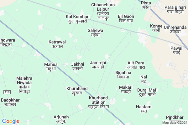
Jamrehi
Jamrehi Map
EDIT Map
Add Your House
 ..
..
Current Corona Virus Infected Patients Count in Banda District
| City Name | District Name | Total Covid cases |
|---|---|---|
| Banda District | Banda | 5 |
Locality Name :
Jamrehi
( जमरेही )
Block Name : Mahuva
District : Banda
State : Uttar Pradesh
Division : Chitrakoot
Language : Hindi and Urdu, Bundeli
Current Time 07:46 AM
Date: Wednesday , Apr 30,2025 (IST)
Time zone: IST (UTC+5:30)
Elevation / Altitude: 130 meters. Above Seal level
Telephone Code / Std Code: 05191
Assembly constituency : Banda assembly constituency
Assembly MLA : Prakash Dwivedi
Lok Sabha constituency : Banda parliamentary constituency
Parliament MP : R.K. SINGH PATEL
Serpanch Name :
Pin Code : 210120
Post Office Name : Khurand R.S.
Commodities Prices : Atarra Market / Mandi
Jamrehi Live Weather
Temperature: 28.0 °C
clear sky
Humidity: 40%
Wind : 4.74 mt/sec towards SE
StationName : "Bisenda Buzurg"
observed on 53 Mins Back
Temperature: 28.0 °C
clear sky
Humidity: 40%
Wind : 4.74 mt/sec towards SE
StationName : "Bisenda Buzurg"
observed on 53 Mins Back
Jamrehi Weather Forecast for Next 5 days
01-05-2025
28.9°C to 39.0°C
clear sky
28.9°C to 39.0°C
clear sky
02-05-2025
29.5°C to 41.3°C
scattered clouds, broken clouds, clear sky, few clouds
29.5°C to 41.3°C
scattered clouds, broken clouds, clear sky, few clouds
03-05-2025
30.5°C to 42.3°C
clear sky, scattered clouds, few clouds
30.5°C to 42.3°C
clear sky, scattered clouds, few clouds
04-05-2025
29.6°C to 43.2°C
scattered clouds, overcast clouds, few clouds, clear sky
29.6°C to 43.2°C
scattered clouds, overcast clouds, few clouds, clear sky
05-05-2025
29.7°C to 44.4°C
scattered clouds, broken clouds, light rain
29.7°C to 44.4°C
scattered clouds, broken clouds, light rain
National Highways Reachable To Jamrehi
Nationa High Way :NH35
Nationa High Way :NH35
Rivers Near Jamrehi
Baghain
Garara Nadi
Baghain
Garara Nadi
About Jamrehi
Correct below Info and add more info about JamrehiJamrehi is a Village in Mahuva Block in Banda District of Uttar Pradesh State, India. It belongs to Chitrakoot Division . It is located 19 KM towards East from District head quarters Banda. 11 KM from Mahuwa. 196 KM from State capital Lucknow
Jamrehi Pin code is 210120 and postal head office is Khurand R.S. .
Ghuraunda ( 3 KM ) , Sahewa ( 4 KM ) , Khurhand ( 4 KM ) , Barsanda Khurd ( 4 KM ) , Makari ( 4 KM ) are the nearby Villages to Jamrehi. Jamrehi is surrounded by Badokhar Khurd Block towards west , Banda Block towards west , Bisanda Block towards East , Tindwari Block towards North .
Banda , Chitrakoot , Mahoba , Fatehpur are the near by Cities to Jamrehi.
Jamrehi 2011 Census Details
Jamrehi Local Language is Hindi. Jamrehi Village Total population is 1822 and number of houses are 322. Female Population is 47.6%. Village literacy rate is 56.3% and the Female Literacy rate is 20.3%.
Population
| Census Parameter | Census Data |
| Total Population | 1822 |
| Total No of Houses | 322 |
| Female Population % | 47.6 % ( 868) |
| Total Literacy rate % | 56.3 % ( 1025) |
| Female Literacy rate | 20.3 % ( 369) |
| Scheduled Tribes Population % | 0.0 % ( 0) |
| Scheduled Caste Population % | 23.0 % ( 419) |
| Working Population % | 32.7 % |
| Child(0 -6) Population by 2011 | 338 |
| Girl Child(0 -6) Population % by 2011 | 51.5 % ( 174) |
Jamrehi Census More Deatils.
Politics in Jamrehi
BJP , SP , BSP , INC are the major political parties in this area.Polling Stations /Booths near Jamrehi
1)Pr. Vi. Bansakha2)Pr.vi.khurhnd Room No.1
3)Pr.vi.khinninaka Banda Room No 4
4)Pr. Vi. Vayas Ka Purva Ans Bisanda Gramin
5)Pr.vi.bandhapurwa
HOW TO REACH Jamrehi
By Rail
Khurhand Rail Way Station , Dingwahi Rail Way Station are the very nearby railway stations to Jamrehi.Colleges near Jamrehi
Pandit Jawahar Lal Nehroo Inter Collage Girwan
Address :
Schools in Jamrehi
U.p S Kanya Amrehi
Address : jamrehi , mahuwa , banda , Uttar Pradesh . PIN- 210120 , Post - Khurand R.S.
U.p S Amrehi
Address : jamrehi , mahuwa , banda , Uttar Pradesh . PIN- 210120 , Post - Khurand R.S.
Govt Health Centers near Jamrehi
1) Bilgaon , Bilgaon , ,2) Jakhani , jakhni , ,
3) Khurhand , Khurhand , ,
Sub Villages in Jamrehi
Hospitals in Jamrehi,Mahuva
Primary Health Centre
Khurhand Banda; Banda; NH-76; Chitrakoot Banda Road; Khurahand; Khurahand; Uttar Pradesh 210120; India
3.9 KM distance Detail
Primary Health Centre Mahua
Banda; NH-76; Chitrakoot Banda Road; Mahua; Mahua; Uttar Pradesh 210120; India
5.2 KM distance Detail
more ..
Petrol Bunks in Jamrehi,Mahuva
Indian Oil
Khurhand Banda; Banda; NH-76; Chitrakoot Banda Road; Khurahand; Khurahand; Uttar Pradesh 210120; India
3.7 KM distance Detail
Essar Petroleum
Khurhand Banda; Banda; NH-76; Chitrakoot Banda Road; Khurahand; Khurahand; Uttar Pradesh 210120; India
4.0 KM distance Detail
more ..
Colleges in Jamrehi,Mahuva
Technology solution Services
Station Road; Khurhand Station; Uttar Pradesh 210120; India
5.0 KM distance Detail
Rajkiye Inter College
Konee; Banda; Banda Oran Road; Bisanda Buzurg; Bisanda Buzurg; Uttar Pradesh 210120; India
6.4 KM distance Detail
Bundelkhand Intermediate College
Mathana Khera; Banda; NH-76; Chitrakoot Banda Road; Dingwahi; Dingwahi; Uttar Pradesh 210120; India
10.1 KM distance Detail
more ..
Schools in Jamrehi,Mahuva
Prathmik Vidyalaya Khurhand 1
Mahua; Banda; NH-76; Chitrakoot Banda Road; Khurahand; Khurahand; Uttar Pradesh 210120; India
3.6 KM distance Detail
Purva Madhyamik Vidyalaya
Sahewa; Banda; Banda Oran Road; Bisanda Buzurg; Bisanda Buzurg; Uttar Pradesh 210001; India
5.0 KM distance Detail
Kanya Prathmik Vidyalaya Khurhand 2
Mahua; Banda; NH-76; Chitrakoot Banda Road; Khurahand; Khurahand; Uttar Pradesh 210120; India
5.2 KM distance Detail
Prathamik Vidyalay Nagnedhi Vikas Khand
Khurhand Banda; Banda; NH-76; Chitrakoot Banda Road; Khurahand; Khurahand; Uttar Pradesh 210120; India
5.3 KM distance Detail
Purva Madhyamik Vidyalaya Mahua
Banda; NH-76; Chitrakoot Banda Road; Mahua; Mahua; Uttar Pradesh 210120; India
5.3 KM distance Detail
Electronic Shops in Jamrehi,Mahuva
Prachi mobile Centre
210120; RD Complex; U-3; Unnamed Rd; Sector 3; Avas Vikas Colony; Sikandra; Agra; Uttar Pradesh 282004; India
4.8 KM distance Detail
आरती मोबाइल &इलेक्ट्रॉनिकस
Station Road; Khurhand Station; Uttar Pradesh 210120; India
4.9 KM distance Detail
Super Markets in Jamrehi,Mahuva
Antika Pan And Cold Drink Store
Banda-Oran Rd; Bisanda; Uttar Pradesh 210203; India
17.4 KM distance Detail
Rahul Traders
Mandi Samiti; Tindwari Road; Ladaka Purwa; Banda; Uttar Pradesh 210001; India
17.5 KM distance Detail
Local Parks in Jamrehi,Mahuva
Madhav Park
near city garden; Baberu; road; Vishwa Vihar Colony; Banda; Uttar Pradesh; India
17.8 KM distance Detail
About Jamrehi &
History
How to reach Jamrehi
Tourist Places Near By Jamrehi
Schools in Jamrehi
Colleges in Jamrehi
Temperature & weather of Jamrehi
places in Jamrehi
Jamrehi photos
More Information
How to reach Jamrehi
Tourist Places Near By Jamrehi
Schools in Jamrehi
Colleges in Jamrehi
Temperature & weather of Jamrehi
places in Jamrehi
Jamrehi photos
More Information
Village Talk
Post News or Events about this Village
Near Cities
Banda 18 KM near
Chitrakoot 52 KM near
Mahoba 69 KM near
Fatehpur 75 KM near
Banda 18 KM near
Chitrakoot 52 KM near
Mahoba 69 KM near
Fatehpur 75 KM near
Near By Taluks
Mahuva 10 KM near
Badokhar Khurd 15 KM near
Banda 17 KM near
Bisanda 24 KM near
Mahuva 10 KM near
Badokhar Khurd 15 KM near
Banda 17 KM near
Bisanda 24 KM near
Near By Air Ports
Khajuraho Airport 95 KM near
Kanpur Airport 125 KM near
Bamrauli Airport 142 KM near
Amausi Airport 176 KM near
Khajuraho Airport 95 KM near
Kanpur Airport 125 KM near
Bamrauli Airport 142 KM near
Amausi Airport 176 KM near
Near By Tourist Places
Kalinjar 49 KM near
Ajaigarh 65 KM near
Panna 90 KM near
Khajuraho 94 KM near
Kaushambi 105 KM near
Kalinjar 49 KM near
Ajaigarh 65 KM near
Panna 90 KM near
Khajuraho 94 KM near
Kaushambi 105 KM near
Near By Districts
Banda 18 KM near
Mahoba 68 KM near
Chitrakoot 76 KM near
Fatehpur 77 KM near
Banda 18 KM near
Mahoba 68 KM near
Chitrakoot 76 KM near
Fatehpur 77 KM near
Near By RailWay Station
Khurhand Rail Way Station 4.1 KM near
Dingwahi Rail Way Station 7.1 KM near
Banda Rail Way Station 17 KM near
Atarra Rail Way Station 18 KM near
Khurhand Rail Way Station 4.1 KM near
Dingwahi Rail Way Station 7.1 KM near
Banda Rail Way Station 17 KM near
Atarra Rail Way Station 18 KM near