| Home | City Bus | Maps | Villages | Cities | Rail | Tourist Places | School | College | Pin Codes | Corona Cases Count |
| Distance Calculator Bus Services IFSC Codes Trace Mobile Number Weather Search Place Trace IP Available Cash ATM/Banks Locate Polling Booth Report an Error contact People |
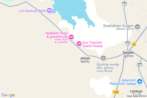
Jaloya
Jaloya Map
EDIT Map
Add Your House
 ..
..
Current Corona Virus Infected Patients Count in Banas Kantha District
| City Name | District Name | Total Covid cases |
|---|
Locality Name :
Jaloya
( જલોયા )
Taluka Name : Vav
District : Banas Kantha
State : Gujarat
Language : Gujarati and Hindi
Current Time 01:03 PM
Date: Sunday , Apr 27,2025 (IST)
Time zone: IST (UTC+5:30)
Elevation / Altitude: 38 meters. Above Seal level
Telephone Code / Std Code: 02740
Assembly constituency : Vav assembly constituency
Assembly MLA : Thakor Geniben Nagaji
Lok Sabha constituency : Banaskantha parliamentary constituency
Parliament MP : PARBATBHAI SAVABHAI PATEL
Serpanch Name :
Alternate Village Name : Jaloya School
Commodities Prices : Vav Market / Mandi
Edit below overview about Jaloya
Edit below overview about Jaloya
OverView of Jaloya
Jaloya is the last village lies in the northern range from here Indo-Pak Border is 35 kms away generally called Nadabet.Edit below overview about Jaloya
National Highways Reachable To Jaloya
Nationa High Way :NH68
Nationa High Way :NH68
Rivers Near Jaloya
Luni :लूनी
Luni :लूनी
About Jaloya
Jaloya is a Village in Vav Taluka in Banas Kantha District of Gujarat State, India. It is located 135 KM towards west from District head quarters Palanpur. 27 KM from Vav. 202 KM from State capital Gandhinagar
Limbuni ( 11 KM ) , Madhpura ( 11 KM ) , Radosan ( 12 KM ) , Bharadava ( 13 KM ) , Benap ( 15 KM ) are the nearby Villages to Jaloya. Jaloya is surrounded by Bhabhar Taluka towards East , Santalpur Taluka towards South , Radhanpur Taluka towards South , Deodar Taluka towards East .
Tharad , Radhanpur , Sanchore , Rapar are the near by Cities to Jaloya.
Jaloya 2011 Census Details
Jaloya Local Language is Gujarati. Jaloya Village Total population is 1544 and number of houses are 246. Female Population is 40.3%. Village literacy rate is 47.6% and the Female Literacy rate is 9.3%.
Population
| Census Parameter | Census Data |
| Total Population | 1544 |
| Total No of Houses | 246 |
| Female Population % | 40.3 % ( 622) |
| Total Literacy rate % | 47.6 % ( 735) |
| Female Literacy rate | 9.3 % ( 144) |
| Scheduled Tribes Population % | 0.3 % ( 5) |
| Scheduled Caste Population % | 1.0 % ( 16) |
| Working Population % | 52.5 % |
| Child(0 -6) Population by 2011 | 229 |
| Girl Child(0 -6) Population % by 2011 | 38.9 % ( 89) |
Jaloya Census More Deatils.
Politics in Jaloya
Bharatiya Janata Party , BJP , INC are the major political parties in this area.Polling Stations /Booths near Jaloya
1)Suigam-22)Suigam-3
3)Suigam-1
4)Soneth-3
5)Manpura Bhabhar
HOW TO REACH Jaloya
By Rail
There is no railway station near to Jaloya in less than 10 km.Pincodes near Jaloya
385570 ( Suigam ) , 385320 ( Bhabhar ) , 385575 ( Vav )Colleges near Jaloya
Vimla Vikas Vartul Gadh
Address :
D.n.p. Arts&com.college Deesa
Address :
I.t.i Collage Morthal
Address : Gram Panchayat Morthal
Dharti Education Academy , Tharad
Address : 2nd Floor, Jalaram Complex, Near Bus Station, Tharad, Banaskantha, 385565
Bkm Law College
Address : Opp.s.t.work Shop, Highway,palanpur,dist.banaskant
Schools near Jaloya
K.g.b.v(dhhima)
Address : dhhima , vav , banas kantha , Gujarat . PIN- 385566 , Post - Dhima
Ratangadhh Pri. Sch.
Address : ratangadhh , vav , banas kantha , Gujarat . PIN- 385566 , Post - Dhima
Radha Nesda Pri. Sch.
Address : radha nesda , vav , banas kantha , Gujarat . PIN- 385575 , Post - Vav
Tejpura Pri. Sch.
Address : tejpura , vav , banas kantha , Gujarat . PIN- 385566 , Post - Dhima
Govt Health Centers near Jaloya
1) Zazam , 8 , SHIDHADA TO SUIGAM ROAD , PRIMAY SCHOOL NI BAJUMA2) Asaravas , Asaravas phc , Rabarivas , NEAR SADPARI TEMPLE
3) Tirthgam , PHCTirthgam , Main Choak , Near grampanchayat
Local Parks in Jaloya,Vav
About Jaloya &
History
How to reach Jaloya
Tourist Places Near By Jaloya
Schools in Jaloya
Colleges in Jaloya
Temperature & weather of Jaloya
places in Jaloya
Jaloya photos
More Information
How to reach Jaloya
Tourist Places Near By Jaloya
Schools in Jaloya
Colleges in Jaloya
Temperature & weather of Jaloya
places in Jaloya
Jaloya photos
More Information
Village Talk
Post News or Events about this Village
Near Cities
Tharad 48 KM near
Radhanpur 55 KM near
Sanchore 92 KM near
Rapar 102 KM near
Tharad 48 KM near
Radhanpur 55 KM near
Sanchore 92 KM near
Rapar 102 KM near
Near By Taluks
Vav 25 KM near
Bhabhar 37 KM near
Santalpur 43 KM near
Radhanpur 53 KM near
Vav 25 KM near
Bhabhar 37 KM near
Santalpur 43 KM near
Radhanpur 53 KM near
Near By Air Ports
Kandla Airport 187 KM near
Ahmedabad Airport 205 KM near
Rudra Mata Airport 213 KM near
Civil Airport 237 KM near
Kandla Airport 187 KM near
Ahmedabad Airport 205 KM near
Rudra Mata Airport 213 KM near
Civil Airport 237 KM near
Near By Tourist Places
Patan 104 KM near
Kutch 108 KM near
Modhera 121 KM near
Dholavira 125 KM near
Banaskantha 130 KM near
Patan 104 KM near
Kutch 108 KM near
Modhera 121 KM near
Dholavira 125 KM near
Banaskantha 130 KM near
Near By Districts
Patan 103 KM near
Banas Kantha 130 KM near
Mahesana 145 KM near
Surendranagar 183 KM near
Patan 103 KM near
Banas Kantha 130 KM near
Mahesana 145 KM near
Surendranagar 183 KM near
Near By RailWay Station
Bhildi Junction Rail Way Station 83 KM near
Disa Rail Way Station 102 KM near
Bhildi Junction Rail Way Station 83 KM near
Disa Rail Way Station 102 KM near