| Home | City Bus | Maps | Villages | Cities | Rail | Tourist Places | School | College | Pin Codes | Corona Cases Count |
| Distance Calculator Bus Services IFSC Codes Trace Mobile Number Weather Search Place Trace IP Available Cash ATM/Banks Locate Polling Booth Report an Error contact People |
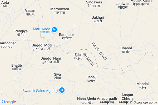
Edal
Edal Map
EDIT Map
Add Your House
 ..
..
Current Corona Virus Infected Patients Count in Banas Kantha District
| City Name | District Name | Total Covid cases |
|---|
Locality Name :
Edal
( એડલ )
Taluka Name : Dhanera
District : Banas Kantha
State : Gujarat
Language : Gujarati and Hindi
Current Time 05:35 PM
Date: Tuesday , Apr 29,2025 (IST)
Time zone: IST (UTC+5:30)
Elevation / Altitude: 135 meters. Above Seal level
Telephone Code / Std Code: 02748
Assembly constituency : Dhanera assembly constituency
Assembly MLA : Mavjibhai Maganbhai Desai
Lok Sabha constituency : Banaskantha parliamentary constituency
Parliament MP : PARBATBHAI SAVABHAI PATEL
Serpanch Name :
Pin Code : 385310
Post Office Name : Dhanera
Main Village Name : Edal
Commodities Prices : Dhanera Market / Mandi
Edal Live Weather
Temperature: 40.7 °C
clear sky
Humidity: 15%
Wind : 6.09 mt/sec towards SW
StationName : "Dhanera"
observed on Now
Temperature: 40.7 °C
clear sky
Humidity: 15%
Wind : 6.09 mt/sec towards SW
StationName : "Dhanera"
observed on Now
Edal Weather Forecast for Next 5 days
30-04-2025
26.6°C to 37.8°C
clear sky
26.6°C to 37.8°C
clear sky
01-05-2025
24.8°C to 42.3°C
clear sky
24.8°C to 42.3°C
clear sky
02-05-2025
24.6°C to 41.2°C
clear sky
24.6°C to 41.2°C
clear sky
03-05-2025
23.7°C to 39.8°C
clear sky
23.7°C to 39.8°C
clear sky
04-05-2025
23.5°C to 39.2°C
clear sky
23.5°C to 39.2°C
clear sky
Rivers Near Edal
Davangan Nadi
Sipu
Davangan Nadi
Sipu
About Edal
Correct below Info and add more info about EdalEdal is a small Village/hamlet in Dhanera Taluka in Banas Kantha District of Gujarat State, India. It comes under Edal Panchayath. It is located 69 KM towards North from District head quarters Palanpur. 9 KM from . 192 KM from State capital Gandhinagar
Edal Pin code is 385310 and postal head office is Dhanera .
Raviya ( 7 KM ) , Bhatib ( 9 KM ) , Mandal ( 11 KM ) , Vasan ( 11 KM ) , Jadi ( 11 KM ) are the nearby Villages to Edal. Edal is surrounded by Dantivada Taluka towards South , Raniwara Taluka towards North , Deesa Taluka towards South , Reodar Taluka towards East .
Sanchore , Bhinmal , Deesa , Mount Abu are the near by Cities to Edal.
Edal 2011 Census Details
Edal Local Language is Gujarati. Edal Village Total population is 1445 and number of houses are 217. Female Population is 49.8%. Village literacy rate is 48.5% and the Female Literacy rate is 17.1%.
Population
| Census Parameter | Census Data |
| Total Population | 1445 |
| Total No of Houses | 217 |
| Female Population % | 49.8 % ( 719) |
| Total Literacy rate % | 48.5 % ( 701) |
| Female Literacy rate | 17.1 % ( 247) |
| Scheduled Tribes Population % | 5.8 % ( 84) |
| Scheduled Caste Population % | 15.3 % ( 221) |
| Working Population % | 30.3 % |
| Child(0 -6) Population by 2011 | 305 |
| Girl Child(0 -6) Population % by 2011 | 50.5 % ( 154) |
Edal Census More Deatils.
Politics in Edal
Bharatiya Janata Party , BJP , INC are the major political parties in this area.Polling Stations /Booths near Edal
1)Motimhudi2)Jadia-2
3)Kotada-dhakha
4)Ravia-1
5)Ravi-2
HOW TO REACH Edal
By Rail
Marwar Ratanpur Rail Way Station , Dugdol Rail Way Station are the very nearby railway stations to Edal.Colleges near Edal
Vimla Vikas Vartul Gadh
Address :
D.n.p. Arts&com.college Deesa
Address :
I.t.i Collage Morthal
Address : Gram Panchayat Morthal
Dharti Education Academy , Tharad
Address : 2nd Floor, Jalaram Complex, Near Bus Station, Tharad, Banaskantha, 385565
Bkm Law College
Address : Opp.s.t.work Shop, Highway,palanpur,dist.banaskant
Schools near Edal
Royal Eng. Med. Pri.sch.
Address : dhanera , dhanera , banas kantha , Gujarat . PIN- 385310 , Post - Dhanera
Shri Jagruti Pri. Sch.
Address : khimat , dhanera , banas kantha , Gujarat . PIN- 385545 , Post - Khimat
Ramsihpura(sankad) Pri. Sch.
Address : sankad , dhanera , banas kantha , Gujarat . PIN- 385310 , Post - Dhanera
Smt. G.m.v.e.m.pri. Sch.
Address : dhanera , dhanera , banas kantha , Gujarat . PIN- 385310 , Post - Dhanera
Govt Health Centers near Edal
1) Rah , chc rah , rah chc building , by highway2) Piluda , chc piluda , sc building , on highway
3) Amirgadh - T , CHC AMIRGADH , CHC AMIRGADH , CHC AMIRGADH ROAD
Colleges in Edal,Dhanera
Shri Raghunath Bishnoi Memorial College; Raniwara
Badgaon Road; Bus Stand; RJ SH 11; Raniwara Kalan; Rajasthan 343040; India
15.8 KM distance Detail
more ..
Super Markets in Edal,Dhanera
SHIVAM AUTOMOBILES RANIWARA
sanchore bay pass raod; Raniwara; Rajasthan; India
15.8 KM distance Detail
About Edal &
History
How to reach Edal
Tourist Places Near By Edal
Schools in Edal
Colleges in Edal
Temperature & weather of Edal
places in Edal
Edal photos
More Information
How to reach Edal
Tourist Places Near By Edal
Schools in Edal
Colleges in Edal
Temperature & weather of Edal
places in Edal
Edal photos
More Information
Village Talk
Post News or Events about this Village
Near Cities
Sanchore 45 KM near
Bhinmal 47 KM near
Deesa 47 KM near
Mount Abu 64 KM near
Sanchore 45 KM near
Bhinmal 47 KM near
Deesa 47 KM near
Mount Abu 64 KM near
Near By Taluks
Dhanera 9 KM near
Dantivada 36 KM near
Raniwara 40 KM near
Deesa 42 KM near
Dhanera 9 KM near
Dantivada 36 KM near
Raniwara 40 KM near
Deesa 42 KM near
Near By Air Ports
Dabok Airport 198 KM near
Ahmedabad Airport 203 KM near
Jodhpur Airport 226 KM near
Kandla Airport 299 KM near
Dabok Airport 198 KM near
Ahmedabad Airport 203 KM near
Jodhpur Airport 226 KM near
Kandla Airport 299 KM near
Near By Tourist Places
Mount Abu 64 KM near
Banaskantha 66 KM near
Danta Ambaji 88 KM near
Ambaji 88 KM near
Patan 100 KM near
Mount Abu 64 KM near
Banaskantha 66 KM near
Danta Ambaji 88 KM near
Ambaji 88 KM near
Patan 100 KM near
Near By Districts
Banas Kantha 66 KM near
Sirohi 86 KM near
Patan 98 KM near
Jalore 103 KM near
Banas Kantha 66 KM near
Sirohi 86 KM near
Patan 98 KM near
Jalore 103 KM near
Near By RailWay Station
Marwar Ratanpur Rail Way Station 5.1 KM near
Dugdol Rail Way Station 8.9 KM near
Disa Rail Way Station 50 KM near
Bhildi Junction Rail Way Station 57 KM near
Marwar Ratanpur Rail Way Station 5.1 KM near
Dugdol Rail Way Station 8.9 KM near
Disa Rail Way Station 50 KM near
Bhildi Junction Rail Way Station 57 KM near