| Home | City Bus | Maps | Villages | Cities | Rail | Tourist Places | School | College | Pin Codes | Corona Cases Count |
| Distance Calculator Bus Services IFSC Codes Trace Mobile Number Weather Search Place Trace IP Available Cash ATM/Banks Locate Polling Booth Report an Error contact People |
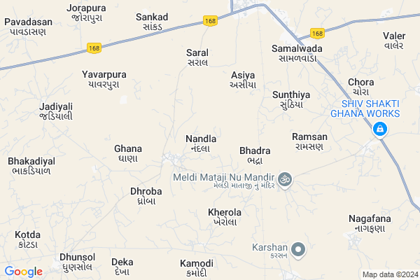
Nandala
Nandala Map
EDIT Map
Add Your House
 ..
..
Current Corona Virus Infected Patients Count in Banas Kantha District
| City Name | District Name | Total Covid cases |
|---|
Locality Name :
Nandala
( નંદલા )
Taluka Name : Deesa
District : Banas Kantha
State : Gujarat
Language : Gujarati and Hindi
Current Time 12:37 PM
Date: Sunday , Apr 27,2025 (IST)
Time zone: IST (UTC+5:30)
Elevation / Altitude: 139 meters. Above Seal level
Telephone Code / Std Code: 02744
Assembly constituency : Deodar assembly constituency
Assembly MLA : Keshaji Shivaji Chauhan
Lok Sabha constituency : Banaskantha parliamentary constituency
Parliament MP : PARBATBHAI SAVABHAI PATEL
Serpanch Name :
Pin Code : 385310
Post Office Name : Dhanera
Main Village Name : Nandla
Commodities Prices : Dhanera Market / Mandi
Nandala Live Weather
Temperature: 41.7 °C
clear sky
Humidity: 12%
Wind : 6.15 mt/sec towards W
StationName : "Dhanera"
observed on Now
Temperature: 41.7 °C
clear sky
Humidity: 12%
Wind : 6.15 mt/sec towards W
StationName : "Dhanera"
observed on Now
Nandala Weather Forecast for Next 5 days
28-04-2025
26.5°C to 42.7°C
clear sky
26.5°C to 42.7°C
clear sky
29-04-2025
24.8°C to 42.8°C
clear sky
24.8°C to 42.8°C
clear sky
30-04-2025
24.8°C to 42.0°C
clear sky
24.8°C to 42.0°C
clear sky
01-05-2025
24.3°C to 41.4°C
clear sky, few clouds, broken clouds, scattered clouds
24.3°C to 41.4°C
clear sky, few clouds, broken clouds, scattered clouds
02-05-2025
23.9°C to 41.0°C
clear sky
23.9°C to 41.0°C
clear sky
Edit below overview about Nandala
Edit below overview about Nandala
OverView of Nandala
Nandala is the cleanest village of Banaskanthaand it's an full of RAJPUTANA peoples.Edit below overview about Nandala
National Highways Reachable To Nandala
Nationa High Way :NH68
Nationa High Way :NH68
Rivers Near Nandala
Kapra
Balaram
Kapra
Balaram
About Nandala
Nandala is a small Village/hamlet in Deesa Taluka in Banas Kantha District of Gujarat State, India. It comes under Nandla Panchayath. It is located 60 KM towards west from District head quarters Palanpur. 20 KM from . 175 KM from State capital Gandhinagar
Nandala Pin code is 385310 and postal head office is Dhanera .
Nandala is surrounded by Dhanera Taluka towards North , Tharad Taluka towards west , Dantivada Taluka towards East , Deodar Taluka towards South .
Deesa , Tharad , Sanchore , Palanpur are the near by Cities to Nandala.
Demographics of Nandala
Gujarati is the Local Language here.Politics in Nandala
Bharatiya Janata Party , BJP , INC are the major political parties in this area.Polling Stations /Booths near Nandala
1)Nanakapra-22)Nandala-1
3)Baloghar-1
4)Khanodar-2
5)Kherola-1
HOW TO REACH Nandala
By Rail
Ramsan Rail Way Station , Dhanera Rail Way Station are the very nearby railway stations to Nandala.Colleges near Nandala
D.n.p. Arts&com.college Deesa
Address :
Schools in Nandala
Rajaramnagar Nad. Pri. Sch.
Address : nandala , deesa , banas kantha , Gujarat . PIN- 385310 , Post - Dhanera
Saraswatinagar (na) Pri. Sch.
Address : nandala , deesa , banas kantha , Gujarat . PIN- 385310 , Post - Dhanera
Nandala Pri. Sch.
Address : nandala , deesa , banas kantha , Gujarat . PIN- 385310 , Post - Dhanera
Govt Health Centers near Nandala
1) Rah , chc rah , rah chc building , by highway2) Piluda , chc piluda , sc building , on highway
3) SDH Tharad , SDH tharad , by road , highway tharad
Hospitals in Nandala,Deesa
Samuhik Arogya Kendra
Banaskantha; NH-168A; Banaskantha Road; Dhanera; Dhanera; Gujarat 385330; India
7.8 KM distance Detail
more ..
Petrol Bunks in Nandala,Deesa
Dhanera Petroleum Agency.
Near; Teen Rasta Deesa Rd; Dhanera; Gujarat 385310; India
8.3 KM distance Detail
Sundheshree Petroleum Rah
Gujarat State Highway 128; Rah; Gujarat 385310; India
8.6 KM distance Detail
more ..
Colleges in Nandala,Deesa
Shree Anjana Arts And Commerce College Dhanera
Banaskantha; Gujarat 385310; India
6.9 KM distance Detail
Gujarat Training Institute
At & Post : Kummar;Ta :; Dhanera; Gujarat 385310; India
16.8 KM distance Detail
more ..
Governement Offices near Nandala,Deesa
Magistrate Office
Dhnera; Banaskantha; SH-129; Banaskantha Road; Dhanera; Dhanera; Gujarat 385310; India
7.8 KM distance Detail
Nagar Palika Office
Dhnera; Banaskantha; NH-168A; Banaskantha Road; Dhanera; Dhanera; Gujarat 385330; India
8.1 KM distance Detail
Nagar Seva Sadan
Banaskantha; SH-129; Banaskantha Road; Dhanera; Dhanera; Gujarat 385330; India
8.5 KM distance Detail
About Nandala &
History
How to reach Nandala
Tourist Places Near By Nandala
Schools in Nandala
Colleges in Nandala
Temperature & weather of Nandala
places in Nandala
Nandala photos
More Information
How to reach Nandala
Tourist Places Near By Nandala
Schools in Nandala
Colleges in Nandala
Temperature & weather of Nandala
places in Nandala
Nandala photos
More Information
Village Talk
Post News or Events about this Village
Near Cities
Deesa 31 KM near
Tharad 43 KM near
Sanchore 49 KM near
Palanpur 59 KM near
Deesa 31 KM near
Tharad 43 KM near
Sanchore 49 KM near
Palanpur 59 KM near
Near By Taluks
Deesa 19 KM near
Dhanera 19 KM near
Tharad 33 KM near
Dantivada 37 KM near
Deesa 19 KM near
Dhanera 19 KM near
Tharad 33 KM near
Dantivada 37 KM near
Near By Air Ports
Ahmedabad Airport 184 KM near
Dabok Airport 214 KM near
Jodhpur Airport 255 KM near
Kandla Airport 273 KM near
Ahmedabad Airport 184 KM near
Dabok Airport 214 KM near
Jodhpur Airport 255 KM near
Kandla Airport 273 KM near
Near By Tourist Places
Banaskantha 58 KM near
Patan 76 KM near
Mount Abu 81 KM near
Danta Ambaji 88 KM near
Ambaji 96 KM near
Banaskantha 58 KM near
Patan 76 KM near
Mount Abu 81 KM near
Danta Ambaji 88 KM near
Ambaji 96 KM near
Near By Districts
Banas Kantha 57 KM near
Patan 74 KM near
Sirohi 110 KM near
Mahesana 113 KM near
Banas Kantha 57 KM near
Patan 74 KM near
Sirohi 110 KM near
Mahesana 113 KM near
Near By RailWay Station
Ramsan Rail Way Station 3.0 KM near
Dhanera Rail Way Station 9.1 KM near
Bhildi Junction Rail Way Station 30 KM near
Disa Rail Way Station 31 KM near
Ramsan Rail Way Station 3.0 KM near
Dhanera Rail Way Station 9.1 KM near
Bhildi Junction Rail Way Station 30 KM near
Disa Rail Way Station 31 KM near