| Home | City Bus | Maps | Villages | Cities | Rail | Tourist Places | School | College | Pin Codes | Corona Cases Count |
| Distance Calculator Bus Services IFSC Codes Trace Mobile Number Weather Search Place Trace IP Available Cash ATM/Banks Locate Polling Booth Report an Error contact People |
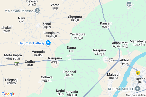
Dhunsol
Dhunsol Map
EDIT Map
Add Your House
 ..
..
Current Corona Virus Infected Patients Count in Banas Kantha District
| City Name | District Name | Total Covid cases |
|---|
Locality Name :
Dhunsol
( ધૂંસોલ )
Taluka Name : Deesa
District : Banas Kantha
State : Gujarat
Language : Gujarati and Hindi
Current Time 02:01 PM
Date: Monday , Apr 28,2025 (IST)
Time zone: IST (UTC+5:30)
Elevation / Altitude: 139 meters. Above Seal level
Telephone Code / Std Code: 02744
Assembly constituency : assembly constituency
Assembly MLA :
Lok Sabha constituency : parliamentary constituency
Parliament MP :
Serpanch Name :
Pin Code : 385535
Post Office Name : Disa Mukhya Dak Ghar
Commodities Prices : Deesa(Bhildi) Market / Mandi
Dhunsol Live Weather
Temperature: 40.3 °C
clear sky
Humidity: 17%
Wind : 4.78 mt/sec towards W
StationName : "Deesa"
observed on 2 Hours Back
Temperature: 40.3 °C
clear sky
Humidity: 17%
Wind : 4.78 mt/sec towards W
StationName : "Deesa"
observed on 2 Hours Back
Dhunsol Weather Forecast for Next 5 days
29-04-2025
27.3°C to 43.0°C
clear sky, broken clouds
27.3°C to 43.0°C
clear sky, broken clouds
30-04-2025
25.3°C to 42.4°C
scattered clouds, few clouds, clear sky
25.3°C to 42.4°C
scattered clouds, few clouds, clear sky
01-05-2025
24.8°C to 41.7°C
clear sky
24.8°C to 41.7°C
clear sky
02-05-2025
23.9°C to 40.7°C
clear sky
23.9°C to 40.7°C
clear sky
03-05-2025
23.7°C to 40.6°C
clear sky, broken clouds, scattered clouds
23.7°C to 40.6°C
clear sky, broken clouds, scattered clouds
National Highways Reachable To Dhunsol
Nationa High Way :NH68
Nationa High Way :NH68
Rivers Near Dhunsol
Kapra
Balaram
Kapra
Balaram
About Dhunsol
Correct below Info and add more info about DhunsolDhunsol is a Village in Deesa Taluka in Banas Kantha District of Gujarat State, India. It is located 43 KM towards west from District head quarters Palanpur. 154 KM from State capital Gandhinagar
Dhunsol Pin code is 385535 and postal head office is Disa Mukhya Dak Ghar .
Dhunsol is surrounded by Dantivada Taluka towards East , Dhanera Taluka towards North , Deodar Taluka towards west , Palanpur Taluka towards East .
Deesa , Palanpur , Tharad , Patan are the near by Cities to Dhunsol.
Dhunsol 2011 Census Details
Dhunsol Local Language is Gujarati. Dhunsol Village Total population is 4177 and number of houses are 647. Female Population is 48.1%. Village literacy rate is 43.4% and the Female Literacy rate is 15.7%.
Population
| Census Parameter | Census Data |
| Total Population | 4177 |
| Total No of Houses | 647 |
| Female Population % | 48.1 % ( 2011) |
| Total Literacy rate % | 43.4 % ( 1814) |
| Female Literacy rate | 15.7 % ( 656) |
| Scheduled Tribes Population % | 0.1 % ( 3) |
| Scheduled Caste Population % | 4.3 % ( 180) |
| Working Population % | 44.2 % |
| Child(0 -6) Population by 2011 | 771 |
| Girl Child(0 -6) Population % by 2011 | 48.5 % ( 374) |
Dhunsol Census More Deatils.
HOW TO REACH Dhunsol
By Rail
Jenal Rail Way Station is the very nearby railway stations to Dhunsol.Colleges near Dhunsol
D.n.p. Arts&com.college Deesa
Address :
Schools in Dhunsol
Dhunsol Pri. Sch.
Address : dhunsol , deesa , banas kantha , Gujarat . PIN- 385535 , Post - Disa Mukhya Dak Ghar
Govt Health Centers near Dhunsol
1) Rah , chc rah , rah chc building , by highway2) Vadgam , CHC Building , Main Bus stand bazar , On Kheralu road
3) SDH Tharad , SDH tharad , by road , highway tharad
Petrol Bunks in Dhunsol,Deesa
jay Bharmani Petroleum Rampura
bharmani petroleum rampura tharad rod deesa palanpur; India
3.7 KM distance Detail
more ..
Colleges in Dhunsol,Deesa
Krishna Distributors
Service Rd; Gulbani Nagar; Deesa; Gujarat 385535; India
11.9 KM distance Detail
Swami Vivekanand Peramedical Nursing Institute
gaytri mandir road; Deesa; Gujarat 385535; India
12.0 KM distance Detail
panchshil secondary school
Near sport clab;gayatri mandir road;Deesa; Deesa; Gujarat 385535; India
12.5 KM distance Detail
more ..
Super Markets in Dhunsol,Deesa
Gomata Gau Seva Trust
Disa - Tharad Road; Tekara; Deesa; Gujarat 385535; India
3.6 KM distance Detail
Local Parks in Dhunsol,Deesa
Hotel Anantara Greens
NH-27; Behind Teeve Trading Petrol Pump; Tekara; Deesa; Gujarat 385535; India
10.7 KM distance Detail
Ratna park
Ratna Park B/H Unnati Park B/H P. K. Party Plot Highway; Deesa; Gujarat 385535; India
11.8 KM distance Detail
Governement Offices near Dhunsol,Deesa
Indian Meteorological Department
Banaskantha; NH-14; Banaskantha Road; Deesa; Gujarat 385535; India
11.7 KM distance Detail
શ્રી સાંચોરી ઔદિચ્ય સહસ્ત્ર બ્રાહ્મણ સમાજ વિકાસ સંઘ;ડીસા (શ્રી ખેતેશ્વર ભવન;ડીસા)
Opposite Gayatri Temple;Near; NH 27; Gulbani Nagar; Deesa; Gujarat 385535; India
11.9 KM distance Detail
VISA FOREX
10-11; Shreeji Arcade; B/h Jalaram Bhojanalay; Deesa Highway Road; Deesa; Gujarat 385535; India
12.3 KM distance Detail
About Dhunsol &
History
How to reach Dhunsol
Tourist Places Near By Dhunsol
Schools in Dhunsol
Colleges in Dhunsol
Temperature & weather of Dhunsol
places in Dhunsol
Dhunsol photos
More Information
How to reach Dhunsol
Tourist Places Near By Dhunsol
Schools in Dhunsol
Colleges in Dhunsol
Temperature & weather of Dhunsol
places in Dhunsol
Dhunsol photos
More Information
Village Talk
Post News or Events about this Village
Near Cities
Deesa 13 KM near
Palanpur 43 KM near
Tharad 53 KM near
Patan 55 KM near
Deesa 13 KM near
Palanpur 43 KM near
Tharad 53 KM near
Patan 55 KM near
Near By Taluks
Deesa 0 KM near
Dantivada 30 KM near
Dhanera 33 KM near
Deodar 38 KM near
Deesa 0 KM near
Dantivada 30 KM near
Dhanera 33 KM near
Deodar 38 KM near
Near By Air Ports
Ahmedabad Airport 165 KM near
Dabok Airport 208 KM near
Jodhpur Airport 267 KM near
Kandla Airport 270 KM near
Ahmedabad Airport 165 KM near
Dabok Airport 208 KM near
Jodhpur Airport 267 KM near
Kandla Airport 270 KM near
Near By Tourist Places
Banaskantha 41 KM near
Patan 58 KM near
Danta Ambaji 74 KM near
Mount Abu 79 KM near
Ambaji 86 KM near
Banaskantha 41 KM near
Patan 58 KM near
Danta Ambaji 74 KM near
Mount Abu 79 KM near
Ambaji 86 KM near
Near By Districts
Banas Kantha 41 KM near
Patan 56 KM near
Mahesana 93 KM near
Sirohi 113 KM near
Banas Kantha 41 KM near
Patan 56 KM near
Mahesana 93 KM near
Sirohi 113 KM near
Near By RailWay Station
Jenal Rail Way Station 7.1 KM near
Disa Rail Way Station 12 KM near
Bhildi Junction Rail Way Station 15 KM near
Jenal Rail Way Station 7.1 KM near
Disa Rail Way Station 12 KM near
Bhildi Junction Rail Way Station 15 KM near