| Home | City Bus | Maps | Villages | Cities | Rail | Tourist Places | School | College | Pin Codes | Corona Cases Count |
| Distance Calculator Bus Services IFSC Codes Trace Mobile Number Weather Search Place Trace IP Available Cash ATM/Banks Locate Polling Booth Report an Error contact People |
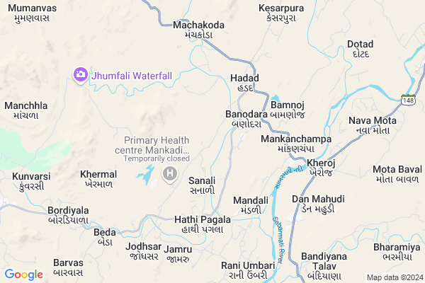
Amloi
Amloi Map
EDIT Map
Add Your House
 ..
..
Current Corona Virus Infected Patients Count in Banas Kantha District
| City Name | District Name | Total Covid cases |
|---|
Locality Name :
Amloi
( અમલો )
Taluka Name : Danta
District : Banas Kantha
State : Gujarat
Language : Gujarati and Hindi
Current Time 06:23 PM
Date: Wednesday , Feb 05,2025 (IST)
Time zone: IST (UTC+5:30)
Elevation / Altitude: 216 meters. Above Seal level
Telephone Code / Std Code: 02749
Assembly constituency : Danta assembly constituency
Assembly MLA : Kantibhai Kalabhai Kharadi
Lok Sabha constituency : Banaskantha parliamentary constituency
Parliament MP : PARBATBHAI SAVABHAI PATEL
Serpanch Name :
Pin Code : 385120
Post Office Name : Danta Bhavangadh
Main Village Name : Amloi
Commodities Prices : Khedbrahma Market / Mandi
Amloi Live Weather
Temperature: 21.4 °C
clear sky
Humidity: 15%
Wind : 4.32 mt/sec towards N
StationName : "Khedbrahma"
observed on Now
Temperature: 21.4 °C
clear sky
Humidity: 15%
Wind : 4.32 mt/sec towards N
StationName : "Khedbrahma"
observed on Now
Amloi Weather Forecast for Next 5 days
06-02-2025
13.5°C to 23.0°C
clear sky
13.5°C to 23.0°C
clear sky
07-02-2025
12.6°C to 29.0°C
clear sky
12.6°C to 29.0°C
clear sky
08-02-2025
13.3°C to 30.1°C
clear sky, broken clouds, few clouds, overcast clouds
13.3°C to 30.1°C
clear sky, broken clouds, few clouds, overcast clouds
09-02-2025
16.2°C to 31.6°C
overcast clouds
16.2°C to 31.6°C
overcast clouds
10-02-2025
17.8°C to 33.6°C
overcast clouds, clear sky, few clouds, scattered clouds, broken clouds
17.8°C to 33.6°C
overcast clouds, clear sky, few clouds, scattered clouds, broken clouds
Rivers Near Amloi
Kapra
Som
Kapra
Som
About Amloi
Correct below Info and add more info about AmloiAmloi is a small Village/hamlet in Danta Taluka in Banas Kantha District of Gujarat State, India. It comes under Amloi Panchayath. It is located 63 KM towards East from District head quarters Palanpur. 12 KM from Danta. 136 KM from State capital Gandhinagar
Amloi Pin code is 385120 and postal head office is Danta Bhavangadh .
Hadad ( 4 KM ) , Bamnoj ( 4 KM ) , Mankanchampa ( 5 KM ) , Khermal ( 6 KM ) , Jodhsar ( 6 KM ) are the nearby Villages to Amloi. Amloi is surrounded by Khedbrahma Taluka towards South , Satlasna Taluka towards South , Kotra Taluka towards East , Abu Road Taluka towards North .
Khedbrahma , Idar , Mount Abu , Palanpur are the near by Cities to Amloi.
This Place is in the border of the Banas Kantha District and Sirohi District. Sirohi District Abu Road is North towards this place . It is near to the Rajasthan State Border.
Amloi 2011 Census Details
Amloi Local Language is Gujarati. Amloi Village Total population is 600 and number of houses are 94. Female Population is 46.8%. Village literacy rate is 50.2% and the Female Literacy rate is 18.7%.
Population
| Census Parameter | Census Data |
| Total Population | 600 |
| Total No of Houses | 94 |
| Female Population % | 46.8 % ( 281) |
| Total Literacy rate % | 50.2 % ( 301) |
| Female Literacy rate | 18.7 % ( 112) |
| Scheduled Tribes Population % | 96.5 % ( 579) |
| Scheduled Caste Population % | 0.0 % ( 0) |
| Working Population % | 47.5 % |
| Child(0 -6) Population by 2011 | 152 |
| Girl Child(0 -6) Population % by 2011 | 40.8 % ( 62) |
Amloi Census More Deatils.
Politics in Amloi
Bharatiya Janata Party , BJP , INC are the major political parties in this area.Polling Stations /Booths near Amloi
1)Toda2)Navavas-12
3)Bamanoj
4)Rabarna
5)Manpuriya-12
HOW TO REACH Amloi
By Rail
There is no railway station near to Amloi in less than 10 km.Colleges near Amloi
Vimla Vikas Vartul Gadh
Address :
D.n.p. Arts&com.college Deesa
Address :
I.t.i Collage Morthal
Address : Gram Panchayat Morthal
Dharti Education Academy , Tharad
Address : 2nd Floor, Jalaram Complex, Near Bus Station, Tharad, Banaskantha, 385565
Bkm Law College
Address : Opp.s.t.work Shop, Highway,palanpur,dist.banaskant
Schools in Amloi
Amloi Pri. Sch.
Address : amloi , danta , banas kantha , Gujarat . PIN- 385110 , Post - Ambaji
Govt Health Centers near Amloi
1) VIRAMPUR , NEAR BUS STAND , NEAR BUS STAND , NEAR BUS STAND2) Moriya , CHC Building , On Mumanvas road , Near water tank
3) Amirgadh - T , CHC AMIRGADH , CHC AMIRGADH , CHC AMIRGADH ROAD
Hospitals in Amloi,Danta
Primary Health Centre
Bubadiyana Chhapran; Sabarkantha; NH-76A; Kotra Idar Road; Khedbrahma; Khedbrahma; Gujarat 383270; India
13.1 KM distance Detail
more ..
Petrol Bunks in Amloi,Danta
Reliance Petroleum
SURVEY NO 78/3; VILLAGE AMBAJI; Ambaji; Gujarat 385110; India
17.5 KM distance Detail
BHAVANI AUTOMOBILES
AMBAJI; OPP. AMBAJI TEMPLE; BANASKAHTHA; Gujarat 385110; India
18.1 KM distance Detail
more ..
Colleges in Amloi,Danta
Shri Dr. Ratilal Kanjibhai Patel & KKP B.Ed college
Hadad; Data Taluk; Banaskantha; Gujarat 385110; India
3.9 KM distance Detail
Shree Ambaji Arts College
Kumbhariya; Danta Highway; Ambaji; Banaskantha; Gujarat 385110; India
16.0 KM distance Detail
Ambaji Arts & Commerce College
opp. Hospital; Danta road;; Ambaji; Gujarat 385110; India
16.9 KM distance Detail
Arasuri College Of Science
Shaktidhara Society; Ambaji; Gujarat 385110; India
17.4 KM distance Detail
more ..
Governement Offices near Amloi,Danta
LinkedIn Advertisements
S/O. PARSHOTTAMBHAI GHANSHYAMDAS SHARMA AMBAJI VILLAGE; BLOCK; Danta; Palanpur; Ambaji; Gujarat 385110; India
17.5 KM distance Detail
Milan Transport service
Krishna Palace near Koteshwar Road; Ambaji; Ambaji; Gujarat 385110; India
17.5 KM distance Detail
Doordarshan Relay Center
Banaskantha; SH-56; Banaskantha Road; Banaskantha; Banaskantha; Gujarat 385110; India
17.5 KM distance Detail
About Amloi &
History
How to reach Amloi
Tourist Places Near By Amloi
Schools in Amloi
Colleges in Amloi
Temperature & weather of Amloi
places in Amloi
Amloi photos
More Information
How to reach Amloi
Tourist Places Near By Amloi
Schools in Amloi
Colleges in Amloi
Temperature & weather of Amloi
places in Amloi
Amloi photos
More Information
Village Talk
Post News or Events about this Village
Near Cities
Khedbrahma 26 KM near
Idar 49 KM near
Mount Abu 52 KM near
Palanpur 58 KM near
Khedbrahma 26 KM near
Idar 49 KM near
Mount Abu 52 KM near
Palanpur 58 KM near
Near By Taluks
Danta 12 KM near
Khedbrahma 18 KM near
Kotra 35 KM near
Satlasna 36 KM near
Danta 12 KM near
Khedbrahma 18 KM near
Kotra 35 KM near
Satlasna 36 KM near
Near By Air Ports
Dabok Airport 115 KM near
Ahmedabad Airport 151 KM near
Vadodara Airport 239 KM near
Jodhpur Airport 252 KM near
Dabok Airport 115 KM near
Ahmedabad Airport 151 KM near
Vadodara Airport 239 KM near
Jodhpur Airport 252 KM near
Near By Tourist Places
Ambaji 17 KM near
Danta Ambaji 26 KM near
Mount Abu 52 KM near
Banaskantha 60 KM near
Sirohi 77 KM near
Ambaji 17 KM near
Danta Ambaji 26 KM near
Mount Abu 52 KM near
Banaskantha 60 KM near
Sirohi 77 KM near
Near By Districts
Banas Kantha 60 KM near
Sabar Kantha 80 KM near
Sirohi 81 KM near
Udaipur 94 KM near
Banas Kantha 60 KM near
Sabar Kantha 80 KM near
Sirohi 81 KM near
Udaipur 94 KM near
Near By RailWay Station
Abu Road Rail Way Station 35 KM near
Palanpur Junction Rail Way Station 60 KM near
Abu Road Rail Way Station 35 KM near
Palanpur Junction Rail Way Station 60 KM near