| Home | City Bus | Maps | Villages | Cities | Rail | Tourist Places | School | College | Pin Codes | Corona Cases Count |
| Distance Calculator Bus Services IFSC Codes Trace Mobile Number Weather Search Place Trace IP Available Cash ATM/Banks Locate Polling Booth Report an Error contact People |
Parasrampur
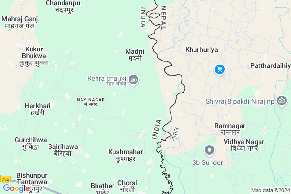
Parasrampur Map
EDIT Map
Add Your House
 ..
..
Current Corona Virus Infected Patients Count in Balrampur District
| City Name | District Name | Total Covid cases |
|---|---|---|
| Balrampur District | Balrampur | 1 |
Locality Name :
Parasrampur
( परसरामपुर )
Block Name : Pachpedwa
District : Balrampur
State : Uttar Pradesh
Division : Devipatan
Language : Hindi and Urdu
Current Time 11:01 AM
Date: Monday , Apr 28,2025 (IST)
Time zone: IST (UTC+5:30)
Elevation / Altitude: 116 meters. Above Seal level
Telephone Code / Std Code: 05265
Assembly constituency : Gainsari assembly constituency
Assembly MLA : Dr. Shiv Pratap Yadav
Lok Sabha constituency : Shravasti parliamentary constituency
Parliament MP : RAM SHIROMANI
Serpanch Name :
Pin Code : 271206
Post Office Name : Pachperwa
Commodities Prices : Panchpedwa Market / Mandi
Rivers Near Parasrampur
Sotwa Nala
Banganga
Sotwa Nala
Banganga
About Parasrampur
Correct below Info and add more info about ParasrampurParasrampur is a Village in Pachpedwa Block in Balrampur District of Uttar Pradesh State, India. It belongs to Devipatan Division . It is located 66 KM towards East from District head quarters Balrampur. 12 KM from Pachpedwa. 227 KM from State capital Lucknow
Parasrampur Pin code is 271206 and postal head office is Pachperwa .
Kushmahar ( 4 KM ) , Pokhar Bhitwa ( 5 KM ) , Dhamauli ( 5 KM ) , Dhamauli ( 5 KM ) , Farendi ( 6 KM ) are the nearby Villages to Parasrampur. Parasrampur is surrounded by Barhni Block towards South , Gaisri Block towards west , Itwa Block towards South , Shoharatgarh Block towards East .
Tulsipur , Utraula , Tetri Bazar , Balrampur are the near by Cities to Parasrampur.
This Place is in the border of the Balrampur District and Siddharth Nagar District. Siddharth Nagar District Barhni is South towards this place .
Parasrampur 2011 Census Details
Parasrampur Local Language is Hindi. Parasrampur Village Total population is 1275 and number of houses are 205. Female Population is 47.5%. Village literacy rate is 35.1% and the Female Literacy rate is 12.3%.
Population
| Census Parameter | Census Data |
| Total Population | 1275 |
| Total No of Houses | 205 |
| Female Population % | 47.5 % ( 606) |
| Total Literacy rate % | 35.1 % ( 447) |
| Female Literacy rate | 12.3 % ( 157) |
| Scheduled Tribes Population % | 1.4 % ( 18) |
| Scheduled Caste Population % | 22.6 % ( 288) |
| Working Population % | 43.9 % |
| Child(0 -6) Population by 2011 | 254 |
| Girl Child(0 -6) Population % by 2011 | 51.6 % ( 131) |
Parasrampur Census More Deatils.
Politics in Parasrampur
BJP , SP , BSP are the major political parties in this area.Polling Stations /Booths near Parasrampur
1)P.p. Ratanpur Room 22)P.p.mankuora Kashiram North
3)P.p. Hajjideah M0 Mangurahva
4)P.p. Dhawayee Extra Room
5)P.p. Deeh Surat Singh Room 2
HOW TO REACH Parasrampur
By Rail
Trilokpur Rail Way Station , Pachperwa Rail Way Station are the very nearby railway stations to Parasrampur.Colleges near Parasrampur
Lok Manya Tilak Inter College
Address : Nai Bazar Pachperwa
Schools near Parasrampur
Noor Public Inter College Gainsari
Address : Gainsari bazaar jarwa Road balrampur
Madarsa Ahle Sunnat Darul Uloom Gausiya
Address : Gurchihwa
Madarsa Anwarul Uloom
Address : Near Aslam kirana store
Govt Health Centers near Parasrampur
1) Main Sub Center , , ,2) PHC Badhani , , ,
3) Khurhuriya , , ,
Sub Villages in Parasrampur
Hospitals in Parasrampur,Pachpedwa
CHAUDHARY NEURO&GYANO HOSPITAL
Barhani - Pachperwa Rd; Shankerpur Kalan; Uttar Pradesh 272201; India
9.9 KM distance Detail
Sachin Medical
Laxminagar - Malda Rd; Pachperwa; Uttar Pradesh 272201; India
10.0 KM distance Detail
Aisha health care centre ; Dr. Afzal Hussain
Pachperwa; Uttar Pradesh 271206; India
11.0 KM distance Detail
more ..
Petrol Bunks in Parasrampur,Pachpedwa
Reliance Petroleum
PACHPERWA BARHNI MARG; SIRSIA BALRAMPUR; TULSIPUR; BALRAMPUR; Tulsipur; Uttar Pradesh 271201; India
12.6 KM distance Detail
JAI BAJRANG AUTOMOBILES.
PANCHPERWA DIST:-BALRAMPUR; Balrampur; Uttar Pradesh 271201; India
12.7 KM distance Detail
more ..
Colleges in Parasrampur,Pachpedwa
Ayesha Siddiqua Girls College; Krishna Nagar; Nepal
Rahmani Nagar road; Krishnanagar 32800; Nepal
12.0 KM distance Detail
more ..
Schools in Parasrampur,Pachpedwa
Amaanat School
Barhani - Pachperwa Rd; Shankerpur Kalan; Uttar Pradesh 272201; India
8.9 KM distance Detail
วัดสิทธารถ ราชมณเทียร
Barhani - Pachperwa Rd; Shankerpur Kalan; Uttar Pradesh 272201; India
10.2 KM distance Detail
Electronic Shops in Parasrampur,Pachpedwa
Sonu Mobile Shop Ppw
Barhani - Pachperwa Rd; Shankerpur Kalan; Uttar Pradesh 272201; India
10.0 KM distance Detail
Governement Offices near Parasrampur,Pachpedwa
JAN SEWA KENDRA SHANKARPUR KALAN
Barhani - Pachperwa Rd; Shankerpur Kalan; Uttar Pradesh 271206; India
10.2 KM distance Detail
Tax Office Of Of Kapilvastu District; Nepal
32815; Krishnanagar 32815; Nepal
12.7 KM distance Detail
About Parasrampur &
History
How to reach Parasrampur
Tourist Places Near By Parasrampur
Schools in Parasrampur
Colleges in Parasrampur
Temperature & weather of Parasrampur
places in Parasrampur
Parasrampur photos
More Information
How to reach Parasrampur
Tourist Places Near By Parasrampur
Schools in Parasrampur
Colleges in Parasrampur
Temperature & weather of Parasrampur
places in Parasrampur
Parasrampur photos
More Information
Village Talk
Post News or Events about this Village
Near Cities
Tulsipur 35 KM near
Utraula 47 KM near
Tetri Bazar 54 KM near
Balrampur 63 KM near
Tulsipur 35 KM near
Utraula 47 KM near
Tetri Bazar 54 KM near
Balrampur 63 KM near
Near By Taluks
Pachpedwa 12 KM near
Barhni 19 KM near
Gaisri 25 KM near
Itwa 28 KM near
Pachpedwa 12 KM near
Barhni 19 KM near
Gaisri 25 KM near
Itwa 28 KM near
Near By Air Ports
Gorakhpur Airport 130 KM near
Amausi Airport 228 KM near
Varanasi Airport 265 KM near
Bamrauli Airport 288 KM near
Gorakhpur Airport 130 KM near
Amausi Airport 228 KM near
Varanasi Airport 265 KM near
Bamrauli Airport 288 KM near
Near By Tourist Places
Kapilvastu 30 KM near
Sravasti 84 KM near
Basti 95 KM near
Ayodhya 113 KM near
Faizabad 118 KM near
Kapilvastu 30 KM near
Sravasti 84 KM near
Basti 95 KM near
Ayodhya 113 KM near
Faizabad 118 KM near
Near By Districts
Siddharth Nagar 54 KM near
Balrampur 63 KM near
Shravasti 77 KM near
Basti 97 KM near
Siddharth Nagar 54 KM near
Balrampur 63 KM near
Shravasti 77 KM near
Basti 97 KM near
Near By RailWay Station
Barhni Rail Way Station 12 KM near
Shohratgarh Rail Way Station 34 KM near
Barhni Rail Way Station 12 KM near
Shohratgarh Rail Way Station 34 KM near