| Home | City Bus | Maps | Villages | Cities | Rail | Tourist Places | School | College | Pin Codes | Corona Cases Count |
| Distance Calculator Bus Services IFSC Codes Trace Mobile Number Weather Search Place Trace IP Available Cash ATM/Banks Locate Polling Booth Report an Error contact People |
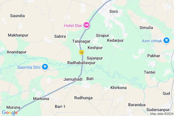
Kashaba Map
EDIT Map
Add Your House
 ..
..
Current Corona Virus Infected Patients Count in Baleshwar District
| City Name | District Name | Total Covid cases |
|---|
Locality Name :
Kashaba
( କଷବା )
Tehsil Name : Soro
District : Baleshwar
State : Odisha
Language : Oriya and Hindi
Current Time 11:16 AM
Date: Sunday , Apr 27,2025 (IST)
Time zone: IST (UTC+5:30)
Elevation / Altitude: 14 meters. Above Seal level
Telephone Code / Std Code: 06788
Assembly constituency : Soro assembly constituency
Assembly MLA : parshuram dhada
Lok Sabha constituency : Bhadrak parliamentary constituency
Parliament MP : MANJULATA MANDAL
Serpanch Name :
Pin Code : 756055
Post Office Name : Chakabarahapur
Commodities Prices : Barikpur Market / Mandi
Kashaba Live Weather
Temperature: 36.8 °C
overcast clouds
Humidity: 27%
Wind : 5.51 mt/sec towards W
StationName : "BÄ\u0081sudebpur"
observed on 1 Hours Back
Temperature: 36.8 °C
overcast clouds
Humidity: 27%
Wind : 5.51 mt/sec towards W
StationName : "BÄ\u0081sudebpur"
observed on 1 Hours Back
Kashaba Weather Forecast for Next 5 days
28-04-2025
30.1°C to 41.8°C
overcast clouds
30.1°C to 41.8°C
overcast clouds
29-04-2025
24.3°C to 38.0°C
overcast clouds, few clouds, light rain, moderate rain, broken clouds
24.3°C to 38.0°C
overcast clouds, few clouds, light rain, moderate rain, broken clouds
30-04-2025
23.7°C to 36.5°C
broken clouds, clear sky, light rain, moderate rain, overcast clouds
23.7°C to 36.5°C
broken clouds, clear sky, light rain, moderate rain, overcast clouds
01-05-2025
23.6°C to 34.7°C
broken clouds, clear sky, few clouds, light rain, heavy intensity rain, overcast clouds, scattered clouds
23.6°C to 34.7°C
broken clouds, clear sky, few clouds, light rain, heavy intensity rain, overcast clouds, scattered clouds
02-05-2025
21.6°C to 33.2°C
scattered clouds, clear sky, light rain, heavy intensity rain, overcast clouds
21.6°C to 33.2°C
scattered clouds, clear sky, light rain, heavy intensity rain, overcast clouds
National Highways Reachable To Kashaba
Nationa High Way :NH16
Nationa High Way :NH16
Rivers Near Kashaba
Salandi
Gonda
Salandi
Gonda
About Kashaba
Correct below Info and add more info about KashabaKashaba is a small Village/hamlet in Soro Tehsil in Baleshwar District of Odisha State, India. It is located 44 KM towards South from District head quarters Balasore. 8 KM from Soro. 160 KM from State capital Bhubaneswar
Kashaba Pin code is 756055 and postal head office is Chakabarahapur .
Bati ( 3 KM ) , Kedarpur ( 4 KM ) , Jamujhadi ( 4 KM ) , Sabira ( 5 KM ) , Chalunigan ( 7 KM ) are the nearby Villages to Kashaba. Kashaba is surrounded by Soro Tehsil towards North , Bahanaga Tehsil towards East , Oupada Tehsil towards North , Khaira Tehsil towards west .
Soro , Basudebpur , Bhadrak , Baleshwar are the near by Cities to Kashaba.
It is near to bay of bengal. There is a chance of humidity in the weather.
Kashaba 2011 Census Details
Kashaba Local Language is Oriya. Kashaba Village Total population is 524 and number of houses are 115. Female Population is 49.4%. Village literacy rate is 74.2% and the Female Literacy rate is 33.6%.
Population
| Census Parameter | Census Data |
| Total Population | 524 |
| Total No of Houses | 115 |
| Female Population % | 49.4 % ( 259) |
| Total Literacy rate % | 74.2 % ( 389) |
| Female Literacy rate | 33.6 % ( 176) |
| Scheduled Tribes Population % | 4.4 % ( 23) |
| Scheduled Caste Population % | 0.8 % ( 4) |
| Working Population % | 31.3 % |
| Child(0 -6) Population by 2011 | 63 |
| Girl Child(0 -6) Population % by 2011 | 57.1 % ( 36) |
Kashaba Census More Deatils.
Politics in Kashaba
BJD , INC are the major political parties in this area.Polling Stations /Booths near Kashaba
1)Kedarapur Girl Bidyalaya East2)Keshapur Ugup School
3)Salagan Pry. School Salagan
4)Sahaspura Ugup School
5)Banabishnupur Up School East
HOW TO REACH Kashaba
By Rail
Sabira Rail Way Station , Soro Rail Way Station are the very nearby railway stations to Kashaba.Colleges near Kashaba
Upendranath College,soro,balasore
Address :
Schools near Kashaba
Happy Home School
Address : ward no -04 , soro nac , balasore , Sikkim . PIN- 756045 , Post - Uttareswar
J. Navodaya Vidyalaya
Address : mahumuhan , soro , balasore , Sikkim . PIN- 756045 , Post - Uttareswar
S.p.g High School
Address : dandapalasa , soro , balasore , Sikkim . PIN- 756047 , Post - Turigaria
Pranbandhu High School
Address : balanga , soro , balasore , Sikkim . PIN- 756046 , Post - Anantapur (Baleswar)
Govt Health Centers near Kashaba
1) SABARANGA , , , L.I CENTRE2) Sunhat OH , Sunhat OH , Sunhat , Near SBI ATM
3) Biruhan SC , Gadadhar Panda , Biruhan , Near Biruhan AWC
Schools in Kashaba,Soro
Panasabanka UP School
PanasaBanka; Sunari; Sabira; Soro; Balalasore; Odisha 756045; India
2.3 KM distance Detail
About Kashaba &
History
How to reach Kashaba
Tourist Places Near By Kashaba
Schools in Kashaba
Colleges in Kashaba
Temperature & weather of Kashaba
places in Kashaba
Kashaba photos
More Information
How to reach Kashaba
Tourist Places Near By Kashaba
Schools in Kashaba
Colleges in Kashaba
Temperature & weather of Kashaba
places in Kashaba
Kashaba photos
More Information
Village Talk
Post News or Events about this Village
Near Cities
Soro 6 KM near
Basudebpur 14 KM near
Bhadrak 29 KM near
Baleshwar 42 KM near
Soro 6 KM near
Basudebpur 14 KM near
Bhadrak 29 KM near
Baleshwar 42 KM near
Near By Taluks
Simulia 7 KM near
Soro 8 KM near
Oupada 18 KM near
Bahanaga 19 KM near
Simulia 7 KM near
Soro 8 KM near
Oupada 18 KM near
Bahanaga 19 KM near
Near By Air Ports
Bhubaneswar Airport 156 KM near
Netaji Subhas Chandra Bose Airport 270 KM near
Ranchi Airport 302 KM near
Gaya Airport 479 KM near
Bhubaneswar Airport 156 KM near
Netaji Subhas Chandra Bose Airport 270 KM near
Ranchi Airport 302 KM near
Gaya Airport 479 KM near
Near By Tourist Places
Chandipur 50 KM near
Barehipani & Joranda Barehipani & Joranda Falls 75 KM near
Baripada 88 KM near
Digha 111 KM near
Paradeep Beach 113 KM near
Chandipur 50 KM near
Barehipani & Joranda Barehipani & Joranda Falls 75 KM near
Baripada 88 KM near
Digha 111 KM near
Paradeep Beach 113 KM near
Near By Districts
Bhadrak 27 KM near
Baleshwar 42 KM near
Jajapur 60 KM near
Mayurbhanj 87 KM near
Bhadrak 27 KM near
Baleshwar 42 KM near
Jajapur 60 KM near
Mayurbhanj 87 KM near
Near By RailWay Station
Sabira Rail Way Station 3.6 KM near
Soro Rail Way Station 8.8 KM near
Markona Rail Way Station 9.0 KM near
Bhadrak Rail Way Station 24 KM near
Sabira Rail Way Station 3.6 KM near
Soro Rail Way Station 8.8 KM near
Markona Rail Way Station 9.0 KM near
Bhadrak Rail Way Station 24 KM near