| Home | City Bus | Maps | Villages | Cities | Rail | Tourist Places | School | College | Pin Codes | Corona Cases Count |
| Distance Calculator Bus Services IFSC Codes Trace Mobile Number Weather Search Place Trace IP Available Cash ATM/Banks Locate Polling Booth Report an Error contact People |
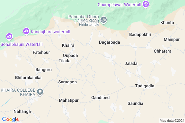
Jaipur Map
EDIT Map
Add Your House
 ..
..
Current Corona Virus Infected Patients Count in Baleshwar District
| City Name | District Name | Total Covid cases |
|---|
Locality Name :
Jaipur
( ଯଇପୁର )
Tehsil Name : Khaira
District : Baleshwar
State : Odisha
Language : Oriya and Hindi
Current Time 05:09 AM
Date: Saturday , Apr 26,2025 (IST)
Time zone: IST (UTC+5:30)
Elevation / Altitude: 14 meters. Above Seal level
Telephone Code / Std Code: 06788
Assembly constituency : Simulia assembly constituency
Assembly MLA : jyoti prakash panigrahi
Lok Sabha constituency : Bhadrak parliamentary constituency
Parliament MP : MANJULATA MANDAL
Serpanch Name :
Pin Code : 756049
Post Office Name : Oupada
Commodities Prices : Barikpur Market / Mandi
Jaipur Live Weather
Temperature: 25.8 °C
clear sky
Humidity: 85%
Wind : 2.19 mt/sec towards SW
StationName : "Soro"
observed on 1 Hours Back
Temperature: 25.8 °C
clear sky
Humidity: 85%
Wind : 2.19 mt/sec towards SW
StationName : "Soro"
observed on 1 Hours Back
Jaipur Weather Forecast for Next 5 days
27-04-2025
25.6°C to 43.3°C
clear sky, broken clouds
25.6°C to 43.3°C
clear sky, broken clouds
28-04-2025
26.8°C to 41.0°C
scattered clouds, few clouds, overcast clouds, broken clouds
26.8°C to 41.0°C
scattered clouds, few clouds, overcast clouds, broken clouds
29-04-2025
25.5°C to 40.4°C
broken clouds, overcast clouds, few clouds, scattered clouds, light rain
25.5°C to 40.4°C
broken clouds, overcast clouds, few clouds, scattered clouds, light rain
30-04-2025
20.8°C to 39.6°C
few clouds, scattered clouds, clear sky, heavy intensity rain, moderate rain, overcast clouds
20.8°C to 39.6°C
few clouds, scattered clouds, clear sky, heavy intensity rain, moderate rain, overcast clouds
National Highways Reachable To Jaipur
Nationa High Way :NH53
Nationa High Way :NH16
Nationa High Way :NH53
Nationa High Way :NH16
Rivers Near Jaipur
Brahmani :Брагмані
Salandi
Brahmani :Брагмані
Salandi
About Jaipur
Correct below Info and add more info about JaipurJaipur is a small Village/hamlet in Khaira Tehsil in Baleshwar District of Odisha State, India. It is located 49 KM towards west from District head quarters Balasore. 8 KM from Khaira. 160 KM from State capital Bhubaneswar
Jaipur Pin code is 756049 and postal head office is Oupada .
Jalada ( 4 KM ) , Aghirapada ( 5 KM ) , Gagandhuli ( 5 KM ) , Mahatipur ( 6 KM ) , Gadasahi ( 7 KM ) are the nearby Villages to Jaipur. Jaipur is surrounded by Khaira Tehsil towards South , Soro Tehsil towards East , Simulia Tehsil towards South , Kaptipada Tehsil towards North .
Soro , Basudebpur , Bhadrak , Anandapur are the near by Cities to Jaipur.
Jaipur 2011 Census Details
Jaipur Local Language is Oriya. Jaipur Village Total population is 414 and number of houses are 95. Female Population is 55.3%. Village literacy rate is 72.9% and the Female Literacy rate is 38.9%.
Population
| Census Parameter | Census Data |
| Total Population | 414 |
| Total No of Houses | 95 |
| Female Population % | 55.3 % ( 229) |
| Total Literacy rate % | 72.9 % ( 302) |
| Female Literacy rate | 38.9 % ( 161) |
| Scheduled Tribes Population % | 1.9 % ( 8) |
| Scheduled Caste Population % | 0.0 % ( 0) |
| Working Population % | 24.9 % |
| Child(0 -6) Population by 2011 | 63 |
| Girl Child(0 -6) Population % by 2011 | 52.4 % ( 33) |
Jaipur Census More Deatils.
Politics in Jaipur
BJD , INC are the major political parties in this area.Polling Stations /Booths near Jaipur
1)Sridhar Nodal U.p School2)Malhia Pry. School
3)Sampei Pry. School
4)Samsarpur Pry School
5)Nilambar Govt. High School Tudigadia
HOW TO REACH Jaipur
By Rail
There is no railway station near to Jaipur in less than 10 km.Colleges near Jaipur
Harekrushna Mahatab College,kupari
Address :
Agani Narendra Mahavidyalaya,antara
Address : Antara, Khaira,balasore
Schools in Jaipur
Jaipur Primary School
Address : jaipur , khaira , balasore , Sikkim . PIN- 756018 , Post - Khirachora Gopinath
Govt Health Centers near Jaipur
1) SABARANGA , , , L.I CENTRE2) Sarasada SC , , , AFTER SARSADA HIGH SCHOOL,NATIONAL HIGHWAY 5 SIDE
3) Sunhat OH , Sunhat OH , Sunhat , Near SBI ATM
Petrol Bunks in Jaipur,Khaira
Bharat Petroleum Petrol Pump;bpcl;jhatia
turigadia gandibed road;; Jhatia; Odisha 756047; India
4.8 KM distance Detail
more ..
Colleges in Jaipur,Khaira
Syamarai Sanskrit Mahavidyalaya
Alipur; 756182; Khaira; Balasore; Odisha; India
11.1 KM distance Detail
more ..
About Jaipur &
History
How to reach Jaipur
Tourist Places Near By Jaipur
Schools in Jaipur
Colleges in Jaipur
Temperature & weather of Jaipur
places in Jaipur
Jaipur photos
More Information
How to reach Jaipur
Tourist Places Near By Jaipur
Schools in Jaipur
Colleges in Jaipur
Temperature & weather of Jaipur
places in Jaipur
Jaipur photos
More Information
Village Talk
Post News or Events about this Village
Near Cities
Soro 18 KM near
Basudebpur 33 KM near
Bhadrak 33 KM near
Anandapur 47 KM near
Soro 18 KM near
Basudebpur 33 KM near
Bhadrak 33 KM near
Anandapur 47 KM near
Near By Taluks
Oupada 6 KM near
Khaira 7 KM near
Soro 15 KM near
Simulia 17 KM near
Oupada 6 KM near
Khaira 7 KM near
Soro 15 KM near
Simulia 17 KM near
Near By Air Ports
Bhubaneswar Airport 156 KM near
Netaji Subhas Chandra Bose Airport 275 KM near
Ranchi Airport 285 KM near
Gaya Airport 463 KM near
Bhubaneswar Airport 156 KM near
Netaji Subhas Chandra Bose Airport 275 KM near
Ranchi Airport 285 KM near
Gaya Airport 463 KM near
Near By Tourist Places
Barehipani & Joranda Barehipani & Joranda Falls 58 KM near
Chandipur 59 KM near
Baripada 80 KM near
Digha 121 KM near
Paradeep Beach 124 KM near
Barehipani & Joranda Barehipani & Joranda Falls 58 KM near
Chandipur 59 KM near
Baripada 80 KM near
Digha 121 KM near
Paradeep Beach 124 KM near
Near By Districts
Bhadrak 31 KM near
Baleshwar 47 KM near
Jajapur 62 KM near
Mayurbhanj 79 KM near
Bhadrak 31 KM near
Baleshwar 47 KM near
Jajapur 62 KM near
Mayurbhanj 79 KM near
Near By RailWay Station
Soro Rail Way Station 19 KM near
Bhadrak Rail Way Station 28 KM near
Soro Rail Way Station 19 KM near
Bhadrak Rail Way Station 28 KM near