| Home | City Bus | Maps | Villages | Cities | Rail | Tourist Places | School | College | Pin Codes | Corona Cases Count |
| Distance Calculator Bus Services IFSC Codes Trace Mobile Number Weather Search Place Trace IP Available Cash ATM/Banks Locate Polling Booth Report an Error contact People |
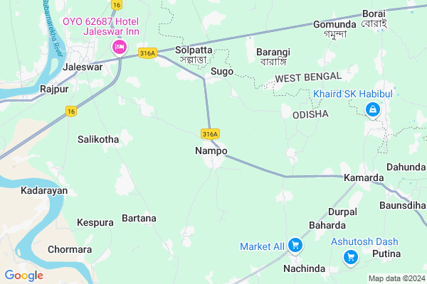
Nampo Map
EDIT Map
Add Your House
 ..
..
Current Corona Virus Infected Patients Count in Baleshwar District
| City Name | District Name | Total Covid cases |
|---|
Locality Name :
Nampo
( ନଂପୁ )
Tehsil Name : Jaleswar
District : Baleshwar
State : Odisha
Language : Oriya and Hindi
Current Time 12:31 PM
Date: Monday , Apr 28,2025 (IST)
Time zone: IST (UTC+5:30)
Elevation / Altitude: 13 meters. Above Seal level
Telephone Code / Std Code: 06781
Assembly constituency : Jaleswar assembly constituency
Assembly MLA : aswini kumar patra
Lok Sabha constituency : Balasore parliamentary constituency
Parliament MP : PRATAP CHANDRA SARANGI
Serpanch Name :
Pin Code : 756034
Post Office Name : Nampo
Commodities Prices : Jaleswar Market / Mandi
National Highways Reachable To Nampo
Nationa High Way :NH116B;SH4
Nationa High Way :NH116B;SH4
Rivers Near Nampo
Rasulpur River :রসুলপুর নদী
Budhabalanga
Rasulpur River :রসুলপুর নদী
Budhabalanga
About Nampo
Correct below Info and add more info about NampoNampo is a Village in Jaleswar Tehsil in Baleshwar District of Odisha State, India. It is located 59 KM towards East from District head quarters Balasore. 7 KM from Jaleswar. 262 KM from State capital Bhubaneswar
Nampo Pin code is 756034 and postal head office is Nampo .
Sugo ( 4 KM ) , Aruha ( 5 KM ) , Nahara ( 5 KM ) , Balim ( 7 KM ) , Nachinda ( 8 KM ) are the nearby Villages to Nampo. Nampo is surrounded by Baliapal Tehsil towards South , Bhograi Tehsil towards East , Dantan-I Tehsil towards North , Mohanpur Tehsil towards East .
Jaleswar , Contai , Balasore , Baleshwar are the near by Cities to Nampo.
This Place is in the border of the Baleshwar District and Medinipur West District. Medinipur West District Dantan-i is North towards this place . It is near to the West Bengal State Border.
Nampo 2011 Census Details
Nampo Local Language is Oriya. Nampo Village Total population is 2815 and number of houses are 620. Female Population is 47.9%. Village literacy rate is 78.5% and the Female Literacy rate is 35.0%.
Population
| Census Parameter | Census Data |
| Total Population | 2815 |
| Total No of Houses | 620 |
| Female Population % | 47.9 % ( 1348) |
| Total Literacy rate % | 78.5 % ( 2211) |
| Female Literacy rate | 35.0 % ( 985) |
| Scheduled Tribes Population % | 4.1 % ( 116) |
| Scheduled Caste Population % | 6.8 % ( 192) |
| Working Population % | 40.3 % |
| Child(0 -6) Population by 2011 | 328 |
| Girl Child(0 -6) Population % by 2011 | 44.2 % ( 145) |
Nampo Census More Deatils.
Politics in Nampo
BJP , BJD , INC are the major political parties in this area.Polling Stations /Booths near Nampo
1)Namakana Pry. School2)Nampo High School(n)
3)Nampo Me School Ambapunja
4)Nampho Pry. School
5)Nampo High School(n)
HOW TO REACH Nampo
By Rail
Jaleswar Rail Way Station , Lakshannath Road Rail Way Station are the very nearby railway stations to Nampo.Colleges near Nampo
Rural Institute Of Industrial Training Centre, Dehurda
Address :
Rural Instititue Of Indastrial Trinneng Center
Address :
Bahanaga College
Address :
Harekrushna Mahatab College,kupari
Address :
Remuna Juniur College
Address :
Schools in Nampo
A.s.g Ups, Gadpada
Address : nampo , jaleswar , balasore , Sikkim . PIN- 756034 , Post - Nampo
Kandaragadia Pry. School
Address : nampo , jaleswar , balasore , Sikkim . PIN- 756034 , Post - Nampo
Govt Health Centers near Nampo
1) Sunhat OH , Sunhat OH , Sunhat , Near SBI ATMPetrol Bunks in Nampo,Jaleswar
Baruneswar KSL Filling Station Indian Oil Petrol Pump
Sugo; Baleshwar; SH-57; Jaleswar Chandswar Road; Balasore; Balasore; Odisha 756084; India
3.2 KM distance Detail
Sugo Samrat Filling Station Bharat Petroleum
Sugo; Baleshwar; SH-57; Jaleswar Chandswar Road; Balasore; Balasore; Odisha 756084; India
3.9 KM distance Detail
more ..
Schools in Nampo,Jaleswar
Biswajit Bhaban
Near SH-57;Nampo Hato; Nampo; Jaleswar; Jaleswar; Odisha 756034; India
0.1 KM distance Detail
Super Markets in Nampo,Jaleswar
Benga bhusimal Store
Kamarda-Kantabani Rd; Sagadasahi; Kantabani; Odisha 756035; India
9.4 KM distance Detail
About Nampo &
History
How to reach Nampo
Tourist Places Near By Nampo
Schools in Nampo
Colleges in Nampo
Temperature & weather of Nampo
places in Nampo
Nampo photos
More Information
How to reach Nampo
Tourist Places Near By Nampo
Schools in Nampo
Colleges in Nampo
Temperature & weather of Nampo
places in Nampo
Nampo photos
More Information
Village Talk
Post News or Events about this Village
Near Cities
Jaleswar 7 KM near
Contai 53 KM near
Balasore 53 KM near
Baleshwar 56 KM near
Jaleswar 7 KM near
Contai 53 KM near
Balasore 53 KM near
Baleshwar 56 KM near
Near By Taluks
Jaleswar 7 KM near
Baliapal 17 KM near
Bhograi 18 KM near
Dantan-I 18 KM near
Jaleswar 7 KM near
Baliapal 17 KM near
Bhograi 18 KM near
Dantan-I 18 KM near
Near By Air Ports
Netaji Subhas Chandra Bose Airport 171 KM near
Bhubaneswar Airport 254 KM near
Ranchi Airport 297 KM near
Gaya Airport 457 KM near
Netaji Subhas Chandra Bose Airport 171 KM near
Bhubaneswar Airport 254 KM near
Ranchi Airport 297 KM near
Gaya Airport 457 KM near
Near By Tourist Places
Mandarmani 32 KM near
Digha 32 KM near
Chandipur 50 KM near
Baripada 67 KM near
Midnapore 81 KM near
Mandarmani 32 KM near
Digha 32 KM near
Chandipur 50 KM near
Baripada 67 KM near
Midnapore 81 KM near
Near By Districts
Baleshwar 56 KM near
Mayurbhanj 67 KM near
Medinipur West 81 KM near
Medinipur East 97 KM near
Baleshwar 56 KM near
Mayurbhanj 67 KM near
Medinipur West 81 KM near
Medinipur East 97 KM near
Near By RailWay Station
Jaleswar Rail Way Station 9.1 KM near
Basta Rail Way Station 27 KM near
Jaleswar Rail Way Station 9.1 KM near
Basta Rail Way Station 27 KM near