| Home | City Bus | Maps | Villages | Cities | Rail | Tourist Places | School | College | Pin Codes | Corona Cases Count |
| Distance Calculator Bus Services IFSC Codes Trace Mobile Number Weather Search Place Trace IP Available Cash ATM/Banks Locate Polling Booth Report an Error contact People |
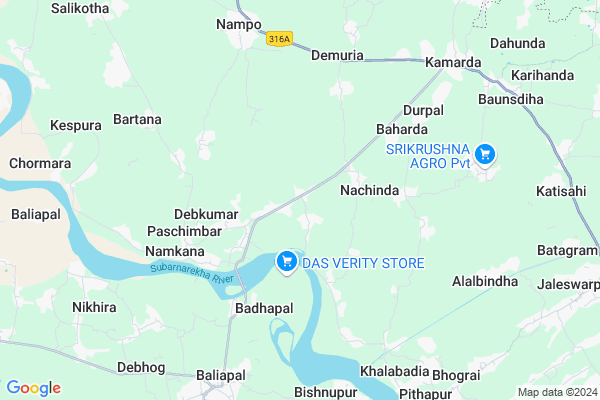
Uluda Map
EDIT Map
Add Your House
 ..
..
Current Corona Virus Infected Patients Count in Baleshwar District
| City Name | District Name | Total Covid cases |
|---|
Locality Name :
Uluda
( ଉଲୁଦା )
Tehsil Name : Bhograi
District : Baleshwar
State : Odisha
Language : Oriya and Hindi
Current Time 10:08 AM
Date: Wednesday , Apr 30,2025 (IST)
Time zone: IST (UTC+5:30)
Elevation / Altitude: 13 meters. Above Seal level
Telephone Code / Std Code: 06781
Assembly constituency : Bhograi assembly constituency
Assembly MLA : ananta das
Lok Sabha constituency : Balasore parliamentary constituency
Parliament MP : PRATAP CHANDRA SARANGI
Serpanch Name :
Commodities Prices : Jaleswar Market / Mandi
Uluda Live Weather
Temperature: 29.5 °C
clear sky
Humidity: 54%
Wind : 2.04 mt/sec towards W
StationName : "Jaleshwar"
observed on 1 Hours Back
Temperature: 29.5 °C
clear sky
Humidity: 54%
Wind : 2.04 mt/sec towards W
StationName : "Jaleshwar"
observed on 1 Hours Back
Uluda Weather Forecast for Next 5 days
01-05-2025
25.4°C to 31.7°C
clear sky, scattered clouds, light rain, broken clouds
25.4°C to 31.7°C
clear sky, scattered clouds, light rain, broken clouds
02-05-2025
25.4°C to 31.5°C
few clouds, clear sky, light rain, moderate rain, overcast clouds, scattered clouds
25.4°C to 31.5°C
few clouds, clear sky, light rain, moderate rain, overcast clouds, scattered clouds
03-05-2025
24.2°C to 30.8°C
few clouds, clear sky, scattered clouds, broken clouds
24.2°C to 30.8°C
few clouds, clear sky, scattered clouds, broken clouds
04-05-2025
25.8°C to 32.4°C
broken clouds, clear sky, light rain, overcast clouds, scattered clouds
25.8°C to 32.4°C
broken clouds, clear sky, light rain, overcast clouds, scattered clouds
05-05-2025
26.1°C to 32.7°C
few clouds, clear sky, light rain, scattered clouds
26.1°C to 32.7°C
few clouds, clear sky, light rain, scattered clouds
National Highways Reachable To Uluda
Nationa High Way :NH116B
Nationa High Way :NH116B;SH4
Nationa High Way :NH116B
Nationa High Way :NH116B;SH4
Rivers Near Uluda
Budhabalanga
Subarnarekha River
Budhabalanga
Subarnarekha River
About Uluda
Correct below Info and add more info about UludaUluda is a small Village/hamlet in Bhograi Tehsil in Baleshwar District of Odisha State, India. It is located 57 KM towards East from District head quarters Balasore. 12 KM from Bhograi. 259 KM from State capital Bhubaneswar
Kusuda ( 4 KM ) , Paschimbad ( 5 KM ) , Nahara ( 7 KM ) , Putina ( 7 KM ) , Nampo ( 7 KM ) are the nearby Villages to Uluda. Uluda is surrounded by Baliapal Tehsil towards South , Jaleswar Tehsil towards North , Basta Tehsil towards west , Mohanpur Tehsil towards North .
Jaleswar , Balasore , Contai , Baleshwar are the near by Cities to Uluda.
This Place is in the border of the Baleshwar District and Medinipur East District. Medinipur East District Ramnagar-i is East towards this place . It is near to the West Bengal State Border. It is near to bay of bengal. There is a chance of humidity in the weather.
Uluda 2011 Census Details
Uluda Local Language is Oriya. Uluda Village Total population is 2673 and number of houses are 627. Female Population is 48.4%. Village literacy rate is 64.5% and the Female Literacy rate is 27.9%.
Population
| Census Parameter | Census Data |
| Total Population | 2673 |
| Total No of Houses | 627 |
| Female Population % | 48.4 % ( 1294) |
| Total Literacy rate % | 64.5 % ( 1725) |
| Female Literacy rate | 27.9 % ( 747) |
| Scheduled Tribes Population % | 1.8 % ( 47) |
| Scheduled Caste Population % | 66.7 % ( 1782) |
| Working Population % | 55.8 % |
| Child(0 -6) Population by 2011 | 384 |
| Girl Child(0 -6) Population % by 2011 | 47.9 % ( 184) |
Uluda Census More Deatils.
Politics in Uluda
BJD is the major political party in this area.Polling Stations /Booths near Uluda
1)Patharaghata Pry.school2)Pasarabindha Pry School(e)
3)Uladi Nodal Up School
4)Ulda Pry.school
5)D.n.nodal Up School(w)
HOW TO REACH Uluda
By Rail
There is no railway station near to Uluda in less than 10 km.Pincodes near Uluda
756079 ( Dahamunda ) , 756039 ( Kakhra ) , 756034 ( Nampo )Colleges near Uluda
Rural Institute Of Industrial Training Centre, Dehurda
Address :
Rural Instititue Of Indastrial Trinneng Center
Address :
Chandnaswar Maha Vidilai Barobatia
Address :
Schools in Uluda
Chandimata N.r.u.p.s
Address : uluda , bhogarai , balasore , Sikkim . PIN- 756079 , Post - Dahamunda
Govt Health Centers near Uluda
1) Sunhat OH , Sunhat OH , Sunhat , Near SBI ATMPetrol Bunks in Uluda,Bhograi
Putineswar Filling Station Bharat Petroleum
Kamarda; Baleshwar; SH-57; Jaleswar Chandswar Road; Balasore; Balasore; Odisha 756035; India
9.3 KM distance Detail
Baruneswar KSL Filling Station Indian Oil Petrol Pump
Sugo; Baleshwar; SH-57; Jaleswar Chandswar Road; Balasore; Balasore; Odisha 756084; India
11.4 KM distance Detail
more ..
Super Markets in Uluda,Bhograi
Benga bhusimal Store
Kamarda-Kantabani Rd; Sagadasahi; Kantabani; Odisha 756035; India
9.7 KM distance Detail
Governement Offices near Uluda,Bhograi
Marriage License Bureau; Baliapal
Kalipada-Baliapal Rd; Badasimulia; Odisha 756026; India
9.1 KM distance Detail
About Uluda &
History
How to reach Uluda
Tourist Places Near By Uluda
Schools in Uluda
Colleges in Uluda
Temperature & weather of Uluda
places in Uluda
Uluda photos
More Information
How to reach Uluda
Tourist Places Near By Uluda
Schools in Uluda
Colleges in Uluda
Temperature & weather of Uluda
places in Uluda
Uluda photos
More Information
Village Talk
Post News or Events about this Village
Near Cities
Jaleswar 13 KM near
Balasore 50 KM near
Contai 51 KM near
Baleshwar 54 KM near
Jaleswar 13 KM near
Balasore 50 KM near
Contai 51 KM near
Baleshwar 54 KM near
Near By Taluks
Baliapal 11 KM near
Bhograi 12 KM near
Jaleswar 13 KM near
Basta 20 KM near
Baliapal 11 KM near
Bhograi 12 KM near
Jaleswar 13 KM near
Basta 20 KM near
Near By Air Ports
Netaji Subhas Chandra Bose Airport 174 KM near
Bhubaneswar Airport 251 KM near
Ranchi Airport 303 KM near
Gaya Airport 464 KM near
Netaji Subhas Chandra Bose Airport 174 KM near
Bhubaneswar Airport 251 KM near
Ranchi Airport 303 KM near
Gaya Airport 464 KM near
Near By Tourist Places
Digha 26 KM near
Mandarmani 28 KM near
Chandipur 46 KM near
Baripada 72 KM near
Midnapore 88 KM near
Digha 26 KM near
Mandarmani 28 KM near
Chandipur 46 KM near
Baripada 72 KM near
Midnapore 88 KM near
Near By Districts
Baleshwar 54 KM near
Mayurbhanj 71 KM near
Medinipur West 88 KM near
Medinipur East 101 KM near
Baleshwar 54 KM near
Mayurbhanj 71 KM near
Medinipur West 88 KM near
Medinipur East 101 KM near
Near By RailWay Station
Jaleswar Rail Way Station 15 KM near
Digha Rail Way Station 25 KM near
Jaleswar Rail Way Station 15 KM near
Digha Rail Way Station 25 KM near