| Home | City Bus | Maps | Villages | Cities | Rail | Tourist Places | School | College | Pin Codes | Corona Cases Count |
| Distance Calculator Bus Services IFSC Codes Trace Mobile Number Weather Search Place Trace IP Available Cash ATM/Banks Locate Polling Booth Report an Error contact People |
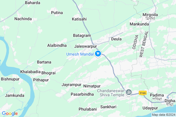
Naguan Map
EDIT Map
Add Your House
 ..
..
Current Corona Virus Infected Patients Count in Baleshwar District
| City Name | District Name | Total Covid cases |
|---|
Locality Name :
Naguan
( ନାଗୁଆନ )
Tehsil Name : Bhograi
District : Baleshwar
State : Odisha
Language : Oriya and Hindi
Current Time 08:40 AM
Date: Wednesday , Apr 30,2025 (IST)
Time zone: IST (UTC+5:30)
Elevation / Altitude: 13 meters. Above Seal level
Telephone Code / Std Code: 06781
Assembly constituency : Bhograi assembly constituency
Assembly MLA : ananta das
Lok Sabha constituency : Balasore parliamentary constituency
Parliament MP : PRATAP CHANDRA SARANGI
Serpanch Name :
Pin Code : 756039
Post Office Name : Kakhra
Commodities Prices : Jaleswar Market / Mandi
Naguan Live Weather
Temperature: 29.5 °C
clear sky
Humidity: 54%
Wind : 2.44 mt/sec towards W
StationName : "Digha"
observed on Now
Temperature: 29.5 °C
clear sky
Humidity: 54%
Wind : 2.44 mt/sec towards W
StationName : "Digha"
observed on Now
Naguan Weather Forecast for Next 5 days
01-05-2025
25.6°C to 32.4°C
clear sky, scattered clouds, light rain, broken clouds
25.6°C to 32.4°C
clear sky, scattered clouds, light rain, broken clouds
02-05-2025
25.6°C to 31.7°C
few clouds, clear sky, light rain, overcast clouds, scattered clouds
25.6°C to 31.7°C
few clouds, clear sky, light rain, overcast clouds, scattered clouds
03-05-2025
24.7°C to 31.0°C
scattered clouds, clear sky, few clouds, overcast clouds
24.7°C to 31.0°C
scattered clouds, clear sky, few clouds, overcast clouds
04-05-2025
25.7°C to 32.5°C
broken clouds, clear sky, light rain, overcast clouds
25.7°C to 32.5°C
broken clouds, clear sky, light rain, overcast clouds
05-05-2025
26.2°C to 32.7°C
scattered clouds, clear sky, light rain, few clouds
26.2°C to 32.7°C
scattered clouds, clear sky, light rain, few clouds
National Highways Reachable To Naguan
Nationa High Way :NH116B
Nationa High Way :NH116B;SH4
Nationa High Way :NH116B
Nationa High Way :NH116B;SH4
Rivers Near Naguan
Budhabalanga
Subarnarekha River
Budhabalanga
Subarnarekha River
About Naguan
Correct below Info and add more info about NaguanNaguan is a small Village/hamlet in Bhograi Tehsil in Baleshwar District of Odisha State, India. It is located 65 KM towards East from District head quarters Balasore. 263 KM from State capital Bhubaneswar
Naguan Pin code is 756039 and postal head office is Kakhra .
Naguan is surrounded by Ramnagar-I Tehsil towards East , Baliapal Tehsil towards west , Mohanpur Tehsil towards North , Ramnagar-Ii Tehsil towards East .
Jaleswar , Contai , Balasore , Baleshwar are the near by Cities to Naguan.
This Place is in the border of the Baleshwar District and Medinipur East District. Medinipur East District Ramnagar-i is East towards this place . It is near to the West Bengal State Border. It is near to bay of bengal. There is a chance of humidity in the weather.
Demographics of Naguan
Oriya is the Local Language here.Politics in Naguan
BJD is the major political party in this area.Polling Stations /Booths near Naguan
1)Dakhinateghari Nodal Up School(e)2)Sultanpur Pry.schoool
3)Sunadharabasan Pry.school
4)Gambharia Pry School
5)H.c.academy Bhograi
HOW TO REACH Naguan
By Rail
There is no railway station near to Naguan in less than 10 km.Colleges near Naguan
Rural Institute Of Industrial Training Centre, Dehurda
Address :
Rural Instititue Of Indastrial Trinneng Center
Address :
Chandnaswar Maha Vidilai Barobatia
Address :
Schools near Naguan
Anadi Academy
Address : kanthibhaunri , bhogarai , balasore , Sikkim . PIN- 756037 , Post - Fulbani
Baga High School
Address : jaldha , bhogarai , balasore , Sikkim . PIN- 756035 , Post - Kamarda
Shantilata Gils High School
Address : mahagab , bhogarai , balasore , Sikkim . PIN- 756035 , Post - Kamarda
Pitabas Das Girls High School
Address : aruhabrutti no-i , bhogarai , balasore , Sikkim . PIN- 756079 , Post - Dahamunda
Govt Health Centers near Naguan
1) Sunhat OH , Sunhat OH , Sunhat , Near SBI ATMPetrol Bunks in Naguan,Bhograi
Indian Oil Petrol Pump Jagannathpur
Jaleswar-Chandaneswar Rd; Biswanathpur; Odisha 756085; India
6.0 KM distance Detail
Gayatri KSK Filling Station Indian Oil Petrol Pump
Bagada; Baleshwar; SH-57; Jaleswar Chandswar Road; Balasore; Balasore; Odisha 756083; India
6.1 KM distance Detail
more ..
Electronic Shops in Naguan,Bhograi
Cm telecom/mumbai fashion zone
College Rd; Chakbadajaleswarpur; Odisha 756036; India
1.4 KM distance Detail
Governement Offices near Naguan,Bhograi
Panchayat Samiti Office (Block); Bhograi; Balasore
Jaleswarpur; Odisha 756036; India
1.2 KM distance Detail
About Naguan &
History
How to reach Naguan
Tourist Places Near By Naguan
Schools in Naguan
Colleges in Naguan
Temperature & weather of Naguan
places in Naguan
Naguan photos
More Information
How to reach Naguan
Tourist Places Near By Naguan
Schools in Naguan
Colleges in Naguan
Temperature & weather of Naguan
places in Naguan
Naguan photos
More Information
Village Talk
Post News or Events about this Village
Near Cities
Jaleswar 25 KM near
Contai 41 KM near
Balasore 58 KM near
Baleshwar 63 KM near
Jaleswar 25 KM near
Contai 41 KM near
Balasore 58 KM near
Baleshwar 63 KM near
Near By Taluks
Bhograi 0 KM near
Ramnagar-I 15 KM near
Baliapal 19 KM near
Mohanpur 21 KM near
Bhograi 0 KM near
Ramnagar-I 15 KM near
Baliapal 19 KM near
Mohanpur 21 KM near
Near By Air Ports
Netaji Subhas Chandra Bose Airport 169 KM near
Bhubaneswar Airport 255 KM near
Ranchi Airport 315 KM near
Gaya Airport 475 KM near
Netaji Subhas Chandra Bose Airport 169 KM near
Bhubaneswar Airport 255 KM near
Ranchi Airport 315 KM near
Gaya Airport 475 KM near
Near By Tourist Places
Digha 14 KM near
Mandarmani 16 KM near
Chandipur 52 KM near
Sagardwip 81 KM near
Baripada 84 KM near
Digha 14 KM near
Mandarmani 16 KM near
Chandipur 52 KM near
Sagardwip 81 KM near
Baripada 84 KM near
Near By Districts
Baleshwar 63 KM near
Mayurbhanj 84 KM near
Medinipur West 94 KM near
Medinipur East 97 KM near
Baleshwar 63 KM near
Mayurbhanj 84 KM near
Medinipur West 94 KM near
Medinipur East 97 KM near
Near By RailWay Station
Digha Rail Way Station 12 KM near
Jaleswar Rail Way Station 27 KM near
Digha Rail Way Station 12 KM near
Jaleswar Rail Way Station 27 KM near